Prince Hill

Hill, Mountain in Surrey Waverley

England

Prince Hill

Hurtwood Millennium Pinetum Pinetum on Holmbury Hill, planted by the Friends of the Hurtwood to celebrate the Millennium with over 30 species.
Hurtwood Millennium Pinetum Credit: Ian Capper

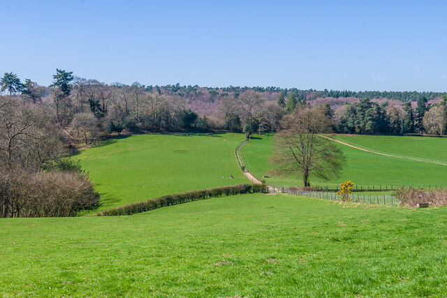
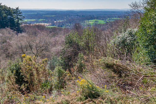
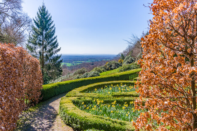
Prince Hill is a prominent hill located in Surrey, England. It stands at an elevation of approximately 180 meters above sea level, making it one of the highest points in the area. Situated near the village of Woldingham, Prince Hill offers breathtaking panoramic views of the surrounding countryside, including the North Downs and the Weald.

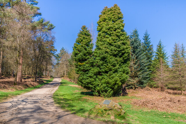
The hill is characterized by its steep slopes and is covered in a variety of vegetation, including grasslands, woodlands, and patches of heathland. The diverse flora and fauna found on Prince Hill make it an important site for biodiversity conservation in the region.

Prince Hill is a popular destination for outdoor enthusiasts and nature lovers alike. It provides numerous walking and hiking trails, allowing visitors to explore its natural beauty and enjoy the stunning vistas. The hill is also a haven for birdwatchers, as it attracts a wide range of bird species, including buzzards, kestrels, and owls.

Historically, Prince Hill has played a significant role in the region. It is believed to have been an ancient meeting place for local communities and has been designated as a Scheduled Ancient Monument. The hill's name is thought to have originated from its association with royalty, possibly referring to a visit by Prince Edward, the Black Prince, in the 14th century.

Overall, Prince Hill in Surrey offers a serene escape from the hustle and bustle of city life, allowing visitors to immerse themselves in nature and appreciate the stunning landscapes that this area of England has to offer.

If you have any feedback on the listing, please let us know in the comments section below.
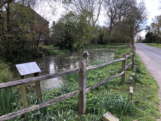
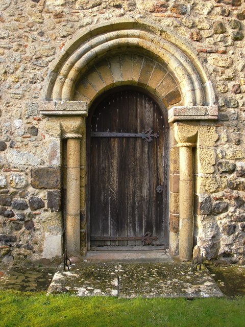
Prince Hill Images

Images are sourced within 2km of 51.161162/-0.42582363 or Grid Reference TQ1041. Thanks to Geograph Open Source API. All images are credited.

Hurtwood Millennium Pinetum Pinetum on Holmbury Hill, planted by the Friends of the Hurtwood to celebrate the Millennium with over 30 species.
Hurtwood Millennium Pinetum
Pinetum on Holmbury Hill, planted by the Friends of the Hurtwood to celebrate the Millennium with over 30 species.
Near Coverwood Farm Fields near Coverwood Farm.
Near Coverwood Farm
Fields near Coverwood Farm.
South from near Holmbury Hill The view south from near Holmbury Hill.
South from near Holmbury Hill
The view south from near Holmbury Hill.
Beech Cottage garden The garden of Beech Cottage on the slope of Holmbury Hill, with extensive views to the south.
Beech Cottage garden
The garden of Beech Cottage on the slope of Holmbury Hill, with extensive views to the south.
Near Holmbury Hill Path through west of the summit of Holmbury Hill.
Near Holmbury Hill
Path through west of the summit of Holmbury Hill.
Larkfield Pond A very well kept looking pond in Ewhurst
Larkfield Pond
A very well kept looking pond in Ewhurst
Approaching Ewhurst On the public footpath from Slythehurst nearing the edge of Ewhurst.
Approaching Ewhurst
On the public footpath from Slythehurst nearing the edge of Ewhurst.
At Woolpit Farm The farm shares a name with the vast mansion <a title="https://www.geograph.org.uk/photo/3473274" href="https://www.geograph.org.uk/photo/3473274">Link</a>  that now houses the Duke of Kent School.  

It was raining at the time I took this photo, but the mud and gravel on the road are evidence of the hours of heavy rain in the previous few days.
At Woolpit Farm
The farm shares a name with the vast mansion Link that now houses the Duke of Kent School. It was raining at the time I took this photo, but the mud and gravel on the road are evidence of the hours of heavy rain in the previous few days.
Barn at Woolpit Farm Everything is soggy after a spell of rainy days.
Barn at Woolpit Farm
Everything is soggy after a spell of rainy days.
View south-east from Woolpit Farm, in rain The day had started almost cloudless, but turned cloudy in the  early afternoon.  This photo was taken at about 5pm, with heavy showers sweeping across the low Weald.

Woolpit Farm stands close to the 160m contour, on the slopes of the Hurtwood.
View south-east from Woolpit Farm, in rain
The day had started almost cloudless, but turned cloudy in the early afternoon. This photo was taken at about 5pm, with heavy showers sweeping across the low Weald. Woolpit Farm stands close to the 160m contour, on the slopes of the Hurtwood.
Old barn at Ewhurst To be found a short distance to the east of Ewhurst church.  Rather oddly, it stands in the grounds of the Old Rectory (now a care home), with no other farm buildings nearby.  Much of the surrounding area is now residential - 20th century development, for the most part.  

I'd guess that (with such huge doors) this was once a threshing barn.  The framing seems very regular and symmetrical - apparently all of one build.

I was going to suggest a Victorian date, but have since found a listing: <span class="nowrap"><a title="http://www.britishlistedbuildings.co.uk/en-291858-barn-in-the-grounds-of-the-old-rectory-e#.Vv3FPyghzo4" rel="nofollow ugc noopener" href="http://www.britishlistedbuildings.co.uk/en-291858-barn-in-the-grounds-of-the-old-rectory-e#.Vv3FPyghzo4">Link</a><img style="margin-left:2px;" alt="External link" title="External link - shift click to open in new window" src="https://s1.geograph.org.uk/img/external.png" width="10" height="10"/></span>    My guess would be that most of what can be seen externally dates from the 20th-century restoration.
Old barn at Ewhurst
To be found a short distance to the east of Ewhurst church. Rather oddly, it stands in the grounds of the Old Rectory (now a care home), with no other farm buildings nearby. Much of the surrounding area is now residential - 20th century development, for the most part. I'd guess that (with such huge doors) this was once a threshing barn. The framing seems very regular and symmetrical - apparently all of one build. I was going to suggest a Victorian date, but have since found a listing: LinkExternal link My guess would be that most of what can be seen externally dates from the 20th-century restoration.
Wealden farmland north of Ewhurst With the slopes of Holmbury Hill rising in the distance.

The tall trees are ashes - and very typical of this area.
Wealden farmland north of Ewhurst
With the slopes of Holmbury Hill rising in the distance. The tall trees are ashes - and very typical of this area.
Ewhurst church from the north-east
Grave-board under a yew tree, Ewhurst churchyard Wooden grave-boards are not uncommon in Surrey, and I've seen them elsewhere in the Home Counties (for instance, at Baldock).  But more often than not what you find are heavily restored boards - or frank replacements (as at Mickleham).

I hadn't explored this churchyard before and it came as a surprise to find a number of 'original' unrestored boards - albeit in various stages of decrepitude.  The inscriptions they once carried had weathered away without trace - as they would do, inevitably, if not repainted every few years.

This one, under its yew tree, was one of the more complete examples - sufficiently complete to give a fair idea as to original design and construction.

I can't claim to know anything of the history of grave-boards, but here in the Weald where timber was abundant (and local stone scarce) their use could stretch back many centuries, poorly documented.  The lack of suitable local stone means that cast-iron grave-markers, too, are fairly common in Surrey and Sussex.
Grave-board under a yew tree, Ewhurst churchyard
Wooden grave-boards are not uncommon in Surrey, and I've seen them elsewhere in the Home Counties (for instance, at Baldock). But more often than not what you find are heavily restored boards - or frank replacements (as at Mickleham). I hadn't explored this churchyard before and it came as a surprise to find a number of 'original' unrestored boards - albeit in various stages of decrepitude. The inscriptions they once carried had weathered away without trace - as they would do, inevitably, if not repainted every few years. This one, under its yew tree, was one of the more complete examples - sufficiently complete to give a fair idea as to original design and construction. I can't claim to know anything of the history of grave-boards, but here in the Weald where timber was abundant (and local stone scarce) their use could stretch back many centuries, poorly documented. The lack of suitable local stone means that cast-iron grave-markers, too, are fairly common in Surrey and Sussex.
18th-century headstone, Ewhurst churchyard: David Tidy, yeoman A good number of 18th-century headstones have survived in this churchyard.  This one, dated 1762, stands with other old stones in the south-eastern part of the yard.

To my eye this stone is an unusually fine piece of work.  The design is restrained - no mourning angels,no trumpets, no skulls or cross-bones (common in the mid-18th century) - it makes its impact by the use of finely executed lettering alone.  

The inscription reads:

IN
MEMORY of
DAVID TIDY Late of this
Parish Yeoman who departed
this Life August the 27th 1762
in the 53d Year of his Age

There is no riot of lettering styles (as became the norm 50 years later): only the words 'Year' and 'Age' are given fancy copper-plate treatment.
18th-century headstone, Ewhurst churchyard: David Tidy, yeoman
A good number of 18th-century headstones have survived in this churchyard. This one, dated 1762, stands with other old stones in the south-eastern part of the yard. To my eye this stone is an unusually fine piece of work. The design is restrained - no mourning angels,no trumpets, no skulls or cross-bones (common in the mid-18th century) - it makes its impact by the use of finely executed lettering alone. The inscription reads: IN MEMORY of DAVID TIDY Late of this Parish Yeoman who departed this Life August the 27th 1762 in the 53d Year of his Age There is no riot of lettering styles (as became the norm 50 years later): only the words 'Year' and 'Age' are given fancy copper-plate treatment.
Ewhurst church: Norman doorway On the south side of the church, at its west end.
Ewhurst church: Norman doorway
On the south side of the church, at its west end.
Weather-boarded cottage at the corner of Wykehurst Lane At the north end of the green, opposite the Bull's Head.  Wykehurst Lane leads west from the main village street.
Weather-boarded cottage at the corner of Wykehurst Lane
At the north end of the green, opposite the Bull's Head. Wykehurst Lane leads west from the main village street.
Wykehurst Lane, Ewhurst The lane leads westward from the main village street, giving access to residential development of a rather suburban character.
Wykehurst Lane, Ewhurst
The lane leads westward from the main village street, giving access to residential development of a rather suburban character.
Show me another place!

Prince Hill is located at Grid Ref: TQ1041 (Lat: 51.161162, Lng: -0.42582363)

Administrative County: Surrey

District: Waverley

Police Authority: Surrey

What 3 Words

///nappy.unpainted.perch. Near Ewhurst, Surrey

Nearby Locations

Prince Hill

Related Wikis

Mullard Space Science Laboratory

The UCL Mullard Space Science Laboratory (MSSL) is the United Kingdom's largest university space research group. MSSL is part of the Department of Space...

Ewhurst, Surrey

Ewhurst is a rural village and civil parish in the borough of Waverley in Surrey, England. It is located 8.3 miles (13.4 km) south-east of Guildford,...

Hurtwood House

Hurtwood House is an independent, co-educational boarding school and sixth form for pupils aged 15–19 in Surrey, England. == Synopsis == Founded in 1970...

Joldwynds

Joldwynds is a modernist style house in Holmbury St Mary, Surrey, England, designed by architect Oliver Hill for Wilfred Greene, 1st Baron Greene. Completed...

Holmbury Hill

Holmbury Hill is a wooded area of 261 metres (856 ft) above sea level in Surrey, England, and the site of an Iron Age-period hillfort. The Old Saxon word...

Marylands

Marylands is a Spanish-style country house on Pitch Hill, a rural part of Ewhurst, Surrey, England. It is a Grade II* listed building, designed during...

Sayer's Croft LNR

Sayer's Croft is a 10.9-hectare (27-acre) Local Nature Reserve west of Ewhurst in Surrey. It is owned by the Sayer's Croft Environmental Education Trust...

Sayers Croft

Sayers Croft is a large outdoor 'learning camp' located in the village of Ewhurst, Surrey. It is one of the few remaining 'Camp schools' built by the National...

Related Videos

Walking through nature - Ewhurst via Hurtwood School to Radnor Road (part 1)

Footpaths in UK, walking through nature, Summer Walk in the UK.

PEASLAKE | HOLMBURY HILLS | MTB & HIKING | AUTUMN 2020

Sunday Afternoon Stroll in beautiful Surrey UK PEASLAKE- Known for MBT. Artist: Leonell Cassio Track: Woho: I thought it be me ...

Walking through nature - Ewhurst via Hurtwood School to Radnor Road (part 2)

Footpaths in UK, walking through nature, Summer Walk in the UK.

A SPLATTER FROM THE SPANIEL! ; #marqenglish #kevinsrambles #group walk #dogs #spaniel #surreyhills

Join me on a walk around Ewhust Surrey with Kevin's Rambles. Music by: www.bensound.com/free-music-for-videos License ...

Nearby Amenities

Located within 500m of 51.161162,-0.42582363
Maxwidth: 1.95
Lat/Long: 51.1576248/-0.4236905
Barrier: stile
Lat/Long: 51.160753/-0.4308808
Barrier: stile
Lat/Long: 51.1620832/-0.419409
The data included in this document is from www.openstreetmap.org. The data is made available under ODbL.

Have you been to Prince Hill?

Leave your review of Prince Hill below (or comments, questions and feedback).