Kirkby la Thorpe

Settlement in Lincolnshire North Kesteven

England

Kirkby la Thorpe

A17 lay-by
A17 lay-by Credit: Alex McGregor

Kirkby la Thorpe is a small village located in the county of Lincolnshire, in the East Midlands region of England. Situated about 3 miles south-east of the market town of Sleaford, the village is nestled along the banks of the River Slea. With a population of around 400 residents, Kirkby la Thorpe retains a charming and close-knit community atmosphere.

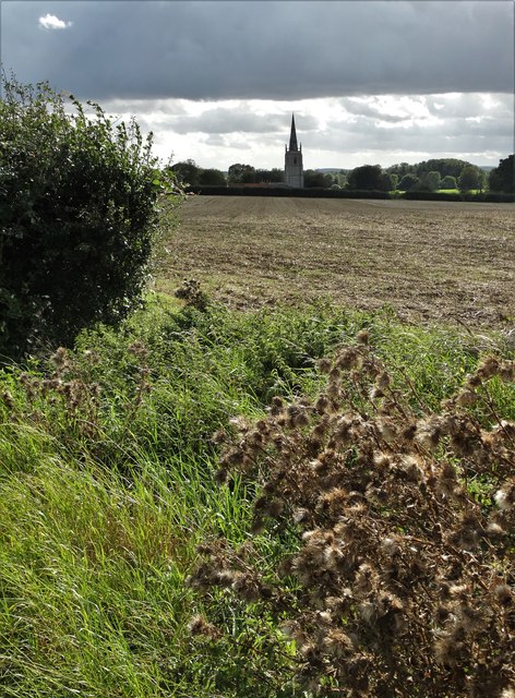
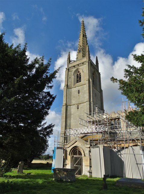
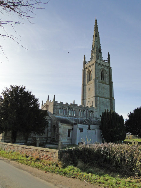
The village is known for its rich history, dating back to medieval times. At its heart stands the Grade I listed St. Denys Church, a magnificent structure built in the 12th century. The church features a Norman doorway and a striking 13th-century font, attracting visitors interested in architectural heritage.

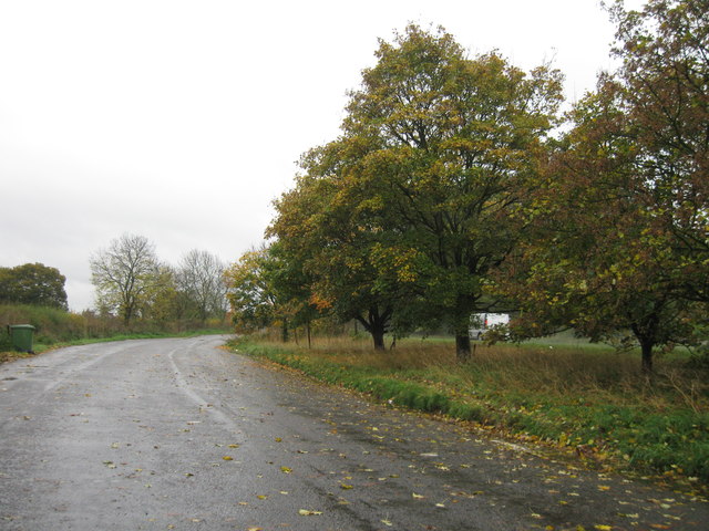
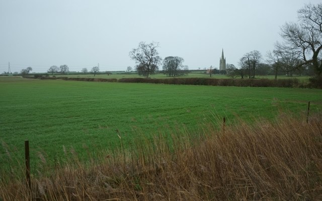
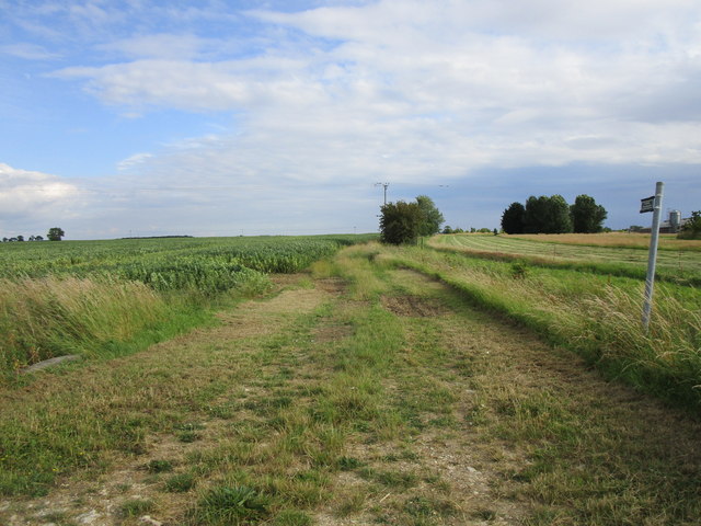
Surrounded by picturesque countryside, Kirkby la Thorpe offers beautiful views and ample opportunities for outdoor activities. The nearby River Slea provides serene spots for fishing and tranquil walks. The village is also home to several well-preserved historic buildings, including quaint cottages and traditional farmhouses, adding to its overall charm.

Despite its small size, Kirkby la Thorpe boasts a strong sense of community spirit. The village hosts regular events and activities such as village fairs and sports tournaments, fostering a sense of belonging among its residents. Additionally, the village has a primary school, offering education to local children.

In terms of amenities, Kirkby la Thorpe has a local pub, providing a friendly gathering place for both residents and visitors. For further amenities, the nearby town of Sleaford offers a wider range of services, including shops, supermarkets, and healthcare facilities.

Overall, Kirkby la Thorpe is a tranquil and historic village that offers a peaceful lifestyle surrounded by natural beauty and a close-knit community.

If you have any feedback on the listing, please let us know in the comments section below.

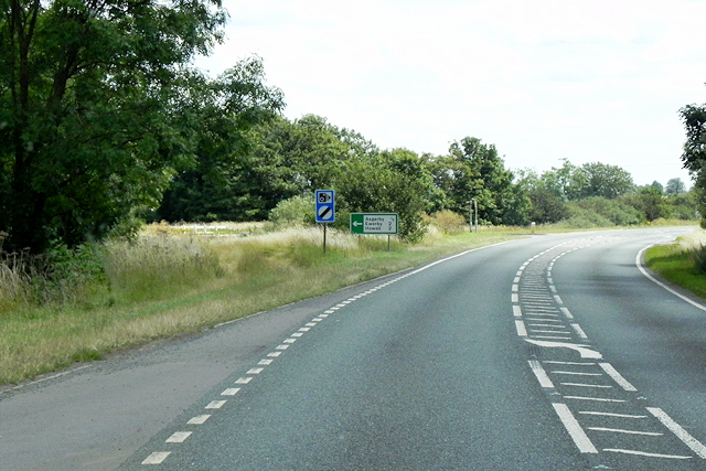
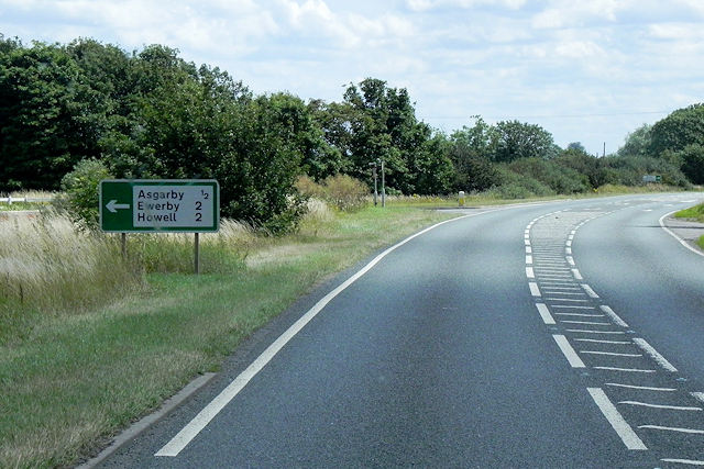
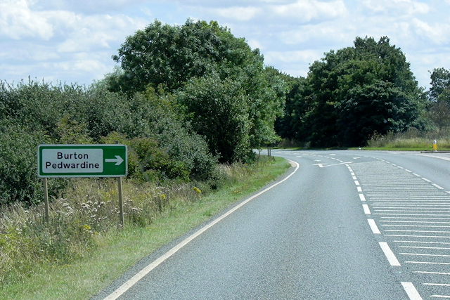
Kirkby la Thorpe Images

Images are sourced within 2km of 52.997208/-0.36407504 or Grid Reference TF0945. Thanks to Geograph Open Source API. All images are credited.

A17 lay-by
A17 lay-by
Towards the church at Asgarby From a lay-by on the A17 on a dismal winter's day. In the next field are many scattered trees. The grade I listed St Andrew's church at Asgarby is also shown in many of the photos at <a title="https://www.geograph.org.uk/search.php?i=60287574" href="https://www.geograph.org.uk/search.php?i=60287574">Link</a> and described at <span class="nowrap"><a title="http://www.historicengland.org.uk/listing/the-list/list-entry/1061832" rel="nofollow ugc noopener" href="http://www.historicengland.org.uk/listing/the-list/list-entry/1061832">Link</a><img style="margin-left:2px;" alt="External link" title="External link - shift click to open in new window" src="https://s1.geograph.org.uk/img/external.png" width="10" height="10"/></span> . The tower dates from the C14.
Towards the church at Asgarby
From a lay-by on the A17 on a dismal winter's day. In the next field are many scattered trees. The grade I listed St Andrew's church at Asgarby is also shown in many of the photos at Link and described at LinkExternal link . The tower dates from the C14.
Lay-by, Asgarby You can get some idea of the gloom from the headlights on passing vehicles. It's raining fairly steadily. This is the spot from which <a href="https://www.geograph.org.uk/photo/4792202">TF1145 : Towards the church at Asgarby</a> was taken.
Lay-by, Asgarby
You can get some idea of the gloom from the headlights on passing vehicles. It's raining fairly steadily. This is the spot from which TF1145 : Towards the church at Asgarby was taken.
The A17, East of Kirkby la Thorpe The A17 is the major route for HGV's accessing Norfolk from Northern England and the Midlands and also a major holiday route in the summer months for cars and caravans making their way to the seaside resorts of Hunstanton, Wells-next-the-Sea, Sheringham, Cromer and Great Yarmouth and is one of only two direct routes that links Norfolk with the A1, the other being the A47. It runs for almost 60 miles from Winthorpe, near Newark-on-Trent to King's Lynn across the flat landscape of the Lincolnshire fens with only four stretches of dual carriageway. 
<span class="nowrap"><a title="http://www.sabre-roads.org.uk/wiki/index.php?title=A17" rel="nofollow ugc noopener" href="http://www.sabre-roads.org.uk/wiki/index.php?title=A17">Link</a><img style="margin-left:2px;" alt="External link" title="External link - shift click to open in new window" src="https://s1.geograph.org.uk/img/external.png" width="10" height="10"/></span>  SABRE
<span class="nowrap"><a title="https://en.wikipedia.org/wiki/A17_road_(England)" rel="nofollow ugc noopener" href="https://en.wikipedia.org/wiki/A17_road_(England)">Link</a><img style="margin-left:2px;" alt="External link" title="External link - shift click to open in new window" src="https://s1.geograph.org.uk/img/external.png" width="10" height="10"/></span>  Wikipedia
The A17, East of Kirkby la Thorpe
The A17 is the major route for HGV's accessing Norfolk from Northern England and the Midlands and also a major holiday route in the summer months for cars and caravans making their way to the seaside resorts of Hunstanton, Wells-next-the-Sea, Sheringham, Cromer and Great Yarmouth and is one of only two direct routes that links Norfolk with the A1, the other being the A47. It runs for almost 60 miles from Winthorpe, near Newark-on-Trent to King's Lynn across the flat landscape of the Lincolnshire fens with only four stretches of dual carriageway. LinkExternal link SABRE LinkExternal link Wikipedia
Eastbound A17 The A17 is the major route for HGV's accessing Norfolk from Northern England and the Midlands and also a major holiday route in the summer months for cars and caravans making their way to the seaside resorts of Hunstanton, Wells-next-the-Sea, Sheringham, Cromer and Great Yarmouth and is one of only two direct routes that links Norfolk with the A1, the other being the A47. It runs for almost 60 miles from Winthorpe, near Newark-on-Trent to King's Lynn across the flat landscape of the Lincolnshire fens with only four stretches of dual carriageway. 
<span class="nowrap"><a title="http://www.sabre-roads.org.uk/wiki/index.php?title=A17" rel="nofollow ugc noopener" href="http://www.sabre-roads.org.uk/wiki/index.php?title=A17">Link</a><img style="margin-left:2px;" alt="External link" title="External link - shift click to open in new window" src="https://s1.geograph.org.uk/img/external.png" width="10" height="10"/></span>  SABRE
<span class="nowrap"><a title="https://en.wikipedia.org/wiki/A17_road_(England)" rel="nofollow ugc noopener" href="https://en.wikipedia.org/wiki/A17_road_(England)">Link</a><img style="margin-left:2px;" alt="External link" title="External link - shift click to open in new window" src="https://s1.geograph.org.uk/img/external.png" width="10" height="10"/></span>  Wikipedia
Eastbound A17
The A17 is the major route for HGV's accessing Norfolk from Northern England and the Midlands and also a major holiday route in the summer months for cars and caravans making their way to the seaside resorts of Hunstanton, Wells-next-the-Sea, Sheringham, Cromer and Great Yarmouth and is one of only two direct routes that links Norfolk with the A1, the other being the A47. It runs for almost 60 miles from Winthorpe, near Newark-on-Trent to King's Lynn across the flat landscape of the Lincolnshire fens with only four stretches of dual carriageway. LinkExternal link SABRE LinkExternal link Wikipedia
A17 near to Asgarby The A17 is the major route for HGV's accessing Norfolk from Northern England and the Midlands and also a major holiday route in the summer months for cars and caravans making their way to the seaside resorts of Hunstanton, Wells-next-the-Sea, Sheringham, Cromer and Great Yarmouth and is one of only two direct routes that links Norfolk with the A1, the other being the A47. It runs for almost 60 miles from Winthorpe, near Newark-on-Trent to King's Lynn across the flat landscape of the Lincolnshire fens with only four stretches of dual carriageway. 
<span class="nowrap"><a title="http://www.sabre-roads.org.uk/wiki/index.php?title=A17" rel="nofollow ugc noopener" href="http://www.sabre-roads.org.uk/wiki/index.php?title=A17">Link</a><img style="margin-left:2px;" alt="External link" title="External link - shift click to open in new window" src="https://s1.geograph.org.uk/img/external.png" width="10" height="10"/></span>  SABRE
<span class="nowrap"><a title="https://en.wikipedia.org/wiki/A17_road_(England)" rel="nofollow ugc noopener" href="https://en.wikipedia.org/wiki/A17_road_(England)">Link</a><img style="margin-left:2px;" alt="External link" title="External link - shift click to open in new window" src="https://s1.geograph.org.uk/img/external.png" width="10" height="10"/></span>  Wikipedia
A17 near to Asgarby
The A17 is the major route for HGV's accessing Norfolk from Northern England and the Midlands and also a major holiday route in the summer months for cars and caravans making their way to the seaside resorts of Hunstanton, Wells-next-the-Sea, Sheringham, Cromer and Great Yarmouth and is one of only two direct routes that links Norfolk with the A1, the other being the A47. It runs for almost 60 miles from Winthorpe, near Newark-on-Trent to King's Lynn across the flat landscape of the Lincolnshire fens with only four stretches of dual carriageway. LinkExternal link SABRE LinkExternal link Wikipedia
Eastbound A17 approaching Turnoff for Asgarby The A17 is the major route for HGV's accessing Norfolk from Northern England and the Midlands and also a major holiday route in the summer months for cars and caravans making their way to the seaside resorts of Hunstanton, Wells-next-the-Sea, Sheringham, Cromer and Great Yarmouth and is one of only two direct routes that links Norfolk with the A1, the other being the A47. It runs for almost 60 miles from Winthorpe, near Newark-on-Trent to King's Lynn across the flat landscape of the Lincolnshire fens with only four stretches of dual carriageway. 
<span class="nowrap"><a title="http://www.sabre-roads.org.uk/wiki/index.php?title=A17" rel="nofollow ugc noopener" href="http://www.sabre-roads.org.uk/wiki/index.php?title=A17">Link</a><img style="margin-left:2px;" alt="External link" title="External link - shift click to open in new window" src="https://s1.geograph.org.uk/img/external.png" width="10" height="10"/></span>  SABRE
<span class="nowrap"><a title="https://en.wikipedia.org/wiki/A17_road_(England)" rel="nofollow ugc noopener" href="https://en.wikipedia.org/wiki/A17_road_(England)">Link</a><img style="margin-left:2px;" alt="External link" title="External link - shift click to open in new window" src="https://s1.geograph.org.uk/img/external.png" width="10" height="10"/></span>  Wikipedia
Eastbound A17 approaching Turnoff for Asgarby
The A17 is the major route for HGV's accessing Norfolk from Northern England and the Midlands and also a major holiday route in the summer months for cars and caravans making their way to the seaside resorts of Hunstanton, Wells-next-the-Sea, Sheringham, Cromer and Great Yarmouth and is one of only two direct routes that links Norfolk with the A1, the other being the A47. It runs for almost 60 miles from Winthorpe, near Newark-on-Trent to King's Lynn across the flat landscape of the Lincolnshire fens with only four stretches of dual carriageway. LinkExternal link SABRE LinkExternal link Wikipedia
Eastbound A17, approaching Turnoff for Burton Pedwardine The A17 is the major route for HGV's accessing Norfolk from Northern England and the Midlands and also a major holiday route in the summer months for cars and caravans making their way to the seaside resorts of Hunstanton, Wells-next-the-Sea, Sheringham, Cromer and Great Yarmouth and is one of only two direct routes that links Norfolk with the A1, the other being the A47. It runs for almost 60 miles from Winthorpe, near Newark-on-Trent to King's Lynn across the flat landscape of the Lincolnshire fens with only four stretches of dual carriageway. 
<span class="nowrap"><a title="http://www.sabre-roads.org.uk/wiki/index.php?title=A17" rel="nofollow ugc noopener" href="http://www.sabre-roads.org.uk/wiki/index.php?title=A17">Link</a><img style="margin-left:2px;" alt="External link" title="External link - shift click to open in new window" src="https://s1.geograph.org.uk/img/external.png" width="10" height="10"/></span>  SABRE
<span class="nowrap"><a title="https://en.wikipedia.org/wiki/A17_road_(England)" rel="nofollow ugc noopener" href="https://en.wikipedia.org/wiki/A17_road_(England)">Link</a><img style="margin-left:2px;" alt="External link" title="External link - shift click to open in new window" src="https://s1.geograph.org.uk/img/external.png" width="10" height="10"/></span>  Wikipedia
Eastbound A17, approaching Turnoff for Burton Pedwardine
The A17 is the major route for HGV's accessing Norfolk from Northern England and the Midlands and also a major holiday route in the summer months for cars and caravans making their way to the seaside resorts of Hunstanton, Wells-next-the-Sea, Sheringham, Cromer and Great Yarmouth and is one of only two direct routes that links Norfolk with the A1, the other being the A47. It runs for almost 60 miles from Winthorpe, near Newark-on-Trent to King's Lynn across the flat landscape of the Lincolnshire fens with only four stretches of dual carriageway. LinkExternal link SABRE LinkExternal link Wikipedia
Flush Bracket OSBM G1478: Asgarby Flush bracket bench mark on a house adjoining the A17.  See <span class="nowrap"><a title="http://www.bench-marks.org.uk/bm16726" rel="nofollow ugc noopener" href="http://www.bench-marks.org.uk/bm16726">Link</a><img style="margin-left:2px;" alt="External link" title="External link - shift click to open in new window" src="https://s1.geograph.org.uk/img/external.png" width="10" height="10"/></span> for details.
Flush Bracket OSBM G1478: Asgarby
Flush bracket bench mark on a house adjoining the A17. See LinkExternal link for details.
A view of St Andrew's Church, Asgarby
St Andrew's Church, Asgarby Currently undergoing major repairs and refurbishment in this underpopulated parish.
St Andrew's Church, Asgarby
Currently undergoing major repairs and refurbishment in this underpopulated parish.
Asgarby St. Andrew's church Undergoing restoration
Asgarby St. Andrew's church
Undergoing restoration
A17 at Asgarby turn
A17 at Asgarby turn
Reservoir south of Kirkby la Thorpe: aerial 2018
Track to Sardeson's Farm The embankment on the right is that of a reservoir.
Track to Sardeson's Farm
The embankment on the right is that of a reservoir.
Footpath to Ewerby Recently re-routed.
Footpath to Ewerby
Recently re-routed.
Drain off Ewerby Road Looking towards Evedon.
Drain off Ewerby Road
Looking towards Evedon.
Bargate Hill
Bargate Hill
Show me another place!

Kirkby la Thorpe is located at Grid Ref: TF0945 (Lat: 52.997208, Lng: -0.36407504)

Division: Parts of Kesteven

Administrative County: Lincolnshire

District: North Kesteven

Police Authority: Lincolnshire

What 3 Words

///robe.slicing.clarifies. Near Sleaford, Lincolnshire

Related Wikis

Kirkby la Thorpe

Kirkby la Thorpe is a village and civil parish in North Kesteven district of Lincolnshire, England.The population at the 2011 census was 1,120. It lies...

East Kesteven Rural District

East Kesteven was a rural district in Lincolnshire, Parts of Kesteven from 1931 to 1974. It was formed under a County Review Order, by the merger of most...

Sleaford Town F.C.

Sleaford Town F.C. is a football club based in Sleaford, Lincolnshire, England. The club plays in the United Counties League Premier Division North....

Evedon

Evedon is a village in the North Kesteven district of Lincolnshire, England. It is situated 2 miles (3.2 km) north-east from the town of Sleaford. In 1885...

Asgarby, North Kesteven

Asgarby is a hamlet in the civil parish of Asgarby and Howell, in the North Kesteven district of Lincolnshire, England. It is situated on the A17 Boston...
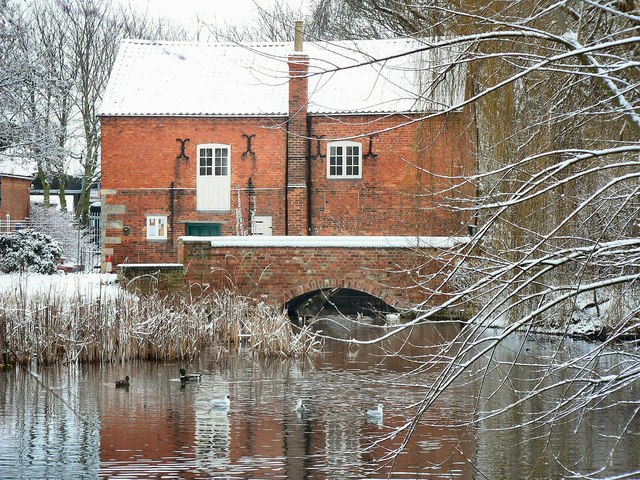
Cogglesford Mill

Cogglesford Mill (sometimes referred to as Coggesford) is a Grade II listed working watermill in Sleaford, Lincolnshire. It is possibly the last working...

Bass Maltings, Sleaford

The Bass Maltings in Sleaford, England are a large group of eight disused malt houses originally owned by the Bass Brewery of Burton upon Trent. Constructed...

Boughton, Lincolnshire

Boughton is a hamlet in Lincolnshire, England. It is in the civil parish of Asgarby and Howell. == External links == Media related to Boughton, Lincolnshire...

Nearby Amenities

Located within 500m of 52.997208,-0.36407504
Kirkby la Thorpe
Is In: Lincolnshire, England, UK
Place: village
Source: npe
Lat/Long: 52.999981/-0.363653
Village Lane End (A17)
Naptan AtcoCode: 270000010064
Naptan Bearing: NW
Naptan CommonName: Village Lane End (A17)
Naptan Indicator: Westbound Layby
Naptan Landmark: Village Lane End (A17)
Naptan NaptanCode: linjgtaw
Naptan Street: A17
Naptan Verified: no
Source: naptan_import
Was Highway: bus_stop
Lat/Long: 52.9960622/-0.3628168
Bus Stop
Mount Lane
Naptan AtcoCode: 270000010065
Naptan Bearing: E
Naptan CommonName: Mount Lane
Naptan Indicator: adj
Naptan Landmark: Mount Lane
Naptan NaptanCode: linjgtda
Naptan Street: West Bound Exit Sliproad
Naptan Verified: no
Source: naptan_import
Lat/Long: 52.9957641/-0.3646758
Bus Stop
Primary School
Naptan AtcoCode: 270002700070
Naptan Bearing: S
Naptan CommonName: Primary School
Naptan Indicator: adj
Naptan Landmark: Primary School
Naptan NaptanCode: linjtamj
Naptan Street: Church Lane
Naptan Verified: no
Source: naptan_import
Lat/Long: 53.0001334/-0.3633632
Bus Stop
Village Lane End (A17)
Naptan AtcoCode: 2700LKT00114
Naptan Bearing: NW
Naptan CommonName: Village Lane End (A17)
Naptan Indicator: Eastbound Layby
Naptan Landmark: Village Lane End (A17)
Naptan NaptanCode: linadawg
Naptan Street: East Bound Exit Sliproad
Naptan Verified: no
Source: naptan_import
Lat/Long: 52.9972341/-0.364352
Bus Stop
Primary School
Naptan AtcoCode: 2700LKTS5712
Naptan Bearing: N
Naptan CommonName: Primary School
Naptan Indicator: opp
Naptan Landmark: Primary School
Naptan NaptanCode: lindwgwa
Naptan Street: Church Lane
Naptan Verified: no
Source: naptan_import
Lat/Long: 53.0001357/-0.363527
Motorway Junction
Kirkby La Thorpe Junction
Noref: yes
Lat/Long: 52.9965636/-0.3656021
Motorway Junction
Kirkby La Thorpe Junction
Noref: yes
Lat/Long: 52.9969902/-0.3676065
Barrier: block
Material: metal
Lat/Long: 52.9954564/-0.3637344
Barrier: block
Material: metal
Lat/Long: 52.9960319/-0.3634515
Crossing
Bicycle: yes
Crossing: unmarked
Crossing Island: no
Kerb: lowered
Lat/Long: 52.9954385/-0.3638353
Mount Lane Farm
Place: farm
Source: Bing
Lat/Long: 52.9937247/-0.3631788
Pub
The Queen's Head Inn
Lat/Long: 52.9969035/-0.3652168
Crossing
Crossing: unmarked
Crossing Markings: no
Lat/Long: 52.9970834/-0.3681208
Crossing
Crossing: unmarked
Crossing Markings: no
Lat/Long: 52.9970723/-0.3685771
The data included in this document is from www.openstreetmap.org. The data is made available under ODbL.

Have you been to Kirkby la Thorpe?

Leave your review of Kirkby la Thorpe below (or comments, questions and feedback).