Old Ballast Pit

Lake, Pool, Pond, Freshwater Marsh in Lincolnshire North Kesteven

England

Old Ballast Pit

A17 lay-by
A17 lay-by Credit: Alex McGregor

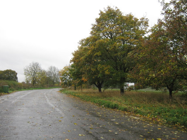
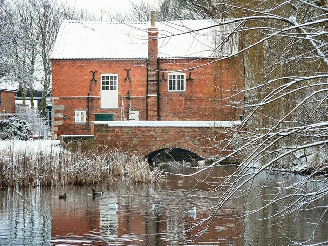
The Old Ballast Pit, located in Lincolnshire, is a notable freshwater feature that encompasses a lake, pool, pond, and freshwater marsh. Situated in a secluded area, it covers a vast expanse of land and offers a serene and picturesque environment.

The lake within the Old Ballast Pit is a sizable body of water, characterized by its calm and tranquil nature. It is surrounded by lush greenery and tall trees, providing a natural habitat for various species of birds, fish, and other aquatic creatures. The lake's crystal-clear water is inviting to both visitors and wildlife, and it serves as a popular spot for fishing, boating, and other recreational activities.

Adjacent to the lake, there is a pool that is smaller in size but equally beautiful. It acts as a haven for smaller species of fish and amphibians, thriving in its calm waters. The pool is often frequented by birdwatchers, as it attracts a diverse array of waterfowl and other avian species.

In addition to the lake and pool, the Old Ballast Pit boasts a charming pond, home to an abundance of aquatic plants and insects. The pond's still water and vibrant flora create a visually stunning landscape, attracting photographers and nature enthusiasts alike.

Finally, the Old Ballast Pit encompasses a freshwater marsh, characterized by its wetland vegetation and saturated soil. The marsh is an essential habitat for various bird species and serves as a breeding ground for amphibians, making it an important ecological site.

Overall, the Old Ballast Pit in Lincolnshire offers a diverse range of freshwater features, providing a harmonious ecosystem for wildlife and a peaceful retreat for visitors seeking tranquility and natural beauty.

If you have any feedback on the listing, please let us know in the comments section below.

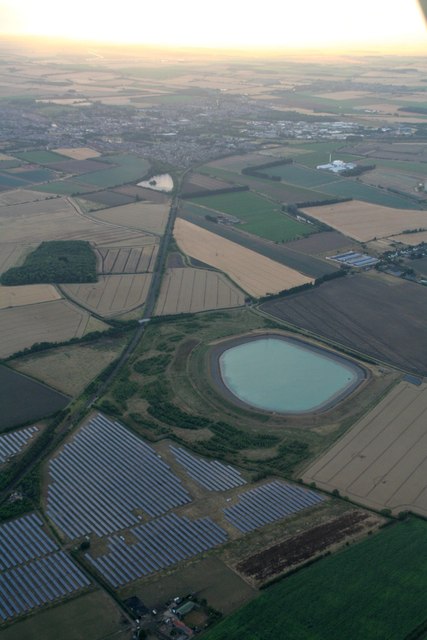
Old Ballast Pit Images

Images are sourced within 2km of 52.992015/-0.37279372 or Grid Reference TF0945. Thanks to Geograph Open Source API. All images are credited.

A17 lay-by
A17 lay-by
Lay-by, Asgarby You can get some idea of the gloom from the headlights on passing vehicles. It's raining fairly steadily. This is the spot from which <a href="https://www.geograph.org.uk/photo/4792202">TF1145 : Towards the church at Asgarby</a> was taken.
Lay-by, Asgarby
You can get some idea of the gloom from the headlights on passing vehicles. It's raining fairly steadily. This is the spot from which TF1145 : Towards the church at Asgarby was taken.
The A17, East of Kirkby la Thorpe The A17 is the major route for HGV's accessing Norfolk from Northern England and the Midlands and also a major holiday route in the summer months for cars and caravans making their way to the seaside resorts of Hunstanton, Wells-next-the-Sea, Sheringham, Cromer and Great Yarmouth and is one of only two direct routes that links Norfolk with the A1, the other being the A47. It runs for almost 60 miles from Winthorpe, near Newark-on-Trent to King's Lynn across the flat landscape of the Lincolnshire fens with only four stretches of dual carriageway. 
<span class="nowrap"><a title="http://www.sabre-roads.org.uk/wiki/index.php?title=A17" rel="nofollow ugc noopener" href="http://www.sabre-roads.org.uk/wiki/index.php?title=A17">Link</a><img style="margin-left:2px;" alt="External link" title="External link - shift click to open in new window" src="https://s1.geograph.org.uk/img/external.png" width="10" height="10"/></span>  SABRE
<span class="nowrap"><a title="https://en.wikipedia.org/wiki/A17_road_(England)" rel="nofollow ugc noopener" href="https://en.wikipedia.org/wiki/A17_road_(England)">Link</a><img style="margin-left:2px;" alt="External link" title="External link - shift click to open in new window" src="https://s1.geograph.org.uk/img/external.png" width="10" height="10"/></span>  Wikipedia
The A17, East of Kirkby la Thorpe
The A17 is the major route for HGV's accessing Norfolk from Northern England and the Midlands and also a major holiday route in the summer months for cars and caravans making their way to the seaside resorts of Hunstanton, Wells-next-the-Sea, Sheringham, Cromer and Great Yarmouth and is one of only two direct routes that links Norfolk with the A1, the other being the A47. It runs for almost 60 miles from Winthorpe, near Newark-on-Trent to King's Lynn across the flat landscape of the Lincolnshire fens with only four stretches of dual carriageway. LinkExternal link SABRE LinkExternal link Wikipedia
Eastbound A17 The A17 is the major route for HGV's accessing Norfolk from Northern England and the Midlands and also a major holiday route in the summer months for cars and caravans making their way to the seaside resorts of Hunstanton, Wells-next-the-Sea, Sheringham, Cromer and Great Yarmouth and is one of only two direct routes that links Norfolk with the A1, the other being the A47. It runs for almost 60 miles from Winthorpe, near Newark-on-Trent to King's Lynn across the flat landscape of the Lincolnshire fens with only four stretches of dual carriageway. 
<span class="nowrap"><a title="http://www.sabre-roads.org.uk/wiki/index.php?title=A17" rel="nofollow ugc noopener" href="http://www.sabre-roads.org.uk/wiki/index.php?title=A17">Link</a><img style="margin-left:2px;" alt="External link" title="External link - shift click to open in new window" src="https://s1.geograph.org.uk/img/external.png" width="10" height="10"/></span>  SABRE
<span class="nowrap"><a title="https://en.wikipedia.org/wiki/A17_road_(England)" rel="nofollow ugc noopener" href="https://en.wikipedia.org/wiki/A17_road_(England)">Link</a><img style="margin-left:2px;" alt="External link" title="External link - shift click to open in new window" src="https://s1.geograph.org.uk/img/external.png" width="10" height="10"/></span>  Wikipedia
Eastbound A17
The A17 is the major route for HGV's accessing Norfolk from Northern England and the Midlands and also a major holiday route in the summer months for cars and caravans making their way to the seaside resorts of Hunstanton, Wells-next-the-Sea, Sheringham, Cromer and Great Yarmouth and is one of only two direct routes that links Norfolk with the A1, the other being the A47. It runs for almost 60 miles from Winthorpe, near Newark-on-Trent to King's Lynn across the flat landscape of the Lincolnshire fens with only four stretches of dual carriageway. LinkExternal link SABRE LinkExternal link Wikipedia
A17 at Asgarby turn
A17 at Asgarby turn
Reservoir south of Kirkby la Thorpe: aerial 2018
Footpath to Whitecross Lane A wide uncultivated verge accommodates both the footpath and a wildlife refuge.
Footpath to Whitecross Lane
A wide uncultivated verge accommodates both the footpath and a wildlife refuge.
Track to Sardeson's Farm The embankment on the right is that of a reservoir.
Track to Sardeson's Farm
The embankment on the right is that of a reservoir.
Drain off Ewerby Road Looking towards Evedon.
Drain off Ewerby Road
Looking towards Evedon.
Bargate Hill
Bargate Hill
Halfmile Lane New Wood on the right.
Halfmile Lane
New Wood on the right.
A17 eastbound
A17 eastbound
Reservoir south of Kirkby la Thorpe: aerial 2021 SW of Sleaford.
Reservoir south of Kirkby la Thorpe: aerial 2021
SW of Sleaford.
Mount Lane turns the corner Leading towards Sardesons Farm.  Compare with a view two years earlier <a href="https://www.geograph.org.uk/photo/6189879">TF1044 : Track to Sardeson's Farm</a>.
Mount Lane turns the corner
Leading towards Sardesons Farm. Compare with a view two years earlier TF1044 : Track to Sardeson's Farm.
Looking the other way A different view of the pleasant tree-lined path <a href="https://www.geograph.org.uk/photo/2726401">TF1043 : Tree lined route</a>.
Looking the other way
A different view of the pleasant tree-lined path TF1043 : Tree lined route.
High Noon New Years Day 2021 in a less-often-photographed square.  Walking around in my t-shirt too!
High Noon
New Years Day 2021 in a less-often-photographed square. Walking around in my t-shirt too!
Where's the path? There is supposed to be a footpath from this point towards the right hand corner of the wooded area in the distance known as Kirkby Mount.  Today there was no sign whatsoever of any path so I took the farm track route which cuts across the photo on the other side of the ditch instead.
Where's the path?
There is supposed to be a footpath from this point towards the right hand corner of the wooded area in the distance known as Kirkby Mount. Today there was no sign whatsoever of any path so I took the farm track route which cuts across the photo on the other side of the ditch instead.
Track to Mount Plantation After crossing over the railway bridge from the north.
Track to Mount Plantation
After crossing over the railway bridge from the north.
Show me another place!

Old Ballast Pit is located at Grid Ref: TF0945 (Lat: 52.992015, Lng: -0.37279372)

Administrative County: Lincolnshire

District: North Kesteven

Police Authority: Lincolnshire

What 3 Words

///sings.trappings.boomer. Near Sleaford, Lincolnshire

Related Wikis

Kirkby la Thorpe

Kirkby la Thorpe is a village and civil parish in North Kesteven district of Lincolnshire, England.The population at the 2011 census was 1,120. It lies...

Sleaford Town F.C.

Sleaford Town F.C. is a football club based in Sleaford, Lincolnshire, England. The club plays in the United Counties League Premier Division North....

East Kesteven Rural District

East Kesteven was a rural district in Lincolnshire, Parts of Kesteven from 1931 to 1974. It was formed under a County Review Order, by the merger of most...

Bass Maltings, Sleaford

The Bass Maltings in Sleaford, England are a large group of eight disused malt houses originally owned by the Bass Brewery of Burton upon Trent. Constructed...

Cogglesford Mill

Cogglesford Mill (sometimes referred to as Coggesford) is a Grade II listed working watermill in Sleaford, Lincolnshire. It is possibly the last working...

Asgarby, North Kesteven

Asgarby is a hamlet in the civil parish of Asgarby and Howell, in the North Kesteven district of Lincolnshire, England. It is situated on the A17 Boston...

North Kesteven Council Offices

The North Kesteven Council Offices, formerly County Offices, Sleaford, is a municipal structure in Lafford Terrace, Sleaford, Lincolnshire, England. The...

Evedon

Evedon is a village in the North Kesteven district of Lincolnshire, England. It is situated 2 miles (3.2 km) north-east from the town of Sleaford. In 1885...

Nearby Amenities

Located within 500m of 52.992015,-0.37279372
Power: tower
Source: NPE
Lat/Long: 52.9916595/-0.3721673
Power: tower
Source: NPE
Lat/Long: 52.9937759/-0.3734191
Power: tower
Source: NPE
Lat/Long: 52.9959983/-0.3747329
Power: tower
Source: NPE
Lat/Long: 52.9893057/-0.3707669
Power: pole
Lat/Long: 52.9902142/-0.3788446
Bone's Farm
Place: farm
Source: Bing
Lat/Long: 52.9896605/-0.3745835
Power: pole
Lat/Long: 52.9910381/-0.3794415
Power: pole
Lat/Long: 52.9911639/-0.3781965
Power: pole
Lat/Long: 52.9920134/-0.3786865
Power: pole
Lat/Long: 52.9920594/-0.3775606
Power: pole
Lat/Long: 52.9930032/-0.3769198
Power: pole
Lat/Long: 52.9930153/-0.3778906
Power: pole
Lat/Long: 52.9938175/-0.3762973
Power: pole
Lat/Long: 52.9940596/-0.3768636
Power: pole
Lat/Long: 52.9946912/-0.3756433
Power: pole
Lat/Long: 52.9949009/-0.3760456
Power: pole
Lat/Long: 52.9955432/-0.3750076
Power: pole
Lat/Long: 52.9957443/-0.3752109
Power: pole
Lat/Long: 52.996068/-0.3743469
The data included in this document is from www.openstreetmap.org. The data is made available under ODbL.

Have you been to Old Ballast Pit?

Leave your review of Old Ballast Pit below (or comments, questions and feedback).