Conduit Hill
Hill, Mountain in Surrey Elmbridge
England
Conduit Hill
Conduit Hill, located in Surrey, England, is a prominent hill that forms part of the North Downs, a range of chalk hills stretching across Surrey and Kent. Standing at an elevation of approximately 200 meters (656 feet), it offers breathtaking views of the surrounding countryside.
The hill gets its name from the conduit, a man-made water channel, which was constructed during the medieval period to supply water to the town of Reigate. The conduit system was established by the Lord of the Manor and was an ingenious solution to provide a reliable water source for the growing population.
Conduit Hill is covered in lush greenery, with a variety of trees and other vegetation dotting its landscape. It is a popular spot for outdoor enthusiasts, hikers, and nature lovers who can enjoy the picturesque scenery and explore the network of footpaths that crisscross the hill.
The hill is also home to a diverse range of wildlife, including various bird species, butterflies, and small mammals. Birdwatchers can often spot buzzards soaring overhead or listen to the melodious songs of thrushes and blackbirds.
On clear days, visitors to Conduit Hill are treated to panoramic views of the surrounding countryside, with the rolling hills of Surrey stretching into the distance. The hill offers a peaceful and tranquil atmosphere, making it an ideal spot for picnics or simply to unwind and enjoy the natural beauty of the area.
Overall, Conduit Hill in Surrey is a picturesque and historically significant location, offering visitors a chance to connect with nature and soak in the stunning views of the surrounding countryside.
If you have any feedback on the listing, please let us know in the comments section below.
Conduit Hill Images
Images are sourced within 2km of 51.359732/-0.4648738 or Grid Reference TQ0663. Thanks to Geograph Open Source API. All images are credited.
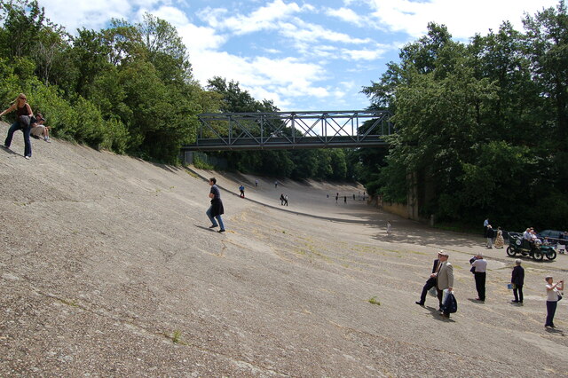
![Brooklands - Napier Railton - Lap record holder This monster of a car was designed by Reid Railton using a 24-litre W12 (3 banks of 4 cylinders)* Napier Lion aero engine. It was manufactured by Thomson & Taylor who were based at Brooklands. It had been commissioned by amateur racing driver (and three times holder of the World Land Speed record) John Cobb. It is thought that this car cost him around £10,000 in 1933 - more than a million in today's money.
On 7th October 1935 Cobb set the Brooklands Lap Record, completing the circuit in just 69 seconds at an average 143.44mph - see <span class="nowrap"><a title="https://www.brooklandsmuseum.com/about/latest-news/80th-anniversary-of-the-napier-railtons-ultimate-outer-lap-record#:~:text=On%20the%207th%20October%201935,beaten%20average%20of%20143.44mph" rel="nofollow ugc noopener" href="https://www.brooklandsmuseum.com/about/latest-news/80th-anniversary-of-the-napier-railtons-ultimate-outer-lap-record#:~:text=On%20the%207th%20October%201935,beaten%20average%20of%20143.44mph">Link</a><img style="margin-left:2px;" alt="External link" title="External link - shift click to open in new window" src="https://s1.geograph.org.uk/img/external.png" width="10" height="10"/></span> for more details of this run.
Its fuel tank holds 65 gallons, which at today&#039;s [2022] petrol prices would cost about £500 to fill - mind you, it needs a decent sized tank as it only manages about 5mpg!
This car is still in perfect running order and is often seen around the country at events such as the Goodwood Festival of Speed.
* Engine details: High compression version (6.1:1) (RAF specification). Naturally aspirated (no supercharger) Napier Lion aero engine. W12 (broad arrow) cylinder configuration of 23.944 litres capacity. Producing 580 bhp (433 kW) at 2585rpm (recorded at 5,000ft), and 1,250 pound-foot (1.695 kNm) of torque.](https://s2.geograph.org.uk/geophotos/07/12/06/7120698_83e9f0cd.jpg)
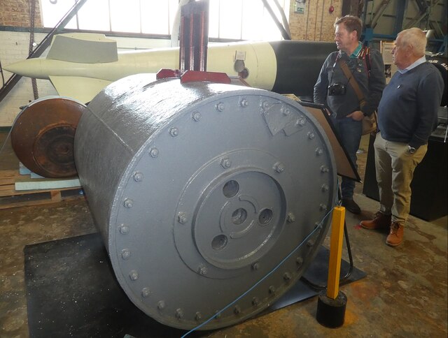
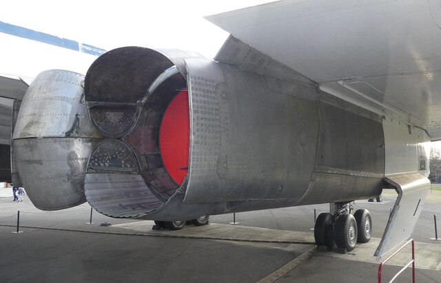
![Brooklands - Rolls Royce Merlin Engine Mk61 The Rolls Royce Merlin Engine was fitted to many iconic WWII aircraft including the Hawker Hurricane (fighter) from its prototype in 1935, the Vickers Wellington (bomber) and Supermarine Spitfire (fighter). The Mk61 seen here was developed in 1942 and was fitted to the Spitfire Mk IX and XI, the latter being a photo-reconnaissance aircraft.
The engine specification for the Mk61 is:
Upright 60° V12 (12 cylinder)
1260bhp (940kW)
27 litre (1637 cu in)
Bore 5.4&quot; (137mm)
Stroke 6&quot; (152mm)
[Note: Assuming the capacity and bore are correct, the stroke is probably nearer 5.95&quot; than 6&quot;]](https://s2.geograph.org.uk/geophotos/07/12/09/7120986_05bb7416.jpg)

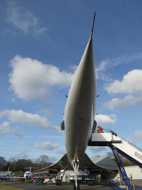
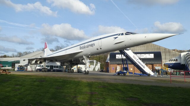
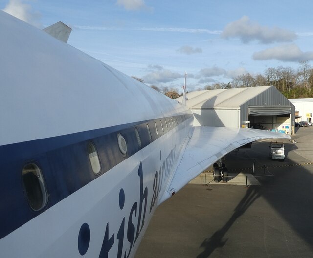
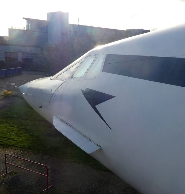
![Brooklands - Concorde 202 G-BBDG ('Delta Golf') A view of Concorde 202 G-BBDG (&#039;Delta Golf&#039;) looking along its fuselage from its pointed nosecone. G-BBDG was the first plane in history to carry 100 passengers at twice the speed of sound. It also has the distinction of having been used as the training plane for every Concorde pilot.
If you visit Brooklands, you can pay a little extra [£6 as of 2022] to enjoy the Concorde Experience where you go onboard and learn a lot of interesting facts about this amazing piece of engineering.](https://s1.geograph.org.uk/geophotos/07/12/12/7121285_96ce0c87.jpg)
Conduit Hill is located at Grid Ref: TQ0663 (Lat: 51.359732, Lng: -0.4648738)
Administrative County: Surrey
District: Elmbridge
Police Authority: Surrey
What 3 Words
///brain.rats.alien. Near Weybridge, Surrey
Nearby Locations
Related Wikis

BAC Concorde G-BBDG
G-BBDG (manufacturer's serial number 202), known as "Delta Golf", was the British development Concorde built for evaluation testing. Along with the French...

Heathside School
Heathside School is a co-educational secondary school for students aged 11–18 situated in Brooklands Lane, Weybridge, Surrey, England. The Executive Principal...
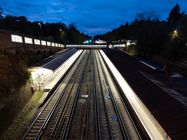
Weybridge railway station
Weybridge railway station is near the established midpoint of Weybridge in Surrey, England and south of its town centre. It is on the South West Main Line...

Martin Hotine
Brigadier Martin Hotine CMG CBE (17 June 1898 – 12 November 1968) was the head of the Trigonometrical and Levelling Division of the Ordnance Survey responsible...
Nearby Amenities
Located within 500m of 51.359732,-0.4648738Have you been to Conduit Hill?
Leave your review of Conduit Hill below (or comments, questions and feedback).