Monument Hill

Hill, Mountain in Surrey Woking

England

Monument Hill

Victoria Square An extreme telephoto view of the towers of Victoria Square in central Woking, around 10km away, taken from The Mount above Guildford.
Victoria Square Credit: Ian Capper

Monument Hill, located in Surrey, England, is a prominent landmark and natural feature in the area. This hill is part of the North Downs, a range of chalk hills that stretches across southeast England. Rising to an elevation of approximately 78 meters (256 feet), Monument Hill offers stunning panoramic views of the surrounding countryside.

The hill derives its name from the monument that stands at its summit. Erected in 1822, the monument commemorates the signing of the Magna Carta, a historic document that laid the foundation for modern democratic principles. The structure itself is an obelisk standing at a height of 19 meters (62 feet) and is made of Portland stone. It serves as a tribute to the significance of this document and its impact on the development of English law.

Monument Hill is a popular destination for both locals and tourists due to its natural beauty and historical importance. Besides providing breathtaking views, the hill also offers several walking and hiking trails that allow visitors to explore the surrounding countryside. The area is known for its diverse flora and fauna, making it a haven for nature enthusiasts.

Additionally, Monument Hill is home to a variety of bird species, making it a popular spot for birdwatching. From the top of the hill, visitors can observe different bird species in their natural habitat, such as kestrels, buzzards, and woodpeckers.

Overall, Monument Hill in Surrey is a captivating natural landmark that offers not only picturesque views but also a glimpse into the rich history and heritage of the area.

If you have any feedback on the listing, please let us know in the comments section below.

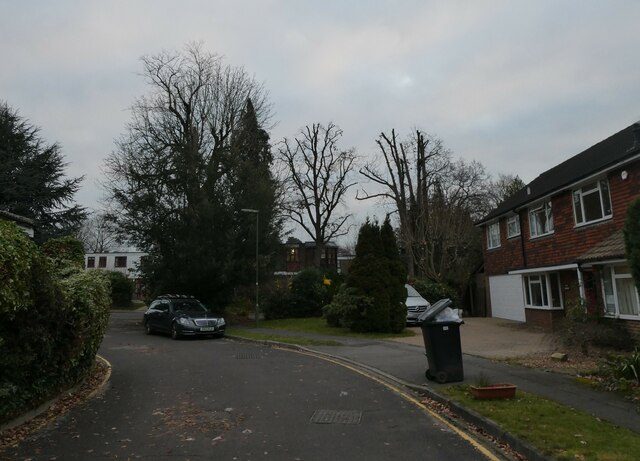
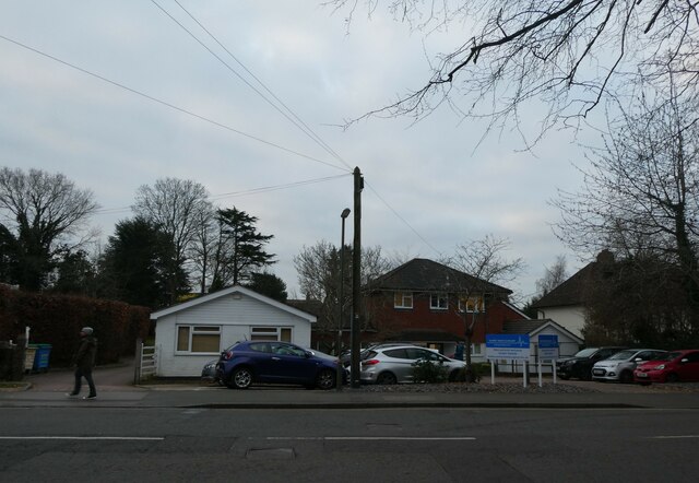
Monument Hill Images

Images are sourced within 2km of 51.30967/-0.53495402 or Grid Reference TQ0257. Thanks to Geograph Open Source API. All images are credited.

Victoria Square An extreme telephoto view of the towers of Victoria Square in central Woking, around 10km away, taken from The Mount above Guildford.
Victoria Square
An extreme telephoto view of the towers of Victoria Square in central Woking, around 10km away, taken from The Mount above Guildford.
Miniature railway, Southern Railway Children's Home, 1969 The exact location within the grounds is a bit of a guess, but it went round a field. The site is now redeveloped.
Miniature railway, Southern Railway Children's Home, 1969
The exact location within the grounds is a bit of a guess, but it went round a field. The site is now redeveloped.
Dinsdale Close
Dinsdale Close
Looking from Dinsdale Close into Coley Avenue
Junction of Coley Avenue and Dinsdale Close
Looking from Coley Avenue into Dinsdale Close
Looking northwards in Coley Avenue (taken from its junction with Dinsdale Close)
Looking northwards in Coley Avenue
(taken from its junction with Dinsdale Close)
Looking along Coley Avenue towards Heathside Road
Junction of Coley Avenue and Heathside Road
Looking eastwards in Heathside Road
Looking from Heathside Road into Coley Avenue
Looking westwards in Heathside Road (taken opposite its junction with Coley Avenue)
Looking westwards in Heathside Road
(taken opposite its junction with Coley Avenue)
Telegraph pole in Heathside Road The very first lines that were hung from poles were telegraph wires. Places was connected to the network with just one or two lines –  very few poles were needed. With the invention of the telephone, this all changed. At first, rival companies did not want to share their poles with one another. Inevitably, legislation was passed to compel it.

Most telegraph poles are about 30ft above the ground with 6 feet planted in the ground.They are tested by a B.T. Openreach  operative after they have been “planted” for twelve years and then at ten yearly intervals. Telegraph poles are still plentiful in the UK and Ireland although they have been completely eradicated in Holland. 

They also have their own web site <span class="nowrap"><a title="https://www.telegraphpoleappreciationsociety.org/" rel="nofollow ugc noopener" href="https://www.telegraphpoleappreciationsociety.org/">Link</a><img style="margin-left:2px;" alt="External link" title="External link - shift click to open in new window" src="https://s1.geograph.org.uk/img/external.png" width="10" height="10"/></span>
Telegraph pole in Heathside Road
The very first lines that were hung from poles were telegraph wires. Places was connected to the network with just one or two lines – very few poles were needed. With the invention of the telephone, this all changed. At first, rival companies did not want to share their poles with one another. Inevitably, legislation was passed to compel it. Most telegraph poles are about 30ft above the ground with 6 feet planted in the ground.They are tested by a B.T. Openreach operative after they have been “planted” for twelve years and then at ten yearly intervals. Telegraph poles are still plentiful in the UK and Ireland although they have been completely eradicated in Holland. They also have their own web site LinkExternal link
Houses in Heathside Road
Lamppost in Heathside Road Road lighting predates the earliest cars by thousands of years. In the 5th century BC, people in Beijing used bamboo pipes to harness and lead natural gas from volcano leaks to their communities which they then used to ignite lamps that  lit up their thoroughfares at night. 1417 marked the first organized public street lighting system in London. Its mayor, Sir Henry Barton, ordered people to place oil lanterns outside their homes at night during the winter. In 1802, William Murdoch invented the first coal-ignited gas lighting system and in 1879 Paris produced the world’s first electric streetlight system. A year later, Thomas Edison introduced the first carbon-thread incandescent lamp. By 1965 most systems used  high-pressure sodium (HID) lamps.  Today, street lighting commonly uses high-intensity discharge lamps. Milan, Italy is the first major city to have entirely switched to LED lighting
Lamppost in Heathside Road
Road lighting predates the earliest cars by thousands of years. In the 5th century BC, people in Beijing used bamboo pipes to harness and lead natural gas from volcano leaks to their communities which they then used to ignite lamps that lit up their thoroughfares at night. 1417 marked the first organized public street lighting system in London. Its mayor, Sir Henry Barton, ordered people to place oil lanterns outside their homes at night during the winter. In 1802, William Murdoch invented the first coal-ignited gas lighting system and in 1879 Paris produced the world’s first electric streetlight system. A year later, Thomas Edison introduced the first carbon-thread incandescent lamp. By 1965 most systems used high-pressure sodium (HID) lamps. Today, street lighting commonly uses high-intensity discharge lamps. Milan, Italy is the first major city to have entirely switched to LED lighting
Approaching the junction of Heathside Road and Bracken Close
Looking from Heathside Road into Bracken Close
Sunny Meed Surgery, Heathside Road My pupils recently expressed incredulity at my assertation that, when I was a boy, the road in which I lived contained one out of twenty six houses with a telephone. Subsequent comments that we had two TV channels, Advent calendars without sweets and one single plug socket in each room were met with similar disbelief. But when I told them that if you were ill you went down to the doctor's house and sat in his waiting room until he saw you, it was my teaching assistants who became the Doubting Thomases. This now seems a typical old man's fantasy as we contemplate urgent exhortations not to go to the surgery, being put on hold for an hour when we try to make an appointment and then a six week wait to see the nurse, who will if necessary zoom call the doctor in the next room. That's progress...
Sunny Meed Surgery, Heathside Road
My pupils recently expressed incredulity at my assertation that, when I was a boy, the road in which I lived contained one out of twenty six houses with a telephone. Subsequent comments that we had two TV channels, Advent calendars without sweets and one single plug socket in each room were met with similar disbelief. But when I told them that if you were ill you went down to the doctor's house and sat in his waiting room until he saw you, it was my teaching assistants who became the Doubting Thomases. This now seems a typical old man's fantasy as we contemplate urgent exhortations not to go to the surgery, being put on hold for an hour when we try to make an appointment and then a six week wait to see the nurse, who will if necessary zoom call the doctor in the next room. That's progress...
Show me another place!

Monument Hill is located at Grid Ref: TQ0257 (Lat: 51.30967, Lng: -0.53495402)

Administrative County: Surrey

District: Woking

Police Authority: Surrey

What 3 Words

///burst.ocean.scarf. Near Woking, Surrey

Related Wikis

Hoe Bridge School

Hoe Bridge School is an independent co-educational, pre-prep and prep school in Woking, England. At its last full inspection in 2023 it was rated excellent...

Old Woking

Old Woking is a ward and the original settlement of the town and borough of Woking, Surrey, about 1.3 miles (2.1 km) southeast of the modern town centre...

White Rose Lane

White Rose Lane is a 3.4-hectare (8.4-acre) Local Nature Reserve in Woking in Surrey. It is owned and managed by Woking Borough Council.This site is damp...

St Peter's Church, Old Woking

St Peter's Church is situated in Old Woking, Surrey, England. It is recorded in the Domesday Book. It also has the third oldest surviving door in the...

Woking College

Woking College is a sixth form college in Woking, Surrey, with over 1,500 16-19-year-olds studying A Levels and advanced vocational courses. It was the...

St John the Baptist School, Woking

St John the Baptist School is a coeducational Catholic secondary school and sixth form in Woking, Surrey, England. The school was one of the first 100...

Woking Palace

Woking Palace is a former manor house of the Royal Manor of Woking on the outskirts of Woking, near the village of Old Woking, Surrey. The manor was in...

St Dunstan's Church, Woking

St Dunstan's Church is a Roman Catholic Parish church in Woking, Surrey. At first it was built in 1899, replaced by a larger church in 1923 and its final...

Nearby Amenities

Located within 500m of 51.30967,-0.53495402
Post Box
Brand: Royal Mail
Brand Wikidata: Q638098
Brand Wikipedia: en:Royal Mail
Collection Plate: CP7D
Collection Times: Mo-Fr 09:00; Sa 07:00; Su off
Last Checked: 2022-02-15
Lastcheck: 2017-06-28
Operator: Royal Mail
Operator Wikidata: Q638098
Post Box Type: lamp
Postal Code: GU22
Ref: GU22 84D
Royal Cypher: EIIR
Royal Cypher Wikidata: Q33102113
Source: survey
Lat/Long: 51.3101408/-0.5398445
Hoe Place
Building: yes
Source: npe
Lat/Long: 51.3068316/-0.5360778
Bus Stop
Palace Way
Naptan AtcoCode: 40004404150A
Naptan Bearing: E
Naptan CommonName: Carters Lane
Naptan Indicator: Just Before
Naptan Landmark: Carters Lane
Naptan NaptanCode: suradaga
Naptan PlusbusZoneRef: WOKING
Naptan Street: Old Woking Road
Naptan Verified: no
Public Transport: platform
Source: naptan_import
Lat/Long: 51.3056549/-0.5368171
Bus Stop
Hoebridge Golf Course
Naptan AtcoCode: 40004404156A
Naptan Bearing: NW
Naptan BusStopType: CUS
Naptan CommonName: Hoebridge Golf Course
Naptan Indicator: Just before
Naptan Landmark: Hoebridge Golf Course
Naptan NaptanCode: surgpjpt
Naptan Street: Old Woking Road
Naptan Verified: no
Physically Present: no
Public Transport: platform
Source: naptan_import
Lat/Long: 51.3086277/-0.5369864
Bus Stop
Hoebridge Golf Course
Naptan AtcoCode: 40004404156B
Naptan Bearing: SE
Naptan CommonName: Hoebridge Golf Course
Naptan Indicator: Just after
Naptan Landmark: Hoebridge Golf Course
Naptan NaptanCode: suradagt
Naptan PlusbusZoneRef: WOKING
Naptan Street: Old Woking Road
Naptan Verified: no
Public Transport: platform
Source: naptan_import
Lat/Long: 51.308728/-0.5368999
Crossing
Crossing: uncontrolled
Crossing Ref: zebra
Source: Bing
Lat/Long: 51.3081937/-0.5351972
Crossing
Crossing: uncontrolled
Crossing Ref: zebra
Source: Bing
Lat/Long: 51.3081147/-0.5352644
Letter Box
Lat/Long: 51.3127561/-0.5304016
The data included in this document is from www.openstreetmap.org. The data is made available under ODbL.

Have you been to Monument Hill?

Leave your review of Monument Hill below (or comments, questions and feedback).