Edlesborough Hill

Hill, Mountain in Bedfordshire

England

Edlesborough Hill

The Icknield Way in Spring The Icknield Way as it passes along the edge of Dunstable Downs. Photo taken looking north east.
The Icknield Way in Spring Credit: Cathy Cox

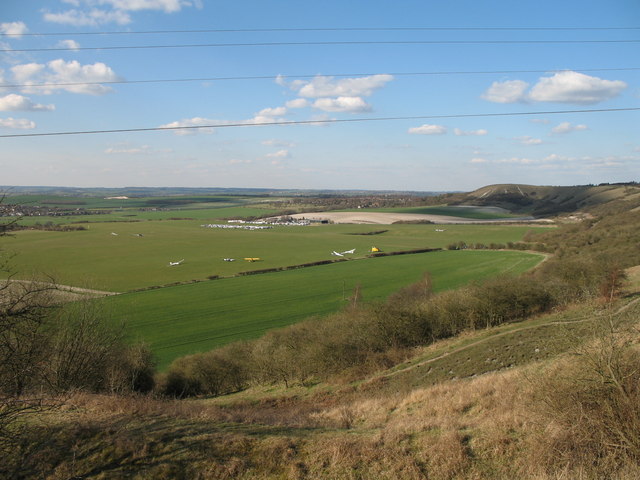
Edlesborough Hill is a prominent geographical feature located in Bedfordshire, England. Standing at an elevation of approximately 248 meters (814 feet), it is classified as a hill rather than a mountain. Situated near the village of Edlesborough, it offers panoramic views of the surrounding countryside and is a popular destination for locals and tourists alike.

The hill is part of the Chiltern Hills, a range of chalk hills that stretch across several counties in southern England. Edlesborough Hill is characterized by its gently sloping sides, covered in grass and scattered with small patches of woodland. Its smooth, rounded shape is a testament to the erosion caused by ice sheets during the last Ice Age.

At the summit of Edlesborough Hill, there is a trig point, which provides a reference point for surveying and mapping purposes. Visitors to the hill can enjoy breathtaking views across the Bedfordshire countryside, with glimpses of neighboring counties such as Buckinghamshire and Hertfordshire.

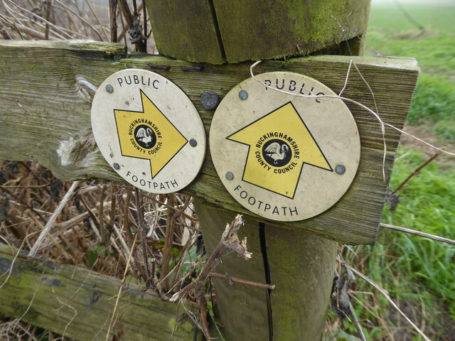
The hill is a popular spot for outdoor activities, including walking, hiking, and birdwatching. It is home to a variety of wildlife, including rabbits, deer, and numerous bird species. The surrounding area features a network of footpaths and bridleways, allowing visitors to explore the picturesque landscape and enjoy the tranquility of the countryside.

Overall, Edlesborough Hill offers a scenic escape from the urban environment, providing visitors with an opportunity to immerse themselves in the natural beauty of Bedfordshire's countryside.

If you have any feedback on the listing, please let us know in the comments section below.

Edlesborough Hill Images

Images are sourced within 2km of 51.861013/-0.57145617 or Grid Reference SP9819. Thanks to Geograph Open Source API. All images are credited.

The Icknield Way in Spring The Icknield Way as it passes along the edge of Dunstable Downs. Photo taken looking north east.
The Icknield Way in Spring
The Icknield Way as it passes along the edge of Dunstable Downs. Photo taken looking north east.
Pylons, Dunstable Downs From near the viewpoint at Robertson Corner.
Pylons, Dunstable Downs
From near the viewpoint at Robertson Corner.
Dunstable Downs Gliding Club A view of the airfield from the downs.   Gliders and tug aircraft await their turn next to the yellow control caravan.  The gliding club buildings and parking area are visible beyond, in the next square.  The downs continue north along the right hand side of the picture towards Pascomb Pit and Five Knolls, (the promontory on the horizon).   The chalky nature of the soil is evident in the ploughed field behind the gliding club buildings.
Dunstable Downs Gliding Club
A view of the airfield from the downs. Gliders and tug aircraft await their turn next to the yellow control caravan. The gliding club buildings and parking area are visible beyond, in the next square. The downs continue north along the right hand side of the picture towards Pascomb Pit and Five Knolls, (the promontory on the horizon). The chalky nature of the soil is evident in the ploughed field behind the gliding club buildings.
Whipsnade sunset A pylon at the top of the scarp of the Dunstable Downs. Two lines of pylons climb the slope, crossing land owned by the National Trust. Much of the steeper ground is covered by scrubby woodland.
Whipsnade sunset
A pylon at the top of the scarp of the Dunstable Downs. Two lines of pylons climb the slope, crossing land owned by the National Trust. Much of the steeper ground is covered by scrubby woodland.
Fence and Pylons on Dunstable Downs The fence separates grazing land from the National Trust managed heathland on the left of this photo.  This path, following the fence, is not marked as a footpath on the OS maps but is a popular walking route.
Fence and Pylons on Dunstable Downs
The fence separates grazing land from the National Trust managed heathland on the left of this photo. This path, following the fence, is not marked as a footpath on the OS maps but is a popular walking route.
B440 Leighton Road Towards Leighton Buzzard, leaving Church End, Edlesborough.
B440 Leighton Road
Towards Leighton Buzzard, leaving Church End, Edlesborough.
B440 Leighton Road, Church End, Edlesborough Towards Leighton Buzzard.
B440 Leighton Road, Church End, Edlesborough
Towards Leighton Buzzard.
B440 Leighton Road Towards Leighton Buzzard.
B440 Leighton Road
Towards Leighton Buzzard.
Crossing of B440 and B489 ahead The B489 more or less follows the ancient Icknield Way.
Crossing of B440 and B489 ahead
The B489 more or less follows the ancient Icknield Way.
B440 Main Road North Towards Edlesborough and Leighton Buzzard.
B440 Main Road North
Towards Edlesborough and Leighton Buzzard.
Ford on the lane With  a raised walkway on the right.
Ford on the lane
With a raised walkway on the right.
Water channel beside the road With interesting wooden hurdles fitted in the stream bed to, reduce erosion or flow, I assume.
Water channel beside the road
With interesting wooden hurdles fitted in the stream bed to, reduce erosion or flow, I assume.
Lane approaching the village The rough grazing here looks like it will be developed for housing.
Lane approaching the village
The rough grazing here looks like it will be developed for housing.
Dormer bungalows on Townside Dormer bungalows are not really bungalows, as they have two storeys, but they are a nice amalgam. These date from the 1960s I think. Extremely well kept. As you would expect.
Dormer bungalows on Townside
Dormer bungalows are not really bungalows, as they have two storeys, but they are a nice amalgam. These date from the 1960s I think. Extremely well kept. As you would expect.
Road junction near Edlesborough A gloomy, drab scene at first sight but I always seek beauty and charm in even the most mundane and melancholy sights. 

I see the care and expertise of the road designers, sign makers and fitters, the men who painted the road markings, after the junction was resurfaced in some summer several years back. I hear a faint echo of their banter, complaints and humour. 

And around the corner will be even more rich distractions, possibilities and realisations.
Road junction near Edlesborough
A gloomy, drab scene at first sight but I always seek beauty and charm in even the most mundane and melancholy sights. I see the care and expertise of the road designers, sign makers and fitters, the men who painted the road markings, after the junction was resurfaced in some summer several years back. I hear a faint echo of their banter, complaints and humour. And around the corner will be even more rich distractions, possibilities and realisations.
Old hoppers near the road A nice collection of aged hoppers.
Old hoppers near the road
A nice collection of aged hoppers.
Footpath way marker discs Thank you Buckinghamshire County Council footpaths team.
Footpath way marker discs
Thank you Buckinghamshire County Council footpaths team.
Scene near the pylon line The sun is making brave efforts to burn off the fog or low cloud.
Scene near the pylon line
The sun is making brave efforts to burn off the fog or low cloud.
Show me another place!

Edlesborough Hill is located at Grid Ref: SP9819 (Lat: 51.861013, Lng: -0.57145617)

Unitary Authority: Central Bedfordshire

Police Authority: Bedfordshire

What 3 Words

///scared.cute.expectant. Near Eaton Bray, Bedfordshire

Nearby Locations

Edlesborough Hill

Related Wikis

Roman Catholic Diocese of Arundel and Brighton

The Diocese of Arundel and Brighton (Latin: Dioecesis Arundeliensis-Brichtelmestunensis) is a Latin diocese of the Catholic Church in southern England...

Cottesloe Hundred

Cottesloe Hundred was a hundred in the county of Buckinghamshire, England. It extended from close to the north of the county and Northamptonshire south...
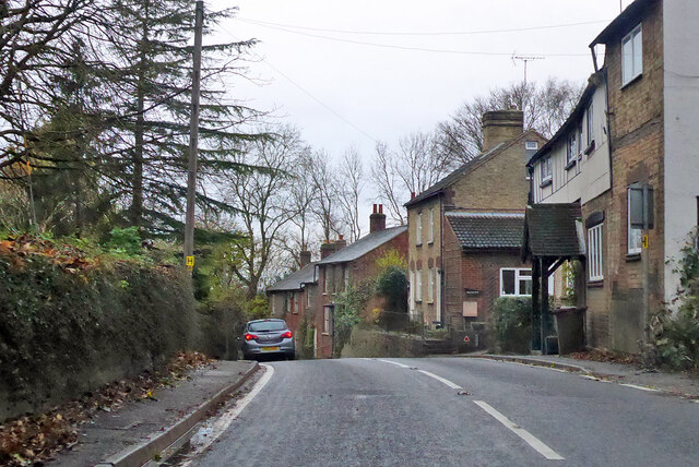
Edlesborough

Edlesborough is a village and civil parish in the Aylesbury Vale district of Buckinghamshire, England. Edlesborough is also next to the village of Eaton...

Church End, Totternhoe

Church End is a hamlet located in Bedfordshire, England. The settlement forms part of the wider Totternhoe village (where the 2011 Census population was...

Related Videos

Solo Hiking 12 Miles along the Chiltern Hills - (4k)

This is one of the best hikes in the Chiltern Hills. Dunstable downs and the Whipsnade loop takes you on an excellent 12 mile ...

Walking the Chilterns - Dunstable Downs 4K

It's been a while, I've been meaning to record a video, but the weather has been shocking and I just haven't had a chance to get ...

Nearby Amenities

Located within 500m of 51.861013,-0.57145617
Ford: yes
Lat/Long: 51.8634776/-0.574483
Power: tower
Lat/Long: 51.8595813/-0.5662735
Power: tower
Lat/Long: 51.8597999/-0.5732687
Power: tower
Lat/Long: 51.8596773/-0.5695243
Power: tower
Lat/Long: 51.8598728/-0.5762835
Building: windmill
Building Levels: 5
Building Material: brick
Functional: no
Man Made: windmill
Roof Levels: 0
Windmill Disused: yes
Windmill Vanes: no
Lat/Long: 51.8624284/-0.5748325
Power: tower
Lat/Long: 51.8567243/-0.5712859
Power: tower
Lat/Long: 51.8572989/-0.5680703
Shop: car_repair
Lat/Long: 51.8645375/-0.5675722
The data included in this document is from www.openstreetmap.org. The data is made available under ODbL.

Have you been to Edlesborough Hill?

Leave your review of Edlesborough Hill below (or comments, questions and feedback).