Beacon Hill

Hill, Mountain in Yorkshire Scarborough

England

Beacon Hill

Telescope at Robin Hood's Bay 50p buys a look through the telescope strategically located at the top of the hill down to the harbour.
Telescope at Robin Hood's Bay Credit: Stephen McKay

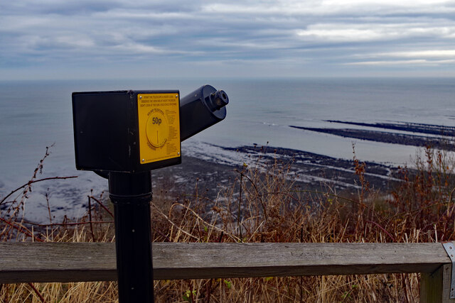
Beacon Hill, located in Yorkshire, England, is a prominent hill that stands at an elevation of 357 meters (1,171 feet) above sea level. It is situated in the southern region of the North York Moors National Park, near the village of Goathland. Offering breathtaking panoramic views of the surrounding countryside, Beacon Hill is a popular destination for hikers, nature enthusiasts, and photographers.

The hill itself is covered in heather moorland, which creates a stunning purple hue during the summer months. It is also home to a variety of wildlife, including birds such as red grouse and curlews, as well as several species of butterflies and moths. Visitors are advised to tread carefully to preserve the delicate ecosystem of the area.

At the summit of Beacon Hill, there is a trig point, which serves as a navigational marker and offers an excellent spot for taking in the picturesque vistas of the North York Moors. On a clear day, it is possible to see as far as the coast and the expansive Yorkshire countryside.

Access to Beacon Hill is relatively easy, with a well-maintained footpath leading to the summit. The hill is a popular choice for both experienced hikers and casual walkers, as the trail is relatively gentle and suitable for all skill levels.

Overall, Beacon Hill in Yorkshire is a must-visit destination for those seeking stunning natural beauty, tranquility, and a chance to immerse themselves in the serene landscapes of the North York Moors National Park.

If you have any feedback on the listing, please let us know in the comments section below.
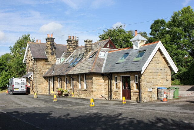
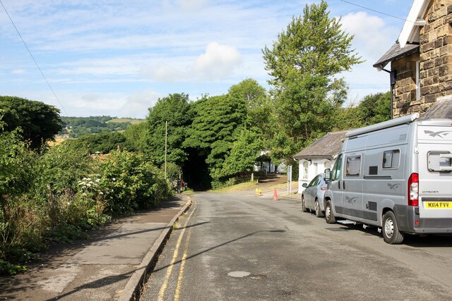
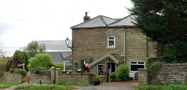
Beacon Hill Images

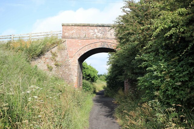
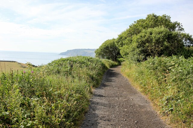
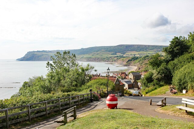
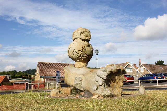
Images are sourced within 2km of 54.440918/-0.55771005 or Grid Reference NZ9306. Thanks to Geograph Open Source API. All images are credited.

Telescope at Robin Hood's Bay 50p buys a look through the telescope strategically located at the top of the hill down to the harbour.
Telescope at Robin Hood's Bay
50p buys a look through the telescope strategically located at the top of the hill down to the harbour.
New Road, Robin Hood's Bay The road down to the sea is both steep and narrow; visitors must park at the top and walk down. This is the view from near the top.
New Road, Robin Hood's Bay
The road down to the sea is both steep and narrow; visitors must park at the top and walk down. This is the view from near the top.
Muir Lea Stores, Robin Hood's Bay According to the shop's website, Muir Lea Stores offers locals, day trippers and people staying in the village 'a large range of goods from food to wine, newspapers to milk, and beach toys to gifts'. Perhaps the range of buckets and spades is a little optimistic for a cold dull day in December. The Covid-19 notice specifies only three customers inside at any one time and asks anyone with a cough or fever not to enter.
Muir Lea Stores, Robin Hood's Bay
According to the shop's website, Muir Lea Stores offers locals, day trippers and people staying in the village 'a large range of goods from food to wine, newspapers to milk, and beach toys to gifts'. Perhaps the range of buckets and spades is a little optimistic for a cold dull day in December. The Covid-19 notice specifies only three customers inside at any one time and asks anyone with a cough or fever not to enter.
Victoria Hotel, Robin Hood's Bay The 16-bedroom Victoria Hotel occupies a prominent position in Robin Hood's Bay with sweeping sea views. It was built in 1897 and was used in 2017 as a location for 'Phantom Thread', an Oscar-nominated film set in the 1950s, starring Daniel Day-Lewis.
Victoria Hotel, Robin Hood's Bay
The 16-bedroom Victoria Hotel occupies a prominent position in Robin Hood's Bay with sweeping sea views. It was built in 1897 and was used in 2017 as a location for 'Phantom Thread', an Oscar-nominated film set in the 1950s, starring Daniel Day-Lewis.
Green Gate, Low Hawsker The entrance to Mill Farm has not changed much in 15 years - see <a href="https://www.geograph.org.uk/photo/198629">NZ9207 : Mill Farm, Hawsker</a> - although the hedge by the house has been trimmed. The mill itself dates from the 1860s but ceased operations about a century ago.
Green Gate, Low Hawsker
The entrance to Mill Farm has not changed much in 15 years - see NZ9207 : Mill Farm, Hawsker - although the hedge by the house has been trimmed. The mill itself dates from the 1860s but ceased operations about a century ago.
Northern end of the Yorkshire Moors South of Normanton
Northern end of the Yorkshire Moors
South of Normanton
Near Robin Hood's Bay Looking towards Ravenscar.
Near Robin Hood's Bay
Looking towards Ravenscar.
Green Veined White By the old railway line.
Green Veined White
By the old railway line.
The Cinder Track at High Hawsker The old railway bridge carries a footpath which leads from High Hawsker to Gnipe Howe.

The Cinder Track, also known as the "Scarborough to Whitby Rail Trail" and "Scarborough to Whitby Cinder Track", is a 21 mile multi-use path following the track of the old Scarborough and Whitby Railway. The railway operated from 1885 to 1965 when it was closed as part of the Beeching Axe.

Wikipedia <span class="nowrap"><a title="https://en.wikipedia.org/wiki/Hawsker_railway_station" rel="nofollow ugc noopener" href="https://en.wikipedia.org/wiki/Hawsker_railway_station">Link</a><img style="margin-left:2px;" alt="External link" title="External link - shift click to open in new window" src="https://s1.geograph.org.uk/img/external.png" width="10" height="10"/></span>
The Cinder Track at High Hawsker
The old railway bridge carries a footpath which leads from High Hawsker to Gnipe Howe. The Cinder Track, also known as the "Scarborough to Whitby Rail Trail" and "Scarborough to Whitby Cinder Track", is a 21 mile multi-use path following the track of the old Scarborough and Whitby Railway. The railway operated from 1885 to 1965 when it was closed as part of the Beeching Axe. Wikipedia LinkExternal link
The Cinder Track near Hawsker Bottoms The Cinder Track, also known as the "Scarborough to Whitby Rail Trail" and "Scarborough to Whitby Cinder Track", is a 21 mile multi-use path following the track of the old Scarborough and Whitby Railway. The railway operated from 1885 to 1965 when it was closed as part of the Beeching Axe.

Wikipedia <span class="nowrap"><a title="https://en.wikipedia.org/wiki/Scarborough_and_Whitby_Railway" rel="nofollow ugc noopener" href="https://en.wikipedia.org/wiki/Scarborough_and_Whitby_Railway">Link</a><img style="margin-left:2px;" alt="External link" title="External link - shift click to open in new window" src="https://s1.geograph.org.uk/img/external.png" width="10" height="10"/></span>
The Cinder Track near Hawsker Bottoms
The Cinder Track, also known as the "Scarborough to Whitby Rail Trail" and "Scarborough to Whitby Cinder Track", is a 21 mile multi-use path following the track of the old Scarborough and Whitby Railway. The railway operated from 1885 to 1965 when it was closed as part of the Beeching Axe. Wikipedia LinkExternal link
Towards Hawsker Bottoms on the Cinder Track Heading northwest towards Hawsker Bottoms on the Cinder Track.

The Cinder Track, also known as the "Scarborough to Whitby Rail Trail" and "Scarborough to Whitby Cinder Track", is a 21 mile multi-use path following the track of the old Scarborough and Whitby Railway. The railway operated from 1885 to 1965 when it was closed as part of the Beeching Axe.

Wikipedia <span class="nowrap"><a title="https://en.wikipedia.org/wiki/Scarborough_and_Whitby_Railway" rel="nofollow ugc noopener" href="https://en.wikipedia.org/wiki/Scarborough_and_Whitby_Railway">Link</a><img style="margin-left:2px;" alt="External link" title="External link - shift click to open in new window" src="https://s1.geograph.org.uk/img/external.png" width="10" height="10"/></span>
Towards Hawsker Bottoms on the Cinder Track
Heading northwest towards Hawsker Bottoms on the Cinder Track. The Cinder Track, also known as the "Scarborough to Whitby Rail Trail" and "Scarborough to Whitby Cinder Track", is a 21 mile multi-use path following the track of the old Scarborough and Whitby Railway. The railway operated from 1885 to 1965 when it was closed as part of the Beeching Axe. Wikipedia LinkExternal link
The Cinder Track near Rain Dale Heading northwest along the Cinder Track near Rain Dale.

The Cinder Track, also known as the "Scarborough to Whitby Rail Trail" and "Scarborough to Whitby Cinder Track", is a 21 mile multi-use path following the track of the old Scarborough and Whitby Railway. The railway operated from 1885 to 1965 when it was closed as part of the Beeching Axe.

Wikipedia <span class="nowrap"><a title="https://en.wikipedia.org/wiki/Scarborough_and_Whitby_Railway" rel="nofollow ugc noopener" href="https://en.wikipedia.org/wiki/Scarborough_and_Whitby_Railway">Link</a><img style="margin-left:2px;" alt="External link" title="External link - shift click to open in new window" src="https://s1.geograph.org.uk/img/external.png" width="10" height="10"/></span>
The Cinder Track near Rain Dale
Heading northwest along the Cinder Track near Rain Dale. The Cinder Track, also known as the "Scarborough to Whitby Rail Trail" and "Scarborough to Whitby Cinder Track", is a 21 mile multi-use path following the track of the old Scarborough and Whitby Railway. The railway operated from 1885 to 1965 when it was closed as part of the Beeching Axe. Wikipedia LinkExternal link
Dropping down to Robin Hood's Bay It's downhill now all the way to Robin Hood's Bay on the Cinder Track.

The Cinder Track, also known as the "Scarborough to Whitby Rail Trail" and "Scarborough to Whitby Cinder Track", is a 21 mile multi-use path following the track of the old Scarborough and Whitby Railway. The railway operated from 1885 to 1965 when it was closed as part of the Beeching Axe.

Wikipedia <span class="nowrap"><a title="https://en.wikipedia.org/wiki/Scarborough_and_Whitby_Railway" rel="nofollow ugc noopener" href="https://en.wikipedia.org/wiki/Scarborough_and_Whitby_Railway">Link</a><img style="margin-left:2px;" alt="External link" title="External link - shift click to open in new window" src="https://s1.geograph.org.uk/img/external.png" width="10" height="10"/></span>
Dropping down to Robin Hood's Bay
It's downhill now all the way to Robin Hood's Bay on the Cinder Track. The Cinder Track, also known as the "Scarborough to Whitby Rail Trail" and "Scarborough to Whitby Cinder Track", is a 21 mile multi-use path following the track of the old Scarborough and Whitby Railway. The railway operated from 1885 to 1965 when it was closed as part of the Beeching Axe. Wikipedia LinkExternal link
At Robin Hood's Bay Looking south towards the bay from the Cleveland Way/England Coast Path.

Wikipedia <span class="nowrap"><a title="https://en.wikipedia.org/wiki/Robin_Hood%27s_Bay" rel="nofollow ugc noopener" href="https://en.wikipedia.org/wiki/Robin_Hood%27s_Bay">Link</a><img style="margin-left:2px;" alt="External link" title="External link - shift click to open in new window" src="https://s1.geograph.org.uk/img/external.png" width="10" height="10"/></span>
At Robin Hood's Bay
Looking south towards the bay from the Cleveland Way/England Coast Path. Wikipedia LinkExternal link
The Millennium Statue at Robin Hoods Bay A stone sculpture of a fallen tree trunk, on which a globe is mounted. Atop the globe is a 'structure' with the year MM and some reliefs as an owl, a boat, portrait of Robin Hood and E.T.

Source <span class="nowrap"><a title="https://statues.vanderkrogt.net/object.php?webpage=ST&record=gbyh207" rel="nofollow ugc noopener" href="https://statues.vanderkrogt.net/object.php?webpage=ST&record=gbyh207">Link</a><img style="margin-left:2px;" alt="External link" title="External link - shift click to open in new window" src="https://s1.geograph.org.uk/img/external.png" width="10" height="10"/></span>
The Millennium Statue at Robin Hoods Bay
A stone sculpture of a fallen tree trunk, on which a globe is mounted. Atop the globe is a 'structure' with the year MM and some reliefs as an owl, a boat, portrait of Robin Hood and E.T. Source LinkExternal link
Robin Hood's Bay Railway Station Robin Hood's Bay railway station was a railway station on the Scarborough & Whitby Railway. It opened in 1885 closed in 1965 and is now used as holiday accommodation.

Wikipedia <span class="nowrap"><a title="https://en.wikipedia.org/wiki/Robin_Hood%27s_Bay_railway_station" rel="nofollow ugc noopener" href="https://en.wikipedia.org/wiki/Robin_Hood%27s_Bay_railway_station">Link</a><img style="margin-left:2px;" alt="External link" title="External link - shift click to open in new window" src="https://s1.geograph.org.uk/img/external.png" width="10" height="10"/></span>
Robin Hood's Bay Railway Station
Robin Hood's Bay railway station was a railway station on the Scarborough & Whitby Railway. It opened in 1885 closed in 1965 and is now used as holiday accommodation. Wikipedia LinkExternal link
The Cinder Track at Robin Hood's Bay Heading west along the Cinder Track next to the now closed Robin Hood's Bay railway station.
The Cinder Track at Robin Hood's Bay
Heading west along the Cinder Track next to the now closed Robin Hood's Bay railway station.
Robin Hoods Bay, Nook House According to the OS benchmark database there is a cutmark on the north-east face of the property. Any view was obscured by troughs and planters.
Robin Hoods Bay, Nook House
According to the OS benchmark database there is a cutmark on the north-east face of the property. Any view was obscured by troughs and planters.
Show me another place!

Beacon Hill is located at Grid Ref: NZ9306 (Lat: 54.440918, Lng: -0.55771005)

Division: North Riding

Administrative County: North Yorkshire

District: Scarborough

Police Authority: North Yorkshire

What 3 Words

///mixers.careless.heaven. Near Whitby, North Yorkshire

Nearby Locations

Beacon Hill

Related Wikis

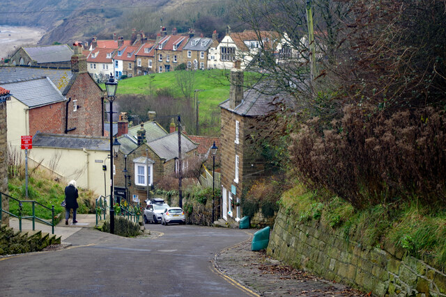
Raw, North Yorkshire

Raw is a hamlet in the Borough of Scarborough of North Yorkshire, England, near to the villages of Fylingthorpe, Robin Hood's Bay, and Hawsker. The hamlet...

Old St Stephen's Church, Fylingdales

Old St Stephen's Church is a redundant Anglican church standing on a hillside in Fylingdales, overlooking Robin Hood's Bay, North Yorkshire, England....

Fylingthorpe

Fylingthorpe is a village in the civil parish of Fylingdales in North Yorkshire, England. == Geography == Fylingthorpe is located about 1.1 mi (1.8 km...

Robin Hood's Bay railway station

Robin Hood's Bay railway station was a railway station on the Scarborough & Whitby Railway situated 15 miles (24 km) from Scarborough and 6 miles (9.7...

Nearby Amenities

Located within 500m of 54.440918,-0.55771005
Raw
Place: hamlet
Wikidata: Q113439456
Lat/Long: 54.4365792/-0.5591641
Post Box
Operator: Royal Mail
Post Box Type: lamp
Ref: YO22 30
Lat/Long: 54.4366107/-0.559705
High Normanby
Place: hamlet
Lat/Long: 54.44146/-0.5632272
Telephone
Booth: KX100
Covered: booth
Lat/Long: 54.4365937/-0.5597209
Raw Farm
Place: farm
Lat/Long: 54.4380662/-0.5615285
Abbey View
Place: farm
Lat/Long: 54.4410611/-0.5628146
High Normanby Farm
Place: farm
Lat/Long: 54.441338/-0.5637735
The data included in this document is from www.openstreetmap.org. The data is made available under ODbL.

Have you been to Beacon Hill?

Leave your review of Beacon Hill below (or comments, questions and feedback).