Temple Hill

Hill, Mountain in Surrey Waverley

England

Temple Hill

Barn at Oxenford Grange It was built in 1843 by Augustus Welby Northmore Pugin in Medieval Gothic style of sandstone rubble with ashlar dressings. It has a plain tiled roof, part restored, with ridge cresting and gable end pinnacles. It is rectangular, with pentice roofed aisle extensions to side. There are five bays with gabled, opposing, entrances to centre, offset flanking buttresses and octagonal gable finial. There are rectangular breathers to both and sides, three to either side alternating with buttresses. There are double doors to centre on both sides with stable doors to side. Interior - main roof trusses on corbels with cross braced roof <span class="nowrap"><a title="https://www.britishlistedbuildings.co.uk/101334359" rel="nofollow ugc noopener" href="https://www.britishlistedbuildings.co.uk/101334359">Link</a><img style="margin-left:2px;" alt="External link" title="External link - shift click to open in new window" src="https://s1.geograph.org.uk/img/external.png" width="10" height="10"/></span>
Barn at Oxenford Grange Credit: John Baker

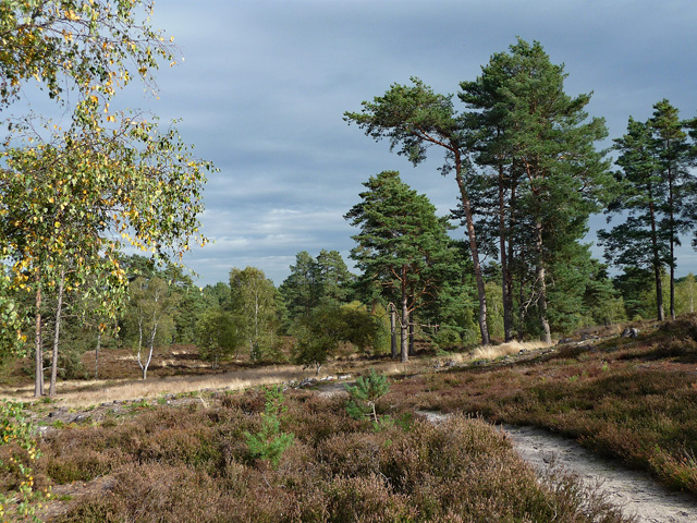
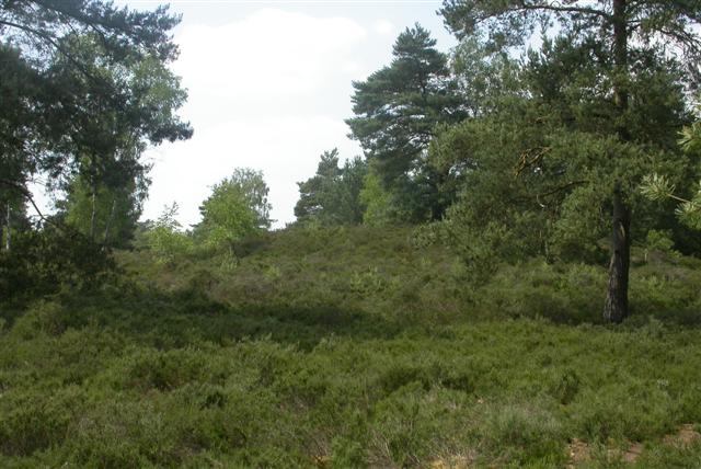
Temple Hill is a prominent hill located in Surrey, England. Situated near the town of Farnham, the hill is part of the beautiful Surrey Hills Area of Outstanding Natural Beauty. Rising to an impressive height of 272 meters (892 feet), Temple Hill offers breathtaking panoramic views of the surrounding countryside.

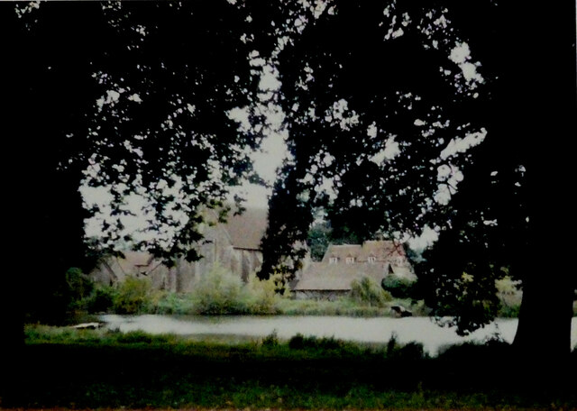
The hill takes its name from the nearby Moor Park Temple, an 18th-century folly that sits atop its summit. This architectural gem adds a touch of historical charm to the area and is a popular attraction for visitors. The temple was originally built as a retreat for the Duke of Northumberland and is now privately owned.

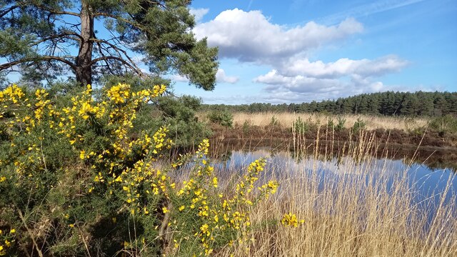
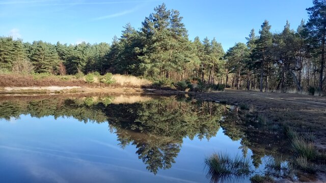
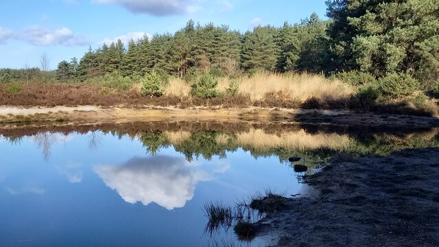
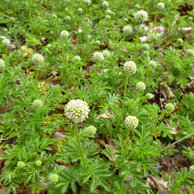
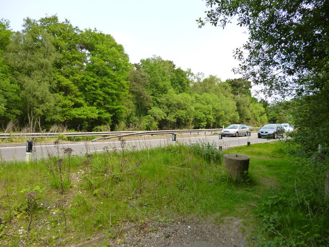
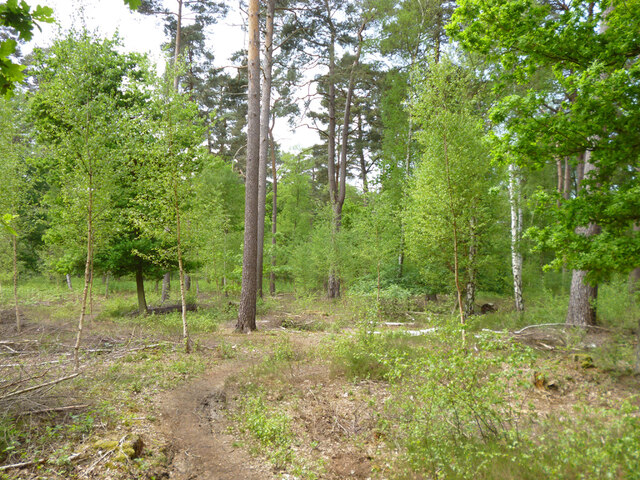
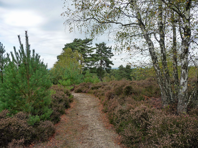
Temple Hill is covered in lush greenery, including a mix of deciduous and coniferous trees, creating a picturesque landscape. The hill is home to a diverse range of wildlife, including various bird species, deer, and foxes.

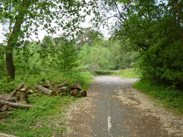
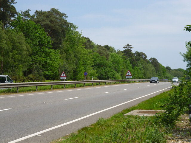
Several footpaths and trails wind their way up Temple Hill, offering outdoor enthusiasts the opportunity to explore the area on foot. The hill is a favorite spot for hikers, walkers, and nature lovers who appreciate the tranquility and natural beauty it offers.

With its commanding height and stunning vistas, Temple Hill is also a popular destination for paragliders and hang gliders, who take advantage of the hill's favorable winds for their aerial pursuits.

Overall, Temple Hill in Surrey is a captivating natural landmark, offering a blend of historical significance, scenic beauty, and recreational opportunities for visitors to enjoy.

If you have any feedback on the listing, please let us know in the comments section below.

Temple Hill Images

Images are sourced within 2km of 51.168751/-0.68101478 or Grid Reference SU9241. Thanks to Geograph Open Source API. All images are credited.

Barn at Oxenford Grange It was built in 1843 by Augustus Welby Northmore Pugin in Medieval Gothic style of sandstone rubble with ashlar dressings. It has a plain tiled roof, part restored, with ridge cresting and gable end pinnacles. It is rectangular, with pentice roofed aisle extensions to side. There are five bays with gabled, opposing, entrances to centre, offset flanking buttresses and octagonal gable finial. There are rectangular breathers to both and sides, three to either side alternating with buttresses. There are double doors to centre on both sides with stable doors to side. Interior - main roof trusses on corbels with cross braced roof <span class="nowrap"><a title="https://www.britishlistedbuildings.co.uk/101334359" rel="nofollow ugc noopener" href="https://www.britishlistedbuildings.co.uk/101334359">Link</a><img style="margin-left:2px;" alt="External link" title="External link - shift click to open in new window" src="https://s1.geograph.org.uk/img/external.png" width="10" height="10"/></span>
Barn at Oxenford Grange
It was built in 1843 by Augustus Welby Northmore Pugin in Medieval Gothic style of sandstone rubble with ashlar dressings. It has a plain tiled roof, part restored, with ridge cresting and gable end pinnacles. It is rectangular, with pentice roofed aisle extensions to side. There are five bays with gabled, opposing, entrances to centre, offset flanking buttresses and octagonal gable finial. There are rectangular breathers to both and sides, three to either side alternating with buttresses. There are double doors to centre on both sides with stable doors to side. Interior - main roof trusses on corbels with cross braced roof LinkExternal link
Elstead Common Nature reserve with blooming gorse beside a heathland pond.
Elstead Common
Nature reserve with blooming gorse beside a heathland pond.
Elstead Common - Pond Nature reserve and heathland - reflective scene on the edge of coniferous woodland.
Elstead Common - Pond
Nature reserve and heathland - reflective scene on the edge of coniferous woodland.
Elstead Common Small pond on heathland in a nature reserve.
Elstead Common
Small pond on heathland in a nature reserve.
Pirri-pirri bur, Acaena novae-zelandiae An alien from New Zealand. The bur stage comes later as the seeds form.  It has clover-like flower heads, but the tiny flowers are not clover-like, nor are the leaves. I have only seen this in similar Surrey locations e.g. <a href="https://www.geograph.org.uk/photo/4971923">SU9167 : Plant in Swinley Forest</a>, although it apparently crops up quite widely.
Pirri-pirri bur, Acaena novae-zelandiae
An alien from New Zealand. The bur stage comes later as the seeds form. It has clover-like flower heads, but the tiny flowers are not clover-like, nor are the leaves. I have only seen this in similar Surrey locations e.g. SU9167 : Plant in Swinley Forest, although it apparently crops up quite widely.
Former Webb Road No longer a road connecting with the A3 beyond, now a bridleway.
Former Webb Road
No longer a road connecting with the A3 beyond, now a bridleway.
End of bridleway 593 and A3 crossing point, Witley Common Bridleway 593 was formerly Webb Road. There is a hazardous crossing point here of the busy dual carriageway to a path parallel with the A3 on the other side.
End of bridleway 593 and A3 crossing point, Witley Common
Bridleway 593 was formerly Webb Road. There is a hazardous crossing point here of the busy dual carriageway to a path parallel with the A3 on the other side.
Witley Common A largely wooded public access common.
Witley Common
A largely wooded public access common.
A3 approaching pedestrian crossing point This is all the protection pedestrians get at the crossing point seen in <a href="https://www.geograph.org.uk/photo/7267969">SU9341 : End of bridleway 593 and A3 crossing point, Witley Common</a>.
A3 approaching pedestrian crossing point
This is all the protection pedestrians get at the crossing point seen in SU9341 : End of bridleway 593 and A3 crossing point, Witley Common.
Road junction near Elstead, Surrey A road junction near the village of Elstead in Surrey.  The road to the right is the B3001, the road to the left is a minor unclassified road.
Road junction near Elstead, Surrey
A road junction near the village of Elstead in Surrey. The road to the right is the B3001, the road to the left is a minor unclassified road.
Weyburn Lane, Elstead, near Farnham Weyburn Lane forms part of a recent housing development on the site formerly occupied by Weyburn Works.  For an image taken in more-or-less the same place in 2009, see <a href="https://www.geograph.org.uk/photo/1608487">SU9243 : Weyburn Works entrance</a>
Weyburn Lane, Elstead, near Farnham
Weyburn Lane forms part of a recent housing development on the site formerly occupied by Weyburn Works. For an image taken in more-or-less the same place in 2009, see SU9243 : Weyburn Works entrance
Ockley Common - partly flooded path
Ockley Common A bleak and desolate landscape.
Ockley Common
A bleak and desolate landscape.
Thursley Common in sunshine Scots pine trees and gorse in evidence.
Thursley Common in sunshine
Scots pine trees and gorse in evidence.
Partly flooded sandy track on Thursley Common
Witley Common (1) A sizeable expanse of open heathland, dotted with silver birches and Scots pines, and woodland, where oaks can also be found. It is a Site of Special Scientific Interest and is managed by the National Trust.
Witley Common (1)
A sizeable expanse of open heathland, dotted with silver birches and Scots pines, and woodland, where oaks can also be found. It is a Site of Special Scientific Interest and is managed by the National Trust.
Witley Common (2) A sizeable expanse of open heathland, dotted with silver birches and Scots pines, and woodland, where oaks can also be found. It is a Site of Special Scientific Interest and is managed by the National Trust.
There were also many young speciments of the unidentified conifer on the left.
Witley Common (2)
A sizeable expanse of open heathland, dotted with silver birches and Scots pines, and woodland, where oaks can also be found. It is a Site of Special Scientific Interest and is managed by the National Trust. There were also many young speciments of the unidentified conifer on the left.
Witley Common (4) A sizeable expanse of open heathland, dotted with silver birches and Scots pines, and woodland, where oaks can also be found. It is a Site of Special Scientific Interest and is managed by the National Trust.
Is there a Scottish tinge to this view?
Witley Common (4)
A sizeable expanse of open heathland, dotted with silver birches and Scots pines, and woodland, where oaks can also be found. It is a Site of Special Scientific Interest and is managed by the National Trust. Is there a Scottish tinge to this view?
Show me another place!

Temple Hill is located at Grid Ref: SU9241 (Lat: 51.168751, Lng: -0.68101478)

Administrative County: Surrey

District: Waverley

Police Authority: Surrey

What 3 Words

///wedding.cope.movements. Near Milford, Surrey

Nearby Locations

Temple Hill Borough Copse

Related Wikis

Elstead Group of Commons

Elstead Group of Commons is a 180-hectare (440-acre) nature reserve east of Elstead in Surrey. It is composed of Royal, Elstead and Ockley Commons, which...

Rodborough Common, Surrey

Rodborough Common is a 62.2-hectare (154-acre) Local Nature Reserve west of Milford in Surrey. It is owned by Surrey County Council and managed by Surrey...

Oxenford Farm

Oxenford Farm is a former abbey farm, a dependency of Waverley Abbey in the civil parish of Witley, Surrey, England, with several listed buildings around...

Witley Camp

Witley Military Camp, often simplified to Camp Witley, was a temporary army camp set up on Witley Common, Surrey, England during both the First and Second...

Witley Common

Witley Common is an area of woodland and heath, close to Witley, Surrey, in the United Kingdom. It is part of a much larger Site of Special Scientific...

Thursley Common

Thursley Common is a national nature reserve in Surrey, England, and has also been designated as a Ramsar wetland. It is also part of a Site of Special...

Elstead

Elstead is a civil parish in Surrey, England with shops, houses and cottages spanning the north and south sides of the River Wey; development is concentrated...

Milford, Surrey

Milford is a village in the civil parish of Witley south west of Godalming in Surrey, England that was a small village in the early medieval period — it...

Nearby Amenities

Located within 500m of 51.168751,-0.68101478
Power: tower
Source: sas
Lat/Long: 51.1723047/-0.6846864
Borough Farm
Landuse: farm
Note Retag: CS #48756035
Source: npe
Lat/Long: 51.1678875/-0.6786691
The data included in this document is from www.openstreetmap.org. The data is made available under ODbL.

Have you been to Temple Hill?

Leave your review of Temple Hill below (or comments, questions and feedback).