Romping Downs

Hill, Mountain in Surrey Guildford

England

Romping Downs

Navigating northwards up the Basher (19) Path eastwards from Chandlers Road to Stony Hill
Navigating northwards up the Basher (19) Credit: Basher Eyre

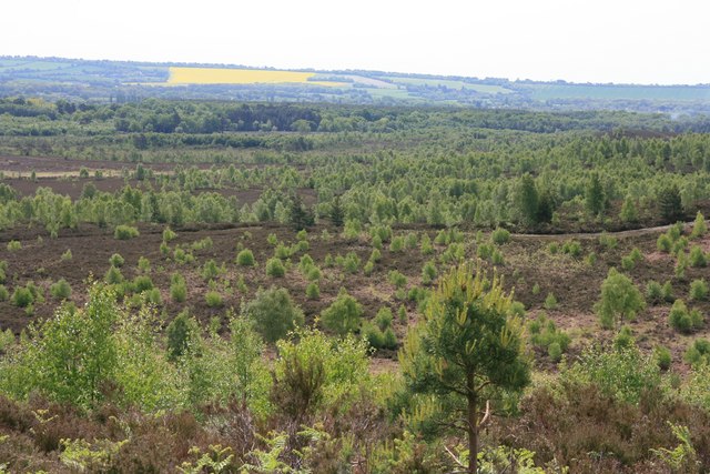
Romping Downs is a prominent hill located in the county of Surrey, England. Nestled in the scenic Surrey Hills, it offers breathtaking views of the surrounding countryside. Standing at an elevation of approximately 200 meters, Romping Downs is a popular destination for outdoor enthusiasts and nature lovers alike.

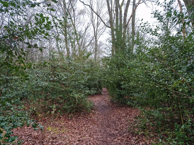
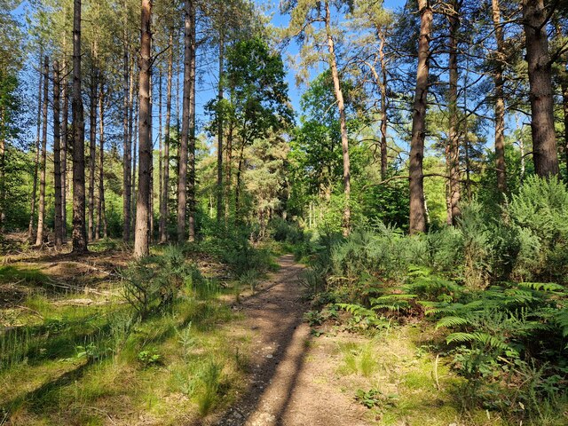
The hill is characterized by its rolling landscape, covered in lush green grass and dotted with patches of vibrant wildflowers during the spring and summer months. The terrain is relatively gentle, making it accessible for hikers of all levels. Numerous trails crisscross the hill, offering opportunities for leisurely strolls, invigorating hikes, and even more challenging treks.

Romping Downs is also home to a diverse array of wildlife. Visitors may spot rabbits, foxes, and various bird species as they explore the area. The hill's natural beauty and tranquility make it an ideal spot for picnics, photography, or simply basking in the peaceful atmosphere.

The hill is easily accessible from the nearby town of Guildford, with ample parking available for visitors. It is also conveniently located near several other attractions in the area, including historic landmarks and charming villages.

Overall, Romping Downs offers a serene escape from the hustle and bustle of everyday life. Its picturesque scenery, diverse wildlife, and well-maintained trails make it a must-visit destination for anyone seeking a peaceful retreat in the heart of Surrey.

If you have any feedback on the listing, please let us know in the comments section below.

Romping Downs Images

Images are sourced within 2km of 51.275218/-0.69598971 or Grid Reference SU9153. Thanks to Geograph Open Source API. All images are credited.

Navigating northwards up the Basher (19) Path eastwards from Chandlers Road to Stony Hill
Navigating northwards up the Basher (19)
Path eastwards from Chandlers Road to Stony Hill
Navigating northwards up the Basher (21) Mytchett: the city limits
Navigating northwards up the Basher (21)
Mytchett: the city limits
Navigating northwards up the Basher (20) The path to Scarp Hill
Navigating northwards up the Basher (20)
The path to Scarp Hill
Mytchett Lake from the Basingstoke Canal towpath At Mytchett the Basingstoke Canal made use of an existing lake or flash, running along its western edge. The origins of the flashes are unknown but they probably resulted from gravel extraction. From the Basingstoke Canal website: Mytchett Lake is an extensive area of open water with abundant white water lily Nymphaea alba and common bulrush Schoenoplectus lacustris and is notable for its fringing colony of purple willow Salix purpurea which is rare in Surrey. The lake supports a large colony of red-eyed damselfly Erythromma najas.
Mytchett Lake from the Basingstoke Canal towpath
At Mytchett the Basingstoke Canal made use of an existing lake or flash, running along its western edge. The origins of the flashes are unknown but they probably resulted from gravel extraction. From the Basingstoke Canal website: Mytchett Lake is an extensive area of open water with abundant white water lily Nymphaea alba and common bulrush Schoenoplectus lacustris and is notable for its fringing colony of purple willow Salix purpurea which is rare in Surrey. The lake supports a large colony of red-eyed damselfly Erythromma najas.
Ash Vale station and bridge The railway from Woking to Alton via Aldershot crosses the Ash to Frimley road on a high embankment, just by Ash Vale station. The station structure - comprising mostly a staircase leading to the platforms - is a less than elegant structure.
Ash Vale station and bridge
The railway from Woking to Alton via Aldershot crosses the Ash to Frimley road on a high embankment, just by Ash Vale station. The station structure - comprising mostly a staircase leading to the platforms - is a less than elegant structure.
Basingstoke Canal near The Swan, Ash Vale The Swan doesn't seem to have a landing stage despite occupying the right bank.
Basingstoke Canal near The Swan, Ash Vale
The Swan doesn't seem to have a landing stage despite occupying the right bank.
Ash Vale railway bridge and Ash Wharf, Basingstoke Canal The nomenclature of the many bridges in this area is somewhat confused.  This is the bridge carrying the ex-LSWR line from Waterloo to Aldershot and Farnham.
Ash Vale railway bridge and Ash Wharf, Basingstoke Canal
The nomenclature of the many bridges in this area is somewhat confused. This is the bridge carrying the ex-LSWR line from Waterloo to Aldershot and Farnham.
Remains of old boat near Mytchett Lake, Basingstoke Canal Only the ribs remain but this boat may have been of archaeological interest.
Remains of old boat near Mytchett Lake, Basingstoke Canal
Only the ribs remain but this boat may have been of archaeological interest.
Mytchett Lake Road Bridge, Basingstoke Canal The bridge carries a minor road.  Beyond it is seen Mytchett Lake, where the canal widens out to form a large stretch of water.
Mytchett Lake Road Bridge, Basingstoke Canal
The bridge carries a minor road. Beyond it is seen Mytchett Lake, where the canal widens out to form a large stretch of water.
Mytchett Lake, Basingstoke Canal Fishing is a popular activity here.  Boats must keep to the strip near the towpath, because parts of the lake are very shallow.
Mytchett Lake, Basingstoke Canal
Fishing is a popular activity here. Boats must keep to the strip near the towpath, because parts of the lake are very shallow.
Mytchett Lake Railway Bridge, Basingstoke Canal This bridge carries the single-track railway from Frimley to Ash Vale, used by trains from Ascot to Aldershot
Mytchett Lake Railway Bridge, Basingstoke Canal
This bridge carries the single-track railway from Frimley to Ash Vale, used by trains from Ascot to Aldershot
Deedman's Footbridge, Basingstoke Canal This footbridge is private, and is not even marked on some maps.
Deedman's Footbridge, Basingstoke Canal
This footbridge is private, and is not even marked on some maps.
Ash Vale Railway Bridge, Basingstoke Canal The bridge carries the Waterloo to Aldershot main line
Ash Vale Railway Bridge, Basingstoke Canal
The bridge carries the Waterloo to Aldershot main line
Greatbottom Flash, Basingstoke Canal Another place where the canal widens out to form a lake.  The use of the term 'Flash' for a stretch of water is interesting and is the only example I know of, outside the Counties of Lancashire and Cheshire, where the term is common.
Greatbottom Flash, Basingstoke Canal
Another place where the canal widens out to form a lake. The use of the term 'Flash' for a stretch of water is interesting and is the only example I know of, outside the Counties of Lancashire and Cheshire, where the term is common.
Heath Vale Bridge, Basingstoke Canal The bridge carries a minor road.
Heath Vale Bridge, Basingstoke Canal
The bridge carries a minor road.
Heath Vale Bridge Another view of this minor bridge, from the other side.
Heath Vale Bridge
Another view of this minor bridge, from the other side.
Woodland on ranges near Mytchett Woods behind the Canal Visitor Centre.
Woodland on ranges near Mytchett
Woods behind the Canal Visitor Centre.
Mytchett Lake Road Bridge, Basingstoke Canal Mytchett Lake is just through the bridge.
Mytchett Lake Road Bridge, Basingstoke Canal
Mytchett Lake is just through the bridge.
Show me another place!

Romping Downs is located at Grid Ref: SU9153 (Lat: 51.275218, Lng: -0.69598971)

Administrative County: Surrey

District: Guildford

Police Authority: Surrey

What 3 Words

///drumbeat.native.scanning. Near Normandy, Surrey

Related Wikis

Ash to Brookwood Heaths

Ash to Brookwood Heaths is a 1,576.3-hectare (3,895-acre) biological Site of Special Scientific Interest west of Guildford in Surrey. It is a Nature Conservation...

Museum of Military Medicine

The Museum of Military Medicine, formerly the Army Medical Services Museum (AMS Museum), is located in Keogh Barracks, on Mytchett Place Road, Mytchett...

Keogh Barracks

Keogh Barracks is a British Army installation on Mytchett Place Road, Mytchett, Surrey, England. == History == The barracks were commissioned to accommodate...

Stag Radio

Stag Radio is the radio station run by the students of the University of Surrey in Guildford, Surrey, England, which broadcasts on 1350AM during term...

Ash Vale

Ash Vale is a village in the borough of Guildford in Surrey, England and the larger, northern settlement of the civil parish of Ash. It is 7 miles (11...

Ash Vale railway station

Ash Vale is a railway station serving the village of Ash Vale in Surrey, England. It is situated at the junction of the London to Alton line and the Ascot...

Snaky Lane Community Wildlife Area

Snaky Lane Community Wildlife Area is a 2.7-hectare (6.7-acre) Local Nature Reserve Surrey. It is owned by Guildford Borough Council and managed by the...

North Camp railway station

North Camp railway station is situated in the civil parish of Ash in Surrey, England. It takes its name from the nearby North Camp area of Farnborough...

Nearby Amenities

Located within 500m of 51.275218,-0.69598971
Cleygate Common
Leisure: common
Place: locality
Source: npe
Lat/Long: 51.2726303/-0.6913886
Lookout Hill
Natural: peak
Source: npe
Lat/Long: 51.2734824/-0.6956942
Ele: 116
Inscription: S5832
Man Made: survey_point
Source: OS7
Lat/Long: 51.275191/-0.6960011
Romping Downs
Place: locality
Source: OS7
Lat/Long: 51.2756409/-0.694203
D
Tourism: viewpoint
Lat/Long: 51.2769018/-0.6916687
The data included in this document is from www.openstreetmap.org. The data is made available under ODbL.

Have you been to Romping Downs?

Leave your review of Romping Downs below (or comments, questions and feedback).