Kinver

Settlement in Staffordshire South Staffordshire

England

Kinver

The Old Grammar School The school from 1511 stands alongside the Holloway in Kinver and is now a private house.
The Old Grammar School Credit: Gordon Griffiths

Kinver is a charming village located in Staffordshire, England. Situated on the western edge of the West Midlands conurbation, it lies approximately 7 miles south-west of Wolverhampton and 9 miles north of Kidderminster. With a population of around 8,000, it maintains a close-knit community atmosphere.

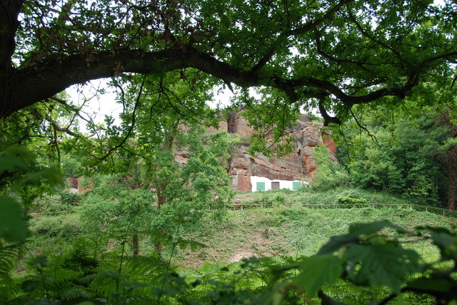
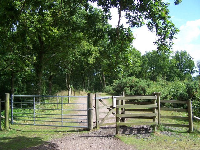
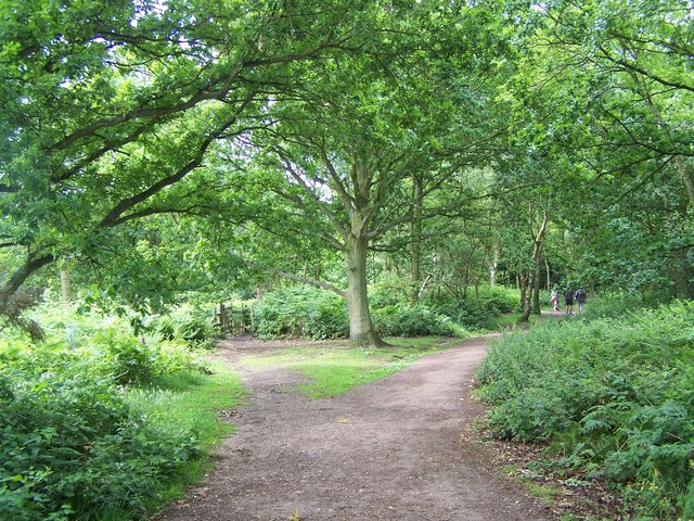
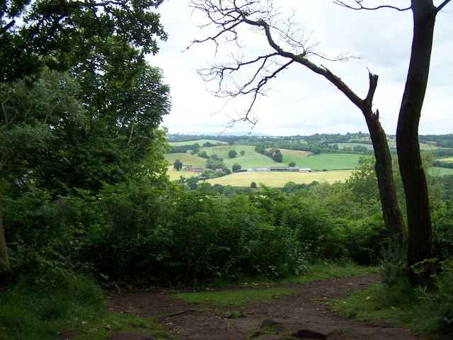
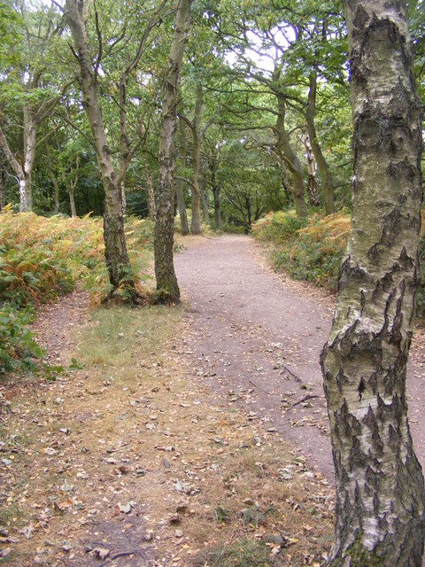
The village is perhaps best known for its stunning sandstone ridge, Kinver Edge, which provides breathtaking views of the surrounding countryside. This National Trust site offers a variety of walking trails and is home to the famous rock houses, cave dwellings that were inhabited until the 1960s. Visitors can explore these unique dwellings and gain insight into the lives of past residents.

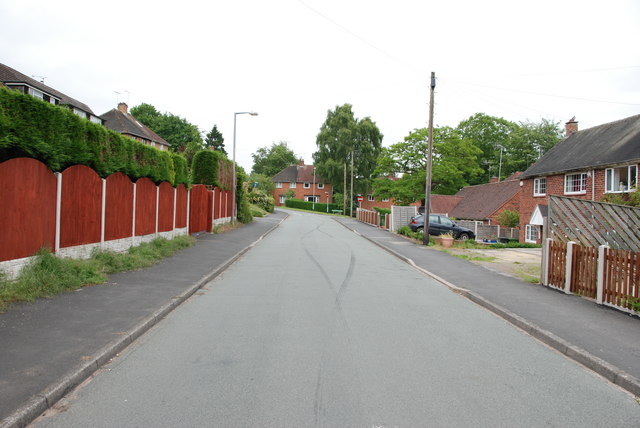
Kinver also boasts a picturesque high street lined with historic buildings, including the 13th-century St. Peter's Church. The village is well-served by local amenities, including a primary school, shops, and several traditional pubs. The historic White Hart Inn, dating back to the 17th century, is a popular spot for locals and tourists alike.

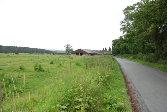
Outdoor enthusiasts will find plenty to enjoy in Kinver, with numerous parks and open spaces, such as the Kingsford Country Park and the Staffordshire and Worcestershire Canal, which offers scenic walks and boating opportunities. The village also hosts various annual events, including the Kinver Country Fayre and the Kinver Music Festival, attracting visitors from near and far.

With its rich history, natural beauty, and strong sense of community, Kinver is a delightful destination for those seeking a tranquil retreat in the heart of Staffordshire.

If you have any feedback on the listing, please let us know in the comments section below.

Kinver Images

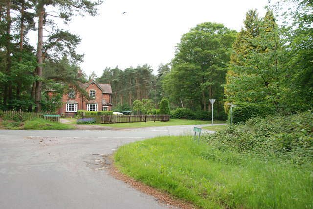
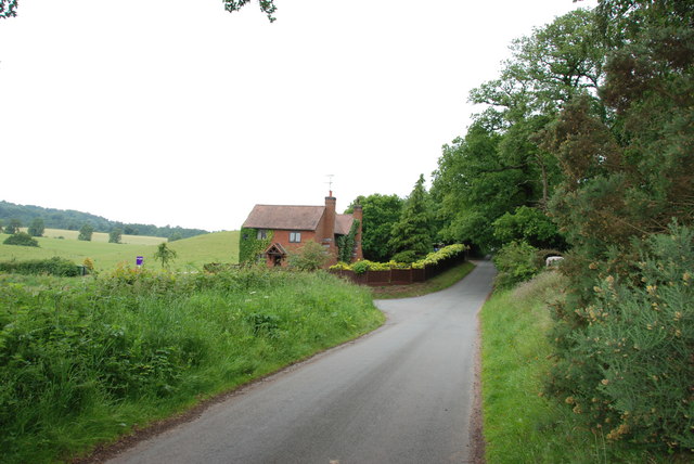
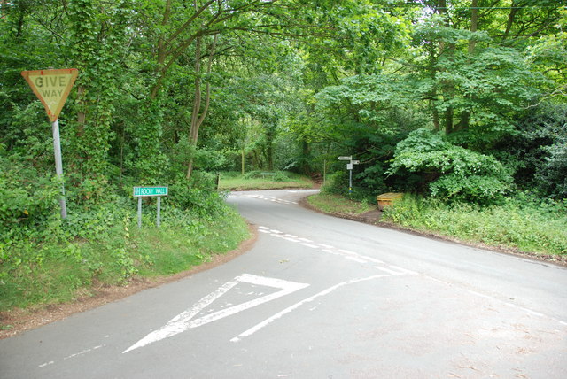
Images are sourced within 2km of 52.454194/-2.235376 or Grid Reference SO8484. Thanks to Geograph Open Source API. All images are credited.

The Old Grammar School The school from 1511 stands alongside the Holloway in Kinver and is now a private house.
The Old Grammar School
The school from 1511 stands alongside the Holloway in Kinver and is now a private house.
The Cross Inn The Kinver Pub stands on the corner of Church Hill and Dark Lane.
The Cross Inn
The Kinver Pub stands on the corner of Church Hill and Dark Lane.
Inside the Cross Inn The Kinver Pub on Church Hill.
Inside the Cross Inn
The Kinver Pub on Church Hill.
Grammar School Plaque The plaque on the front of the former school house in Dark Lane Kinver. See <a href="https://www.geograph.org.uk/photo/2338355">SO8483 : The Old Grammar School</a>
Grammar School Plaque
The plaque on the front of the former school house in Dark Lane Kinver. See SO8483 : The Old Grammar School
Gamekeepers Cottages. These Cottages are on the Enville Road, Compton Road crossroads. Just outside Kinver.
Gamekeepers Cottages.
These Cottages are on the Enville Road, Compton Road crossroads. Just outside Kinver.
House On The Outskirts Of Kinver. This house replaced an old Cottage, around 1990
House On The Outskirts Of Kinver.
This house replaced an old Cottage, around 1990
Crossroads Near Holy Austin Rock, Kinver. These Crossroads are at the Kinver end of Kingsford Lane.
Crossroads Near Holy Austin Rock, Kinver.
These Crossroads are at the Kinver end of Kingsford Lane.
Holy Austin Rock, Kinver. One of the Rock houses has been restored, and is open to the public at certain times.The others have been closed off, as is evident from the Photo, for Health & Safety reasons.
Holy Austin Rock, Kinver.
One of the Rock houses has been restored, and is open to the public at certain times.The others have been closed off, as is evident from the Photo, for Health & Safety reasons.
Entrance To Huntsmans Drive, Kinver
Falcon Farm, Enville. Falcon Farm is part of the Enville Estate.
Falcon Farm, Enville.
Falcon Farm is part of the Enville Estate.
Gate House, Brindley Hall, Compton, Kinver High security, note one of the dogs in right hand corner.
Gate House, Brindley Hall, Compton, Kinver
High security, note one of the dogs in right hand corner.
Staffordshire Way Nearing Kinver
Staffordshire Way On Kinver Edge
View From Kinver Edge
Kinver Ridge Path The footpath runs along the ridge of Kinver Edge.
Kinver Ridge Path
The footpath runs along the ridge of Kinver Edge.
Kinver Lane Junction The view along Compton Road from Meddings Lane, next to Kinver Edge National Trust woodland.
Kinver Lane Junction
The view along Compton Road from Meddings Lane, next to Kinver Edge National Trust woodland.
Kinver Training Camp The view from The Compa of the drive to the local scout hall and the district camp site on Kinver Edge.
Kinver Training Camp
The view from The Compa of the drive to the local scout hall and the district camp site on Kinver Edge.
Kinver Edge Scene The view of the woodland and heath on the National Trust's Kinver Edge near Comber Road.
Kinver Edge Scene
The view of the woodland and heath on the National Trust's Kinver Edge near Comber Road.
Show me another place!

Kinver is located at Grid Ref: SO8484 (Lat: 52.454194, Lng: -2.235376)

Administrative County: Staffordshire

District: South Staffordshire

Police Authority: Staffordshire

What 3 Words

///bids.wasps.trending. Near Kinvere, Staffordshire

Nearby Locations

Littlewood's Common Kinver

Related Wikis

Kinver High School

Kinver High School (formerly Edgecliff High School) is a mixed secondary school and sixth form located in Kinver in the English county of Staffordshire...

Kinver Edge

Kinver Edge is a high heath and woodland escarpment just west of Kinver, about four miles west of Stourbridge, and four miles north of Kidderminster, and...

Kinver

Kinver is a large village in the District of South Staffordshire in Staffordshire, England. It is in the far south-west of the county, at the end of the...

Kinver Edge Hillfort

Kinver Edge Hillfort, is a univallate Iron Age hillfort with a massive rampart and outer ditch along the south-west and south-east sides, with natural...

Nearby Amenities

Located within 500m of 52.454194,-2.235376
Bus Stop
Church View Gardens
Bus: yes
Naptan AtcoCode: 3800C606000
Naptan Bearing: E
Naptan CommonName: Church View Gardens
Naptan Indicator: Adj
Naptan Landmark: No 120
Naptan Street: Church View Gardens
Naptan Verified: no
Public Transport: platform
Source: naptan_import
Lat/Long: 52.4521351/-2.2371801
Bus Stop
Windsor Crescent
Bus: yes
Naptan AtcoCode: 3800C606700
Naptan Bearing: NE
Naptan CommonName: White Hill
Naptan Indicator: Adj
Naptan Landmark: White Hill
Naptan Street: Windsor Crescent
Naptan Verified: no
Public Transport: platform
Source: naptan_import
Lat/Long: 52.4538198/-2.2399116
Bus Stop
Methodist Church
Bus: yes
Naptan AtcoCode: 3800C606800
Naptan Bearing: NW
Naptan BusStopType: CUS
Naptan CommonName: Methodist Church
Naptan Indicator: Adj
Naptan Landmark: Methodist Church
Naptan Street: Potters Cross
Naptan Verified: no
Public Transport: platform
Source: naptan_import
Lat/Long: 52.4540812/-2.2350862
Bus Stop
Methodist Church
Bus: yes
Naptan AtcoCode: 3800C606801
Naptan Bearing: SE
Naptan BusStopType: CUS
Naptan CommonName: Methodist Church
Naptan Indicator: Opp
Naptan Landmark: Methodist Church
Naptan Street: Potters Cross
Naptan Verified: no
Public Transport: platform
Source: naptan_import
Lat/Long: 52.4541176/-2.2348656
Bus Stop
Chandler Avenue
Bus: yes
Naptan AtcoCode: 3800C607000
Naptan Bearing: NW
Naptan CommonName: Chandler Avenue
Naptan Indicator: Opp
Naptan Landmark: Chandler Avenue
Naptan Street: White Hill
Naptan Verified: no
Public Transport: platform
Source: naptan_import
Lat/Long: 52.454724/-2.2373411
Bus Stop
Chandler Avenue
Bus: yes
Naptan AtcoCode: 3800C607001
Naptan Bearing: SE
Naptan BusStopType: CUS
Naptan CommonName: Spring Close
Naptan Indicator: Adj
Naptan Landmark: Spring Close
Naptan Street: White hill
Naptan Verified: no
Public Transport: platform
Source: naptan_import
Lat/Long: 52.454607/-2.2373994
Bus Stop
Edge View Walk
Bus: yes
Naptan AtcoCode: 3800C613000
Naptan Bearing: N
Naptan CommonName: Edge View Walk
Naptan Indicator: Adj
Naptan Landmark: Edge View Walk
Naptan Street: Huntsmans Drive
Naptan Verified: no
Public Transport: platform
Source: naptan_import
Lat/Long: 52.4569752/-2.2400023
Bus Stop
Maple Close
Bus: yes
Naptan AtcoCode: 3800C613100
Naptan Bearing: SE
Naptan CommonName: Maple Close
Naptan Indicator: Adj
Naptan Landmark: Maple Close
Naptan Street: Enville Road
Naptan Verified: no
Public Transport: platform
Source: naptan_import
Lat/Long: 52.45603/-2.2361591
Bus Stop
Meddins Lane
Bus: yes
Naptan AtcoCode: 3800C615701
Naptan Bearing: NW
Naptan CommonName: Meddins Lane
Naptan Indicator: Adj
Naptan Landmark: Meddins Lane
Naptan Street: Windsor Cresent
Naptan Verified: no
Public Transport: platform
Source: naptan_import
Lat/Long: 52.4524161/-2.2405367
Bus Stop
Jenks Avenue
Bus: yes
Naptan AtcoCode: 3800C625701
Naptan Bearing: SE
Naptan CommonName: Jenks Avenue
Naptan Indicator: Opp
Naptan Landmark: Jenks Avenue
Naptan Street: White Hill
Naptan Verified: no
Public Transport: platform
Source: naptan_import
Lat/Long: 52.4550802/-2.2390354
Bus Stop
Jenks Avenue
Bus: yes
Naptan AtcoCode: 3800C625702
Naptan Bearing: NW
Naptan BusStopType: CUS
Naptan CommonName: Jenks Avenue
Naptan Indicator: Adj
Naptan Landmark: Jenks Avenue
Naptan Street: White Hill
Naptan Verified: no
Public Transport: platform
Source: naptan_import
Lat/Long: 52.4549989/-2.2392263
Bus Stop
Castle Street
Bus: yes
Naptan AtcoCode: 3800C630501
Naptan Bearing: NW
Naptan BusStopType: CUS
Naptan CommonName: Foley Street
Naptan Indicator: Opp
Naptan Landmark: Foley Street
Naptan Street: Enville Road
Naptan Verified: no
Public Transport: platform
Source: naptan_import
Lat/Long: 52.45177/-2.2308653
Bus Stop
Castle Street
Bus: yes
Naptan AtcoCode: 3800C630502
Naptan Bearing: SE
Naptan BusStopType: CUS
Naptan CommonName: Foley Street
Naptan Indicator: Adj
Naptan Landmark: Foley Street
Naptan Street: Enville Road
Naptan Verified: no
Public Transport: platform
Source: naptan_import
Lat/Long: 52.4518945/-2.2308783
Bus Stop
Edgecliff High School
Bus: yes
Naptan AtcoCode: 3800C636701
Naptan Bearing: NW
Naptan CommonName: Edgecliff High School
Naptan Indicator: Opp
Naptan Landmark: Edgecliff High School
Naptan Street: Enville Road
Naptan Verified: no
Public Transport: platform
Source: naptan_import
Lat/Long: 52.4530597/-2.2333737
Bus Stop
Edgecliff High School
Bus: yes
Naptan AtcoCode: 3800C636702
Naptan Bearing: SE
Naptan CommonName: Edgecliff High School
Naptan Indicator: Adj
Naptan Landmark: Edgecliff High School
Naptan Street: Enville Road
Naptan Verified: no
Public Transport: platform
Source: naptan_import
Lat/Long: 52.4529798/-2.2328877
Turning Circle
Lat/Long: 52.4520358/-2.2361925
Post Office
Potter's Cross Post Office
Addr City: Stourbridge
Addr Housenumber: 4
Addr Postcode: DY7 6AD
Addr Street: White Hill
Addr Village: Kinver
Brand: Post Office
Brand Wikidata: Q1783168
Fixme: verify by survey
Opening Hours: Mo-Fr 08:30-17:30; Sa 08:30-12:30
Ref Pol Id: 8193
Source: pol_branch_list_2018-02
Website: https://www.postoffice.co.uk/branch-finder/2202085/potter's-cross
Lat/Long: 52.45456/-2.23629
Power: pole
Lat/Long: 52.4572795/-2.230155
Power: pole
Lat/Long: 52.4568659/-2.2295676
Power: pole
Lat/Long: 52.4579281/-2.2316353
Turning Circle
Lat/Long: 52.4526668/-2.2369422
Give Way
Lat/Long: 52.4563077/-2.2411236
Give Way
Direction: backward
Lat/Long: 52.4565465/-2.2414505
Give Way
Direction: backward
Lat/Long: 52.4506252/-2.2389219
The data included in this document is from www.openstreetmap.org. The data is made available under ODbL.

Have you been to Kinver?

Leave your review of Kinver below (or comments, questions and feedback).