Littlewood's Common

Downs, Moorland in Staffordshire South Staffordshire

England

Littlewood's Common

The Old Grammar School The school from 1511 stands alongside the Holloway in Kinver and is now a private house.
The Old Grammar School Credit: Gordon Griffiths

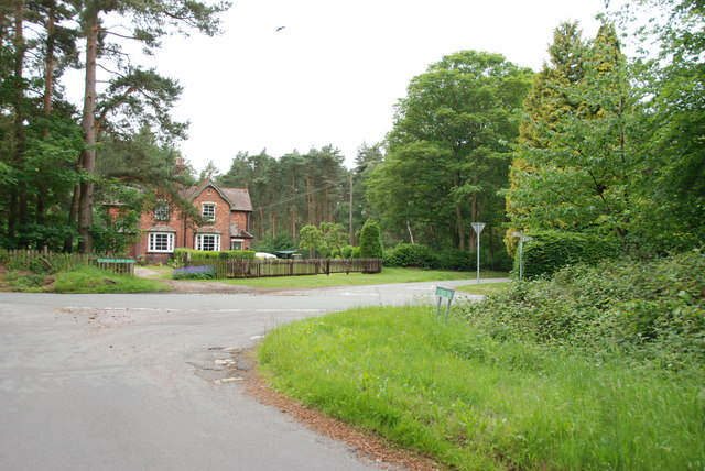
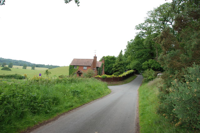
Littlewood's Common is a picturesque area located in Staffordshire, England. It is a combination of downs and moorland, offering a diverse and captivating landscape for visitors to enjoy.

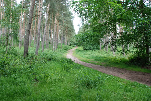
Covering a vast expanse, Littlewood's Common is characterized by rolling hills covered in vibrant green grass, interspersed with patches of heather and wildflowers. The area is renowned for its unspoiled and tranquil atmosphere, making it a popular destination for nature enthusiasts and hikers.

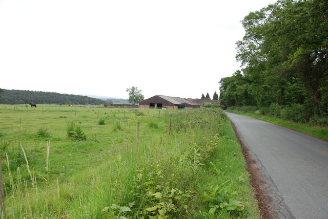
The common is home to a variety of wildlife, including several rare and protected species. Visitors may spot grazing sheep and cattle, as well as rabbits and a wide range of bird species. The diverse flora and fauna make it a haven for nature lovers and photographers.

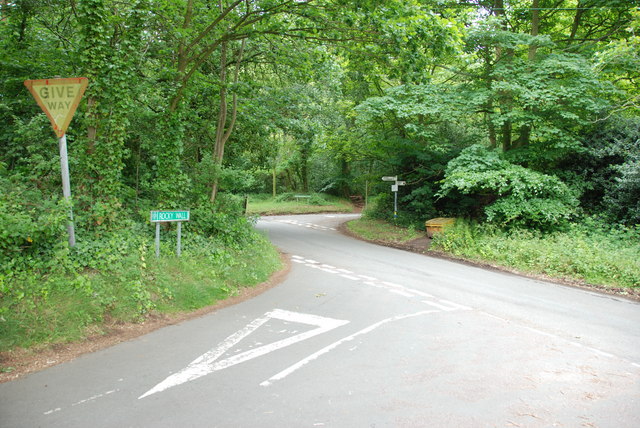
The common offers numerous walking trails and paths, allowing visitors to explore its natural beauty at their own pace. These trails cater to all levels of fitness and provide breathtaking views of the surrounding countryside. From the top of the downs, one can enjoy panoramic vistas of the rolling hills and valleys, enhancing the experience of being in the heart of nature.

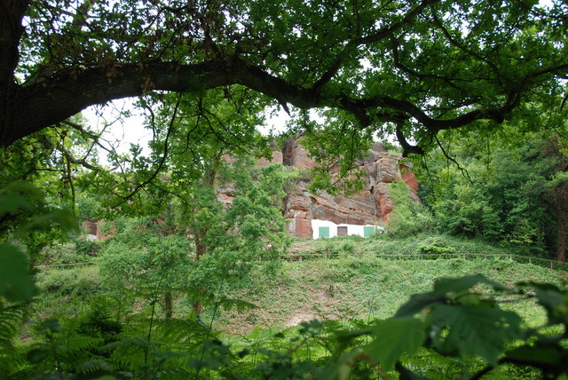
Littlewood's Common also holds historical significance, with traces of ancient settlements and burial grounds dating back to prehistoric times. Archaeological enthusiasts can explore these sites and gain insights into the area's rich history.

In summary, Littlewood's Common in Staffordshire offers a captivating blend of downs and moorland, providing visitors with a serene and picturesque natural setting. Whether it's hiking, wildlife spotting, or immersing oneself in history, this destination has something for everyone.

If you have any feedback on the listing, please let us know in the comments section below.

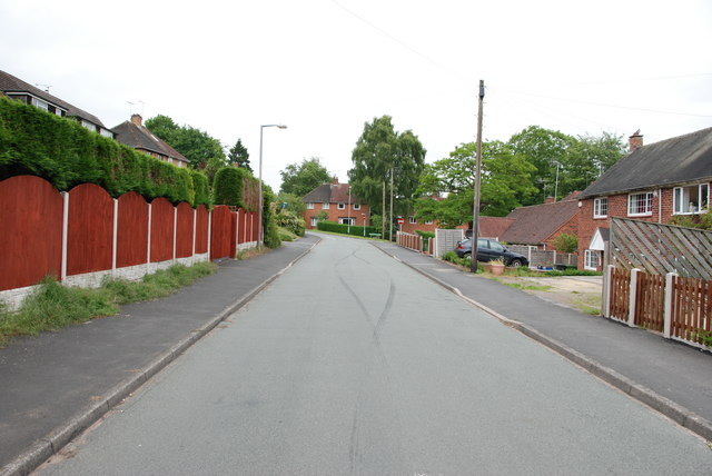
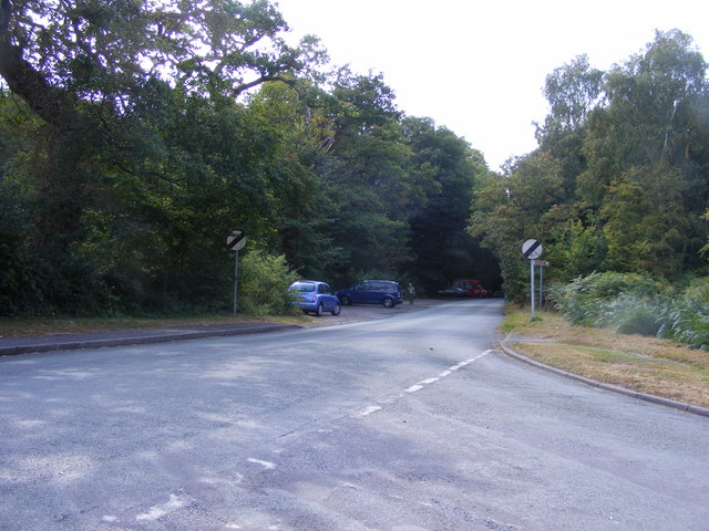
Littlewood's Common Images

Images are sourced within 2km of 52.462667/-2.2340953 or Grid Reference SO8484. Thanks to Geograph Open Source API. All images are credited.

The Old Grammar School The school from 1511 stands alongside the Holloway in Kinver and is now a private house.
The Old Grammar School
The school from 1511 stands alongside the Holloway in Kinver and is now a private house.
The Cross Inn The Kinver Pub stands on the corner of Church Hill and Dark Lane.
The Cross Inn
The Kinver Pub stands on the corner of Church Hill and Dark Lane.
Inside the Cross Inn The Kinver Pub on Church Hill.
Inside the Cross Inn
The Kinver Pub on Church Hill.
Grammar School Plaque The plaque on the front of the former school house in Dark Lane Kinver. See <a href="https://www.geograph.org.uk/photo/2338355">SO8483 : The Old Grammar School</a>
Grammar School Plaque
The plaque on the front of the former school house in Dark Lane Kinver. See SO8483 : The Old Grammar School
Gamekeepers Cottages. These Cottages are on the Enville Road, Compton Road crossroads. Just outside Kinver.
Gamekeepers Cottages.
These Cottages are on the Enville Road, Compton Road crossroads. Just outside Kinver.
House On The Outskirts Of Kinver. This house replaced an old Cottage, around 1990
House On The Outskirts Of Kinver.
This house replaced an old Cottage, around 1990
Crossroads Near Holy Austin Rock, Kinver. These Crossroads are at the Kinver end of Kingsford Lane.
Crossroads Near Holy Austin Rock, Kinver.
These Crossroads are at the Kinver end of Kingsford Lane.
Holy Austin Rock, Kinver. One of the Rock houses has been restored, and is open to the public at certain times.The others have been closed off, as is evident from the Photo, for Health & Safety reasons.
Holy Austin Rock, Kinver.
One of the Rock houses has been restored, and is open to the public at certain times.The others have been closed off, as is evident from the Photo, for Health & Safety reasons.
Entrance To Huntsmans Drive, Kinver
A Track Into The Million.
Falcon Farm, Enville. Falcon Farm is part of the Enville Estate.
Falcon Farm, Enville.
Falcon Farm is part of the Enville Estate.
Public bridleway through Million Wood, near Enville The public bridleway which runs through the heart of this large wood, is the only route which the public can use. There are no other public rights of way, nor is it access land. Forestry operations are undertaken in the wood, so it is probably safest to stick to the correct route!
Public bridleway through Million Wood, near Enville
The public bridleway which runs through the heart of this large wood, is the only route which the public can use. There are no other public rights of way, nor is it access land. Forestry operations are undertaken in the wood, so it is probably safest to stick to the correct route!
Million Wood near Enville A typical scene in the wood, taken from the public bridleway. Although there appears to be a path here, there is no public right of way other than on the bridleway. The trees here are mainly pine. In April 2011, another part of the wood suffered a bad fire, which took some days to extinguish.
Million Wood near Enville
A typical scene in the wood, taken from the public bridleway. Although there appears to be a path here, there is no public right of way other than on the bridleway. The trees here are mainly pine. In April 2011, another part of the wood suffered a bad fire, which took some days to extinguish.
Kinver Lane Junction The view along Compton Road from Meddings Lane, next to Kinver Edge National Trust woodland.
Kinver Lane Junction
The view along Compton Road from Meddings Lane, next to Kinver Edge National Trust woodland.
Kinver Training Camp The view from The Compa of the drive to the local scout hall and the district camp site on Kinver Edge.
Kinver Training Camp
The view from The Compa of the drive to the local scout hall and the district camp site on Kinver Edge.
The Royal Exchange (1), High Street, Kinver It has been a public house for at least a hundred years, probably considerably longer. In the 1911 census it is described as the Royal Exchange Inn. Apparently at one time it was known by local people as the Cherry Tree. Possibly this was once its name, or perhaps more likely there used to be a cherry tree there.

<a href="https://www.geograph.org.uk/photo/2570247">SO8483 : The Royal Exchange (2) - sign, High Street, Kinver</a>.
The Royal Exchange (1), High Street, Kinver
It has been a public house for at least a hundred years, probably considerably longer. In the 1911 census it is described as the Royal Exchange Inn. Apparently at one time it was known by local people as the Cherry Tree. Possibly this was once its name, or perhaps more likely there used to be a cherry tree there. SO8483 : The Royal Exchange (2) - sign, High Street, Kinver.
The Royal Exchange (2) - sign, High Street, Kinver There are various explanations for the meaning of this pub name. This one seems to have something to do with a king, as one is clearly shown on the sign. It is unfortunately rather faded.

<a href="https://www.geograph.org.uk/photo/2570228">SO8483 : The Royal Exchange (1), High Street, Kinver</a>.
The Royal Exchange (2) - sign, High Street, Kinver
There are various explanations for the meaning of this pub name. This one seems to have something to do with a king, as one is clearly shown on the sign. It is unfortunately rather faded. SO8483 : The Royal Exchange (1), High Street, Kinver.
High Street, Kinver A small section of Kinver's very long High Street, which is the main road in the village. The road coming in from the right is Sterrymere Gardens.
High Street, Kinver
A small section of Kinver's very long High Street, which is the main road in the village. The road coming in from the right is Sterrymere Gardens.
Show me another place!

Littlewood's Common is located at Grid Ref: SO8484 (Lat: 52.462667, Lng: -2.2340953)

Administrative County: Staffordshire

District: South Staffordshire

Police Authority: Staffordshire

What 3 Words

///fries.bridges.foresight. Near Kinvere, Staffordshire

Nearby Locations

Littlewood's Common Kinver

Related Wikis

Kinver High School

Kinver High School (formerly Edgecliff High School) is a mixed secondary school and sixth form located in Kinver in the English county of Staffordshire...

Dunsley, Staffordshire

Dunsley is a hamlet in Kinver, Staffordshire, England. The settled part of the hamlet is the part of the village of Kinver, lying east of the River Stour...

Kinver Edge

Kinver Edge is a high heath and woodland escarpment just west of Kinver, about four miles west of Stourbridge, and four miles north of Kidderminster, and...

Kinver

Kinver is a large village in the District of South Staffordshire in Staffordshire, England. It is in the far south-west of the county, at the end of the...

Kinver Edge Hillfort

Kinver Edge Hillfort, is a univallate Iron Age hillfort with a massive rampart and outer ditch along the south-west and south-east sides, with natural...

Enville Hall

Enville Hall is an English Tudor country house in the village of Enville, Staffordshire. It is a Grade II listed building.The house has a 16th and 17th...

Smestow Brook

The Smestow Brook, sometimes called the River Smestow, is a small river that plays an important part in the drainage of Wolverhampton, South Staffordshire...

Great Fountain, Enville

The Great Fountain, Enville, was a fountain created in the mid-19th century by the Earl of Stamford in the middle of a lake on his Enville Hall estate...

Nearby Amenities

Located within 500m of 52.462667,-2.2340953
Gallowstree Elm
Created By: Potlatch 0.10f
Place: hamlet
Lat/Long: 52.4590202/-2.2367071
Bus Stop
Fox Inn PH
Bus: yes
Naptan AtcoCode: 3800C606100
Naptan Bearing: W
Naptan CommonName: Fox Inn PH
Naptan Indicator: Opp
Naptan Landmark: Fox Inn PH
Naptan Street: Clanbrook Rd
Naptan Verified: no
Public Transport: platform
Source: naptan_import
Lat/Long: 52.4650971/-2.2336582
Bus Stop
Chester Road
Bus: yes
Naptan AtcoCode: 3800C606500
Naptan Bearing: NW
Naptan CommonName: Elm Tree
Naptan Indicator: Adj
Naptan Landmark: Elm Tree
Naptan Street: Enville Rd
Naptan Verified: no
Public Transport: platform
Source: naptan_import
Lat/Long: 52.4616219/-2.2406457
Bus Stop
Chester Road
Bus: yes
Naptan AtcoCode: 3800C606501
Naptan Bearing: SE
Naptan CommonName: Chester Road
Naptan Indicator: Adj
Naptan Landmark: Chester Road
Naptan Street: Enville Road
Naptan Verified: no
Public Transport: platform
Source: naptan_import
Lat/Long: 52.4615954/-2.2403954
Littlewood's Common
Place: locality
Source: OS_OpenData_StreetView
Lat/Long: 52.4624094/-2.2345908
Power: pole
Lat/Long: 52.4652971/-2.2394274
Power: pole
Lat/Long: 52.4652775/-2.2396769
Power: pole
Lat/Long: 52.4603341/-2.2297822
Power: pole
Lat/Long: 52.4624145/-2.2312145
Power: pole
Lat/Long: 52.4644164/-2.2351305
Power: pole
Lat/Long: 52.4634898/-2.2367211
Power: pole
Lat/Long: 52.4648804/-2.2382875
Power: pole
Lat/Long: 52.4626612/-2.235329
Power: pole
Lat/Long: 52.4640111/-2.237574
Power: pole
Lat/Long: 52.462975/-2.2358762
Power: pole
Lat/Long: 52.4631531/-2.2333147
Power: pole
Lat/Long: 52.4611202/-2.2296856
Power: pole
Lat/Long: 52.4595627/-2.2298761
Power: pole
Lat/Long: 52.4635731/-2.2345324
Power: pole
Lat/Long: 52.4627282/-2.2321265
Power: pole
Lat/Long: 52.4613751/-2.2332449
Power: pole
Lat/Long: 52.4644588/-2.2383304
Power: pole
Lat/Long: 52.4639717/-2.235841
Power: pole
Lat/Long: 52.4604141/-2.2316812
Power: pole
Lat/Long: 52.4644245/-2.2369625
Power: pole
Lat/Long: 52.4639392/-2.2355811
Power: pole
Lat/Long: 52.461849/-2.2296105
Power: pole
Lat/Long: 52.4609273/-2.2325181
Power: pole
Lat/Long: 52.4622805/-2.234747
Power: pole
Lat/Long: 52.4618948/-2.2340898
The data included in this document is from www.openstreetmap.org. The data is made available under ODbL.

Have you been to Littlewood's Common?

Leave your review of Littlewood's Common below (or comments, questions and feedback).