Larks Hill

Hill, Mountain in Berkshire

England

Larks Hill

Temple Way, Bracknell
Temple Way, Bracknell Credit: Robin Webster

Larks Hill is a picturesque hill located in the county of Berkshire, England. Situated near the village of Larkswood, this natural formation stands at an elevation of approximately 300 meters above sea level. It is part of the Berkshire Downs, a range of chalk hills stretching across the county.

The hill itself is characterized by its gently sloping sides, covered in lush green grass and sprinkled with a variety of wildflowers, providing a delightful sight during the spring and summer months. Larks Hill offers breathtaking panoramic views of the surrounding countryside, with its summit providing an excellent vantage point for observing the rolling hills, meandering rivers, and dense woodlands that make up the landscape.

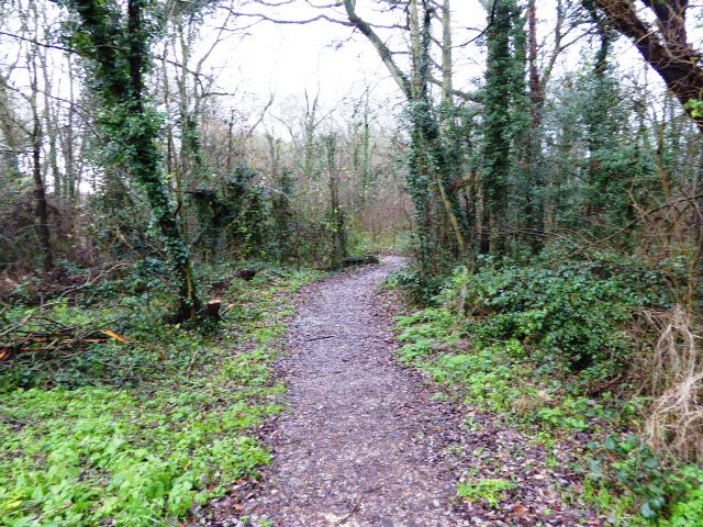
Larks Hill has long been a favored destination for hikers and nature enthusiasts, thanks to its well-maintained footpaths that crisscross the area. These trails cater to a range of abilities, from leisurely strolls to more challenging hikes, ensuring that visitors of all ages and fitness levels can enjoy the beauty of the hill.

The hill also boasts a diverse range of flora and fauna, making it an important habitat for various species of birds, mammals, and plants. Rare wildflowers such as orchids can be found dotting the hillside, while birdwatchers may spot kestrels, skylarks, and other avian species soaring above.

Larks Hill is not only a natural treasure but also holds historical significance. It is believed to have been inhabited since ancient times, with archaeological evidence suggesting human activity dating back thousands of years. Today, the hill serves as a peaceful retreat, offering visitors a chance to reconnect with nature and immerse themselves in the rich history and beauty of the Berkshire countryside.

If you have any feedback on the listing, please let us know in the comments section below.
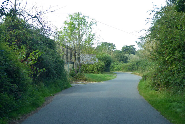
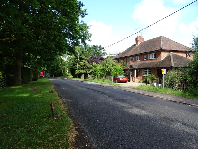
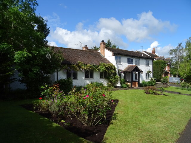
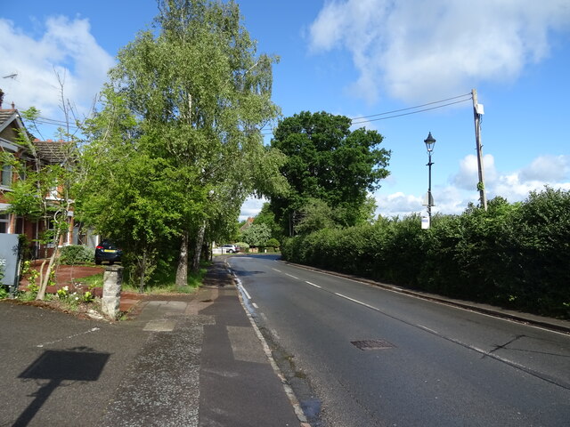
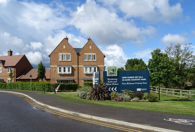
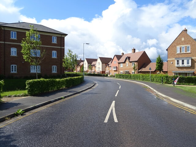
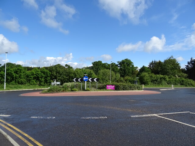
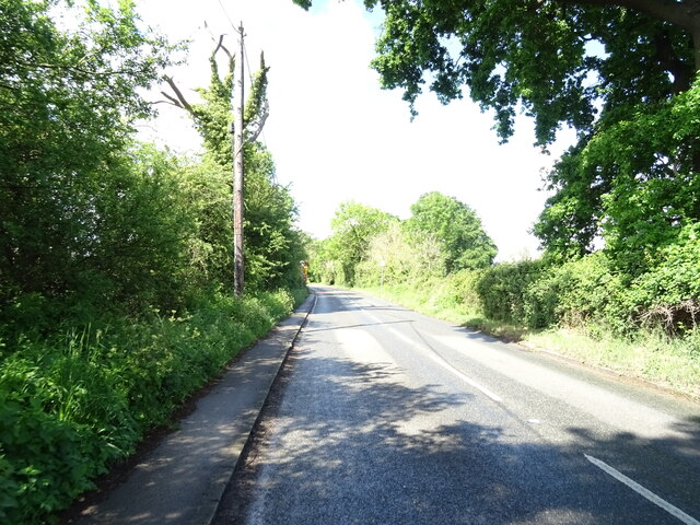
Larks Hill Images

Images are sourced within 2km of 51.429735/-0.75007057 or Grid Reference SU8670. Thanks to Geograph Open Source API. All images are credited.

Temple Way, Bracknell
Cabbage Hill Lane By Ryehurst Farm.
Cabbage Hill Lane
By Ryehurst Farm.
St Michael the Archangel, Warfield: churchyard
St Michael, Warfield at twilight
House on Forest Road, Hayley Green
Cottages on Forest Road
Forest Road (B3034), Hayley Green
Strawberry Hill, Warfield
House on the B3034
House on the B3034
B3034, Newell Green
B3034, Newell Green
House, Newell Green
House, Newell Green
The Yorkshire Rose, Newell Green
Sign for the Yorkshire Rose, Newell Green See <a href="https://www.geograph.org.uk/photo/7280477">SU8771 : The Yorkshire Rose, Newell Green</a> for context.
Sign for the Yorkshire Rose, Newell Green
Forest Road (A3095), Newell Green
Woodhurst Park New housing development, Warfield.
Woodhurst Park
New housing development, Warfield.
Woodhurst Park New housing development, Warfield.
Woodhurst Park
New housing development, Warfield.
Roundabout on the B3034
B3034 towards Binfield
Show me another place!

Larks Hill is located at Grid Ref: SU8670 (Lat: 51.429735, Lng: -0.75007057)

Unitary Authority: Bracknell Forest

Police Authority: Thames Valley

What 3 Words

///lobby.asleep.winter. Near Bracknell, Berkshire

Nearby Locations

Larks Hill

Related Wikis

Quelm Park

Quelm Park is a suburb of Bracknell, in Berkshire, England. The settlement lies west of the A3095 road, south of the Bracknell Northern Distributor Road...

Piggy Wood

Piggy Wood is a 2.3-hectare (5.7-acre) Local Nature Reserve on the northern outskirts of Bracknell in Berkshire. It is owned and managed by Bracknell...

Lawrence Hill, Berkshire

Lawrence Hill is a northern suburb of Bracknell in the English county of Berkshire. It stands within the civil parish of Warfield. The settlement lies...

Whitegrove Copse

Whitegrove Copse is a 3.6-hectare (8.9-acre) Local Nature Reserve on the northern outskirts of Bracknell in Berkshire. It is owned and managed by Bracknell...

Nearby Amenities

Located within 500m of 51.429735,-0.75007057
Created By: Merkaartor 0.10
Lat/Long: 51.4292361/-0.7459143
Crossing
Crossing: unmarked
Kerb: lowered
Lat/Long: 51.4293253/-0.7568849
Mini Roundabout
Direction: clockwise
Lat/Long: 51.4273559/-0.7501652
Mini Roundabout
Direction: clockwise
Lat/Long: 51.4269597/-0.7493618
Mini Roundabout
Direction: clockwise
Source: bing
Lat/Long: 51.4285322/-0.7526409
Crossing
Crossing: uncontrolled
Kerb: lowered
Sloped Curb: yes
Lat/Long: 51.4289171/-0.7543549
Bench
Lat/Long: 51.4298423/-0.749447
Recycling
Lat/Long: 51.4295212/-0.7494642
Ford: yes
Lat/Long: 51.4308852/-0.7522966
Bench
Backrest: yes
Lat/Long: 51.4306666/-0.7441709
Waste Basket
Lat/Long: 51.4306674/-0.7441971
Bench
Backrest: yes
Lat/Long: 51.4306683/-0.7442239
Turning Circle
Lat/Long: 51.4256778/-0.748788
Crossing
Crossing: unmarked
Kerb: lowered
Sloped Curb: yes
Lat/Long: 51.4279493/-0.751364
Mini Roundabout
Source: bing
Lat/Long: 51.428066/-0.752148
Mini Roundabout
Source: bing
Lat/Long: 51.4285257/-0.7533387
Barrier: cycle_barrier
Lat/Long: 51.427184/-0.7449549
Crossing
Crossing: unmarked
Kerb: lowered
Sloped Curb: yes
Lat/Long: 51.4277648/-0.7538444
Crossing
Crossing: unmarked
Kerb: lowered
Sloped Curb: yes
Lat/Long: 51.4280842/-0.7538791
Crossing
Bicycle: yes
Crossing: uncontrolled
Crossing Island: yes
Kerb: lowered
Lat/Long: 51.4292104/-0.7444668
Traffic Calming: island
Lat/Long: 51.4290666/-0.7431162
Crossing
Bicycle: yes
Crossing: uncontrolled
Crossing Island: yes
Kerb: lowered
Lat/Long: 51.429507/-0.744876
Crossing
Bicycle: yes
Crossing: uncontrolled
Crossing Island: yes
Kerb: lowered
Lat/Long: 51.4293014/-0.7444558
Crossing
Bicycle: yes
Crossing: uncontrolled
Crossing Island: yes
Kerb: lowered
Lat/Long: 51.4290287/-0.7449236
Crossing
Bicycle: yes
Crossing: uncontrolled
Crossing Island: yes
Kerb: lowered
Lat/Long: 51.4290324/-0.7447912
Crossing
Bicycle: yes
Crossing: uncontrolled
Crossing Island: yes
Kerb: lowered
Lat/Long: 51.4294994/-0.7450024
Crossing
Crossing: uncontrolled
Kerb: lowered
Sloped Curb: yes
Lat/Long: 51.4292037/-0.75476
Crossing
Crossing: unmarked
Kerb: lowered
Sloped Curb: yes
Lat/Long: 51.4290466/-0.7547461
Barrier: cycle_barrier
Lat/Long: 51.4271712/-0.7559143
Barrier: bollard
Lat/Long: 51.4274175/-0.7558087
Crossing
Bicycle: yes
Crossing Island: yes
Kerb: lowered
Sloped Curb: yes
Lat/Long: 51.4279522/-0.7510946
Crossing
Bicycle: yes
Crossing Island: yes
Kerb: lowered
Sloped Curb: yes
Lat/Long: 51.4277676/-0.7506722
Crossing
Crossing Island: yes
Kerb: lowered
Sloped Curb: yes
Lat/Long: 51.4277869/-0.7506173
Crossing
Bicycle: yes
Crossing Island: yes
Kerb: lowered
Sloped Curb: yes
Lat/Long: 51.4279118/-0.7510974
Crossing
Crossing Island: yes
Kerb: lowered
Sloped Curb: yes
Lat/Long: 51.4280689/-0.7507232
Crossing
Crossing Island: yes
Kerb: lowered
Sloped Curb: yes
Lat/Long: 51.4280762/-0.7508032
Crossing
Bicycle: yes
Crossing: uncontrolled
Crossing Island: yes
Lat/Long: 51.4295473/-0.7500291
Crossing
Bicycle: yes
Crossing: uncontrolled
Crossing Island: yes
Lat/Long: 51.4294699/-0.7500457
Crossing
Bicycle: yes
Crossing: uncontrolled
Crossing Island: yes
Lat/Long: 51.4292474/-0.7505291
Crossing
Bicycle: yes
Crossing: uncontrolled
Crossing Island: yes
Lat/Long: 51.4292378/-0.7504047
Crossing
Bicycle: yes
Crossing: uncontrolled
Crossing Island: yes
Kerb: lowered
Lat/Long: 51.4291352/-0.7453291
Crossing
Bicycle: yes
Crossing: uncontrolled
Crossing Island: yes
Kerb: lowered
Lat/Long: 51.4292152/-0.7453631
Crossing
Bicycle: yes
Crossing: uncontrolled
Crossing Island: yes
Lat/Long: 51.4294006/-0.7532278
Crossing
Crossing: uncontrolled
Crossing Island: yes
Lat/Long: 51.4294946/-0.7527324
Crossing
Bicycle: yes
Crossing: unmarked
Lat/Long: 51.4310357/-0.7510336
Crossing
Bicycle: yes
Crossing: uncontrolled
Crossing Island: yes
Lat/Long: 51.4297271/-0.7505664
Crossing
Bicycle: yes
Crossing: uncontrolled
Crossing Island: yes
Lat/Long: 51.4297441/-0.750436
Crossing
Bicycle: yes
Crossing: traffic_signals
Crossing Island: yes
Crossing Ref: toucan
Source: survey
Lat/Long: 51.4313257/-0.75093
Traffic Signals
Source: seen on journey
Traffic Signals Direction: backward
Lat/Long: 51.4312727/-0.7509385
Traffic Signals
Source: seen on journey
Traffic Signals Direction: forward
Lat/Long: 51.4313779/-0.7509217
Barrier: cycle_barrier
Material: wood
Lat/Long: 51.4314503/-0.7559946
Crossing
Bicycle: yes
Crossing: unmarked
Lat/Long: 51.4314423/-0.7559296
Barrier: cycle_barrier
Material: wood
Lat/Long: 51.4314335/-0.7558575
Crossing
Crossing: uncontrolled
Crossing Island: yes
Lat/Long: 51.4332881/-0.7507713
Barrier: kerb
Kerb: lowered
Tactile Paving: yes
Lat/Long: 51.4322518/-0.7509117
Crossing
Crossing: uncontrolled
Crossing Island: yes
Lat/Long: 51.4332668/-0.7508275
Barrier: kerb
Kerb: lowered
Tactile Paving: yes
Lat/Long: 51.4321408/-0.7509447
Barrier: kerb
Kerb: lowered
Tactile Paving: yes
Lat/Long: 51.4317159/-0.7509765
Barrier: kerb
Kerb: lowered
Tactile Paving: yes
Lat/Long: 51.4318209/-0.7509652
Crossing
Bicycle: yes
Crossing: unmarked
Lat/Long: 51.4317688/-0.7509708
Crossing
Crossing: marked
Lat/Long: 51.4316538/-0.7511684
Crossing
Bicycle: yes
Crossing: unmarked
Lat/Long: 51.4322065/-0.7509252
Crossing
Crossing: marked
Lat/Long: 51.4316659/-0.7514002
Barrier: cycle_barrier
Lat/Long: 51.431119/-0.7507399
Bicycle: yes
Board Type: notice
Foot: yes
Information: map
Tourism: information
Lat/Long: 51.4311833/-0.7546362
Crossing
Crossing: uncontrolled
Crossing Island: yes
Lat/Long: 51.4335504/-0.7511106
Crossing
Crossing: uncontrolled
Crossing Island: yes
Lat/Long: 51.4335197/-0.7507071
Crossing
Crossing: uncontrolled
Crossing Island: yes
Lat/Long: 51.4334788/-0.7506673
Crossing
Crossing: uncontrolled
Crossing Island: yes
Lat/Long: 51.4335878/-0.7510186
Crossing
Crossing: unmarked
Kerb: lowered
Lat/Long: 51.433096/-0.7526555
Barrier: kerb
Kerb: lowered
Tactile Paving: yes
Lat/Long: 51.4338695/-0.7513348
Barrier: kerb
Kerb: lowered
Tactile Paving: yes
Lat/Long: 51.4340089/-0.7513969
Crossing
Bicycle: yes
Crossing: unmarked
Crossing Island: yes
Lat/Long: 51.4339387/-0.7513656
Barrier: bollard
Bollard: fixed
Material: wood
Motor Vehicle: no
Lat/Long: 51.4315508/-0.7485556
Crossing
Crossing: uncontrolled
Crossing Ref: zebra
Lat/Long: 51.4335546/-0.7501337
Crossing
Bicycle: yes
Crossing: uncontrolled
Crossing Island: yes
Lat/Long: 51.4333405/-0.7511865
Crossing
Bicycle: yes
Crossing: uncontrolled
Crossing Island: yes
Lat/Long: 51.4332993/-0.7511407
Barrier: kerb
Lat/Long: 51.4329491/-0.753049
Crossing
Barrier: kerb
Bicycle: yes
Crossing: traffic_signals
Crossing Ref: toucan
Kerb: lowered
Source: survey
Lat/Long: 51.4294742/-0.7511195
Traffic Signals
Source: survey
Traffic Signals Direction: forward
Lat/Long: 51.4294784/-0.75119
Traffic Signals
Source: survey
Traffic Signals Direction: backward
Lat/Long: 51.4294674/-0.7510529
Crossing
Crossing: unmarked
Lat/Long: 51.4326018/-0.7476892
Information: board
Tourism: information
Lat/Long: 51.4307474/-0.7488858
Barrier: kerb
Kerb: lowered
Tactile Paving: yes
Lat/Long: 51.4335557/-0.751085
Generator Method: photovoltaic
Generator Output Electricity: yes
Generator Solar Modules: 34
Generator Source: solar
Generator Type: solar_photovoltaic_panel
Location: roof
Power: generator
Tilted: no
Lat/Long: 51.433837/-0.7506023
Generator Method: photovoltaic
Generator Output Electricity: yes
Generator Solar Modules: 68
Generator Source: solar
Generator Type: solar_photovoltaic_panel
Location: roof
Power: generator
Tilted: no
Lat/Long: 51.4339687/-0.7509212
Generator Method: photovoltaic
Generator Output Electricity: yes
Generator Solar Modules: 40
Generator Source: solar
Generator Type: solar_photovoltaic_panel
Location: roof
Power: generator
Tilted: no
Lat/Long: 51.4341882/-0.7507662
Direction: 215
Generator Method: photovoltaic
Generator Output Electricity: yes
Generator Solar Modules: 15
Generator Source: solar
Generator Type: solar_photovoltaic_panel
Location: roof
Power: generator
Lat/Long: 51.4284394/-0.7473458
Direction: 180
Generator Method: photovoltaic
Generator Output Electricity: yes
Generator Solar Modules: 5
Generator Source: solar
Generator Type: solar_photovoltaic_panel
Location: roof
Power: generator
Lat/Long: 51.4280154/-0.7462928
Direction: 180
Generator Method: photovoltaic
Generator Output Electricity: yes
Generator Solar Modules: 5
Generator Source: solar
Generator Type: solar_photovoltaic_panel
Location: roof
Power: generator
Lat/Long: 51.4280138/-0.7461648
Direction: 180
Generator Method: photovoltaic
Generator Output Electricity: yes
Generator Solar Modules: 5
Generator Source: solar
Generator Type: solar_photovoltaic_panel
Location: roof
Power: generator
Lat/Long: 51.4280115/-0.7460357
Direction: 180
Generator Method: photovoltaic
Generator Output Electricity: yes
Generator Solar Modules: 5
Generator Source: solar
Generator Type: solar_photovoltaic_panel
Location: roof
Power: generator
Lat/Long: 51.4280103/-0.7458984
Direction: 180
Generator Method: photovoltaic
Generator Output Electricity: yes
Generator Solar Modules: 2
Generator Source: solar
Generator Type: solar_photovoltaic_panel
Location: roof
Power: generator
Lat/Long: 51.4280189/-0.7459667
Direction: 180
Generator Method: photovoltaic
Generator Output Electricity: yes
Generator Solar Modules: 2
Generator Source: solar
Generator Type: solar_photovoltaic_panel
Location: roof
Power: generator
Lat/Long: 51.4280219/-0.7462286
Direction: 230
Generator Method: photovoltaic
Generator Output Electricity: yes
Generator Solar Modules: 11
Generator Source: solar
Generator Type: solar_photovoltaic_panel
Location: roof
Power: generator
Lat/Long: 51.427774/-0.7459571
Direction: 230
Generator Method: photovoltaic
Generator Output Electricity: yes
Generator Solar Modules: 11
Generator Source: solar
Generator Type: solar_photovoltaic_panel
Location: roof
Power: generator
Lat/Long: 51.427731/-0.7460465
Direction: 175
Generator Method: photovoltaic
Generator Output Electricity: yes
Generator Solar Modules: 5
Generator Source: solar
Generator Type: solar_photovoltaic_panel
Location: roof
Power: generator
Lat/Long: 51.427261/-0.7452643
Direction: 265
Generator Method: photovoltaic
Generator Output Electricity: yes
Generator Solar Modules: 11
Generator Source: solar
Generator Type: solar_photovoltaic_panel
Location: roof
Power: generator
Lat/Long: 51.4272745/-0.7453063
Direction: 180
Generator Method: photovoltaic
Generator Output Electricity: yes
Generator Solar Modules: 16
Generator Source: solar
Generator Type: solar_photovoltaic_panel
Location: roof
Power: generator
Lat/Long: 51.4278352/-0.7446075
Direction: 180
Generator Method: photovoltaic
Generator Output Electricity: yes
Generator Solar Modules: 16
Generator Source: solar
Generator Type: solar_photovoltaic_panel
Location: roof
Power: generator
Lat/Long: 51.4268503/-0.7539713
Direction: 230
Generator Method: photovoltaic
Generator Output Electricity: yes
Generator Solar Modules: 17
Generator Source: solar
Generator Type: solar_photovoltaic_panel
Location: roof
Power: generator
Lat/Long: 51.4258781/-0.7489501
Barrier: kerb
Kerb: lowered
Tactile Paving: yes
Lat/Long: 51.429399/-0.7531124
Barrier: kerb
Kerb: lowered
Tactile Paving: yes
Lat/Long: 51.4294025/-0.7533557
Barrier: kerb
Kerb: lowered
Tactile Paving: yes
Lat/Long: 51.4294004/-0.7532107
Barrier: kerb
Kerb: lowered
Tactile Paving: yes
Lat/Long: 51.4294009/-0.7532468
Barrier: kerb
Kerb: lowered
Tactile Paving: no
Lat/Long: 51.4295525/-0.7528414
Barrier: kerb
Kerb: lowered
Tactile Paving: yes
Lat/Long: 51.4294846/-0.7527319
Barrier: kerb
Kerb: lowered
Tactile Paving: yes
Lat/Long: 51.4295079/-0.752733
Barrier: kerb
Kerb: lowered
Tactile Paving: yes
Lat/Long: 51.4295384/-0.7527343
Barrier: kerb
Kerb: lowered
Tactile Paving: yes
Lat/Long: 51.4294605/-0.7527309
Barrier: kerb
Kerb: lowered
Tactile Paving: yes
Lat/Long: 51.4294912/-0.7500515
Barrier: kerb
Kerb: lowered
Tactile Paving: yes
Lat/Long: 51.4295352/-0.7500352
Barrier: kerb
Kerb: lowered
Tactile Paving: no
Lat/Long: 51.4292431/-0.7504333
Barrier: kerb
Kerb: lowered
Tactile Paving: no
Lat/Long: 51.429246/-0.7504811
Barrier: kerb
Kerb: lowered
Tactile Paving: no
Lat/Long: 51.4292493/-0.7505924
Barrier: kerb
Kerb: lowered
Tactile Paving: no
Lat/Long: 51.4292246/-0.7503334
Barrier: kerb
Kerb: lowered
Tactile Paving: yes
Lat/Long: 51.4294283/-0.7511213
Barrier: kerb
Kerb: lowered
Tactile Paving: yes
Lat/Long: 51.4295208/-0.7511177
Barrier: kerb
Kerb: lowered
Tactile Paving: yes
Lat/Long: 51.4297329/-0.7506099
Barrier: kerb
Kerb: lowered
Tactile Paving: yes
Lat/Long: 51.4297212/-0.7505219
Barrier: kerb
Kerb: lowered
Tactile Paving: yes
Lat/Long: 51.429731/-0.7504777
Barrier: kerb
Kerb: lowered
Tactile Paving: yes
Lat/Long: 51.4297537/-0.7504053
Barrier: kerb
Kerb: lowered
Tactile Paving: yes
Lat/Long: 51.42943/-0.750035
Barrier: kerb
Kerb: lowered
Tactile Paving: yes
Lat/Long: 51.4295828/-0.7500111
Barrier: kerb
Kerb: lowered
Tactile Paving: yes
Lat/Long: 51.4310632/-0.7510457
Barrier: kerb
Kerb: lowered
Tactile Paving: yes
Lat/Long: 51.4310086/-0.7510216
Barrier: kerb
Kerb: lowered
Tactile Paving: yes
Lat/Long: 51.4313253/-0.7508583
Barrier: kerb
Kerb: lowered
Tactile Paving: yes
Lat/Long: 51.431326/-0.7510054
Barrier: kerb
Kerb: lowered
Tactile Paving: yes
Lat/Long: 51.4313258/-0.7509543
Barrier: kerb
Kerb: lowered
Tactile Paving: yes
Lat/Long: 51.4313256/-0.7509063
Barrier: bollard
Motor Vehicle: no
Source Motor Vehicle: sign
Lat/Long: 51.4319937/-0.7473973
Barrier: kerb
Kerb: lowered
Tactile Paving: yes
Lat/Long: 51.4325679/-0.7476785
Barrier: kerb
Kerb: lowered
Tactile Paving: yes
Lat/Long: 51.4326885/-0.7477166
Barrier: kerb
Lat/Long: 51.4335926/-0.7483231
Crossing
Crossing: unmarked
Source: Bing
Lat/Long: 51.4333479/-0.7492757
Barrier: kerb
Kerb: lowered
Tactile Paving: no
Lat/Long: 51.4335379/-0.7502299
Barrier: kerb
Kerb: lowered
Tactile Paving: no
Lat/Long: 51.433596/-0.7501882
Barrier: kerb
Kerb: lowered
Tactile Paving: yes
Lat/Long: 51.4335777/-0.7501185
Barrier: kerb
Kerb: lowered
Tactile Paving: yes
Lat/Long: 51.4335278/-0.7501491
Barrier: kerb
Kerb: lowered
Tactile Paving: yes
Lat/Long: 51.4332479/-0.7508535
Barrier: kerb
Kerb: lowered
Tactile Paving: yes
Lat/Long: 51.433277/-0.7508134
Barrier: kerb
Kerb: lowered
Tactile Paving: yes
Lat/Long: 51.433285/-0.7507933
Barrier: kerb
Kerb: lowered
Tactile Paving: yes
Lat/Long: 51.4332961/-0.7507151
Barrier: kerb
Kerb: lowered
Tactile Paving: yes
Lat/Long: 51.4334558/-0.7506368
Barrier: kerb
Kerb: lowered
Tactile Paving: yes
Lat/Long: 51.4334907/-0.7506832
Barrier: kerb
Kerb: lowered
Tactile Paving: yes
Lat/Long: 51.4335063/-0.7507011
Barrier: kerb
Kerb: lowered
Tactile Paving: yes
Lat/Long: 51.43355/-0.7507206
Barrier: kerb
Kerb: lowered
Tactile Paving: yes
Lat/Long: 51.433573/-0.7510418
Barrier: kerb
Kerb: lowered
Tactile Paving: yes
Lat/Long: 51.4335412/-0.7511547
Barrier: kerb
Kerb: lowered
Tactile Paving: yes
Lat/Long: 51.4336011/-0.7509979
Barrier: kerb
Kerb: lowered
Tactile Paving: yes
Lat/Long: 51.433329/-0.7511693
Barrier: kerb
Kerb: lowered
Tactile Paving: yes
Lat/Long: 51.4333145/-0.7511497
Barrier: kerb
Kerb: lowered
Tactile Paving: yes
Lat/Long: 51.4332808/-0.7511299
Barrier: kerb
Kerb: lowered
Tactile Paving: yes
Lat/Long: 51.4333619/-0.7512187
Barrier: kerb
Lat/Long: 51.4334736/-0.7495918
Barrier: kerb
Kerb: lowered
Tactile Paving: yes
Lat/Long: 51.4314379/-0.7558935
Barrier: kerb
Kerb: lowered
Tactile Paving: yes
Lat/Long: 51.4314475/-0.7559716
Give Way
Lat/Long: 51.4318303/-0.7511219
Crossing
Crossing: marked
Lat/Long: 51.4322777/-0.7510412
The data included in this document is from www.openstreetmap.org. The data is made available under ODbL.

Have you been to Larks Hill?

Leave your review of Larks Hill below (or comments, questions and feedback).