Toston Hill

Hill, Mountain in Leicestershire Melton

England

Toston Hill

Seat in coppiced ash; Grantham Canal The ash seems to be in good health
Seat in coppiced ash; Grantham Canal Credit: Tim Heaton

Toston Hill is a prominent hill located in Leicestershire, England. It is situated near the village of Toston, hence its name. With an elevation of approximately 200 meters (656 feet), it is not classified as a mountain but rather as a hill. Despite its relatively modest height, Toston Hill offers stunning panoramic views of the surrounding countryside, making it a popular destination for outdoor enthusiasts and nature lovers.

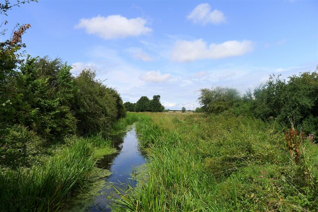
The hill itself is characterized by its gentle slopes, covered in grass and occasionally dotted with trees. It is accessible via several footpaths and trails that wind their way up to the summit. These paths are well-maintained and suitable for walkers of all abilities. Along the way, visitors can admire a variety of flora and fauna, including wildflowers and numerous bird species.

At the top of Toston Hill, visitors are rewarded with breathtaking views of the Leicestershire countryside. On clear days, it is possible to see for miles in every direction, with rolling fields and picturesque villages stretching out before you. The summit also offers an ideal vantage point for watching the sunset or sunrise, as the unobstructed views create a truly magical experience.

Toston Hill is not only a popular spot for leisurely walks and enjoying the scenery, but it also holds historical significance. The hill has been inhabited since ancient times, and archaeological evidence suggests that it was once the site of an Iron Age settlement. Today, visitors can explore these historical remnants, adding an extra layer of interest to their visit.

In conclusion, Toston Hill is a stunning natural landmark in Leicestershire, offering visitors the chance to immerse themselves in the beauty of the countryside while also exploring its rich history.

If you have any feedback on the listing, please let us know in the comments section below.

Toston Hill Images

Images are sourced within 2km of 52.928125/-0.80190579 or Grid Reference SK8037. Thanks to Geograph Open Source API. All images are credited.

Seat in coppiced ash; Grantham Canal The ash seems to be in good health
Seat in coppiced ash; Grantham Canal
The ash seems to be in good health
The Grantham Canal north of Redmile The late summer vegetation makes the canal invisible from the towpath.
The Grantham Canal north of Redmile
The late summer vegetation makes the canal invisible from the towpath.
Public footpath off Easthorpe Lane
Easthorpe Lane byway entering Redmile
Footpath through wheat field Heading towards Redmile
Footpath through wheat field
Heading towards Redmile
Wheat, Vale of Belvoir The Vale has some good quality agricultural land.
Wheat, Vale of Belvoir
The Vale has some good quality agricultural land.
Track from Muston Gorse Farm Leading towards a bridge over the Grantham Canal
Track from Muston Gorse Farm
Leading towards a bridge over the Grantham Canal
Grantham Canal from Muston Gorse Bridge A public towpath runs along the north (left) side
Grantham Canal from Muston Gorse Bridge
A public towpath runs along the north (left) side
The footpath alongside Winter Beck
Footpath approaching Castle View road The path has followed Winter Beck (left of post) from Muston Gorse Farm, passing fields of wheat and, here, oats.
Footpath approaching Castle View road
The path has followed Winter Beck (left of post) from Muston Gorse Farm, passing fields of wheat and, here, oats.
Castle View Road crossing Winter Beck
Grantham Canal from Easthorpe Road Bridge Why the change in the bridge's name? Easthorpe Road Bridge was formerly called 'Middlestile Bridge' on older OS maps; and the road it carries is called Castle View Road.
Grantham Canal from Easthorpe Road Bridge
Why the change in the bridge's name? Easthorpe Road Bridge was formerly called 'Middlestile Bridge' on older OS maps; and the road it carries is called Castle View Road.
Grantham Canal towpath The canal on its circuitous route across the Vale of Belvoir
Grantham Canal towpath
The canal on its circuitous route across the Vale of Belvoir
Grantham Canal entering the cutting at Coston Hill As a largely 'contour' canal its route meanders across the Vale of Belvoir following the 45 metre level. At this point it must cut through a 'hill' (a relative term for the Vale) of just over 50 metres.
Grantham Canal entering the cutting at Coston Hill
As a largely 'contour' canal its route meanders across the Vale of Belvoir following the 45 metre level. At this point it must cut through a 'hill' (a relative term for the Vale) of just over 50 metres.
St Mary's Parish Church, Bottesford St Mary's Parish Church, Grade I listed, 13thC origins with tower and crocketed spire originally 15thC but completely rebuilt 1876
St Mary's Parish Church, Bottesford
St Mary's Parish Church, Grade I listed, 13thC origins with tower and crocketed spire originally 15thC but completely rebuilt 1876
OS Cut Mark - Bottesford, St Mary's Church <span class="nowrap"><a title="https://www.bench-marks.org.uk/bm34655" rel="nofollow ugc noopener" href="https://www.bench-marks.org.uk/bm34655">Link</a><img style="margin-left:2px;" alt="External link" title="External link - shift click to open in new window" src="https://s1.geograph.org.uk/img/external.png" width="10" height="10"/></span>
OS Cut Mark - Bottesford, St Mary's Church
Location of Cut Mark - Bottesford, St Mary's Church
Bottesford Station Seen here from the footbridge between the staggered platforms, Bottesford is an intermediate stop on the line between Grantham and Nottingham. It was opened in 1850 and became part of the Great Northern Railway's network in the East Midlands. Until 1953, in addition to trains heading for Nottingham, this platform was used by trains to Leicester via Melton Mowbray, although in the years before withdrawal the service was extremely sparse. Perhaps surprisingly, the station was not listed for closure in the Beeching report although it has been unstaffed for many years and passenger facilities are nowadays limited to a waiting shelter.
Bottesford Station
Seen here from the footbridge between the staggered platforms, Bottesford is an intermediate stop on the line between Grantham and Nottingham. It was opened in 1850 and became part of the Great Northern Railway's network in the East Midlands. Until 1953, in addition to trains heading for Nottingham, this platform was used by trains to Leicester via Melton Mowbray, although in the years before withdrawal the service was extremely sparse. Perhaps surprisingly, the station was not listed for closure in the Beeching report although it has been unstaffed for many years and passenger facilities are nowadays limited to a waiting shelter.
Show me another place!

Toston Hill is located at Grid Ref: SK8037 (Lat: 52.928125, Lng: -0.80190579)

Administrative County: Leicestershire

District: Melton

Police Authority: Leicestershire

What 3 Words

///trouble.regaining.weddings. Near Bottesford, Leicestershire

Nearby Locations

Toston Hill

Related Wikis

Belvoir Rural District

Belvoir was a rural district in Leicestershire, England from 1894 to 1935. It was formed under the Local Government Act 1894 from the part of the Grantham...

Bottesford, Leicestershire

Bottesford is a village and civil parish in the Borough of Melton in the ceremonial county of Leicestershire, England. It lies close to the borders of...

The Priory Belvoir Academy

The Priory Belvoir Academy (formerly Belvoir High School) is a mixed secondary school located in Bottesford in the English county of Leicestershire. The...

Bottesford South railway station

Bottesford South railway station was a railway station serving the village of Bottesford, Leicestershire, on the Great Northern and London and North Western...

Nearby Amenities

Located within 500m of 52.928125,-0.80190579
Description: Grantham Canal information board
Tourism: information
Lat/Long: 52.927893/-0.8037805
Bench
Lat/Long: 52.9263045/-0.8064498
Power: tower
Source: Bing
Lat/Long: 52.9313551/-0.8035902
Power: tower
Source: Bing
Lat/Long: 52.9282573/-0.7960478
Power: tower
Source: Bing
Lat/Long: 52.9298353/-0.799878
Bottesford Wharf
Place: locality
Source: Bing
Lat/Long: 52.9276056/-0.804649
Thisisit
Place: isolated_dwelling
Source: Bing
Lat/Long: 52.927675/-0.8023701
Toston Hill
Place: locality
Source: Bing
Lat/Long: 52.9289639/-0.8021012
Material: wood
Power: pole
Source: Bing
Lat/Long: 52.9316946/-0.8014441
Material: wood
Power: pole
Source: Bing
Lat/Long: 52.9312354/-0.8026779
Material: wood
Power: pole
Source: Bing
Lat/Long: 52.9307213/-0.8039332
Material: wood
Power: pole
Source: Bing
Lat/Long: 52.9302665/-0.805153
Material: wood
Power: pole
Source: Bing
Lat/Long: 52.9297831/-0.8063949
Material: wood
Power: pole
Source: Bing
Lat/Long: 52.9301129/-0.8077387
Material: wood
Power: pole
Source: Bing
Lat/Long: 52.9321828/-0.8002049
Material: wood
Power: pole
Lat/Long: 52.9240417/-0.7997543
Material: wood
Power: pole
Lat/Long: 52.9250022/-0.800221
Material: wood
Power: pole
Lat/Long: 52.9258512/-0.8006153
Material: wood
Power: pole
Lat/Long: 52.9267186/-0.8011101
Material: wood
Power: pole
Lat/Long: 52.9275522/-0.8014923
Material: wood
Power: pole
Lat/Long: 52.9281375/-0.8022058
Material: wood
Power: pole
Lat/Long: 52.9280291/-0.8032478
Material: wood
Power: pole
Lat/Long: 52.9279596/-0.803846
Material: wood
Power: pole
Lat/Long: 52.9278278/-0.8050597
Material: wood
Power: pole
Lat/Long: 52.9280599/-0.8065912
Material: wood
Power: pole
Lat/Long: 52.9282733/-0.8080651
The data included in this document is from www.openstreetmap.org. The data is made available under ODbL.

Have you been to Toston Hill?

Leave your review of Toston Hill below (or comments, questions and feedback).