Quarry Bank

Hill, Mountain in Yorkshire Scarborough

England

Quarry Bank

The "Cod & Lobster", Staithes
The "Cod & Lobster", Staithes Credit: habiloid

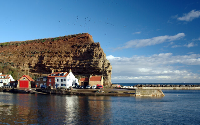
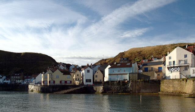
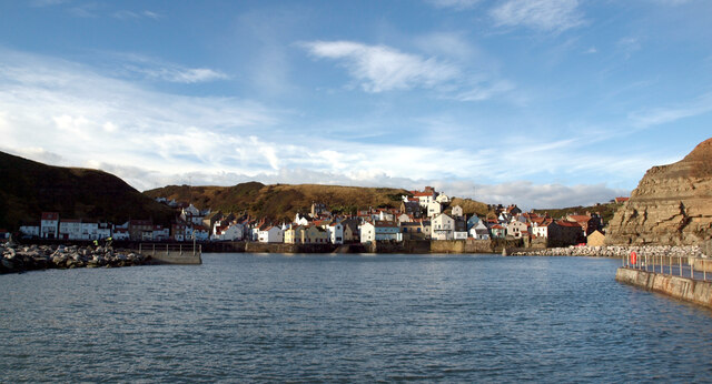
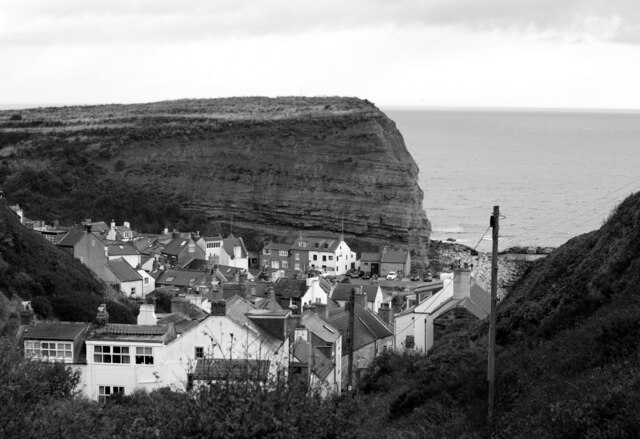
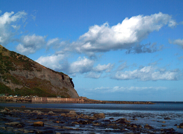
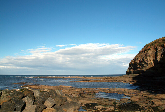
Quarry Bank, located in Yorkshire, is a prominent hill in the region known for its historical significance and picturesque landscapes. Situated in the heart of the county, Quarry Bank stands tall at an elevation of approximately 200 meters, making it an ideal destination for nature lovers and outdoor enthusiasts.

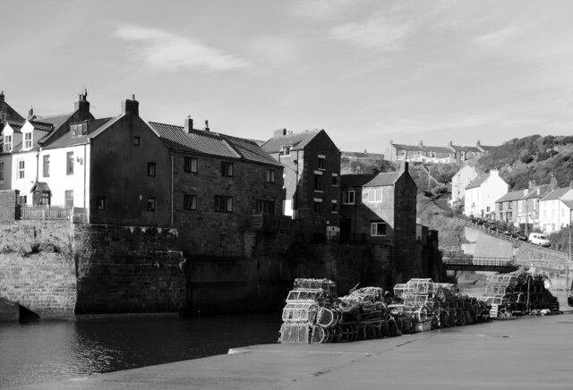
The hill gets its name from the quarrying activities that took place in the area during the 19th century. These activities were primarily focused on extracting limestone, which was widely utilized for construction purposes at the time. As a result, Quarry Bank became an important hub for the local economy, attracting workers and businesses alike.

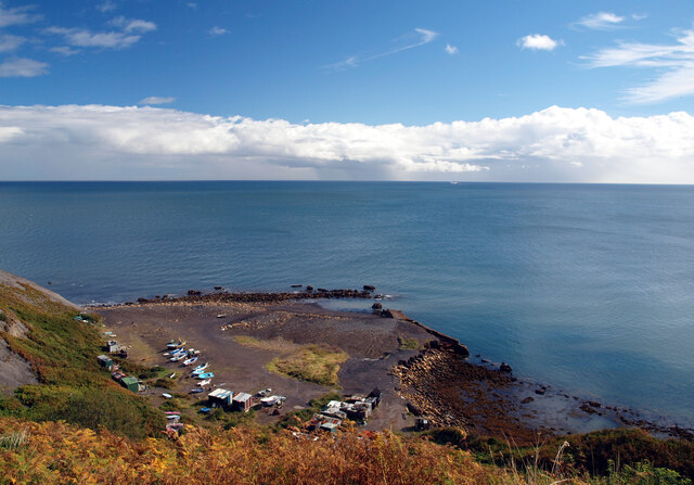
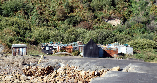
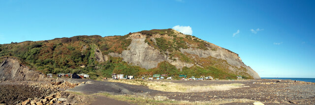
Today, Quarry Bank offers visitors breathtaking views of the surrounding countryside. Its gentle slopes and well-maintained trails make it a popular spot for hikers, joggers, and cyclists. The hill is also home to a diverse range of flora and fauna, including various species of birds, wildflowers, and trees, adding to its natural charm.

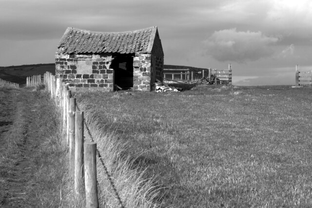
Additionally, Quarry Bank is an important historical site, as it houses the remnants of the old quarrying operations that once thrived in the area. Visitors can explore the abandoned quarries, which provide a fascinating glimpse into the region's industrial past. Interpretive plaques and signage offer detailed information about the quarrying process and its impact on the local community.

In conclusion, Quarry Bank in Yorkshire is a captivating hill that combines natural beauty with historical significance. Its stunning vistas, well-maintained trails, and remnants of the quarrying industry make it a must-visit destination for those seeking to immerse themselves in the region's rich heritage and natural wonders.

If you have any feedback on the listing, please let us know in the comments section below.
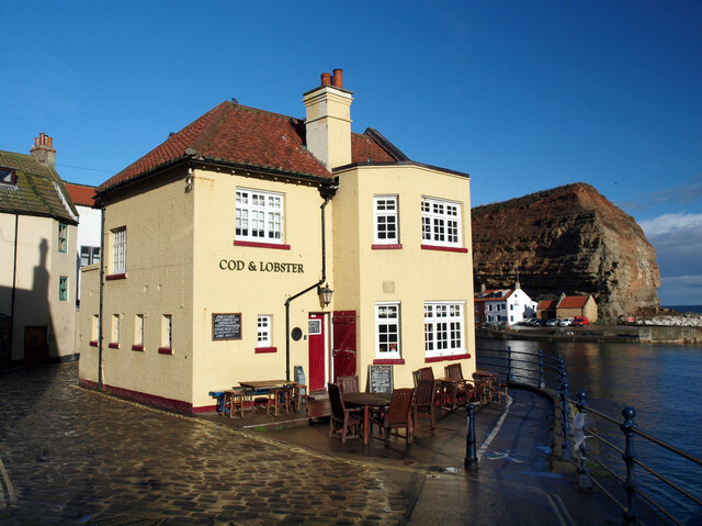
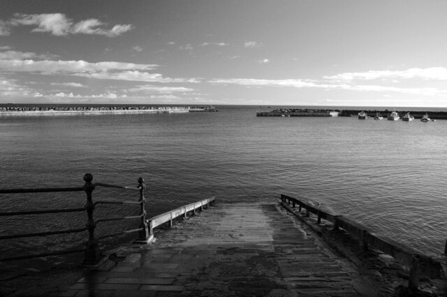
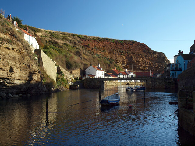
Quarry Bank Images

Images are sourced within 2km of 54.553566/-0.77669089 or Grid Reference NZ7918. Thanks to Geograph Open Source API. All images are credited.

The "Cod & Lobster", Staithes
Slipway, Staithes Harbour
Cowbar Nab, Staithes
Staithes Beck
Staithes Beck
Staithes seen across the harbour
North Side, Staithes Staithes Beck is entering the harbour at high tide.
North Side, Staithes
Staithes Beck is entering the harbour at high tide.
Staithes seen from the harbour entrance
Staithes seen from Gun Gutter
Derelict barn near Stiathes This barn lies on the Cleveland Way east of Staithes.
Derelict barn near Stiathes
This barn lies on the Cleveland Way east of Staithes.
Port Mulgrave A harbour was built in 1856-27 on Rosedale Wyke to ship ironstone from Charles Palmer's nearby mine. When the mine at Rosedale Wyke began to give out a mine (Grinkle Mine) was established three miles inland near Dalehouse. The ore was moved from the mine to the port along a tramway which finished in a tunnel a mile long emerging 10m above the sea in the cliff above the harbour. Ships were loaded from a gantry on the east harbour wall.
In 1916 Grinkle Mine was linked to the railway network and the harbour at Port Mulgrave began to fall into decay. The west harbour wall was destroyed by the army in World War II to prevent it being used by a potential German invasion.
Fishing cabins made mostly from flotsam and other found materials now line the base of the cliffs.
Port Mulgrave
A harbour was built in 1856-27 on Rosedale Wyke to ship ironstone from Charles Palmer's nearby mine. When the mine at Rosedale Wyke began to give out a mine (Grinkle Mine) was established three miles inland near Dalehouse. The ore was moved from the mine to the port along a tramway which finished in a tunnel a mile long emerging 10m above the sea in the cliff above the harbour. Ships were loaded from a gantry on the east harbour wall. In 1916 Grinkle Mine was linked to the railway network and the harbour at Port Mulgrave began to fall into decay. The west harbour wall was destroyed by the army in World War II to prevent it being used by a potential German invasion. Fishing cabins made mostly from flotsam and other found materials now line the base of the cliffs.
Shacks and a blocked mine entrance, Port Mulgrave A harbour was built in 1856-27 on Rosedale Wyke to ship ironstone from Charles Palmer's nearby mine. When the mine at Rosedale Wyke began to give out a mine (Grinkle Mine) was established three miles inland near Dalehouse. The ore was moved from the mine to the port along a tramway which finished in a tunnel a mile long emerging 10m above the sea in the cliff above the harbour. Ships were loaded from a gantry on the east harbour wall.
In 1916 Grinkle Mine was linked to the railway network and the harbour at Port Mulgrave began to fall into decay. The west harbour wall was destroyed by the army in World War II to prevent it being used by a potential German invasion.
Fishing cabins made mostly from flotsam and other found materials now line the base of the cliffs.
Shacks and a blocked mine entrance, Port Mulgrave
A harbour was built in 1856-27 on Rosedale Wyke to ship ironstone from Charles Palmer's nearby mine. When the mine at Rosedale Wyke began to give out a mine (Grinkle Mine) was established three miles inland near Dalehouse. The ore was moved from the mine to the port along a tramway which finished in a tunnel a mile long emerging 10m above the sea in the cliff above the harbour. Ships were loaded from a gantry on the east harbour wall. In 1916 Grinkle Mine was linked to the railway network and the harbour at Port Mulgrave began to fall into decay. The west harbour wall was destroyed by the army in World War II to prevent it being used by a potential German invasion. Fishing cabins made mostly from flotsam and other found materials now line the base of the cliffs.
Port Mulgrave A harbour was built in 1856-27 on Rosedale Wyke to ship ironstone from Charles Palmer's nearby mine. When the mine at Rosedale Wyke began to give out a mine (Grinkle Mine) was established three miles inland near Dalehouse. The ore was moved from the mine to the port along a tramway which finished in a tunnel a mile long emerging 10m above the sea in the cliff above the harbour. Ships were loaded from a gantry on the east harbour wall.
In 1916 Grinkle Mine was linked to the railway network and the harbour at Port Mulgrave began to fall into decay. The west harbour wall was destroyed by the army in World War II to prevent it being used by a potential German invasion.
Fishing cabins made mostly from flotsam and other found materials now line the base of the cliffs.
Port Mulgrave
A harbour was built in 1856-27 on Rosedale Wyke to ship ironstone from Charles Palmer's nearby mine. When the mine at Rosedale Wyke began to give out a mine (Grinkle Mine) was established three miles inland near Dalehouse. The ore was moved from the mine to the port along a tramway which finished in a tunnel a mile long emerging 10m above the sea in the cliff above the harbour. Ships were loaded from a gantry on the east harbour wall. In 1916 Grinkle Mine was linked to the railway network and the harbour at Port Mulgrave began to fall into decay. The west harbour wall was destroyed by the army in World War II to prevent it being used by a potential German invasion. Fishing cabins made mostly from flotsam and other found materials now line the base of the cliffs.
Port Mulgrave seen from Rosedale Wyke A harbour was built in 1856-27 on Rosedale Wyke to ship ironstone from Charles Palmer's nearby mine. When the mine at Rosedale Wyke began to give out a mine (Grinkle Mine) was established three miles inland near Dalehouse. The ore was moved from the mine to the port along a tramway which finished in a tunnel a mile long emerging 10m above the sea in the cliff above the harbour. Ships were loaded from a gantry on the east harbour wall.
In 1916 Grinkle Mine was linked to the railway network and the harbour at Port Mulgrave began to fall into decay. The west harbour wall was destroyed by the army in World War II to prevent it being used by a potential German invasion.
Fishing cabins made mostly from flotsam and other found materials now line the base of the cliffs.
Port Mulgrave seen from Rosedale Wyke
A harbour was built in 1856-27 on Rosedale Wyke to ship ironstone from Charles Palmer's nearby mine. When the mine at Rosedale Wyke began to give out a mine (Grinkle Mine) was established three miles inland near Dalehouse. The ore was moved from the mine to the port along a tramway which finished in a tunnel a mile long emerging 10m above the sea in the cliff above the harbour. Ships were loaded from a gantry on the east harbour wall. In 1916 Grinkle Mine was linked to the railway network and the harbour at Port Mulgrave began to fall into decay. The west harbour wall was destroyed by the army in World War II to prevent it being used by a potential German invasion. Fishing cabins made mostly from flotsam and other found materials now line the base of the cliffs.
Houses on Gun Gutter Street, Staithes Viewed from the rear of the Arts & Craft Centre on Church Street.
Houses on Gun Gutter Street, Staithes
Viewed from the rear of the Arts & Craft Centre on Church Street.
Low tide in Staithes Harbour
Penny Steel and Penny Nab, Staithes
Staithes seen from the harbour pier
Show me another place!

Quarry Bank is located at Grid Ref: NZ7918 (Lat: 54.553566, Lng: -0.77669089)

Division: North Riding

Administrative County: North Yorkshire

District: Scarborough

Police Authority: North Yorkshire

What 3 Words

///mammoths.outdone.facelift. Near Loftus, North Yorkshire

Related Wikis

Port Mulgrave, North Yorkshire

Port Mulgrave is a derelict former ironstone exporting port on the North Yorkshire coast midway between Staithes and Runswick Bay in the civil parish of...

Staithes railway station

Staithes railway station was a railway station on the Whitby Redcar and Middlesbrough Union Railway, serving the villages of Staithes and Dalehouse in...

Staithes and Runswick Lifeboat Station

Staithes and Runswick Lifeboat Station is a Royal National Lifeboat Institution (RNLI) lifeboat station based in the village of Staithes, North Yorkshire...
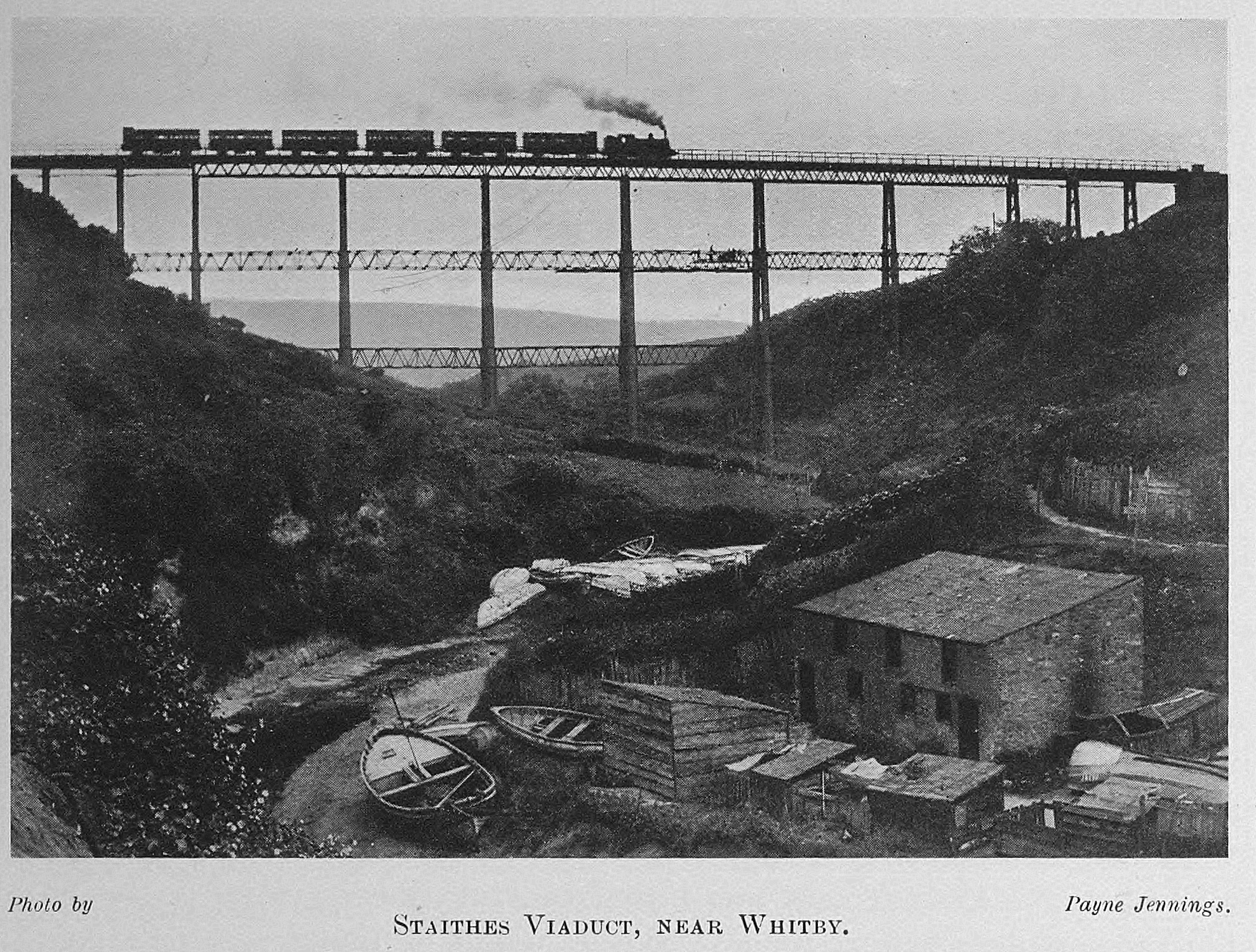
Staithes Viaduct

Staithes Viaduct was a railway bridge that straddled Staithes Beck at Staithes, Yorkshire, England. It was north of the closed Staithes railway station...
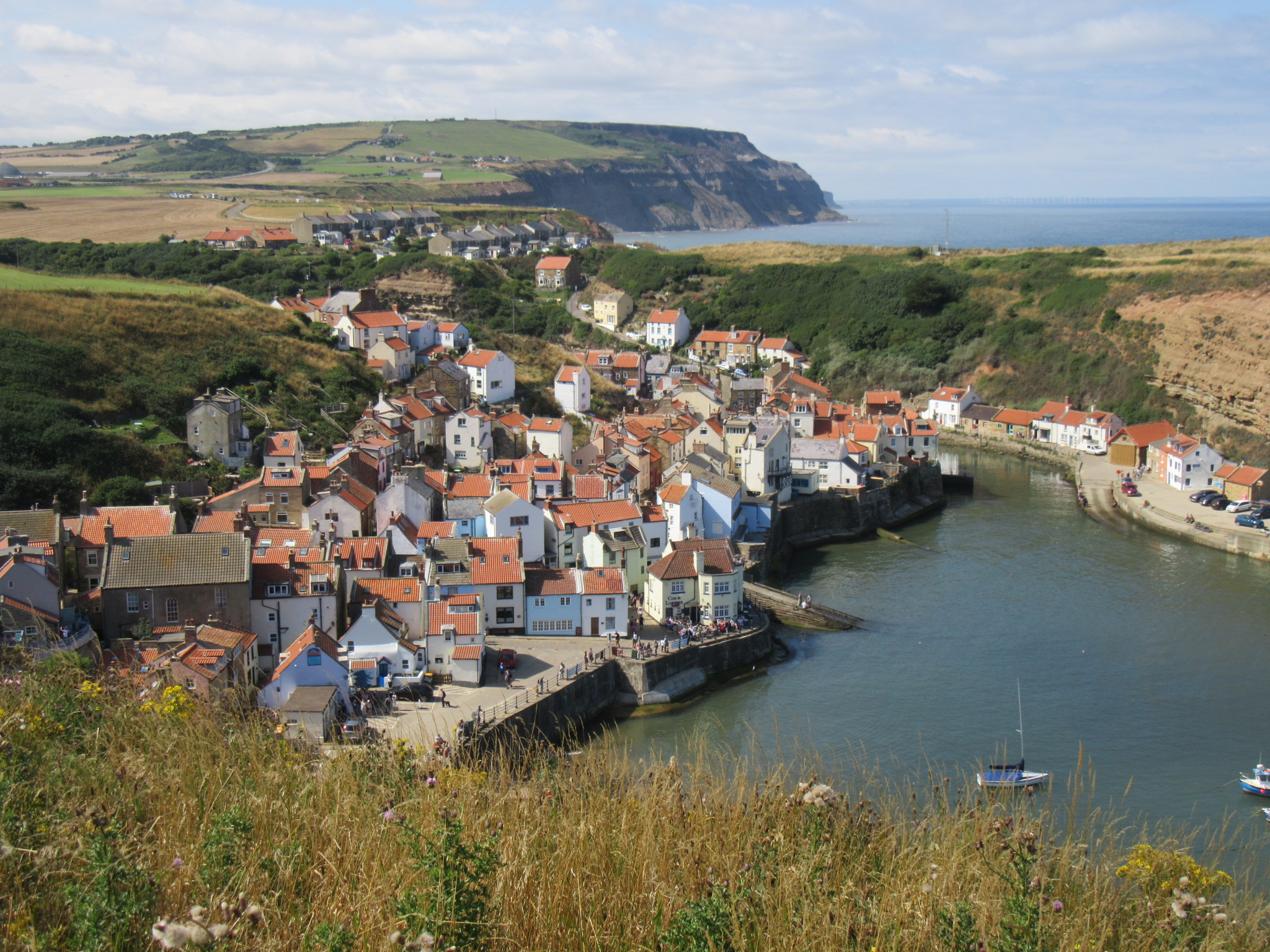
Staithes

Staithes is a seaside village in North Yorkshire, England. Easington and Roxby Becks, two brooks that run into Staithes Beck, form the border between the...

Hinderwell

Hinderwell is a village and civil parish in the Scarborough district of North Yorkshire, England which lies within the North York Moors National Park,...

Hinderwell railway station

Hinderwell railway station was a railway station on the Whitby Redcar and Middlesbrough Union Railway. It was opened on 3 December 1883, and served the...

Runswick Bay

Runswick Bay is a bay in the Scarborough Borough of North Yorkshire, England. It is also the name of a village located on the western edge of the bay...

Nearby Amenities

Located within 500m of 54.553566,-0.77669089
Source: PGS
Lat/Long: 54.5523453/-0.7697115
Source: PGS
Lat/Long: 54.552395/-0.7708272
Source: PGS
Lat/Long: 54.5524946/-0.7720289
Source: PGS
Lat/Long: 54.5529924/-0.7730588
Source: PGS
Lat/Long: 54.5534901/-0.7736597
Source: PGS
Lat/Long: 54.5540377/-0.7743463
Source: PGS
Lat/Long: 54.5546848/-0.7748613
Source: PGS
Lat/Long: 54.5554314/-0.7747755
Source: PGS
Lat/Long: 54.5562278/-0.7743463
Source: PGS
Lat/Long: 54.5570739/-0.774003
Source: PGS
Lat/Long: 54.5576214/-0.7744321
Old Nab
Place: locality
Source: PGS;OS7
Lat/Long: 54.5578703/-0.7747755
Source: PGS
Lat/Long: 54.557721/-0.7756338
Source: PGS
Lat/Long: 54.5573228/-0.7757196
Source: PGS
Lat/Long: 54.5571237/-0.7760629
Source: PGS
Lat/Long: 54.5571996/-0.7774937
Source: PGS
Lat/Long: 54.5574484/-0.7786095
Bench
Lat/Long: 54.5511112/-0.7717386
Barrier: kissing_gate
Lat/Long: 54.553897/-0.7766343
The data included in this document is from www.openstreetmap.org. The data is made available under ODbL.

Have you been to Quarry Bank?

Leave your review of Quarry Bank below (or comments, questions and feedback).