Shirburn Hill

Hill, Mountain in Oxfordshire South Oxfordshire

England

Shirburn Hill

Woodland, Lewknor Autumnal beeches in Langleygreen Plantation on the Wormsley Estate.
Woodland, Lewknor Credit: Andrew Smith

Shirburn Hill is a prominent hill located in Oxfordshire, England. Situated in the Chiltern Hills, it boasts an elevation of approximately 267 meters (876 feet) above sea level. The hill is part of the wider Chilterns Area of Outstanding Natural Beauty, renowned for its breathtaking landscapes and rich biodiversity.

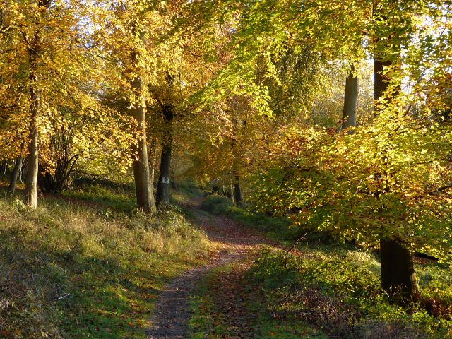
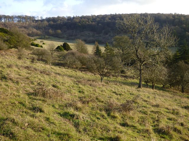
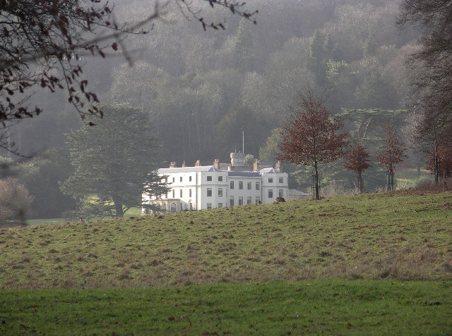
Covered in lush greenery, Shirburn Hill offers panoramic views of the surrounding countryside, making it a popular destination for both locals and tourists alike. On a clear day, visitors can admire the picturesque towns and villages that dot the landscape, including nearby Watlington and Pyrton.

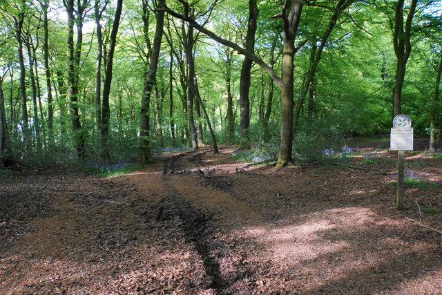
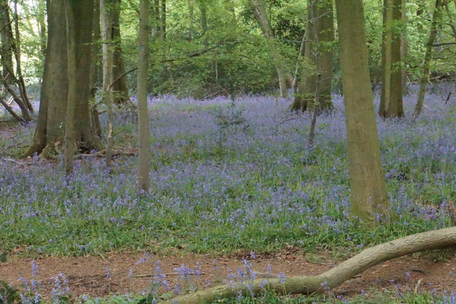
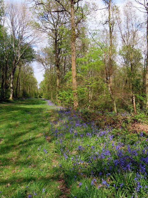
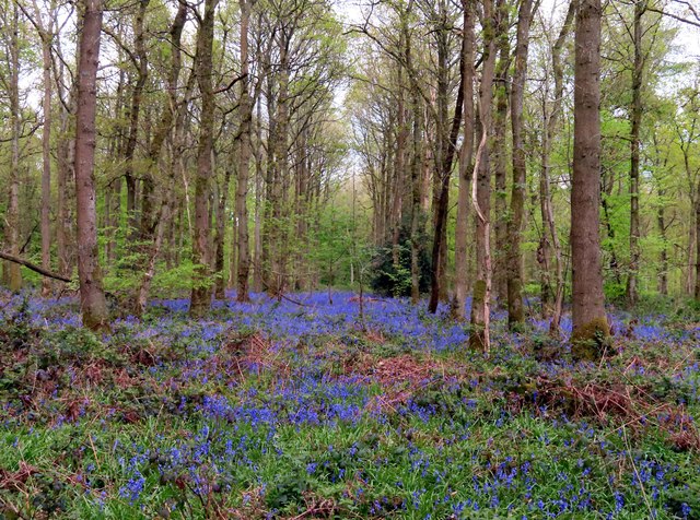
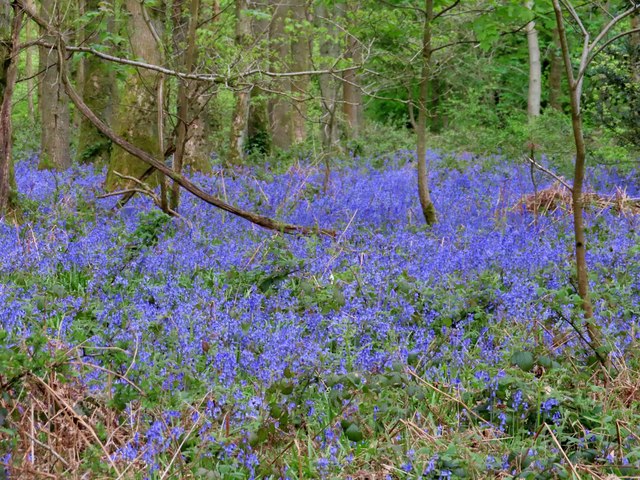
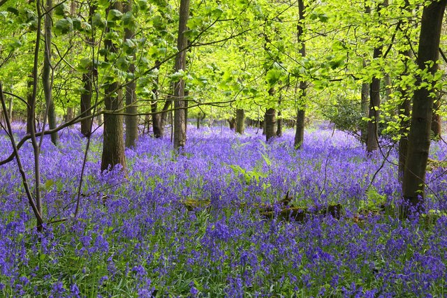
The hill is characterized by its gentle slopes and verdant meadows, which support a diverse range of flora and fauna. Wildflowers such as bluebells and primroses bloom in abundance during the spring, creating a vibrant tapestry of colors. The area is also home to various bird species, including red kites, buzzards, and skylarks, offering birdwatchers a delightful experience.

Shirburn Hill has historical significance as well. It is believed to have been inhabited by humans since the Iron Age, with remnants of ancient settlements and burial mounds discovered in the vicinity. The hill's strategic location provided a vantage point for observing the surrounding landscape and served as a defensive position in times of conflict.

Nature enthusiasts, hikers, and history buffs can explore the numerous footpaths and trails that crisscross Shirburn Hill, allowing them to immerse themselves in its natural beauty and explore its fascinating past. Whether seeking a peaceful retreat or an adventurous outing, Shirburn Hill offers something for everyone to enjoy.

If you have any feedback on the listing, please let us know in the comments section below.

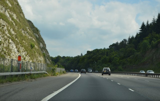
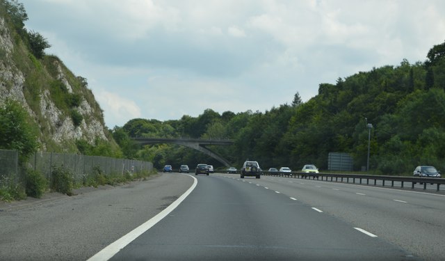
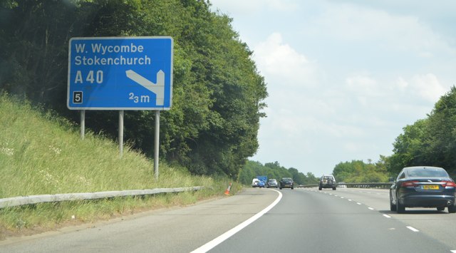
Shirburn Hill Images

Images are sourced within 2km of 51.651316/-0.95571913 or Grid Reference SU7295. Thanks to Geograph Open Source API. All images are credited.

Woodland, Lewknor Autumnal beeches in Langleygreen Plantation on the Wormsley Estate.
Woodland, Lewknor
Autumnal beeches in Langleygreen Plantation on the Wormsley Estate.
M40, southbound The M40 Motorway runs 89 miles between London and Birmingham. Built in several stages between 1967 and 1990, it provides an alternative route to the M1/M6 route between the two cities.
M40, southbound
The M40 Motorway runs 89 miles between London and Birmingham. Built in several stages between 1967 and 1990, it provides an alternative route to the M1/M6 route between the two cities.
Ascending the M40 The M40 Motorway runs 89 miles between London and Birmingham. Built in several stages between 1967 and 1990, it provides an alternative route to the M1/M6 route between the two cities.
Ascending the M40
The M40 Motorway runs 89 miles between London and Birmingham. Built in several stages between 1967 and 1990, it provides an alternative route to the M1/M6 route between the two cities.
M40, southbound The M40 Motorway runs 89 miles between London and Birmingham. Built in several stages between 1967 and 1990, it provides an alternative route to the M1/M6 route between the two cities.
M40, southbound
The M40 Motorway runs 89 miles between London and Birmingham. Built in several stages between 1967 and 1990, it provides an alternative route to the M1/M6 route between the two cities.
M40 The M40 Motorway runs 89 miles between London and Birmingham. Built in several stages between 1967 and 1990, it provides an alternative route to the M1/M6 route between the two cities.
M40
The M40 Motorway runs 89 miles between London and Birmingham. Built in several stages between 1967 and 1990, it provides an alternative route to the M1/M6 route between the two cities.
Path in Aston Wood A path in National Trust land at the top of the Chiltern escarpment.
Path in Aston Wood
A path in National Trust land at the top of the Chiltern escarpment.
Bluebells in Aston Wood A fine display, though it is surprisingly difficult to convey the full effect.
Bluebells in Aston Wood
A fine display, though it is surprisingly difficult to convey the full effect.
Bluebells in Aston Wood The more distant tree trunks appear to emerge from a blue haze.
Bluebells in Aston Wood
The more distant tree trunks appear to emerge from a blue haze.
Pastoral and wooded countryside, Lewknor On the bridleway climbing from Lower Vicar's Farm to Upper Vicar's Farm on the Wormsley Estate.
Pastoral and wooded countryside, Lewknor
On the bridleway climbing from Lower Vicar's Farm to Upper Vicar's Farm on the Wormsley Estate.
Pasture, Lewknor Sheep in a scrubby area on the southern flank of Bald Hill within the Aston Rowant National Nature Reserve.
Pasture, Lewknor
Sheep in a scrubby area on the southern flank of Bald Hill within the Aston Rowant National Nature Reserve.
Barn at Portobello Farm, Shirburn A muddy farmyard with cattle ensconced for the winter.
Barn at Portobello Farm, Shirburn
A muddy farmyard with cattle ensconced for the winter.
Shirburn Hill, Shirburn The somewhat scrubby grassland has a few larger trees including a stand of conifers to the right of picture and large areas of what appears to be box or privet to the left.
Shirburn Hill, Shirburn
The somewhat scrubby grassland has a few larger trees including a stand of conifers to the right of picture and large areas of what appears to be box or privet to the left.
A bluebell lined ride in Cowleaze Wood
Bluebells in Cowleaze Wood The Forestry Commission owns Coweleaze Wood, and planted it between 1957 and 1966.
Bluebells in Cowleaze Wood
The Forestry Commission owns Coweleaze Wood, and planted it between 1957 and 1966.
Bluebells in Cowleaze Wood The Forestry Commission owns Coweleaze Wood, and planted it between 1957 and 1966.
Bluebells in Cowleaze Wood
The Forestry Commission owns Coweleaze Wood, and planted it between 1957 and 1966.
Bluebells in Cowleaze Wood The Forestry Commission owns Coweleaze Wood, and planted it between 1957 and 1966.
Bluebells in Cowleaze Wood
The Forestry Commission owns Coweleaze Wood, and planted it between 1957 and 1966.
Show me another place!

Shirburn Hill is located at Grid Ref: SU7295 (Lat: 51.651316, Lng: -0.95571913)

Administrative County: Oxfordshire

District: South Oxfordshire

Police Authority: Thames Valley

What 3 Words

///jokes.lost.encrusted. Near Watlington, Oxfordshire

Related Wikis

Cowleaze Wood

Cowleaze Wood is a 70-acre (28 ha) woodland in the Chiltern Hills, a chalk ridge in South East England. The wood is in the civil parish of Lewknor, in...

Shirburn Hill

Shirburn Hill is a 63.7-hectare (157-acre) biological Site of Special Scientific Interest just outside and to the northeast of Watlington, Oxfordshire...

Aston Rowant National Nature Reserve

Aston Rowant National Nature Reserve is located on the north-west escarpment of the Chiltern Hills, in the Chilterns Area of Outstanding Natural Beauty...

Wormsley Park

Wormsley is a private estate of Mark Getty and his family, set in 2,700-acre (1,100 ha) of rolling countryside in the Chiltern Hills of Buckinghamshire...

Aston Rowant Cutting

Aston Rowant Cutting is a 3.5-hectare (8.6-acre) geological Site of Special Scientific Interest south of Aston Rowant in Oxfordshire. It is a Geological...

Garsington Opera

Garsington Opera is an annual summer opera festival founded in 1989 by Leonard Ingrams. The Philharmonia Orchestra and The English Concert are its two...

Christmas Common

Christmas Common is a hamlet in Watlington civil parish, Oxfordshire about 7+1⁄2 miles (12 km) south of Thame in Oxfordshire, close to the boundary with...

Lewknor Bridge Halt railway station

Lewknor Bridge Halt railway station was a halt on the Watlington and Princes Risborough Railway which the Great Western Railway opened in 1906 to serve...

Nearby Amenities

Located within 500m of 51.651316,-0.95571913
Man Made: water_tower
Lat/Long: 51.6525236/-0.9540939
Bald Hill
Ele: 257
Natural: peak
Lat/Long: 51.6507671/-0.9557044
Barrier: kissing_gate
Bicycle: no
Foot: yes
Lat/Long: 51.6514818/-0.9604869
Barrier: stile
Bicycle: no
Foot: yes
Material: wood
Stile: stepover
Lat/Long: 51.6515865/-0.9593638
Barrier: stile
Foot: yes
Material: wood
Stile: stepover
Lat/Long: 51.6525265/-0.9545695
The data included in this document is from www.openstreetmap.org. The data is made available under ODbL.

Have you been to Shirburn Hill?

Leave your review of Shirburn Hill below (or comments, questions and feedback).