Berins Hill

Hill, Mountain in Oxfordshire South Oxfordshire

England

Berins Hill

Woodland, Checkendon Beeches to the west of Checkendon Court.
Woodland, Checkendon Credit: Andrew Smith

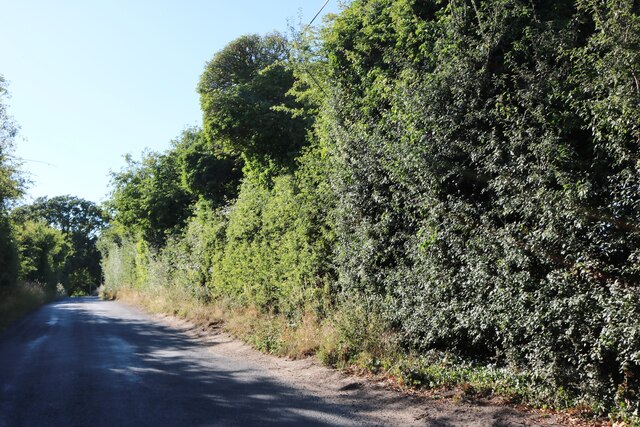
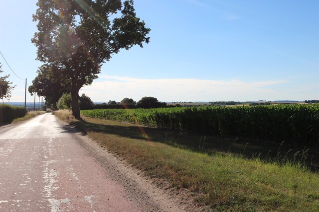
Berins Hill is a small hill located in the county of Oxfordshire, England. Situated within the Chiltern Hills, it is part of an Area of Outstanding Natural Beauty, renowned for its picturesque landscapes and rich biodiversity.

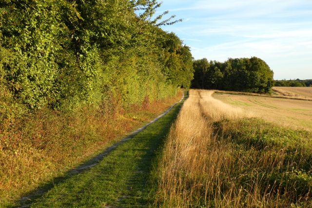
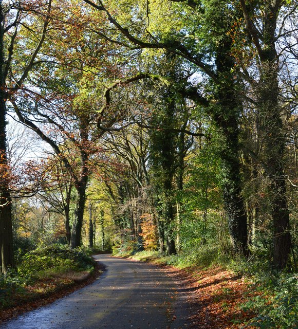
Rising to an elevation of approximately 148 meters (485 feet), Berins Hill offers stunning panoramic views of the surrounding countryside. It is nestled amidst rolling green pastures, ancient woodlands, and tranquil streams, making it a popular destination for nature enthusiasts and hikers.

The hill is characterized by its gentle slopes and is easily accessible through well-maintained footpaths. Its summit is adorned with a diverse range of plant and animal life, including rare species such as the Duke of Burgundy butterfly and the Bee Orchid. Berins Hill is also home to a variety of bird species, making it an excellent spot for birdwatching.

The hill has a rich historical significance, with evidence of human habitation dating back to the Iron Age. Archaeological discoveries have unearthed artifacts and remnants of ancient settlements, providing insights into the area's past.

Berins Hill is conveniently located within close proximity to several charming villages and towns, including Wallingford and Didcot. It offers a peaceful retreat from the hustle and bustle of city life, providing visitors with an opportunity to immerse themselves in the natural beauty of Oxfordshire's countryside.

Overall, Berins Hill is a captivating destination that combines natural beauty, historical significance, and recreational opportunities, making it a must-visit for anyone exploring the Oxfordshire area.

If you have any feedback on the listing, please let us know in the comments section below.
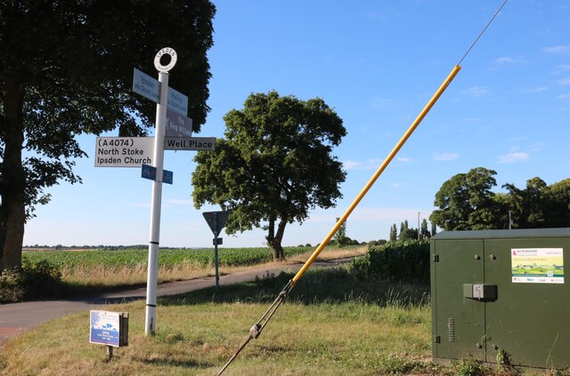
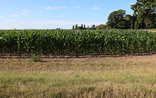
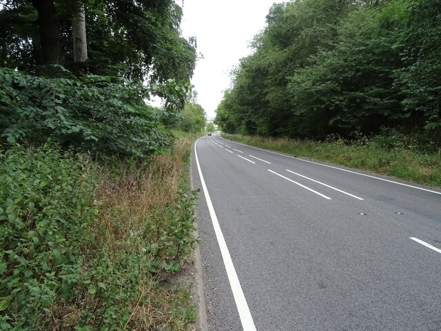
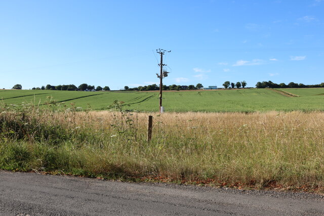
Berins Hill Images

Images are sourced within 2km of 51.555098/-1.0611997 or Grid Reference SU6584. Thanks to Geograph Open Source API. All images are credited.

Woodland, Checkendon Beeches to the west of Checkendon Court.
Woodland, Checkendon
Beeches to the west of Checkendon Court.
Remains of the Polish Village After WW2 there were a lot of displaced Polish people who needed somewhere to live. Old military buildings provided accommodation for a Polish community here up until the 1960s.
Abandoned buildings from that time can still be seen in the woods.
History on <span class="nowrap"><a title="https://www.polishresettlementcampsintheuk.co.uk/checkendon.htm" rel="nofollow ugc noopener" href="https://www.polishresettlementcampsintheuk.co.uk/checkendon.htm">Link</a><img style="margin-left:2px;" alt="External link" title="External link - shift click to open in new window" src="https://s1.geograph.org.uk/img/external.png" width="10" height="10"/></span>
Remains of the Polish Village
After WW2 there were a lot of displaced Polish people who needed somewhere to live. Old military buildings provided accommodation for a Polish community here up until the 1960s. Abandoned buildings from that time can still be seen in the woods. History on LinkExternal link
Another Hut in the Woods Another one of the derelict buildings left over from WW2 which can still be seen in the woods round here. These were lived in up until the 1960s by community of Polish people displaced by the war.
History on <span class="nowrap"><a title="https://www.polishresettlementcampsintheuk.co.uk/checkendon.htm" rel="nofollow ugc noopener" href="https://www.polishresettlementcampsintheuk.co.uk/checkendon.htm">Link</a><img style="margin-left:2px;" alt="External link" title="External link - shift click to open in new window" src="https://s1.geograph.org.uk/img/external.png" width="10" height="10"/></span>
Another Hut in the Woods
Another one of the derelict buildings left over from WW2 which can still be seen in the woods round here. These were lived in up until the 1960s by community of Polish people displaced by the war. History on LinkExternal link
Quiet Lane, Ipsden
Quiet Lane, Ipsden
Maize field in Ipsden
Red Lane (A4074) Towards Oxford.
Red Lane (A4074)
Towards Oxford.
Kit Lane, Stoke Row
Kit Lane, Stoke Row
Field by Well Place Road, Hailey
Well Place Road, Hailey
Well Place Road, Ipsden
Woods, track and farmland, Ipsden
Farmland, Ipsden Fields and woodland on the flank of Garson's Hill.
Farmland, Ipsden
Fields and woodland on the flank of Garson's Hill.
Pasture, Ipsden Paddocks at Well Place with Rowan Atkinson's house at Handsmooth not looking particularly attractive, but debatably not much worse than the one it replaced, in the background.
Pasture, Ipsden
Paddocks at Well Place with Rowan Atkinson's house at Handsmooth not looking particularly attractive, but debatably not much worse than the one it replaced, in the background.
1 Langtree Cottages, Checkendon, Oxfordshire 1906 by Maxwell Ayrton in Arts and Crafts style. 

(Source:Historic England)
1 Langtree Cottages, Checkendon, Oxfordshire
1906 by Maxwell Ayrton in Arts and Crafts style. (Source:Historic England)
Foundry Cottage, Checkendon, Oxfordshire C17 with C20 windows. Brick ground floor with areas of flint; timber frame to first floor, rendered panels to left, brick infill to right. Old plain tile roof; brick stacks. 2-unit plan. 2-storey, 3-window range. Central 2-panel door with C20 gabled tile porch. 2-light casement to left. 2 single-light casements to right. Three 2-light casements to first floor. Roof hipped to right. Ridge stack to right and end stack to left.

(Source:Historic England)
Foundry Cottage, Checkendon, Oxfordshire
C17 with C20 windows. Brick ground floor with areas of flint; timber frame to first floor, rendered panels to left, brick infill to right. Old plain tile roof; brick stacks. 2-unit plan. 2-storey, 3-window range. Central 2-panel door with C20 gabled tile porch. 2-light casement to left. 2 single-light casements to right. Three 2-light casements to first floor. Roof hipped to right. Ridge stack to right and end stack to left. (Source:Historic England)
Country lane, Ipsden, Oxfordshire
Byway, Checkendon, Oxfordshire
Autumn colours, Checkendon, Oxfordshire
Show me another place!

Berins Hill is located at Grid Ref: SU6584 (Lat: 51.555098, Lng: -1.0611997)

Administrative County: Oxfordshire

District: South Oxfordshire

Police Authority: Thames Valley

What 3 Words

///sizes.quilting.galaxies. Near Goring, Oxfordshire

Related Wikis

Warren Bank

Warren Bank is a 3.1-hectare (7.7-acre) biological Site of Special Scientific Interest south-east of Wallingford in Oxfordshire. It is managed by the Berkshire...

Ipsden Heath

Ipsden Heath is a 32-acre (13-hectare) woodland in the English county of Oxfordshire, within the Chiltern Area of Outstanding Natural Beauty. == References ==

Braziers Park

Braziers Park is a Grade II* country house and estate on the edge of Ipsden - a small village near Wallingford, Oxfordshire, England - housing a secular...

Wood (festival)

Wood is an annual small early summer folk and roots music festival and environmental gathering, which takes place in Braziers Park, Ipsden near Wallingford...

Checkendon

Checkendon is a village and civil parish about 6 miles (10 km) west of Henley-on-Thames in South Oxfordshire and about 9 miles (14 km) north west of Reading...

St Peter and St Paul, Checkendon

St Peter and St Paul is the Church of England parish church of Checkendon, a village in Oxfordshire, England. Its parish is part of the Deanery of Henley...

Ipsden

Ipsden is a village and civil parish in the Chiltern Hills in South Oxfordshire, about 3 miles (5 km) southeast of Wallingford. It is almost equidistant...

Woodcote

Woodcote is a village and civil parish in South Oxfordshire, about 5 miles (8 km) southeast of Wallingford and about 7 miles (11 km) northwest of Reading...

Nearby Amenities

Located within 500m of 51.555098,-1.0611997
The Devil's Churchyard (Enclosure)
Historic: archaeological_site
Note: This appears on historic maps, and was difficult to find on the ground. Dated to mid-late Iron Age.
Source: GPS
Lat/Long: 51.5511344/-1.0607
Barrier: kissing_gate
Foot: yes
Lat/Long: 51.5580005/-1.0630781
Barrier: stile
Source: GPS
Lat/Long: 51.5551284/-1.0581051
Barrier: kissing_gate
Foot: yes
Lat/Long: 51.5586036/-1.0638574
Barrier: kissing_gate
Foot: yes
Lat/Long: 51.5563241/-1.0584661
Barrier: kissing_gate
Foot: yes
Lat/Long: 51.5559956/-1.0583597
Blue Tin Produce
Addr City: Ipsden
Addr Housename: Keepers Cottage
Addr Place: Garsons Farm
Addr Postcode: OX10 6QU
Addr Street: Garsons Lane
Email: info@bluetinproduce.co.uk
Opening Hours: We 09:00-13:00; Fr,Sa 09:00-15:00
Phone: +44 1491 681145
Shop: farm
Website: https://www.bluetinproduce.co.uk/
Lat/Long: 51.5560158/-1.0611939
Cafe
Addr City: Ipsden
Addr Housename: Keepers Cottage
Addr Place: Garsons Farm
Addr Postcode: OX10 6QU
Addr Street: Garsons Lane
Email: info@bluetinproduce.co.uk
Opening Hours: We 09:00-13:00; Fr,Sa 09:00-15:00
Phone: +44 1491 681145
Website: https://www.bluetinproduce.co.uk/
Lat/Long: 51.5559543/-1.0610084
Keepers Cottage
Addr City: Ipsden
Addr Housename: Keepers Cottage
Addr Place: Garsons Farm
Addr Postcode: OX10 6QU
Addr Street: Garsons Lane
Place: isolated_dwelling
Wikidata: Q26650338
Lat/Long: 51.5555209/-1.0614187
Place: isolated_dwelling
Lat/Long: 51.5559317/-1.0573126
The data included in this document is from www.openstreetmap.org. The data is made available under ODbL.

Have you been to Berins Hill?

Leave your review of Berins Hill below (or comments, questions and feedback).