Braziers Common

Wood, Forest in Oxfordshire South Oxfordshire

England

Braziers Common

Woodland, Checkendon Beeches to the west of Checkendon Court.
Woodland, Checkendon Credit: Andrew Smith

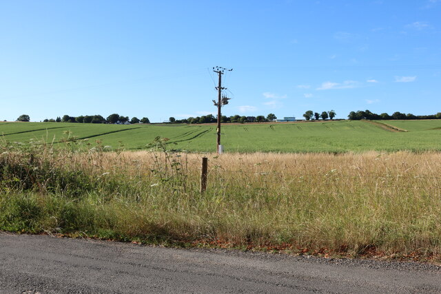
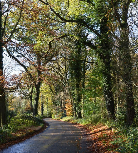
Braziers Common is a picturesque wood located in Oxfordshire, England. Covering an area of approximately 100 acres, it is a popular destination for nature enthusiasts and locals seeking tranquility amidst the stunning forest landscape.

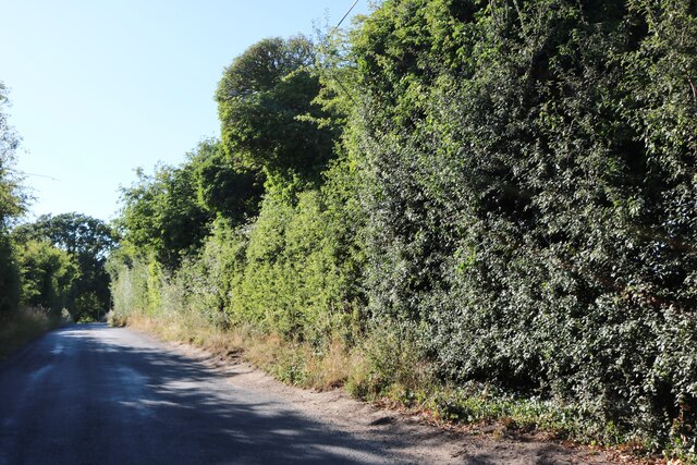
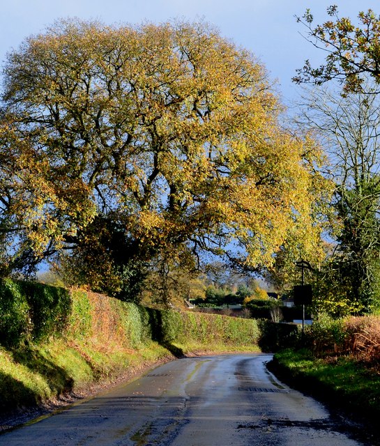
The common is primarily composed of deciduous trees, including oak, beech, and ash, which create a dense canopy providing shade and shelter for a diverse range of wildlife. The forest floor is adorned with an array of vibrant wildflowers during the spring and summer months, adding to the scenic beauty of the area.

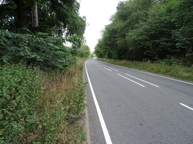
Traversing through Braziers Common, visitors will find a network of well-maintained footpaths that wind their way through the woods, allowing for leisurely strolls or more adventurous hikes. The paths are surrounded by lush undergrowth and occasional clearings, providing opportunities for picnicking and appreciating the natural surroundings.

The common is home to a variety of wildlife, including deer, foxes, badgers, and numerous bird species. Birdwatchers can spot woodpeckers, nuthatches, and various songbirds amongst the treetops. The peaceful atmosphere and absence of heavy traffic make it an ideal spot for birdwatching and wildlife photography.

Braziers Common is also steeped in history, with evidence of human habitation dating back thousands of years. The remains of ancient settlements and burial mounds can be found within the woodland, serving as a reminder of the area's rich cultural heritage.

Overall, Braziers Common offers a serene escape from the hustle and bustle of modern life, providing visitors with an opportunity to connect with nature and appreciate the beauty of Oxfordshire's woodlands.

If you have any feedback on the listing, please let us know in the comments section below.

Braziers Common Images

Images are sourced within 2km of 51.55141/-1.0577132 or Grid Reference SU6584. Thanks to Geograph Open Source API. All images are credited.

Woodland, Checkendon Beeches to the west of Checkendon Court.
Woodland, Checkendon
Beeches to the west of Checkendon Court.
Pasture and farm buildings, Checkendon Corker's Farm viewed from the footpath passing to its west.
Pasture and farm buildings, Checkendon
Corker's Farm viewed from the footpath passing to its west.
Remains of the Polish Village After WW2 there were a lot of displaced Polish people who needed somewhere to live. Old military buildings provided accommodation for a Polish community here up until the 1960s.
Abandoned buildings from that time can still be seen in the woods.
History on <span class="nowrap"><a title="https://www.polishresettlementcampsintheuk.co.uk/checkendon.htm" rel="nofollow ugc noopener" href="https://www.polishresettlementcampsintheuk.co.uk/checkendon.htm">Link</a><img style="margin-left:2px;" alt="External link" title="External link - shift click to open in new window" src="https://s1.geograph.org.uk/img/external.png" width="10" height="10"/></span>
Remains of the Polish Village
After WW2 there were a lot of displaced Polish people who needed somewhere to live. Old military buildings provided accommodation for a Polish community here up until the 1960s. Abandoned buildings from that time can still be seen in the woods. History on LinkExternal link
Another Hut in the Woods Another one of the derelict buildings left over from WW2 which can still be seen in the woods round here. These were lived in up until the 1960s by community of Polish people displaced by the war.
History on <span class="nowrap"><a title="https://www.polishresettlementcampsintheuk.co.uk/checkendon.htm" rel="nofollow ugc noopener" href="https://www.polishresettlementcampsintheuk.co.uk/checkendon.htm">Link</a><img style="margin-left:2px;" alt="External link" title="External link - shift click to open in new window" src="https://s1.geograph.org.uk/img/external.png" width="10" height="10"/></span>
Another Hut in the Woods
Another one of the derelict buildings left over from WW2 which can still be seen in the woods round here. These were lived in up until the 1960s by community of Polish people displaced by the war. History on LinkExternal link
Red Lane (A4074) Towards Oxford.
Red Lane (A4074)
Towards Oxford.
Kit Lane, Stoke Row
Kit Lane, Stoke Row
Field by Well Place Road, Hailey
Well Place Road, Hailey
Farmland, Ipsden Fields and woodland on the flank of Garson's Hill.
Farmland, Ipsden
Fields and woodland on the flank of Garson's Hill.
Pasture, Ipsden Paddocks at Well Place with Rowan Atkinson's house at Handsmooth not looking particularly attractive, but debatably not much worse than the one it replaced, in the background.
Pasture, Ipsden
Paddocks at Well Place with Rowan Atkinson's house at Handsmooth not looking particularly attractive, but debatably not much worse than the one it replaced, in the background.
1 Langtree Cottages, Checkendon, Oxfordshire 1906 by Maxwell Ayrton in Arts and Crafts style. 

(Source:Historic England)
1 Langtree Cottages, Checkendon, Oxfordshire
1906 by Maxwell Ayrton in Arts and Crafts style. (Source:Historic England)
Foundry Cottage, Checkendon, Oxfordshire C17 with C20 windows. Brick ground floor with areas of flint; timber frame to first floor, rendered panels to left, brick infill to right. Old plain tile roof; brick stacks. 2-unit plan. 2-storey, 3-window range. Central 2-panel door with C20 gabled tile porch. 2-light casement to left. 2 single-light casements to right. Three 2-light casements to first floor. Roof hipped to right. Ridge stack to right and end stack to left.

(Source:Historic England)
Foundry Cottage, Checkendon, Oxfordshire
C17 with C20 windows. Brick ground floor with areas of flint; timber frame to first floor, rendered panels to left, brick infill to right. Old plain tile roof; brick stacks. 2-unit plan. 2-storey, 3-window range. Central 2-panel door with C20 gabled tile porch. 2-light casement to left. 2 single-light casements to right. Three 2-light casements to first floor. Roof hipped to right. Ridge stack to right and end stack to left. (Source:Historic England)
After rain, Stoke Row, Oxfordshire
Country lane, Ipsden, Oxfordshire
Byway, Checkendon, Oxfordshire
Autumn colours, Checkendon, Oxfordshire
Langtree Cottages in Checkendon
House on the corner, Checkendon, Oxfordshire
Show me another place!

Braziers Common is located at Grid Ref: SU6584 (Lat: 51.55141, Lng: -1.0577132)

Administrative County: Oxfordshire

District: South Oxfordshire

Police Authority: Thames Valley

What 3 Words

///graduated.universe.mentioned. Near Rotherfield Peppard, Oxfordshire

Related Wikis

Checkendon

Checkendon is a village and civil parish about 6 miles (10 km) west of Henley-on-Thames in South Oxfordshire and about 9 miles (14 km) north west of Reading...

St Peter and St Paul, Checkendon

St Peter and St Paul is the Church of England parish church of Checkendon, a village in Oxfordshire, England. Its parish is part of the Deanery of Henley...

Ipsden Heath

Ipsden Heath is a 32-acre (13-hectare) woodland in the English county of Oxfordshire, within the Chiltern Area of Outstanding Natural Beauty. == References ==

Warren Bank

Warren Bank is a 3.1-hectare (7.7-acre) biological Site of Special Scientific Interest south-east of Wallingford in Oxfordshire. It is managed by the Berkshire...
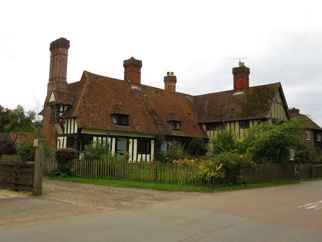
Braziers Park

Braziers Park is a Grade II* country house and estate on the edge of Ipsden - a small village near Wallingford, Oxfordshire, England - housing a secular...
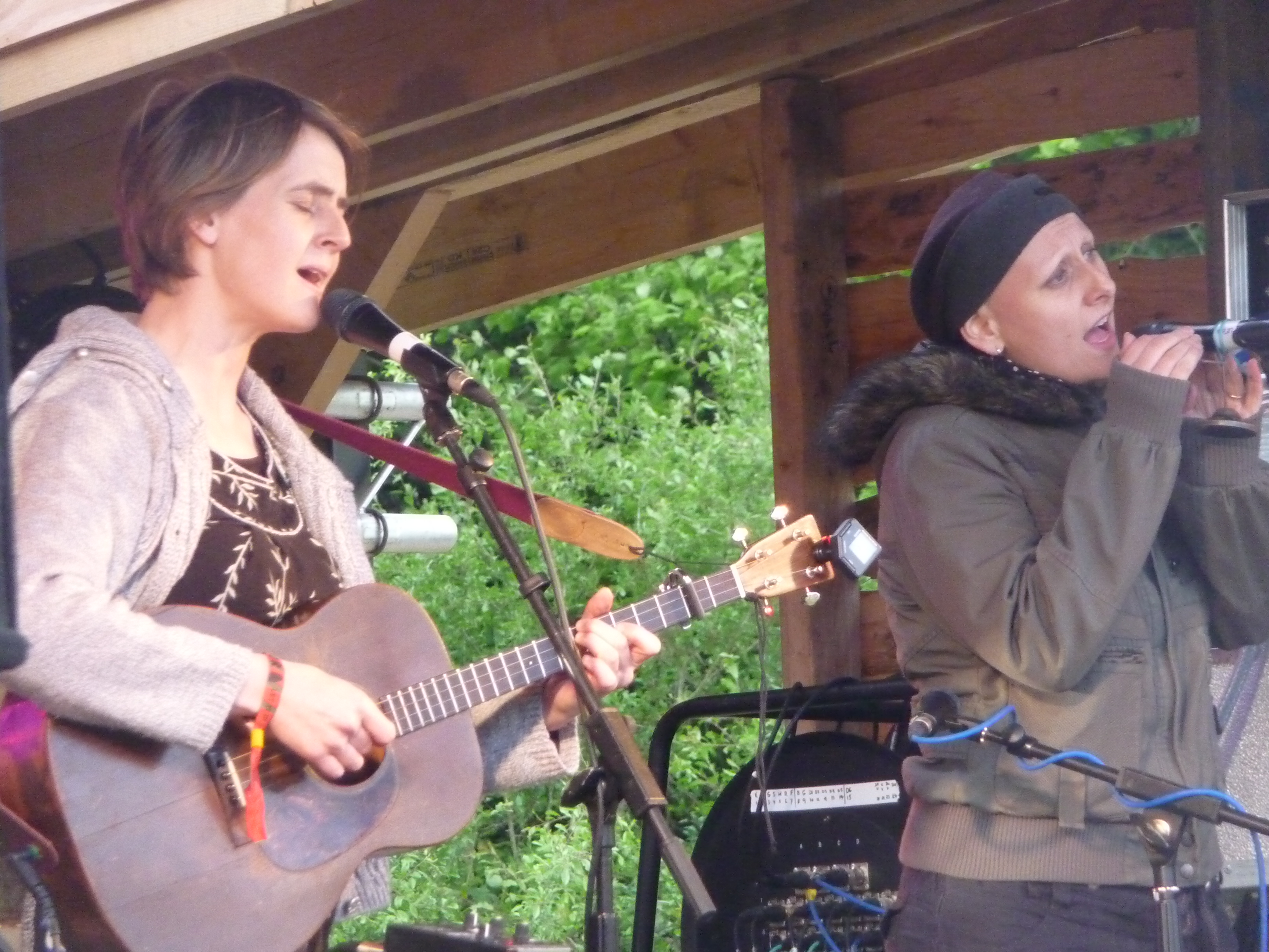
Wood (festival)

Wood is an annual small early summer folk and roots music festival and environmental gathering, which takes place in Braziers Park, Ipsden near Wallingford...

The Oratory School

The Oratory School () is an HMC co-educational private Roman Catholic boarding and day school for pupils aged 11–18 located in Woodcote, 6 miles (9.7 km...

Langtree School

Langtree School is a coeducational secondary school located in the village of Woodcote in South Oxfordshire, England. The school has approximately 624...

Nearby Amenities

Located within 500m of 51.55141,-1.0577132
The Devil's Churchyard (Enclosure)
Historic: archaeological_site
Note: This appears on historic maps, and was difficult to find on the ground. Dated to mid-late Iron Age.
Source: GPS
Lat/Long: 51.5511344/-1.0607
Barrier: stile
Source: GPS
Lat/Long: 51.5551284/-1.0581051
Barrier: stile
Bicycle: no
Foot: yes
Material: wood
Stile: stepover
Lat/Long: 51.5494544/-1.057028
The data included in this document is from www.openstreetmap.org. The data is made available under ODbL.

Have you been to Braziers Common?

Leave your review of Braziers Common below (or comments, questions and feedback).