Greenmoor Hill

Hill, Mountain in Oxfordshire South Oxfordshire

England

Greenmoor Hill
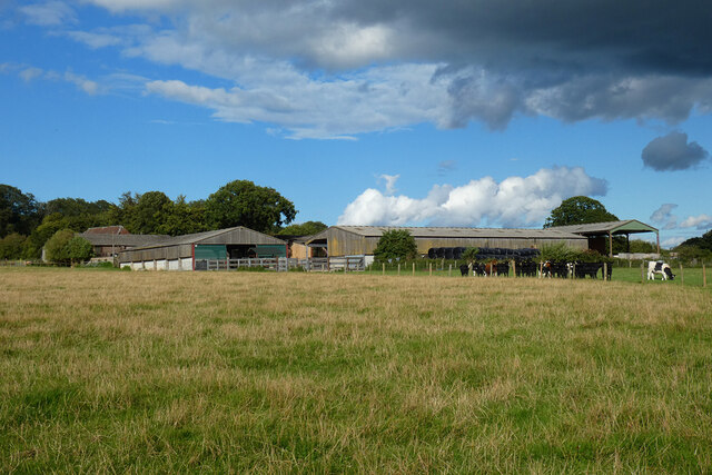
Pasture and farm buildings, Checkendon Corker's Farm viewed from the footpath passing to its west.
Pasture and farm buildings, Checkendon Credit: Andrew Smith

Greenmoor Hill is a prominent hill located in Oxfordshire, England. It is situated within the picturesque Chiltern Hills, a designated Area of Outstanding Natural Beauty. Rising to an elevation of approximately 248 meters (814 feet), Greenmoor Hill commands breathtaking panoramic views of the surrounding countryside.

Cloaked in a lush carpet of greenery, the hill is predominantly covered in a mixture of grasses, wildflowers, and scattered patches of woodland. The landscape is dotted with a variety of native flora and fauna, adding to the area's natural beauty and ecological significance.

Hikers and nature enthusiasts are drawn to Greenmoor Hill for its well-maintained footpaths and walking trails, which offer a range of difficulty levels suitable for all ages and abilities. These paths wind their way through the hill's verdant slopes, leading visitors to quaint villages, meandering streams, and charming woodlands.

One of the key attractions of Greenmoor Hill is its rich historical and archaeological heritage. The hill is home to ancient burial mounds and earthworks, which stand as testament to the area's long-standing human occupation. Archaeologists have uncovered traces of Iron Age settlements, further adding to the hill's historical significance.

Greenmoor Hill's idyllic location, captivating views, and rich natural and historical heritage make it a popular destination for outdoor enthusiasts, history buffs, and those seeking a tranquil escape from the bustle of city life. Whether one is seeking a leisurely stroll, an invigorating hike, or simply a moment of peaceful contemplation, Greenmoor Hill offers a slice of untouched beauty in the heart of Oxfordshire.

If you have any feedback on the listing, please let us know in the comments section below.

Greenmoor Hill Images

Images are sourced within 2km of 51.526822/-1.0683545 or Grid Reference SU6481. Thanks to Geograph Open Source API. All images are credited.
Pasture and farm buildings, Checkendon Corker's Farm viewed from the footpath passing to its west.
Pasture and farm buildings, Checkendon
Corker's Farm viewed from the footpath passing to its west.
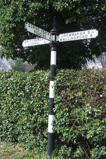
Direction Sign – Signpost on the B471 in Woodcote parish Located on the northwest side of the junction of the B471 Goring Road and Whitehouse Road in Woodcote parish. 3 arms and pawn finial. The Goring Heath / Reading arm had been lost by 2017.

Milestone Society National ID: OX_SU6481
Direction Sign – Signpost on the B471 in Woodcote parish
Located on the northwest side of the junction of the B471 Goring Road and Whitehouse Road in Woodcote parish. 3 arms and pawn finial. The Goring Heath / Reading arm had been lost by 2017. Milestone Society National ID: OX_SU6481
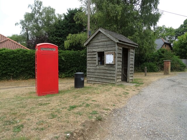
K6 telephone box and bus shelter, Cray's Pond
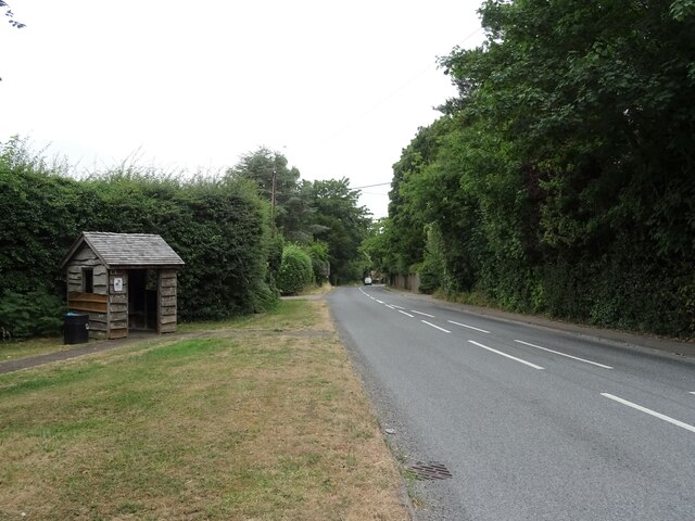
Bus shelter on the B4256, Cray's Pond
B4526, Cray's Pond
B4526, Cray's Pond
The White Lion, Cray's Pond Not currently open (2022).
See <a href="https://www.geograph.org.uk/photo/2829589">SU6380 : The White Lion, Crays Pond</a> for happier times.
The White Lion, Cray's Pond
Not currently open (2022). See SU6380 : The White Lion, Crays Pond for happier times.
Garage and car sales, Cray's Pond
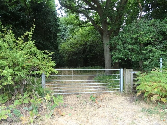
Gated track and footpath off Goring Road
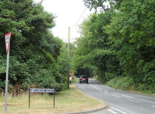
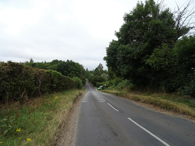
Goring Road The B471 towards Woodcote.
Goring Road
The B471 towards Woodcote.
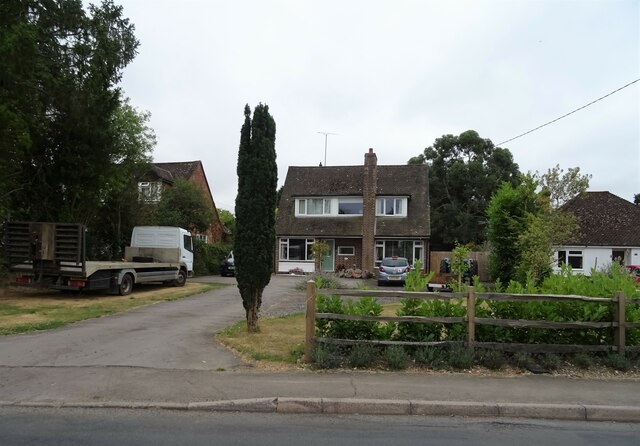
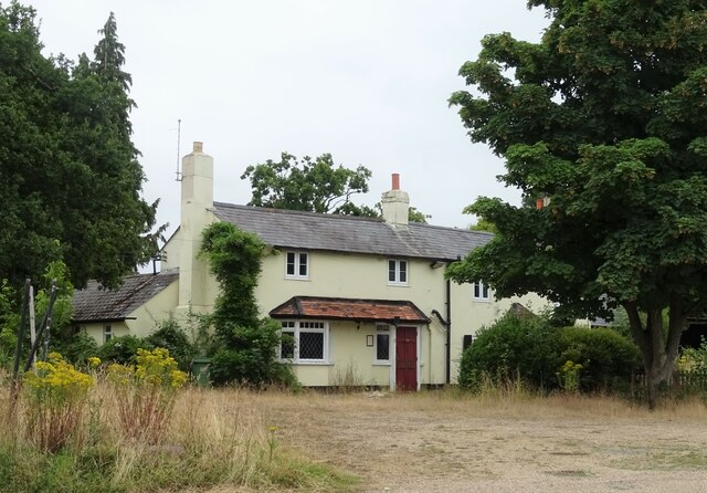
House on Goring Road
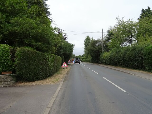
Roadworks on Goring Road (B471)
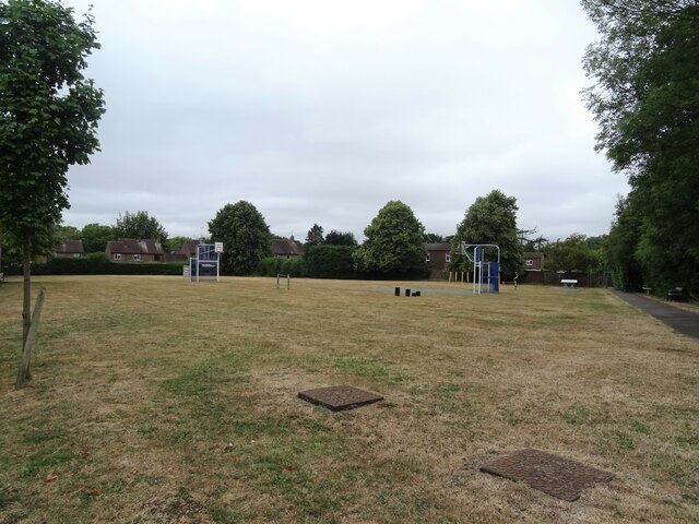
Recreation ground, Woodcote
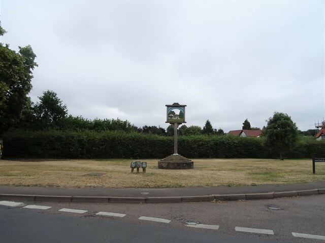
Village sign, Woodcote
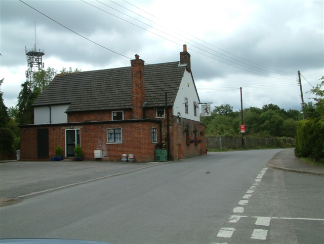
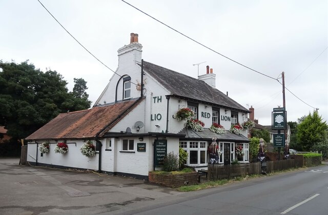
The Red Lion, Woodcote On Goring Road.
See <a href="https://www.geograph.org.uk/photo/7246411">SU6482 : Sign for the Red Lion, Woodcote</a> for sign.
The Red Lion, Woodcote
On Goring Road. See SU6482 : Sign for the Red Lion, Woodcote for sign.
Sign for the Red Lion, Woodcote See <a href="https://www.geograph.org.uk/photo/7246410">SU6482 : The Red Lion, Woodcote</a> for context.
Sign for the Red Lion, Woodcote
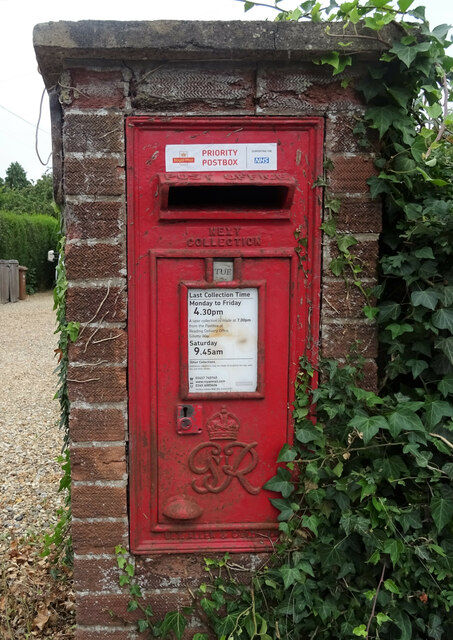
George VI postbox on Goring Road, Woodcote Postbox No. RG8 356.
George VI postbox on Goring Road, Woodcote
Postbox No. RG8 356.
Woodcote Village Hall
War Memorial, Woodcote
Show me another place!

Greenmoor Hill is located at Grid Ref: SU6481 (Lat: 51.526822, Lng: -1.0683545)

Administrative County: Oxfordshire

District: South Oxfordshire

Police Authority: Thames Valley

What 3 Words

///friend.passwords.ritual. Near Goring, Oxfordshire

Related Wikis

Langtree School

Langtree School is a coeducational secondary school located in the village of Woodcote in South Oxfordshire, England. The school has approximately 624...

Woodcote

Woodcote is a village and civil parish in South Oxfordshire, about 5 miles (8 km) southeast of Wallingford and about 7 miles (11 km) northwest of Reading...

The Oratory School

The Oratory School () is an HMC co-educational private Roman Catholic boarding and day school for pupils aged 11–18 located in Woodcote, 6 miles (9.7 km...

Exlade Street

Exlade Street is a hamlet in Checkendon civil parish in Oxfordshire, about 6 miles (9.7 km) northwest of Reading, in the Chiltern Hills. The hamlet is...

Crays Pond

Crays Pond is a hamlet situated in the parish of Goring Heath in South Oxfordshire. Crays Pond is about 2.4 miles (3.9 km) northeast of Goring-on-Thames...

The Oratory Preparatory School

The Oratory Prep School is a Roman Catholic day and boarding school for some 330 boys and girls aged from two to thirteen, founded in 1925. The school...

Whitchurch Hill

Whitchurch Hill is a village in the Chiltern Hills in Oxfordshire, about 5.5 miles (9 km) northwest of Reading, Berkshire, near Whitchurch-on-Thames. The...

Goring Heath

Goring Heath is a hamlet and civil parish in the Chiltern Hills in South Oxfordshire. The civil parish includes the villages of Whitchurch Hill and Crays...

Nearby Amenities

Located within 500m of 51.526822,-1.0683545
Post Box
Lat/Long: 51.5268883/-1.0705183
Post Box
Lat/Long: 51.5301744/-1.0658522
Bus Stop
West Chiltern
Bus: yes
Naptan AtcoCode: 340003294CNR
Naptan Bearing: N
Naptan CommonName: West Chiltern
Naptan Indicator: Corner
Naptan Landmark: West Chiltern
Naptan NaptanCode: oxfgjwgw
Naptan Street: Whitehouse Road
Naptan Verified: no
Public Transport: platform
Shelter: yes
Source: naptan_import
Lat/Long: 51.5300389/-1.0717699
West Chiltern
Naptan AtcoCode: 340003294OPP
Naptan Bearing: S
Naptan BusStopType: CUS
Naptan CommonName: West Chiltern
Naptan Indicator: Opposite
Naptan Landmark: West Chiltern
Naptan NaptanCode: oxfgjwja
Naptan Street: Whitehouse Road
Naptan Verified: no
Source: naptan_import
Lat/Long: 51.5299448/-1.0716661
Bus Stop
Bridle Path
Naptan AtcoCode: 340004145BDP
Naptan Bearing: SE
Naptan CommonName: Bridle Path
Naptan Indicator: Junction
Naptan Landmark: Whitehouse Road
Naptan NaptanCode: oxfgmwtw
Naptan ShortCommonName: Bridle Path
Naptan Street: Bridle Path
Naptan Verified: no
Source: naptan_import
Lat/Long: 51.528432/-1.0718758
Bridle Path
Naptan AtcoCode: 340004145OPP
Naptan Bearing: NW
Naptan BusStopType: CUS
Naptan CommonName: Bridle Path
Naptan Indicator: Outside
Naptan Landmark: 40A
Naptan NaptanCode: oxfgpada
Naptan ShortCommonName: Bridle Path
Naptan Street: Bridle Path
Naptan Verified: no
Source: naptan_import
Lat/Long: 51.5285986/-1.0723232
Turning Circle
Turning Circle: circle2
Lat/Long: 51.5304382/-1.0694278
Turning Circle
Turning Circle: hammer
Lat/Long: 51.5295795/-1.0677046
Turning Circle
Turning Circle: hammer
Lat/Long: 51.5297377/-1.0687455
Turning Circle
Turning Circle: square
Lat/Long: 51.530025/-1.0707763
Barrier: bollard
Bicycle: yes
Foot: yes
Horse: yes
Lat/Long: 51.5249291/-1.0672919
Barrier: kissing_gate
Bicycle: no
Foot: yes
Lat/Long: 51.525906/-1.0742906
Barrier: kissing_gate
Foot: yes
Lat/Long: 51.5240592/-1.0687457
Access: no
Barrier: kissing_gate
Foot: yes
Lat/Long: 51.5232391/-1.0695283
Direction: 145
Generator Method: photovoltaic
Generator Output Electricity: yes
Generator Solar Modules: 2
Generator Source: solar
Generator Type: solar_photovoltaic_panel
Location: roof
Power: generator
Lat/Long: 51.5254376/-1.0699048
Direction: 145
Generator Method: photovoltaic
Generator Output Electricity: yes
Generator Solar Modules: 2
Generator Source: solar
Generator Type: solar_photovoltaic_panel
Location: roof
Power: generator
Lat/Long: 51.5254638/-1.0698421
Direction: 145
Generator Method: photovoltaic
Generator Output Electricity: yes
Generator Solar Modules: 2
Generator Source: solar
Generator Type: solar_photovoltaic_panel
Location: roof
Power: generator
Lat/Long: 51.5254816/-1.0698024
Direction: 235
Generator Method: photovoltaic
Generator Output Electricity: yes
Generator Solar Modules: 2
Generator Source: solar
Generator Type: solar_photovoltaic_panel
Location: roof
Power: generator
Lat/Long: 51.5254126/-1.0700036
Direction: 235
Generator Method: photovoltaic
Generator Output Electricity: yes
Generator Solar Modules: 2
Generator Source: solar
Generator Type: solar_photovoltaic_panel
Location: roof
Power: generator
Lat/Long: 51.5255234/-1.0697433
Direction: 235
Generator Method: photovoltaic
Generator Output Electricity: yes
Generator Solar Modules: 2
Generator Source: solar
Generator Type: solar_photovoltaic_panel
Location: roof
Power: generator
Lat/Long: 51.5252923/-1.06972
Direction: 235
Generator Method: photovoltaic
Generator Output Electricity: yes
Generator Solar Modules: 2
Generator Source: solar
Generator Type: solar_photovoltaic_panel
Location: roof
Power: generator
Lat/Long: 51.5252688/-1.069686
Direction: 235
Generator Method: photovoltaic
Generator Output Electricity: yes
Generator Solar Modules: 2
Generator Source: solar
Generator Type: solar_photovoltaic_panel
Location: roof
Power: generator
Lat/Long: 51.5251828/-1.0695686
Direction: 235
Generator Method: photovoltaic
Generator Output Electricity: yes
Generator Solar Modules: 2
Generator Source: solar
Generator Type: solar_photovoltaic_panel
Location: roof
Power: generator
Lat/Long: 51.5251576/-1.0695385
Direction: 235
Generator Method: photovoltaic
Generator Output Electricity: yes
Generator Solar Modules: 2
Generator Source: solar
Generator Type: solar_photovoltaic_panel
Location: roof
Power: generator
Lat/Long: 51.5256433/-1.0701827
Direction: 235
Generator Method: photovoltaic
Generator Output Electricity: yes
Generator Solar Modules: 2
Generator Source: solar
Generator Type: solar_photovoltaic_panel
Location: roof
Power: generator
Lat/Long: 51.5256778/-1.070226
Direction: 235
Generator Method: photovoltaic
Generator Output Electricity: yes
Generator Solar Modules: 2
Generator Source: solar
Generator Type: solar_photovoltaic_panel
Location: roof
Power: generator
Lat/Long: 51.5257184/-1.0702688
Direction: 195
Generator Method: photovoltaic
Generator Output Electricity: yes
Generator Solar Modules: 13
Generator Source: solar
Generator Type: solar_photovoltaic_panel
Location: roof
Power: generator
Lat/Long: 51.5270994/-1.0718532
Direction: 160
Generator Method: photovoltaic
Generator Output Electricity: yes
Generator Solar Modules: 10
Generator Source: solar
Generator Type: solar_photovoltaic_panel
Location: roof
Power: generator
Lat/Long: 51.5274362/-1.0706336
Direction: 255
Generator Method: photovoltaic
Generator Output Electricity: yes
Generator Solar Modules: 18
Generator Source: solar
Generator Type: solar_photovoltaic_panel
Location: roof
Power: generator
Lat/Long: 51.5296659/-1.0719058
Direction: 190
Generator Method: photovoltaic
Generator Output Electricity: yes
Generator Solar Modules: 16
Generator Source: solar
Generator Type: solar_photovoltaic_panel
Location: roof
Power: generator
Lat/Long: 51.5308188/-1.0668809
Direction: 125
Generator Method: photovoltaic
Generator Output Electricity: yes
Generator Solar Modules: 16
Generator Source: solar
Generator Type: solar_photovoltaic_panel
Location: roof
Power: generator
Lat/Long: 51.5306638/-1.0659899
Direction: 125
Generator Method: photovoltaic
Generator Output Electricity: yes
Generator Solar Modules: 12
Generator Source: solar
Generator Type: solar_photovoltaic_panel
Location: roof
Power: generator
Lat/Long: 51.5305248/-1.0662111
Direction: 210
Generator Method: photovoltaic
Generator Output Electricity: yes
Generator Solar Modules: 15
Generator Source: solar
Generator Type: solar_photovoltaic_panel
Location: roof
Power: generator
Lat/Long: 51.5302711/-1.0662257
Direction: 100
Generator Method: photovoltaic
Generator Output Electricity: yes
Generator Solar Modules: 6
Generator Source: solar
Generator Type: solar_photovoltaic_panel
Location: roof
Power: generator
Lat/Long: 51.5297968/-1.0688495
Direction: 280
Generator Method: photovoltaic
Generator Output Electricity: yes
Generator Solar Modules: 6
Generator Source: solar
Generator Type: solar_photovoltaic_panel
Location: roof
Power: generator
Lat/Long: 51.529802/-1.0688943
Direction: 100
Generator Method: photovoltaic
Generator Output Electricity: yes
Generator Solar Modules: 20
Generator Source: solar
Generator Type: solar_photovoltaic_panel
Location: roof
Power: generator
Lat/Long: 51.5294546/-1.0671387
Direction: 100
Generator Method: photovoltaic
Generator Output Electricity: yes
Generator Solar Modules: 10
Generator Source: solar
Generator Type: solar_photovoltaic_panel
Location: roof
Power: generator
Lat/Long: 51.5297373/-1.0669831
Turning Circle
Turning Circle: knuckle
Lat/Long: 51.5295909/-1.0668236
Direction: 190
Generator Method: photovoltaic
Generator Output Electricity: yes
Generator Solar Modules: 16
Generator Source: solar
Generator Type: solar_photovoltaic_panel
Location: roof
Power: generator
Lat/Long: 51.5289045/-1.0684891
Direction: 165
Generator Method: photovoltaic
Generator Output Electricity: yes
Generator Solar Modules: 16
Generator Source: solar
Generator Type: solar_photovoltaic_panel
Location: roof
Power: generator
Lat/Long: 51.5308783/-1.0714015
The data included in this document is from www.openstreetmap.org. The data is made available under ODbL.

Have you been to Greenmoor Hill?

Leave your review of Greenmoor Hill below (or comments, questions and feedback).