Kingston by Sea
Settlement in Sussex Adur
England
Kingston by Sea

Kingston by Sea, also known as Kingston near Lewes, is a small village located in the county of East Sussex, England. Situated approximately 10 miles west of the coastal city of Brighton and Hove, Kingston by Sea is nestled in the picturesque South Downs National Park. The village is known for its charming and idyllic setting, surrounded by rolling hills and beautiful countryside.
With a population of around 500 residents, Kingston by Sea offers a peaceful and close-knit community atmosphere. The village is characterized by traditional English architecture, with many quaint cottages and historic buildings dotting its streets. The local parish church, dedicated to St. Pancras, dates back to the 12th century and is a prominent landmark in the area.
Despite its small size, Kingston by Sea boasts a few amenities for its residents and visitors. There is a local pub which serves as a hub for socializing and community gatherings. Additionally, the village is home to a primary school, providing education for the younger population.
The surrounding natural beauty of the South Downs offers plenty of opportunities for outdoor activities and exploration. The nearby Sussex countryside provides picturesque walks, cycling routes, and scenic picnic spots. The village is also within close proximity to the coast, allowing residents and visitors to enjoy the sandy beaches and seaside attractions of Brighton and Hove.
Overall, Kingston by Sea offers a tranquil and picturesque retreat for those seeking a peaceful village lifestyle, while still being within easy reach of larger towns and the stunning South Downs National Park.
If you have any feedback on the listing, please let us know in the comments section below.
Kingston by Sea Images
Images are sourced within 2km of 50.834323/-0.251258 or Grid Reference TQ2305. Thanks to Geograph Open Source API. All images are credited.


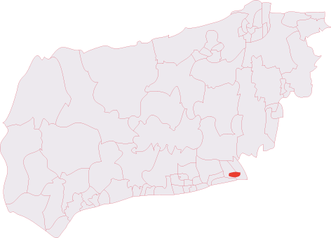
Kingston by Sea is located at Grid Ref: TQ2305 (Lat: 50.834323, Lng: -0.251258)
Administrative County: West Sussex
District: Adur
Police Authority: Sussex
What 3 Words
///wounds.dating.fatherly. Near Shoreham-by-Sea, West Sussex
Nearby Locations
Related Wikis

Kingston by Sea
Kingston by Sea, also known as Kingston Buci, Kingston Bucii or simply Kingston, is a small area in the Adur district of West Sussex, England. Although...
Kingston Buci (electoral division)
Kingston Buci was an electoral division of West Sussex in the United Kingdom, and returned one member to sit on West Sussex County Council. It was abolished...

St Julian's Church, Kingston Buci
St Julian's Church is an Anglican church in Kingston Buci (also known as Kingston by Sea) in the district of Adur, one of seven local government districts...
Shoreham College
Shoreham College is a private day school for boys and girls aged 3 to 16, which is located in Shoreham-by-Sea on the Sussex coast between Brighton and...
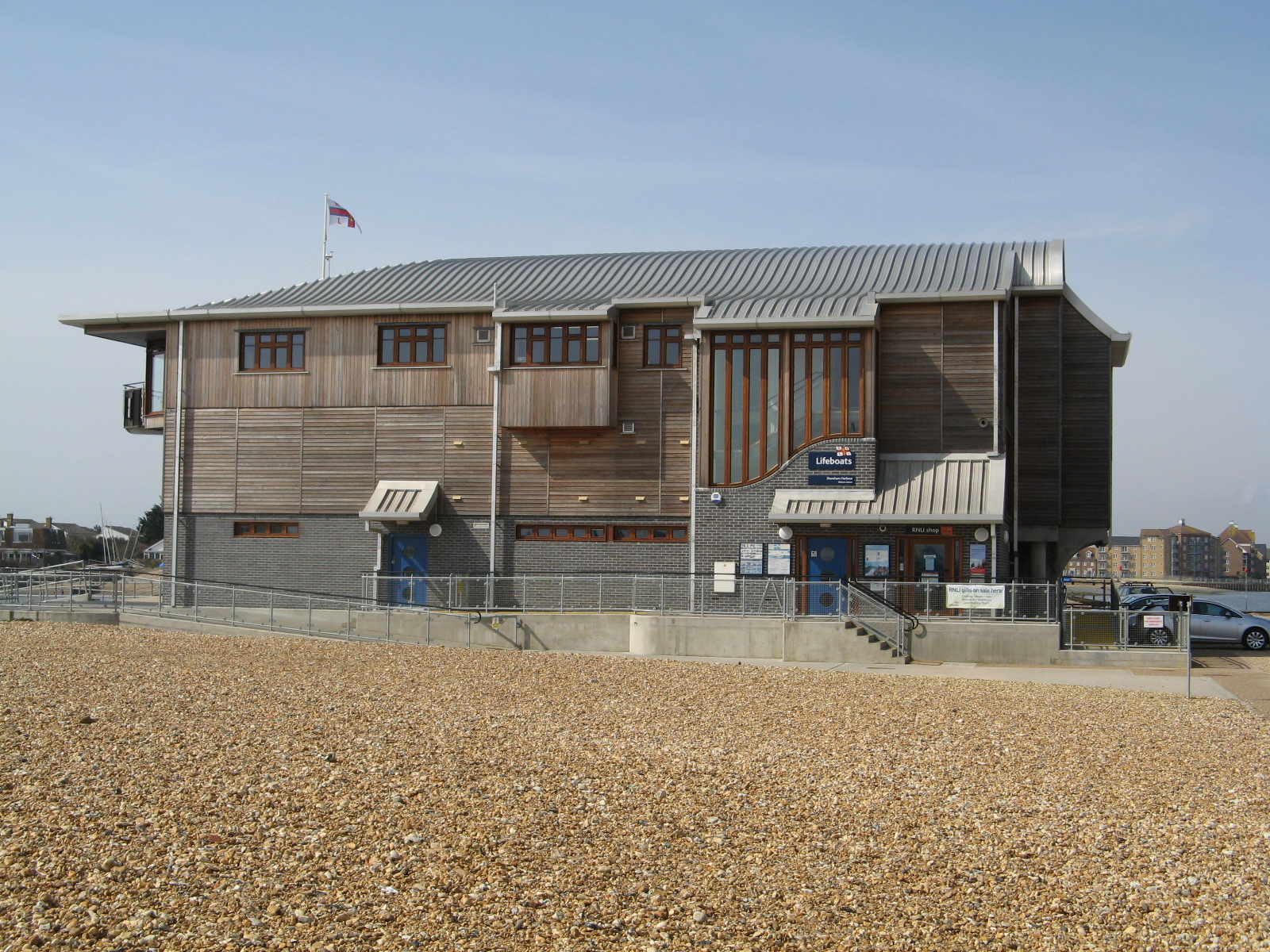
Shoreham Harbour Lifeboat Station
Shoreham Harbour Lifeboat Station is a Royal National Lifeboat Institution (RNLI) station located in the town of Shoreham-by-Sea in the English county...
Kings Manor Community College
Kings Manor Community College (formerly Kings Manor School) was a secondary school located in Shoreham-by-Sea, West Sussex, United Kingdom. A specialist...
Shoreham Academy
Shoreham Academy is a co-educational secondary school and sixth form located in Shoreham-by-Sea, West Sussex, England which opened in September 2009. The...
Shoreham F.C.
Shoreham Football Club is a football club based in Shoreham-by-Sea, West Sussex, England. The club is affiliated to the Sussex County Football Association...
Nearby Amenities
Located within 500m of 50.834323,-0.251258Have you been to Kingston by Sea?
Leave your review of Kingston by Sea below (or comments, questions and feedback).