Snake Hill

Hill, Mountain in Nottinghamshire Mansfield

England

Snake Hill

Footpath to Warren Farm A lone figure walks through the stubble field in the direction of Warren Farm.
Footpath to Warren Farm Credit: Jonathan Thacker

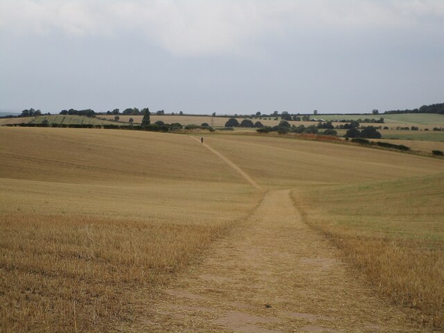
Snake Hill is a prominent geographical feature located in the county of Nottinghamshire, England. Situated in the eastern part of the county, it is a hill of moderate elevation, often referred to as a "mini mountain" due to its distinctive shape and steep sides. Rising approximately 150 meters above sea level, Snake Hill offers picturesque views of the surrounding countryside.

The hill gets its name from its winding, serpentine-like shape, resembling the slithering movement of a snake. It is primarily composed of sandstone, giving it a unique reddish-brown hue that stands out against the greenery of the landscape. The hill's geological formation is believed to have occurred during the Ice Age, as glacial activity shaped the land and carved out its distinctive features.

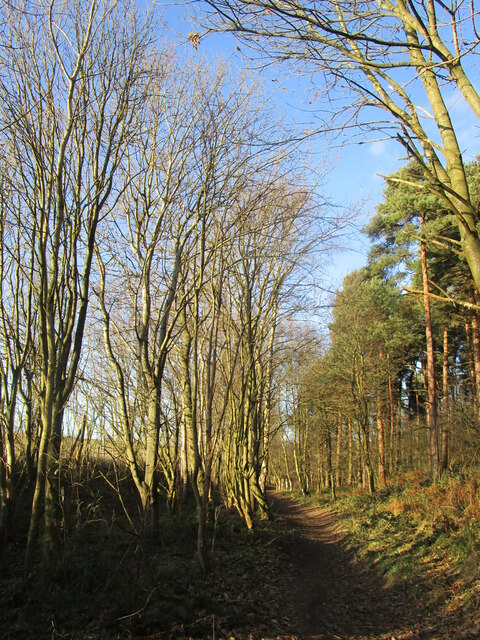
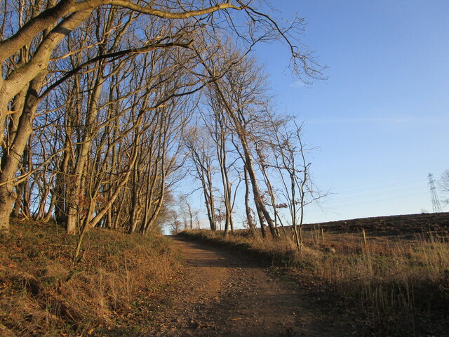
Covered in lush vegetation, Snake Hill is a haven for local wildlife. The diverse flora and fauna found here include various species of wildflowers, grasses, and trees, providing habitat for small mammals, birds, and insects. It is a popular destination for nature enthusiasts, hikers, and those seeking panoramic vistas.

Historically, the hill has also played a significant role in the area. It is rumored to have been a site of ancient settlements, with archaeological evidence suggesting human activity dating back thousands of years. Additionally, Snake Hill has been the subject of local folklore, with tales of buried treasure and mythical creatures adding to its allure.

Overall, Snake Hill in Nottinghamshire is a fascinating and visually striking natural landmark, offering both natural beauty and a glimpse into the region's rich history.

If you have any feedback on the listing, please let us know in the comments section below.

Snake Hill Images

Images are sourced within 2km of 53.167552/-1.1472497 or Grid Reference SK5763. Thanks to Geograph Open Source API. All images are credited.

Footpath to Warren Farm A lone figure walks through the stubble field in the direction of Warren Farm.
Footpath to Warren Farm
A lone figure walks through the stubble field in the direction of Warren Farm.
Whitegates Hotel, Newlands
Stubble field near Forest Town
Autumn sown crop off New Mill Lane
Recent housing below Stinting Lane
Path from Stinting Lane to Goldcrest Road, Mansfield
A glimpse of fields beyond the end of Stinting Lane
Grass field off Stinting Lane Mansfield Woodhouse in the distance.
Grass field off Stinting Lane
Mansfield Woodhouse in the distance.
Rackman's Road A bridleway.
Rackman's Road
A bridleway.
Packman's Road A bridleway running along the edge of Garibaldi Plantation.
Packman's Road
A bridleway running along the edge of Garibaldi Plantation.
Green Lane
Green Lane
Horse riders on Spa Road Spa Road is a bridleway.
Horse riders on Spa Road
Spa Road is a bridleway.
Bridleway to Clipstone Drive Looking towards Newlands.
Bridleway to Clipstone Drive
Looking towards Newlands.
Bridleway to Clipstone Drive The area on the right has been clear felled.
Bridleway to Clipstone Drive
The area on the right has been clear felled.
Clipstone Drive
Clipstone Drive
Spa Ponds The uppermost of the chain of ponds.
Spa Ponds
The uppermost of the chain of ponds.
Spa Ponds A chain of four ponds of which this is the second highest.
Spa Ponds
A chain of four ponds of which this is the second highest.
Electricity pylon near Warren Farm
Show me another place!

Snake Hill is located at Grid Ref: SK5763 (Lat: 53.167552, Lng: -1.1472497)

Administrative County: Nottinghamshire

District: Mansfield

Police Authority: Nottinghamshire

What 3 Words

///hothouse.magnetic.offerings. Near Mansfield Woodhouse, Nottinghamshire

Related Wikis

The Garibaldi School

The Garibaldi School (formerly Garibaldi College) is a co-educational secondary school and sixth form built in the 1960s. It is situated near to the edge...

Clipstone F.C.

Clipstone Football Club is a football club based in Clipstone, Nottinghamshire, England. They are currently members of the United Counties League Division...

St Alban's Church, Forest Town

St. Albans Church, Forest Town is a parish church in the Church of England in Forest Town, Nottinghamshire. == History == St. Albans Church was built by...

Forest Town, Nottinghamshire

Forest Town is a former mining village on the outskirts of Mansfield, Nottinghamshire, England. After continuous development it is no longer a separate...

Nearby Amenities

Located within 500m of 53.167552,-1.1472497
Power: tower
Source: OS_OpenData_StreetView
Lat/Long: 53.1660829/-1.1540454
Power: tower
Source: OS_OpenData_StreetView
Lat/Long: 53.1661532/-1.1508544
Power: tower
Source: OS_OpenData_StreetView
Lat/Long: 53.166224/-1.1473143
Power: tower
Source: OS_OpenData_StreetView
Lat/Long: 53.166418/-1.1443607
Power: tower
Source: OS_OpenData_StreetView
Lat/Long: 53.1666405/-1.1410467
Barrier: horse_stile
Lat/Long: 53.1675882/-1.1494951
Ele: 89.0000000
Lat/Long: 53.167686/-1.1494873
Ele: 88.0000000
Lat/Long: 53.1676221/-1.1494084
Ele: 91.0000000
Lat/Long: 53.1674296/-1.149385
Ele: 91.0000000
Lat/Long: 53.1674534/-1.1494494
Description: Spa Ponds Nature Reserve
Ele: 97.0000000
Information: board
Tourism: information
Lat/Long: 53.1643838/-1.1485844
Ele: 97.0000000
Lat/Long: 53.1642997/-1.1485773
Ele: 95.0000000
Lat/Long: 53.1659623/-1.148884
Ele: 95
Lat/Long: 53.1651436/-1.1489379
Ele: 95
Lat/Long: 53.1650205/-1.1488687
Ele: 91.0000000
Lat/Long: 53.1674196/-1.1492764
Ele: 92.0000000
Lat/Long: 53.1669964/-1.1491038
Ele: 93.0000000
Lat/Long: 53.1669115/-1.148976
Ele: 95.0000000
Lat/Long: 53.1658503/-1.1487829
Ele: 96.0000000
Lat/Long: 53.1646958/-1.1489807
Ele: 73
Lat/Long: 53.1699327/-1.1416593
Ele: 88
Lat/Long: 53.1668854/-1.1406214
Ele: 74
Lat/Long: 53.1700981/-1.141273
The data included in this document is from www.openstreetmap.org. The data is made available under ODbL.

Have you been to Snake Hill?

Leave your review of Snake Hill below (or comments, questions and feedback).