Crow Hill

Hill, Mountain in Nottinghamshire Broxtowe

England

Crow Hill

Wroxham Drive near twitchell over Tottle Brook
Wroxham Drive near twitchell over Tottle Brook Credit: SK53

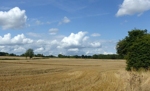
Crow Hill is a prominent hill located in the county of Nottinghamshire, England. Situated near the village of Cuckney, it is part of the eastern edge of the Sherwood Forest. Rising to an elevation of approximately 220 meters (722 feet), Crow Hill offers breathtaking panoramic views of the surrounding landscape.

The hill itself is a natural formation, characterized by its rolling terrain and dense woodland. It is primarily composed of sandstone, with scattered outcrops providing a glimpse into the geological history of the area. The vegetation on Crow Hill is predominantly mixed woodland, comprising of ancient oaks, birch, and hawthorn trees, creating a diverse habitat for various wildlife species.

The area surrounding Crow Hill is steeped in history and folklore, with links to the legend of Robin Hood and his band of outlaws. Sherwood Forest, which encompasses the hill, is renowned for its association with the legendary figure. It is said that Crow Hill was often used as a lookout point by the outlaws, allowing them to spot approaching enemies or potential prey.

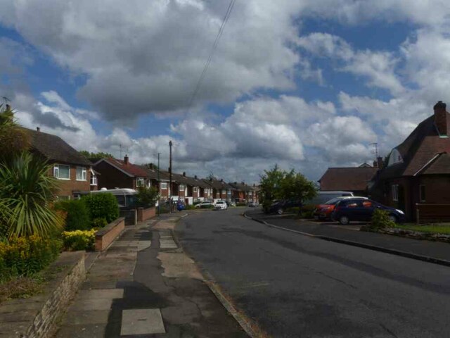
Today, Crow Hill attracts visitors from near and far who come to enjoy its natural beauty and explore the numerous walking trails that crisscross the area. The hill provides an excellent vantage point for birdwatching, with sightings of buzzards, kestrels, and various songbirds being common.

Overall, Crow Hill is a picturesque and historically significant natural landmark in Nottinghamshire, offering visitors a chance to immerse themselves in the beauty of Sherwood Forest and experience the legends that surround it.

If you have any feedback on the listing, please let us know in the comments section below.
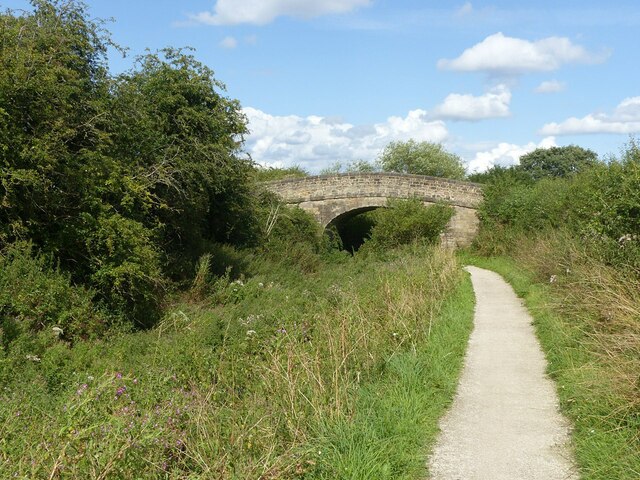
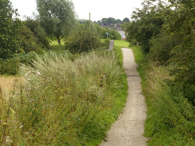
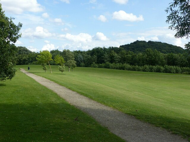
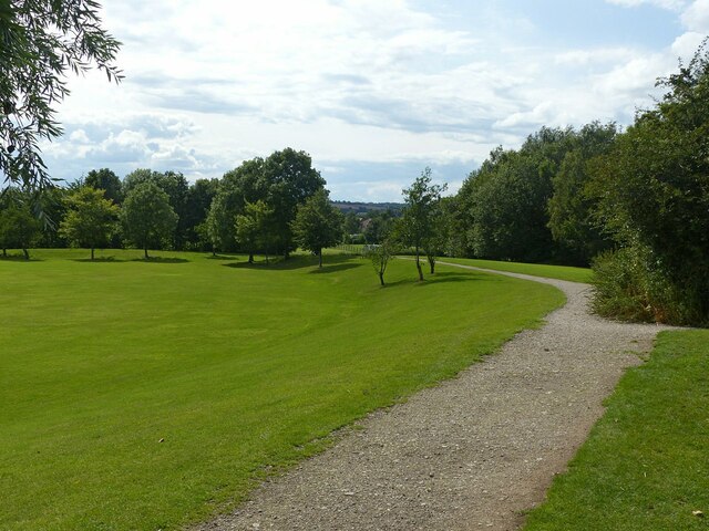
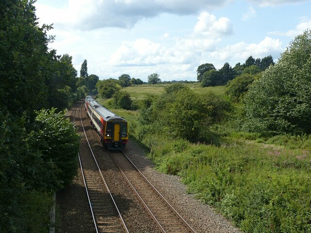
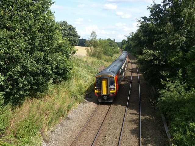
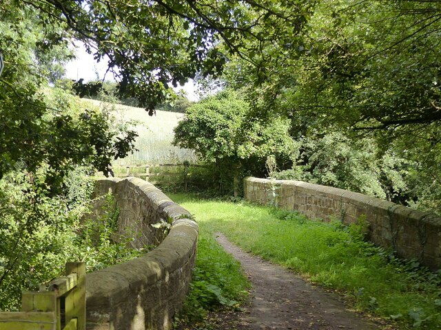
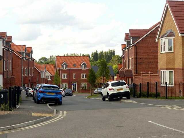
Crow Hill Images

Images are sourced within 2km of 52.937622/-1.2514225 or Grid Reference SK5038. Thanks to Geograph Open Source API. All images are credited.

Wroxham Drive near twitchell over Tottle Brook
Partly harvested field Near the former Swancar Farm.
Partly harvested field
Near the former Swancar Farm.
Swancar Bridge over the Nottingham Canal -1 An original bridge from the creation of the Nottingham Canal, c.1795, Listed Grade II. Originally providing field access, it is now bypassed by a track through the former canal bed alongside.
Swancar Bridge over the Nottingham Canal -1
An original bridge from the creation of the Nottingham Canal, c.1795, Listed Grade II. Originally providing field access, it is now bypassed by a track through the former canal bed alongside.
Swancar Bridge over the Nottingham Canal -2 An original bridge from the creation of the Nottingham Canal, c.1795, Listed Grade II. Originally providing field access, it is now bypassed by a track through the former canal bed alongside. The former canal towpath has been developed as part of the Erewash Valley Trail and also National Cycle Route 6.
Swancar Bridge over the Nottingham Canal -2
An original bridge from the creation of the Nottingham Canal, c.1795, Listed Grade II. Originally providing field access, it is now bypassed by a track through the former canal bed alongside. The former canal towpath has been developed as part of the Erewash Valley Trail and also National Cycle Route 6.
Swancar Bridge over the Nottingham Canal -3 An original bridge from the creation of the Nottingham Canal, c.1795, Listed Grade II. Originally providing field access, it is now bypassed by a track through the former canal bed alongside. The former canal towpath has been developed as part of the Erewash Valley Trail and also National Cycle Route 6.
Swancar Bridge over the Nottingham Canal -3
An original bridge from the creation of the Nottingham Canal, c.1795, Listed Grade II. Originally providing field access, it is now bypassed by a track through the former canal bed alongside. The former canal towpath has been developed as part of the Erewash Valley Trail and also National Cycle Route 6.
Footpath over the railway near Trowell Originally an agricultural accommodation bridge. The path is now part of the Robin Hood Way and Erewash Valley Trail long distance footpaths.
Footpath over the railway near Trowell
Originally an agricultural accommodation bridge. The path is now part of the Robin Hood Way and Erewash Valley Trail long distance footpaths.
Pit Lane Recreation Area Redevelopment of the former Trowell Moor Colliery area as open space.
Pit Lane Recreation Area
Redevelopment of the former Trowell Moor Colliery area as open space.
Pit Lane Recreation Area Redevelopment of the former Trowell Moor Colliery area as open space. The path forms part of the Robin Hood Way long distance path.
Pit Lane Recreation Area
Redevelopment of the former Trowell Moor Colliery area as open space. The path forms part of the Robin Hood Way long distance path.
Train to Nottingham and Norwich Looking west from the footbridge near Pit Lane. The train consists of two Class 158 units, 158 806 and 158 864. Now operated by East Midland Railway, the units are still in the old Stagecoach Group livery of East Midlands Trains.
Train to Nottingham and Norwich
Looking west from the footbridge near Pit Lane. The train consists of two Class 158 units, 158 806 and 158 864. Now operated by East Midland Railway, the units are still in the old Stagecoach Group livery of East Midlands Trains.
Train to Nottingham and Norwich Looking east from the footbridge near Pit Lane. The train consists of two Class 158 units, 158 806 and 158 864. Now operated by East Midland Railway, the units are still in the old Stagecoach Group livery of East Midlands Trains.
Train to Nottingham and Norwich
Looking east from the footbridge near Pit Lane. The train consists of two Class 158 units, 158 806 and 158 864. Now operated by East Midland Railway, the units are still in the old Stagecoach Group livery of East Midlands Trains.
Trowell Garden Centre The commercial entrance, as seen when passing on the Robin Hood Way.
Trowell Garden Centre
The commercial entrance, as seen when passing on the Robin Hood Way.
Swansea Bridge, Nottingham Canal An original bridge from the creation of the Nottingham Canal, c.1795, Listed Grade II. It now carries the Robin Hood Way long distance footpath.
Swansea Bridge, Nottingham Canal
An original bridge from the creation of the Nottingham Canal, c.1795, Listed Grade II. It now carries the Robin Hood Way long distance footpath.
Garden Centre, Trowell Recreating this 'First' for the square <a title="https://www.geograph.org.uk/photo/17066" href="https://www.geograph.org.uk/photo/17066">Link</a> . The canal bed and garden centre have become largely obscured by the significant tree growth in the intervening years.
Garden Centre, Trowell
Recreating this 'First' for the square Link . The canal bed and garden centre have become largely obscured by the significant tree growth in the intervening years.
Stop gate, Nottingham Canal at Swansea Bridge These gates could be used to stop the flow of water along the canal in the event of a breach. A bridge hole where the passage narrowed was always a favoured place. Stop gates were always prudent on long stretches without any proper locks.

More overgrown than when I visited in 2007 <a title="https://www.geograph.org.uk/photo/622412" href="https://www.geograph.org.uk/photo/622412">Link</a> . The access to the nearside towpath is now formally not available.
Stop gate, Nottingham Canal at Swansea Bridge
These gates could be used to stop the flow of water along the canal in the event of a breach. A bridge hole where the passage narrowed was always a favoured place. Stop gates were always prudent on long stretches without any proper locks. More overgrown than when I visited in 2007 Link . The access to the nearside towpath is now formally not available.
Swansea Bridge, Nottingham Canal An original bridge from the building of the canal, c.1795, Listed Grade II. The bridge has been provided with stop-board slots. These could be inserted if it was necessary to drain a particular section of the canal for maintenance purposes. Note also how the bridge has been reinforced with railway rails.

The boarding on the right prevents unwanted access into the garden centre which has taken over the canal bed.
Swansea Bridge, Nottingham Canal
An original bridge from the building of the canal, c.1795, Listed Grade II. The bridge has been provided with stop-board slots. These could be inserted if it was necessary to drain a particular section of the canal for maintenance purposes. Note also how the bridge has been reinforced with railway rails. The boarding on the right prevents unwanted access into the garden centre which has taken over the canal bed.
Field Farm Way, Stapleford New housing development on former farmland.
Field Farm Way, Stapleford
New housing development on former farmland.
Field Farm housing development, Stapleford The farm occupied the area beyond the lighting column.
Field Farm housing development, Stapleford
The farm occupied the area beyond the lighting column.
Ilkeston Road closure, Stapleford A significant closure with substantial diversions while Severn Trent make 'new connections'. The closure notices do not state whether this is for water supply or sewerage.
Ilkeston Road closure, Stapleford
A significant closure with substantial diversions while Severn Trent make 'new connections'. The closure notices do not state whether this is for water supply or sewerage.
Show me another place!

Crow Hill is located at Grid Ref: SK5038 (Lat: 52.937622, Lng: -1.2514225)

Administrative County: Nottinghamshire

District: Broxtowe

Police Authority: Nottinghamshire

What 3 Words

///images.weeks.forum. Near Long Eaton, Derbyshire

Nearby Locations

Bramcote Hill Crow Hill

Related Wikis

Bramcote College

Bramcote College is a co-educational secondary school located in Bramcote, Nottinghamshire, England. It is a member of The White Hills Park Federation...

Church of St Michael and All Angels, Bramcote

The Church of St Michael and All Angels, Bramcote is an Anglican parish church in Bramcote, Broxtowe, Nottinghamshire, England. == History and description... ==

The White Hills Park Federation Trust

The White Hills Park Trust, is a collective group of academies in Nottinghamshire, England. The name is derived from the three schools originally within...

Alderman White School

Alderman White School is a mixed, 11-18 secondary school in Bramcote, Nottinghamshire. The school is a member of The White Hills Park Federation Trust...

Bramcote Hills Sport and Community College

Bramcote Hills Sports and Community College was a mixed state school in Nottinghamshire. It taught children from 11 to 18 (Years 7-13). It is located in...

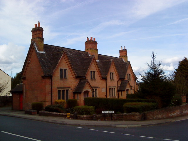
Frances Longden Almshouses

The Frances Jane Longden Almshouses were erected in 1852 in Bramcote, Nottinghamshire, for 4 poor women.The patron was Frances Jane Longden, the sister...

Bramcote

Bramcote (, locally ) is a suburban village and former civil parish in the Broxtowe district of Nottinghamshire, England, between Stapleford and Beeston...
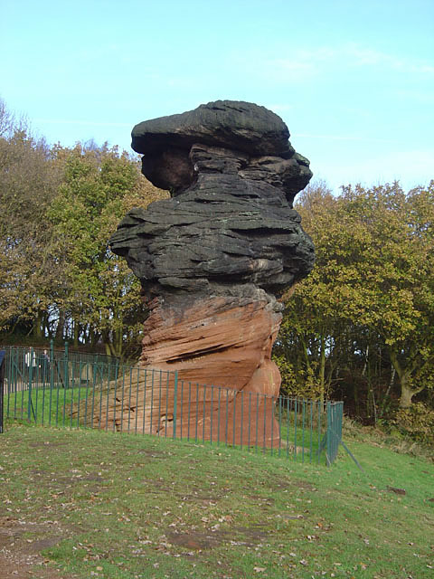
Hemlock Stone

The Hemlock Stone or Himlack Stone is an inselberg on Stapleford Hill at Stapleford, Nottinghamshire, England. == Geology == The Hemlock Stone is an outcrop...

Nearby Amenities

Located within 500m of 52.937622,-1.2514225
Direction: forward
Maxspeed: 30 mph
Traffic Sign: maxspeed
Traffic Sign Direction: forward
Lat/Long: 52.9355597/-1.2505295
Bramcote
Place: village
Wikidata: Q4956139
Wikipedia: en:Bramcote
Lat/Long: 52.9354282/-1.2458076
Traffic Signals
Crossing Markings: no
Traffic Signals: crossing
Lat/Long: 52.9364667/-1.2498851
Exit To: Motorway (M1);Derby A52
Lat/Long: 52.9359947/-1.2499256
Direction: forward
Maxspeed: 70 mph
Traffic Sign: maxspeed
Traffic Sign Direction: forward
Lat/Long: 52.9355318/-1.2503967
Traffic Signals
Crossing Markings: no
Traffic Signals: crossing
Lat/Long: 52.936365/-1.2498999
Bus Stop
Leisure Centre
Bench: yes
Bin: yes
Bus: yes
Lit: no
Naptan AtcoCode: 3300BR0054
Naptan Bearing: SW
Naptan CommonName: Leisure Centre
Naptan Crossing: Church Street
Naptan Indicator: opp
Naptan Landmark: Leisure Centre
Naptan NaptanCode: ntsadadw
Naptan Notes: none
Naptan PlusbusZoneRef: NTNG
Naptan Street: Derby Road
Naptan Verified: yes
Public Transport: platform
Shelter: yes
Source: naptan_import
Tactile Paving: no
Waste Basket: yes
Lat/Long: 52.9371952/-1.2456968
Bus Stop
Leisure Centre
Bench: yes
Bin: yes
Bus: yes
Lit: no
Naptan AtcoCode: 3300BR0086
Naptan Bearing: NE
Naptan CommonName: Leisure Centre
Naptan Crossing: Moor Lane
Naptan Indicator: adj
Naptan Landmark: Leisure Centre
Naptan NaptanCode: ntsadama
Naptan Notes: none
Naptan PlusbusZoneRef: NTNG
Naptan Street: Derby Road
Naptan Verified: yes
Public Transport: platform
Shelter: yes
Source: naptan_import
Tactile Paving: no
Waste Basket: yes
Lat/Long: 52.9374571/-1.2456799
Bus Stop
Bembridge Court (Opposite Sherwin Arms)
Bus: yes
Naptan AtcoCode: 3300BR0100
Naptan Bearing: SW
Naptan CommonName: Bembridge Court
Naptan Crossing: Bembridge Court
Naptan Indicator: adj
Naptan NaptanCode: ntsadaga
Naptan Notes: none
Naptan Street: Derby Road
Naptan Verified: yes
Public Transport: platform
Shelter: yes
Source: naptan_import
Lat/Long: 52.9356469/-1.2525333
Bus Stop
Bembridge Court (Outside Sherwin Arms)
Bench: yes
Bus: yes
Naptan AtcoCode: 3300BR0114
Naptan Bearing: NE
Naptan CommonName: Bembridge Court
Naptan Crossing: Bembridge Court
Naptan Indicator: opp
Naptan Landmark: Sherwin Arms
Naptan NaptanCode: ntsadamd
Naptan Notes: none
Naptan Street: Derby Road
Naptan Verified: yes
Public Transport: platform
Shelter: yes
Source: naptan_import
Tactile Paving: no
Lat/Long: 52.9359216/-1.2519036
Bus Stop
Stanley Drive
Bench: no
Bin: no
Bus: yes
Lit: no
Naptan AtcoCode: 3300BR0126
Naptan Bearing: NE
Naptan CommonName: Stanley Drive
Naptan Crossing: Stanley Drive
Naptan Indicator: opp
Naptan NaptanCode: ntsdagwj
Naptan Notes: none
Naptan Street: Ewe Lamb Lane
Naptan Verified: yes
Public Transport: platform
Shelter: no
Source: naptan_import
Tactile Paving: no
Lat/Long: 52.9365816/-1.2582457
Bus Stop
Stanley Drive
Bench: no
Bin: no
Bus: yes
Lit: no
Naptan AtcoCode: 3300BR0129
Naptan Bearing: SW
Naptan CommonName: Stanley Drive
Naptan Crossing: Stanley Drive
Naptan Indicator: adj
Naptan NaptanCode: ntsdagwp
Naptan Notes: none
Naptan Street: Ewe Lamb Lane
Naptan Verified: yes
Public Transport: platform
Shelter: no
Source: naptan_import
Tactile Paving: no
Lat/Long: 52.9374406/-1.2575912
Bus Stop
Chapel Street
Bench: no
Bin: no
Bus: yes
Lit: yes
Naptan AtcoCode: 3300BR0257
Naptan Bearing: NW
Naptan CommonName: Chapel Street
Naptan Crossing: Church Street
Naptan Indicator: opp
Naptan NaptanCode: ntsdapmp
Naptan Notes: BW
Naptan PlusbusZoneRef: NTNG
Naptan Street: Town Street
Naptan Verified: no
Public Transport: platform
Shelter: no
Source: naptan_import
Tactile Paving: no
Lat/Long: 52.9352867/-1.2481651
Bus Stop
Marshall Drive
Bench: no
Bin: no
Bus: yes
Lit: yes
Local Ref: BR0477
Naptan AtcoCode: 3300BR0477
Naptan Bearing: SW
Naptan CommonName: Marshall Drive
Naptan Indicator: SW-bound
Naptan NaptanCode: ntsawgpa
Naptan Street: Marshall Drive
Naptan Verified: yes
Public Transport: platform
Shelter: no
Source: naptan_import
Tactile Paving: no
Lat/Long: 52.9356871/-1.2553112
Bus Stop
Chapel Street
Bench: no
Bin: no
Bus: yes
Lit: no
Local Ref: adj
Naptan AtcoCode: 3300BR0488
Naptan Bearing: SE
Naptan BusStopType: CUS
Naptan Crossing: Chapel Street
Naptan Notes: 3300BR0257
Naptan PlusbusZoneRef: NTNG
Naptan Street: Town Street
Naptan Verified: no
Public Transport: platform
Ref: ntsgjpmt
Shelter: no
Source: naptan_import
Tactile Paving: no
Lat/Long: 52.9353584/-1.2481341
Crossing
Crossing: uncontrolled
Crossing Island: no
Crossing Ref: zebra
Tactile Paving: yes
Lat/Long: 52.9354274/-1.2534933
Barrier: cycle_barrier
Cycle Barrier: double
Cycle Barrier Installation: fixed
Lat/Long: 52.9361375/-1.2540416
Crossing
Crossing: unmarked
Crossing Island: no
Crossing Markings: no
Kerb: lowered
Tactile Paving: no
Lat/Long: 52.9389683/-1.2558418
Crossing
Bicycle: yes
Button Operated: yes
Crossing: traffic_signals
Crossing Island: no
Crossing Ref: toucan
Tactile Paving: yes
Traffic Signals Sound: yes
Traffic Signals Vibration: no
Lat/Long: 52.9377936/-1.2537982
Post Box
Brand: Royal Mail
Brand Wikidata: Q638098
Brand Wikipedia: en:Royal Mail
Collection Times: Mo-Fr 09:00; Sa 07:00
Location: Central Avenue, Ewe Lamb Lane
Operator: Royal Mail
Operator Wikidata: Q638098
Post Box Design: type_b
Post Box Manufacturer: Carron Company, Stirlingshire
Post Box Type: pillar
Ref: NG9 657D
Royal Cypher: EIIR
Royal Cypher Wikidata: Q33102113
Lat/Long: 52.9369593/-1.2580478
Post Box
Collection Times: Mo-Fr 17:00; Sa 11:00
Location: Bramcote Post Office
Post Box Design: type_b
Post Box Type: pillar
Ref: NG9 628
Royal Cypher: GR
Royal Cypher Wikidata: Q33102273
Lat/Long: 52.9359502/-1.2519318
Traffic Signals
Crossing: traffic_signals
Crossing Ref: pelican
Tactile Paving: yes
Lat/Long: 52.9375388/-1.2446271
Post Box
Brand: Royal Mail
Brand Wikidata: Q638098
Brand Wikipedia: en:Royal Mail
Collection Times: Mo-Fr 09:00; Sa 07:00
Operator: Royal Mail
Operator Wikidata: Q638098
Post Box Design: type_b
Post Box Type: pillar
Ref: NG9 660D
Royal Cypher: EIIR
Royal Cypher Wikidata: Q33102113
Source: survey
Lat/Long: 52.9364073/-1.2468349
Post Box
Brand: Royal Mail
Brand Wikidata: Q638098
Brand Wikipedia: en:Royal Mail
Collection Times: Mo-Fr 09:00; Sa 07:00
Operator: Royal Mail
Operator Wikidata: Q638098
Post Box Design: type_b
Post Box Manufacturer: Lion Foundry Co Ltd, Kirkintilloch
Post Box Type: pillar
Ref: NG9 637D
Royal Cypher: GVIR
Royal Cypher Wikidata: Q33102169
Source: survey
Lat/Long: 52.9379886/-1.2444769
Traffic Signals
Crossing: traffic_signals
Crossing Ref: pelican
Tactile Paving: yes
Lat/Long: 52.9376354/-1.2447833
Barrier: cycle_barrier
Cycle Barrier: double
Cycle Barrier Installation: fixed
Lat/Long: 52.9370067/-1.2524413
Crossing
Button Operated: yes
Crossing: traffic_signals
Crossing Island: no
Crossing Markings: dots
Crossing Ref: puffin
Tactile Paving: yes
Lat/Long: 52.9364181/-1.2496962
Traffic Signals
Crossing Markings: no
Traffic Signals: crossing
Lat/Long: 52.93653/-1.2498075
Traffic Signals
Crossing Markings: no
Traffic Signals: crossing
Lat/Long: 52.936334/-1.2494922
Entrance: main
Lat/Long: 52.9351261/-1.2463166
Recycling
Operator: Broxtowe Borough Council
Recycling Cans: yes
Recycling Cardboard: yes
Recycling Clothes: yes
Recycling Glass Bottles: yes
Recycling Paper: yes
Recycling Plastic Bottles: yes
Recycling Type: container
Source: survey
Lat/Long: 52.9376171/-1.2493249
Traffic Signals
Crossing Markings: no
Traffic Signals: crossing
Lat/Long: 52.9358279/-1.2503841
Traffic Signals
Crossing Markings: no
Traffic Signals: crossing
Lat/Long: 52.9359418/-1.2501763
Parking
Access: yes
Fee: no
Layby: yes
Note: Layby
Parking: layby
Source: survey
Lat/Long: 52.9340169/-1.2514492
Entrance: home
Lat/Long: 52.9383357/-1.2558552
Crossing
Crossing: unmarked
Crossing Island: no
Crossing Markings: no
Lat/Long: 52.9360541/-1.2508838
Barrier: cycle_barrier
Lat/Long: 52.9378337/-1.2444622
Traffic Calming: bump
Lat/Long: 52.9373302/-1.2477109
Barrier: kissing_gate
Lat/Long: 52.9343841/-1.2510728
Addr City: Nottingham
Addr Housenumber: 255A
Addr Postcode: NG9 3JA
Addr Street: Derby Road
Addr Suburb: Bramcote
Entrance: home
Source: survey
Lat/Long: 52.9342662/-1.2560641
Entrance: home
Lat/Long: 52.9377425/-1.256155
Entrance: home
Lat/Long: 52.9377521/-1.2562811
Entrance: home
Lat/Long: 52.9377872/-1.2560748
Entrance: home
Lat/Long: 52.9378037/-1.2563604
Entrance: home
Lat/Long: 52.9378347/-1.2559884
Entrance: home
Lat/Long: 52.937854/-1.2564378
Entrance: home
Lat/Long: 52.9379498/-1.2559127
Entrance: home
Lat/Long: 52.9379683/-1.2557986
Entrance: home
Lat/Long: 52.9382193/-1.2560679
Entrance: home
Lat/Long: 52.9382762/-1.2563268
Entrance: home
Lat/Long: 52.9384795/-1.2563742
Entrance: home
Lat/Long: 52.9384989/-1.2557671
Note: Tree gone - stump only
Lat/Long: 52.9387529/-1.2570058
Note: Tree gone - stump only
Lat/Long: 52.9391173/-1.2573014
Access: private
Capacity: 40
Covered: yes
Disused Amenity: bicycle_parking
Lat/Long: 52.9390359/-1.2519289
Entrance: main
Lat/Long: 52.9390606/-1.2514654
Entrance: yes
Lat/Long: 52.9394382/-1.2516552
Bramcote Hills Park: Site of 'The Hills'
Board Type: history
Check Date: 2023-06-03
Information: board
Source: survey
Tourism: information
Lat/Long: 52.9414034/-1.2545767
Barrier: cycle_barrier
Cycle Barrier: double
Cycle Barrier Installation: fixed
Lat/Long: 52.9395703/-1.2526982
Man Made: mast
Source: survey
Lat/Long: 52.9369806/-1.2489103
Entrance: main
Lat/Long: 52.9373853/-1.2479064
Bicycle Parking
Bicycle Parking: wall_loops
Capacity: 9
Covered: no
Description: Wheel bender loops attached to posts
Lat/Long: 52.9374238/-1.2479619
Bus Stop
Trenton Close
Bench: no
Bin: no
Bus: yes
Lit: yes
Naptan AtcoCode: 3300BR0591
Naptan NaptanCode: ntsgtmgm
Public Transport: platform
Ref: BR0591
Shelter: no
Source: survey
Tactile Paving: no
Lat/Long: 52.9383222/-1.2580252
Bus Stop
Trenton Close
Bench: yes
Bin: no
Bus: yes
Lit: no
Public Transport: platform
Ref: BR0590
Shelter: yes
Source: survey
Tactile Paving: no
Lat/Long: 52.9385739/-1.2581147
Entrance: yes
Lat/Long: 52.9358771/-1.2468356
Defibrillator
Emergency: defibrillator
Indoor: no
Ref GB The Circuit: F51DB349-65AA-4B90-B282-79ACE23CB15E
Lat/Long: 52.9359304/-1.2468051
Entrance: main
Lat/Long: 52.9359366/-1.246794
Waste Basket
Lat/Long: 52.9363909/-1.2468624
Bench
Backrest: yes
Lat/Long: 52.9365497/-1.2469134
Bench
Backrest: yes
Lat/Long: 52.9411409/-1.2546395
Covered: no
Leisure: picnic_table
Lat/Long: 52.94133/-1.2546797
Covered: no
Leisure: picnic_table
Lat/Long: 52.9412928/-1.2545054
Waste Basket
Lat/Long: 52.9413357/-1.254555
Waste Basket
Lat/Long: 52.937425/-1.2503432
Note: No tree (Dec 18)
Lat/Long: 52.9352528/-1.254268
Note: No tree (Dec 18)
Lat/Long: 52.9347896/-1.2555568
Bench
Backrest: yes
Lat/Long: 52.9346424/-1.2467526
Bramcote Conservation Area
Board Type: history
Information: board
Operator: Broxtowe Borough Council
Tourism: information
Lat/Long: 52.9346567/-1.2467576
Waste Basket
Lat/Long: 52.9346093/-1.2467501
Generator Method: photovoltaic
Generator Output Electricity: yes
Generator Source: solar
Generator Type: solar_photovoltaic_panel
Location: roof
Power: generator
Lat/Long: 52.9374623/-1.2570746
Generator Method: photovoltaic
Generator Output Electricity: yes
Generator Source: solar
Generator Type: solar_photovoltaic_panel
Location: roof
Power: generator
Lat/Long: 52.9340535/-1.2523855
Generator Method: photovoltaic
Generator Output Electricity: yes
Generator Source: solar
Generator Type: solar_photovoltaic_panel
Location: roof
Power: generator
Lat/Long: 52.9343069/-1.2519456
Generator Method: photovoltaic
Generator Output Electricity: yes
Generator Source: solar
Generator Type: solar_photovoltaic_panel
Location: roof
Power: generator
Lat/Long: 52.9341537/-1.2543166
Generator Method: photovoltaic
Generator Output Electricity: yes
Generator Source: solar
Generator Type: solar_photovoltaic_panel
Location: roof
Power: generator
Lat/Long: 52.9341246/-1.2544937
Direction: SSE
Generator Method: photovoltaic
Generator Output Electricity: yes
Generator Solar Modules: 9
Generator Source: solar
Generator Type: solar_photovoltaic_panel
Location: roof
Power: generator
Lat/Long: 52.9337211/-1.2545818
Barrier: cycle_barrier
Cycle Barrier: double
Cycle Barrier Installation: fixed
Lat/Long: 52.9372665/-1.2474131
Entrance: main
Lat/Long: 52.9385416/-1.2578979
Waste Basket
Lat/Long: 52.9384924/-1.2578427
Waste Basket
Lat/Long: 52.9368467/-1.2581626
Addr City: Nottingham
Addr Housenumber: 8
Addr Postcode: NG9 3JX
Addr Street: Westbourne Court
Addr Suburb: Bramcote
Entrance: home
Level: 1
Note: Directly above ground floor doorway
Source Addr Housenumber: interpolation
Source Addr Postcode: OS Open Data Codepoint
Lat/Long: 52.9389374/-1.2575298
Addr City: Nottingham
Addr Housenumber: 6
Addr Postcode: NG9 3JX
Addr Street: Westbourne Court
Addr Suburb: Bramcote
Entrance: home
Level: 1
Note: Directly above ground floor doorway
Source Addr Housenumber: interpolation
Source Addr Postcode: OS Open Data Codepoint
Lat/Long: 52.9389589/-1.2574916
Addr City: Nottingham
Addr Housenumber: 5
Addr Postcode: NG9 3JX
Addr Street: Westbourne Court
Addr Suburb: Bramcote
Entrance: home
Source Addr Housenumber: interpolation
Source Addr Postcode: OS Open Data Codepoint
Lat/Long: 52.9389649/-1.2574809
Addr City: Nottingham
Addr Housenumber: 7
Addr Postcode: NG9 3JX
Addr Street: Westbourne Court
Addr Suburb: Bramcote
Entrance: home
Source Addr Housenumber: interpolation
Source Addr Postcode: OS Open Data Codepoint
Lat/Long: 52.9389318/-1.2575399
Addr City: Nottingham
Addr Housenumber: 10
Addr Postcode: NG9 3JX
Addr Street: Westbourne Court
Addr Suburb: Bramcote
Entrance: home
Level: 1
Note: Directly above ground floor doorway
Source Addr Housenumber: interpolation
Source Addr Postcode: OS Open Data Codepoint
Lat/Long: 52.9388934/-1.2576377
Addr City: Nottingham
Addr Housenumber: 12
Addr Postcode: NG9 3JX
Addr Street: Westbourne Court
Addr Suburb: Bramcote
Entrance: home
Level: 1
Note: Directly above ground floor doorway
Source Addr Housenumber: interpolation
Source Addr Postcode: OS Open Data Codepoint
Lat/Long: 52.938875/-1.2576704
Addr City: Nottingham
Addr Housenumber: 9
Addr Postcode: NG9 3JX
Addr Street: Westbourne Court
Addr Suburb: Bramcote
Entrance: home
Source Addr Housenumber: interpolation
Source Addr Postcode: OS Open Data Codepoint
Lat/Long: 52.9389002/-1.2576256
Addr City: Nottingham
Addr Housenumber: 11
Addr Postcode: NG9 3JX
Addr Street: Westbourne Court
Addr Suburb: Bramcote
Entrance: home
Source Addr Housenumber: survey
Source Addr Postcode: OS Open Data Codepoint
Lat/Long: 52.9388688/-1.2576814
Addr City: Nottingham
Addr Housenumber: 17
Addr Postcode: NG9 3JX
Addr Street: Westbourne Court
Addr Suburb: Bramcote
Entrance: home
Source Addr Housenumber: survey
Source Addr Postcode: OS Open Data Codepoint
Lat/Long: 52.9387494/-1.2578933
Addr City: Nottingham
Addr Housenumber: 19
Addr Postcode: NG9 3JX
Addr Street: Westbourne Court
Addr Suburb: Bramcote
Entrance: home
Source Addr Housenumber: survey
Source Addr Postcode: OS Open Data Codepoint
Lat/Long: 52.9387141/-1.2579565
Addr City: Nottingham
Addr Housenumber: 18
Addr Postcode: NG9 3JX
Addr Street: Westbourne Court
Addr Suburb: Bramcote
Entrance: home
Level: 1
Note: Directly above ground floor doorway
Source Addr Housenumber: survey
Source Addr Postcode: OS Open Data Codepoint
Lat/Long: 52.9387453/-1.2579004
Addr City: Nottingham
Addr Housenumber: 20
Addr Postcode: NG9 3JX
Addr Street: Westbourne Court
Addr Suburb: Bramcote
Entrance: home
Level: 1
Note: Directly above ground floor doorway
Source Addr Housenumber: interpolation
Source Addr Postcode: OS Open Data Codepoint
Lat/Long: 52.9387176/-1.2579503
Addr City: Nottingham
Addr Housenumber: 14
Addr Postcode: NG9 3JX
Addr Street: Westbourne Court
Addr Suburb: Bramcote
Entrance: home
Level: 1
Note: Directly above ground floor doorway
Source Addr Housenumber: survey
Source Addr Postcode: OS Open Data Codepoint
Lat/Long: 52.9388051/-1.2577551
Addr City: Nottingham
Addr Housenumber: 16
Addr Postcode: NG9 3JX
Addr Street: Westbourne Court
Addr Suburb: Bramcote
Entrance: home
Level: 1
Note: Directly above ground floor doorway
Source Addr Housenumber: survey
Source Addr Postcode: OS Open Data Codepoint
Lat/Long: 52.938783/-1.2577943
Addr City: Nottingham
Addr Housenumber: 13
Addr Postcode: NG9 3JX
Addr Street: Westbourne Court
Addr Suburb: Bramcote
Entrance: home
Source Addr Housenumber: interpolation
Source Addr Postcode: OS Open Data Codepoint
Lat/Long: 52.9388095/-1.2577473
Addr City: Nottingham
Addr Housenumber: 15
Addr Postcode: NG9 3JX
Addr Street: Westbourne Court
Addr Suburb: Bramcote
Entrance: home
Source Addr Housenumber: survey
Source Addr Postcode: OS Open Data Codepoint
Lat/Long: 52.9387789/-1.2578017
Entrance: main
Lat/Long: 52.9386927/-1.2574312
Waste Basket
Lat/Long: 52.9378239/-1.2535787
Bench
Backrest: yes
Lat/Long: 52.9380947/-1.2530798
Waste Basket
Lat/Long: 52.9380793/-1.2531106
Bench
Backrest: yes
Lat/Long: 52.9383121/-1.2526976
Waste Basket
Source: survey
Lat/Long: 52.938696/-1.2545255
Description: Parallel Bars
Leisure: fitness_station
Note: Part of 'Bramcote Hills Park Trim Trail'
Sport: fitness
Lat/Long: 52.9393822/-1.2555179
Waste Basket
Lat/Long: 52.9396037/-1.2559631
Bench
Backrest: yes
Lat/Long: 52.9396271/-1.2559886
Barrier: cycle_barrier
Cycle Barrier: double
Cycle Barrier Installation: fixed
Lat/Long: 52.9396557/-1.2564405
Throw Bag
Emergency: throw_bag
Lat/Long: 52.9392048/-1.2570615
Bench
Backrest: yes
Lat/Long: 52.9393176/-1.2568
Waste Basket
Lat/Long: 52.9393758/-1.2567899
Bench
Backrest: yes
Lat/Long: 52.9390314/-1.2564661
Waste Basket
Lat/Long: 52.9390533/-1.255998
Entrance: home
Lat/Long: 52.9382371/-1.2560358
Entrance: home
Lat/Long: 52.9382049/-1.2560951
Entrance: home
Lat/Long: 52.9382943/-1.2563542
Entrance: home
Lat/Long: 52.9382639/-1.2563092
Entrance: home
Lat/Long: 52.938492/-1.2563925
Entrance: home
Lat/Long: 52.9384694/-1.2563593
Entrance: home
Lat/Long: 52.9384892/-1.2557525
Entrance: home
Lat/Long: 52.9385075/-1.2557798
Entrance: home
Lat/Long: 52.9383474/-1.2558336
Entrance: home
Lat/Long: 52.9383247/-1.2558755
Entrance: home
Lat/Long: 52.938056/-1.2557245
Entrance: home
Lat/Long: 52.9380746/-1.2556068
Entrance: home
Lat/Long: 52.9381614/-1.2555306
Entrance: home
Lat/Long: 52.9381792/-1.2554215
Entrance: home
Lat/Long: 52.9382678/-1.2553455
Entrance: home
Lat/Long: 52.9382866/-1.255233
Waste Basket
Lat/Long: 52.9378082/-1.2539206
Entrance: yes
Lat/Long: 52.9355934/-1.2536353
Entrance: yes
Lat/Long: 52.9355655/-1.2537234
Addr City: Nottingham
Addr Housenumber: 260A
Addr Postcode: NG9 3JN
Addr Street: Derby Road
Addr Suburb: Bramcote
Level: 1
Lat/Long: 52.935665/-1.2536658
Waste Basket
Lat/Long: 52.9355478/-1.2534637
Addr City: Nottingham
Addr Housenumber: 262A
Addr Postcode: NG9 3JN
Addr Street: Derby Road
Addr Suburb: Bramcote
Level: 1
Lat/Long: 52.9356282/-1.253806
Description: Cat lounge entrance
Entrance: yes
Lat/Long: 52.935761/-1.2535706
Entrance: service
Lat/Long: 52.9356851/-1.2535115
Description: Main entrance / reception
Entrance: main
Lat/Long: 52.935639/-1.2534722
Generator Method: photovoltaic
Generator Output Electricity: yes
Generator Source: solar
Generator Type: solar_photovoltaic_panel
Location: roof
Power: generator
Lat/Long: 52.9375782/-1.258062
Description: Step Up
Leisure: fitness_station
Note: Part of 'Bramcote Hills Park Trim Trail'
Sport: fitness
Lat/Long: 52.9396805/-1.253053
Description: Horizontal Bar
Disused Leisure: fitness_station
Note: Part of 'Bramcote Hills Park Trim Trail'
Note 2: Marked as disused because it is broken and not usable
Lat/Long: 52.9410011/-1.2543082
Description: Logs Hops
Disused Leisure: fitness_station
Note: Part of 'Bramcote Hills Park Trim Trail'
Note 2: Marked as disused because it is broken and not usable
Lat/Long: 52.9410512/-1.2545469
Description: Stride Jumps
Leisure: fitness_station
Note: Part of 'Bramcote Hills Park Trim Trail'
Sport: fitness
Lat/Long: 52.9412144/-1.255365
Entrance: home
Lat/Long: 52.9378952/-1.2565012
Waste Basket
Lat/Long: 52.9391373/-1.2451082
Waste Basket
Lat/Long: 52.9381311/-1.244549
Traffic Calming: hump
Lat/Long: 52.9377043/-1.2489277
Traffic Calming: bump
Lat/Long: 52.9376235/-1.2483966
Waste Basket
Lat/Long: 52.9371256/-1.2525594
Bench
Backrest: yes
Lat/Long: 52.940289/-1.257093
Description: Bench Sit Ups
Leisure: fitness_station
Note: Part of a 'fitness trail'
Sport: fitness
Lat/Long: 52.9400878/-1.2566002
Description: Inclined Press Ups
Leisure: fitness_station
Note: Part of 'Bramcote Hills Park Trim Trail'
Sport: fitness
Lat/Long: 52.9398801/-1.2563387
Waste Basket
Lat/Long: 52.939969/-1.2566069
Bench
Backrest: no
Lat/Long: 52.9399819/-1.2566324
Covered: no
Leisure: picnic_table
Lat/Long: 52.9403028/-1.2546408
Description: Gate
Leisure: fitness_station
Note: Part of 'Bramcote Hills Park Trim Trail'
Sport: fitness
Lat/Long: 52.9405582/-1.2533855
Waste Basket
Source: survey
Lat/Long: 52.9411296/-1.2535022
Bench
Backrest: no
Source: survey
Lat/Long: 52.9405162/-1.2530335
Waste Basket
Source: survey
Lat/Long: 52.9402802/-1.2530758
Waste Basket
Source: survey
Lat/Long: 52.9395859/-1.2527324
Covered: no
Leisure: picnic_table
Source: survey
Lat/Long: 52.9394736/-1.2529939
Bench
Backrest: no
Source: survey
Lat/Long: 52.9392238/-1.2529175
Bench
Backrest: no
Lat/Long: 52.9374804/-1.2518379
Waste Basket
Lat/Long: 52.9386726/-1.2518674
Barrier: cycle_barrier
Cycle Barrier: single
Cycle Barrier Installation: fixed
Lat/Long: 52.9386851/-1.2518756
Waste Basket
Lat/Long: 52.9352508/-1.2482598
Entrance: main
Lat/Long: 52.9349381/-1.2476156
Waste Basket
Lat/Long: 52.9351408/-1.2481003
Entrance: main
Lat/Long: 52.9363541/-1.2463698
Grit Bin
Lat/Long: 52.9358097/-1.2468389
Bicycle Parking
Bicycle Parking: stands
Capacity: 8
Covered: no
Lat/Long: 52.9354411/-1.2465613
Entrance: main
Lat/Long: 52.9353989/-1.2464564
Entrance: service
Lat/Long: 52.9352558/-1.2464616
Entrance: main
Lat/Long: 52.935853/-1.2474949
Waste Basket
Lat/Long: 52.9347088/-1.2488244
Waste Basket
Lat/Long: 52.9347516/-1.2484798
Covered: no
Leisure: picnic_table
Lat/Long: 52.9346538/-1.2485106
Covered: no
Leisure: picnic_table
Lat/Long: 52.9345851/-1.2488231
Bench
Backrest: yes
Lat/Long: 52.9339845/-1.2491899
Bench
Backrest: no
Lat/Long: 52.9339898/-1.2481338
Bench
Backrest: yes
Lat/Long: 52.9342695/-1.2477086
Waste Basket
Lat/Long: 52.9345083/-1.2474015
Leisure: fitness_station
Source: survey
Sport: fitness
Lat/Long: 52.9346522/-1.2476885
Waste Basket
Lat/Long: 52.934902/-1.2485207
Waste Basket
Waste: dog_excrement
Lat/Long: 52.935005/-1.2487567
Bench
Backrest: yes
Lat/Long: 52.9347056/-1.2492871
Bench
Backrest: yes
Lat/Long: 52.9348939/-1.2489599
Entrance: main
Lat/Long: 52.9360023/-1.252044
Access: no
Entrance: yes
Lat/Long: 52.9364093/-1.2516405
Entrance: main
Lat/Long: 52.9362551/-1.2515256
Camera Mount: pole
Camera Type: dome
Contact Webcam: http://data.nottinghamtravelwise.org.uk/images30.jpg
Man Made: surveillance
Surveillance: public
Surveillance Type: camera
Surveillance Zone: traffic
Lat/Long: 52.9364089/-1.2500936
Crossing
Crossing: unmarked
Crossing Island: no
Crossing Markings: no
Lat/Long: 52.9361639/-1.2509273
Crossing
Button Operated: yes
Crossing: traffic_signals
Crossing Island: no
Crossing Markings: dots
Crossing Ref: puffin
Tactile Paving: yes
Lat/Long: 52.9363054/-1.249557
Crossing
Button Operated: yes
Crossing: traffic_signals
Crossing Island: no
Crossing Markings: dots
Crossing Ref: puffin
Tactile Paving: yes
Lat/Long: 52.9365194/-1.2497543
Direction: 60
Man Made: surveillance
Surveillance: public
Surveillance Type: ALPR
Surveillance Zone: traffic
Lat/Long: 52.9355479/-1.2528081
Direction: 75
Generator Method: photovoltaic
Generator Output Electricity: yes
Generator Solar Modules: 12
Generator Source: solar
Generator Type: solar_photovoltaic_panel
Location: roof
Power: generator
Lat/Long: 52.9394721/-1.2448536
Direction: 255
Generator Method: photovoltaic
Generator Output Electricity: yes
Generator Solar Modules: 12
Generator Source: solar
Generator Type: solar_photovoltaic_panel
Location: roof
Power: generator
Lat/Long: 52.9393593/-1.2449032
Direction: 165
Generator Method: photovoltaic
Generator Output Electricity: yes
Generator Solar Modules: 2
Generator Source: solar
Generator Type: solar_photovoltaic_panel
Location: roof
Power: generator
Lat/Long: 52.9384371/-1.2443318
Direction: 75
Generator Method: photovoltaic
Generator Output Electricity: yes
Generator Solar Modules: 9
Generator Source: solar
Generator Type: solar_photovoltaic_panel
Location: roof
Power: generator
Lat/Long: 52.9384718/-1.244321
Direction: 85
Generator Method: photovoltaic
Generator Output Electricity: yes
Generator Solar Modules: 6
Generator Source: solar
Generator Type: solar_photovoltaic_panel
Location: roof
Power: generator
Lat/Long: 52.9383538/-1.2442272
Barrier: kerb
Kerb: lowered
Tactile Paving: yes
Lat/Long: 52.9375898/-1.2447636
Barrier: kerb
Kerb: lowered
Tactile Paving: yes
Lat/Long: 52.9375748/-1.2446429
The data included in this document is from www.openstreetmap.org. The data is made available under ODbL.

Have you been to Crow Hill?

Leave your review of Crow Hill below (or comments, questions and feedback).