Bramcote Hill

Hill, Mountain in Nottinghamshire Broxtowe

England

Bramcote Hill

Wroxham Drive near twitchell over Tottle Brook
Wroxham Drive near twitchell over Tottle Brook Credit: SK53

Bramcote Hill is a prominent landmark situated in Nottinghamshire, England. Although referred to as a hill, it is often regarded as more of a gentle slope rather than a significant elevation. It is located in the suburban area of Bramcote, approximately 6 miles west of Nottingham city center.

Standing at an elevation of around 120 meters, Bramcote Hill offers panoramic views of the surrounding countryside and nearby towns. The hill is mainly composed of sandstone, resulting in a distinctive reddish-brown color that adds to its visual appeal. It forms part of the Nottinghamshire sandstone ridge, which stretches across the county.

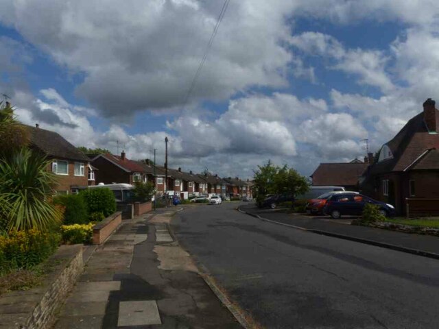
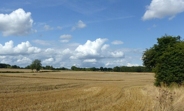
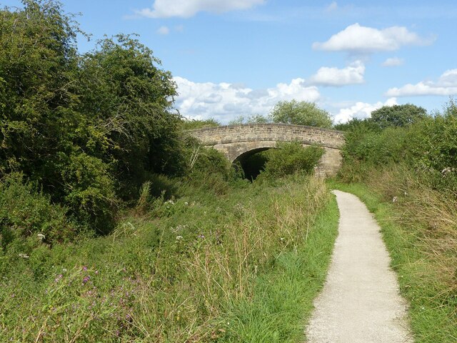
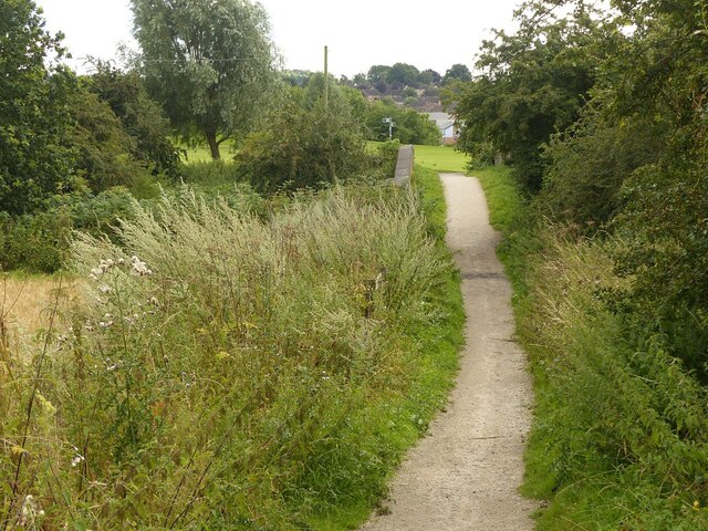
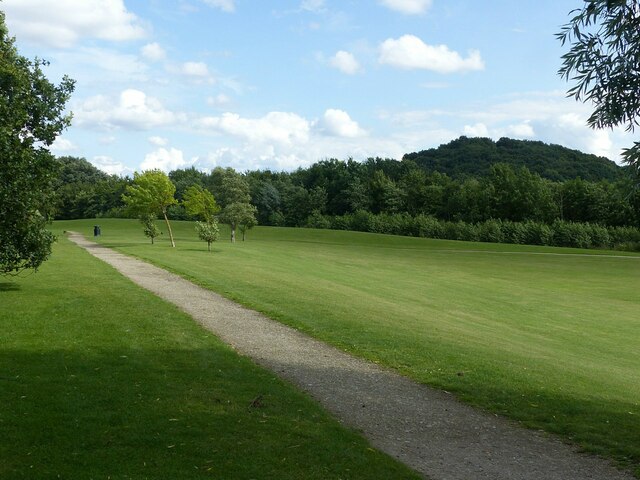
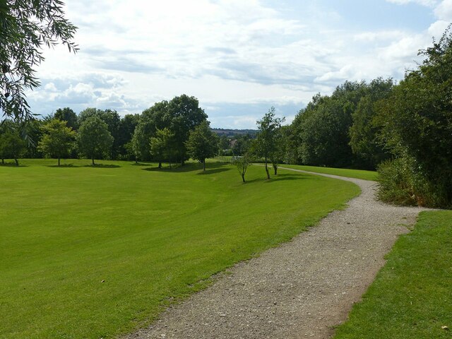
Bramcote Hill is covered with a mix of grassy fields, scattered trees, and shrubs, creating a picturesque landscape. The hill is a popular spot for locals and visitors alike, offering opportunities for leisurely walks, picnics, and outdoor activities. On a clear day, the view from the top of the hill extends as far as the Trent Valley and the city of Nottingham.

Due to its location, Bramcote Hill has historical significance, with evidence of human occupation dating back to the Bronze Age. Archaeological excavations have uncovered ancient artifacts, including flint tools and pottery fragments. The hill also played a role in the English Civil War, as it served as a vantage point for military strategists.

Overall, Bramcote Hill is a cherished natural landmark, appreciated for its scenic beauty, recreational opportunities, and historical importance.

If you have any feedback on the listing, please let us know in the comments section below.

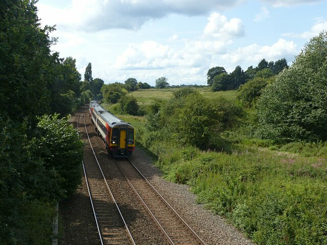
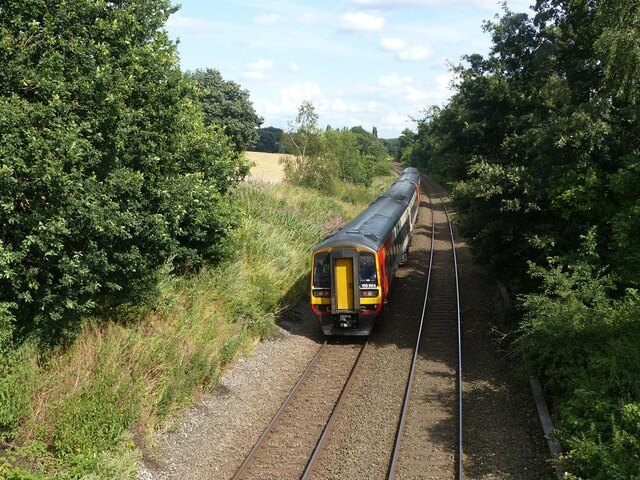
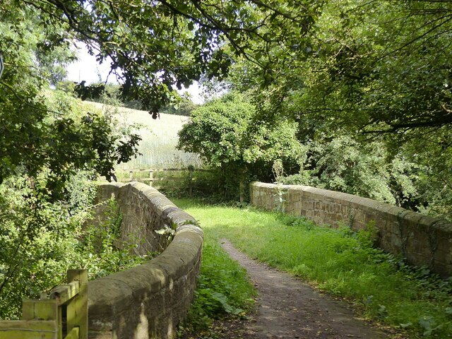
Bramcote Hill Images

Images are sourced within 2km of 52.942098/-1.2526548 or Grid Reference SK5038. Thanks to Geograph Open Source API. All images are credited.

Wroxham Drive near twitchell over Tottle Brook
Partly harvested field Near the former Swancar Farm.
Partly harvested field
Near the former Swancar Farm.
Swancar Bridge over the Nottingham Canal -1 An original bridge from the creation of the Nottingham Canal, c.1795, Listed Grade II. Originally providing field access, it is now bypassed by a track through the former canal bed alongside.
Swancar Bridge over the Nottingham Canal -1
An original bridge from the creation of the Nottingham Canal, c.1795, Listed Grade II. Originally providing field access, it is now bypassed by a track through the former canal bed alongside.
Swancar Bridge over the Nottingham Canal -2 An original bridge from the creation of the Nottingham Canal, c.1795, Listed Grade II. Originally providing field access, it is now bypassed by a track through the former canal bed alongside. The former canal towpath has been developed as part of the Erewash Valley Trail and also National Cycle Route 6.
Swancar Bridge over the Nottingham Canal -2
An original bridge from the creation of the Nottingham Canal, c.1795, Listed Grade II. Originally providing field access, it is now bypassed by a track through the former canal bed alongside. The former canal towpath has been developed as part of the Erewash Valley Trail and also National Cycle Route 6.
Swancar Bridge over the Nottingham Canal -3 An original bridge from the creation of the Nottingham Canal, c.1795, Listed Grade II. Originally providing field access, it is now bypassed by a track through the former canal bed alongside. The former canal towpath has been developed as part of the Erewash Valley Trail and also National Cycle Route 6.
Swancar Bridge over the Nottingham Canal -3
An original bridge from the creation of the Nottingham Canal, c.1795, Listed Grade II. Originally providing field access, it is now bypassed by a track through the former canal bed alongside. The former canal towpath has been developed as part of the Erewash Valley Trail and also National Cycle Route 6.
Footpath over the railway near Trowell Originally an agricultural accommodation bridge. The path is now part of the Robin Hood Way and Erewash Valley Trail long distance footpaths.
Footpath over the railway near Trowell
Originally an agricultural accommodation bridge. The path is now part of the Robin Hood Way and Erewash Valley Trail long distance footpaths.
Pit Lane Recreation Area Redevelopment of the former Trowell Moor Colliery area as open space.
Pit Lane Recreation Area
Redevelopment of the former Trowell Moor Colliery area as open space.
Pit Lane Recreation Area Redevelopment of the former Trowell Moor Colliery area as open space. The path forms part of the Robin Hood Way long distance path.
Pit Lane Recreation Area
Redevelopment of the former Trowell Moor Colliery area as open space. The path forms part of the Robin Hood Way long distance path.
Train to Nottingham and Norwich Looking west from the footbridge near Pit Lane. The train consists of two Class 158 units, 158 806 and 158 864. Now operated by East Midland Railway, the units are still in the old Stagecoach Group livery of East Midlands Trains.
Train to Nottingham and Norwich
Looking west from the footbridge near Pit Lane. The train consists of two Class 158 units, 158 806 and 158 864. Now operated by East Midland Railway, the units are still in the old Stagecoach Group livery of East Midlands Trains.
Train to Nottingham and Norwich Looking east from the footbridge near Pit Lane. The train consists of two Class 158 units, 158 806 and 158 864. Now operated by East Midland Railway, the units are still in the old Stagecoach Group livery of East Midlands Trains.
Train to Nottingham and Norwich
Looking east from the footbridge near Pit Lane. The train consists of two Class 158 units, 158 806 and 158 864. Now operated by East Midland Railway, the units are still in the old Stagecoach Group livery of East Midlands Trains.
Trowell Garden Centre The commercial entrance, as seen when passing on the Robin Hood Way.
Trowell Garden Centre
The commercial entrance, as seen when passing on the Robin Hood Way.
On the Robin Hood Way passing Trowell Garden Centre The Robin Hood Way follows the former Nottingham Canal towpath, but makes a diversion round the garden centre which has taken over the former canal bed at this point. This is also part of National Cycle Route 6, cycling being permitted over what is a public footpath but not a bridleway. The M1 ensures that this is not a quiet location!
On the Robin Hood Way passing Trowell Garden Centre
The Robin Hood Way follows the former Nottingham Canal towpath, but makes a diversion round the garden centre which has taken over the former canal bed at this point. This is also part of National Cycle Route 6, cycling being permitted over what is a public footpath but not a bridleway. The M1 ensures that this is not a quiet location!
Swansea Bridge, Nottingham Canal An original bridge from the creation of the Nottingham Canal, c.1795, Listed Grade II. It now carries the Robin Hood Way long distance footpath.
Swansea Bridge, Nottingham Canal
An original bridge from the creation of the Nottingham Canal, c.1795, Listed Grade II. It now carries the Robin Hood Way long distance footpath.
Garden Centre, Trowell Recreating this 'First' for the square <a title="https://www.geograph.org.uk/photo/17066" href="https://www.geograph.org.uk/photo/17066">Link</a> . The canal bed and garden centre have become largely obscured by the significant tree growth in the intervening years.
Garden Centre, Trowell
Recreating this 'First' for the square Link . The canal bed and garden centre have become largely obscured by the significant tree growth in the intervening years.
Stop gate, Nottingham Canal at Swansea Bridge These gates could be used to stop the flow of water along the canal in the event of a breach. A bridge hole where the passage narrowed was always a favoured place. Stop gates were always prudent on long stretches without any proper locks.

More overgrown than when I visited in 2007 <a title="https://www.geograph.org.uk/photo/622412" href="https://www.geograph.org.uk/photo/622412">Link</a> . The access to the nearside towpath is now formally not available.
Stop gate, Nottingham Canal at Swansea Bridge
These gates could be used to stop the flow of water along the canal in the event of a breach. A bridge hole where the passage narrowed was always a favoured place. Stop gates were always prudent on long stretches without any proper locks. More overgrown than when I visited in 2007 Link . The access to the nearside towpath is now formally not available.
Swansea Bridge, Nottingham Canal An original bridge from the building of the canal, c.1795, Listed Grade II. The bridge has been provided with stop-board slots. These could be inserted if it was necessary to drain a particular section of the canal for maintenance purposes. Note also how the bridge has been reinforced with railway rails.

The boarding on the right prevents unwanted access into the garden centre which has taken over the canal bed.
Swansea Bridge, Nottingham Canal
An original bridge from the building of the canal, c.1795, Listed Grade II. The bridge has been provided with stop-board slots. These could be inserted if it was necessary to drain a particular section of the canal for maintenance purposes. Note also how the bridge has been reinforced with railway rails. The boarding on the right prevents unwanted access into the garden centre which has taken over the canal bed.
Small Tortoiseshell (Aglais urticae) on umbellifer The vivid colours suggest this year's brood rather than last year's.
Small Tortoiseshell (Aglais urticae) on umbellifer
The vivid colours suggest this year's brood rather than last year's.
Tunnel under the M1 near Trowell Farm track incorporating a public footpath. As it also provides shelter for cattle grazing in the adjacent fields, the conditions underfoot require careful negotiation!
Tunnel under the M1 near Trowell
Farm track incorporating a public footpath. As it also provides shelter for cattle grazing in the adjacent fields, the conditions underfoot require careful negotiation!
Show me another place!

Bramcote Hill is located at Grid Ref: SK5038 (Lat: 52.942098, Lng: -1.2526548)

Administrative County: Nottinghamshire

District: Broxtowe

Police Authority: Nottinghamshire

What 3 Words

///shells.edges.splash. Near Kimberley, Nottinghamshire

Nearby Locations

Crow Hill Bramcote Hill

Related Wikis

Bramcote College

Bramcote College is a co-educational secondary school located in Bramcote, Nottinghamshire, England. It is a member of The White Hills Park Federation...

The White Hills Park Federation Trust

The White Hills Park Trust, is a collective group of academies in Nottinghamshire, England. The name is derived from the three schools originally within...

Alderman White School

Alderman White School is a mixed, 11-18 secondary school in Bramcote, Nottinghamshire. The school is a member of The White Hills Park Federation Trust...

Bramcote Hills Sport and Community College

Bramcote Hills Sports and Community College was a mixed state school in Nottinghamshire. It taught children from 11 to 18 (Years 7-13). It is located in...
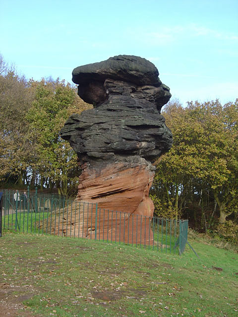
Hemlock Stone

The Hemlock Stone or Himlack Stone is an inselberg on Stapleford Hill at Stapleford, Nottinghamshire, England. == Geology == The Hemlock Stone is an outcrop...

Bramcote Hills

Bramcote Hills forms the northern area of the village and Nottingham suburb of Bramcote, Nottinghamshire, built in the 1950s. It is separated from the...

Church of St Michael and All Angels, Bramcote

The Church of St Michael and All Angels, Bramcote is an Anglican parish church in Bramcote, Broxtowe, Nottinghamshire, England. == History and description... ==

Bramcote

Bramcote (, locally ) is a suburban village and former civil parish in the Broxtowe district of Nottinghamshire, England, between Stapleford and Beeston...

Nearby Amenities

Located within 500m of 52.942098,-1.2526548
Turning Circle
Source: Yahoo
Lat/Long: 52.943225/-1.2458473
Barrier: stile
Material: wood
Stile: stepover
Lat/Long: 52.9430213/-1.255503
Longden Close
Naptan AtcoCode: 3300BR0050
Naptan Bearing: SW
Naptan CommonName: Longden Close
Naptan Crossing: Longden Close
Naptan Indicator: opp
Naptan NaptanCode: ntsawjwg
Naptan Notes: none
Naptan Street: Coventry Lane
Naptan Verified: no
Physically Present: no
Source: naptan_import
Lat/Long: 52.9413194/-1.2585016
Longden Close
Naptan AtcoCode: 3300BR0051
Naptan Bearing: NE
Naptan CommonName: Longden Close
Naptan Crossing: Longden Close
Naptan Indicator: adj
Naptan NaptanCode: ntsdadpt
Naptan Notes: none
Naptan Street: Coventry Lane
Naptan Verified: no
Physically Present: no
Source: naptan_import
Lat/Long: 52.9416521/-1.2582929
Crossing
Bicycle: yes
Button Operated: yes
Crossing: traffic_signals
Crossing Island: no
Crossing Ref: toucan
Tactile Paving: yes
Traffic Signals Sound: yes
Traffic Signals Vibration: no
Lat/Long: 52.9405889/-1.2584329
Crossing
Crossing: unmarked
Crossing Island: no
Crossing Markings: no
Kerb: lowered
Tactile Paving: no
Lat/Long: 52.9389683/-1.2558418
Crossing
Bicycle: yes
Button Operated: yes
Crossing: traffic_signals
Crossing Island: no
Crossing Ref: toucan
Tactile Paving: yes
Traffic Signals Sound: yes
Traffic Signals Vibration: no
Lat/Long: 52.9377936/-1.2537982
Crossing
Button Operated: yes
Crossing: traffic_signals
Crossing Island: no
Crossing Ref: toucan
Lat/Long: 52.9414699/-1.2583515
Barrier: entrance
Lat/Long: 52.9437054/-1.2494724
Note: Dead end
Lat/Long: 52.9449819/-1.257699
Note: Dead end
Lat/Long: 52.9444919/-1.2575926
Barrier: entrance
Source: survey
Lat/Long: 52.9421282/-1.2572356
Barrier: entrance
Source: survey
Lat/Long: 52.9428808/-1.2564415
Entrance: home
Lat/Long: 52.9383357/-1.2558552
The Refugee
Artist Name: Naomi Blake
Artwork Type: sculpture
Historic: memorial
Source: survey
Tourism: artwork
Lat/Long: 52.9426004/-1.2570269
Historic: ice_house
Lat/Long: 52.9422101/-1.2565287
Bench
Backrest: yes
Lat/Long: 52.9425158/-1.2566774
Bench
Backrest: yes
Lat/Long: 52.942593/-1.2568861
Bench
Backrest: yes
Lat/Long: 52.9424448/-1.2567611
Bench
Backrest: yes
Lat/Long: 52.9425226/-1.2569657
Power: substation
Lat/Long: 52.941957/-1.2463326
Mini Roundabout
Direction: clockwise
Lat/Long: 52.9408403/-1.2590094
Mini Roundabout
Direction: clockwise
Lat/Long: 52.9410573/-1.2599021
Entrance: home
Lat/Long: 52.9382193/-1.2560679
Entrance: home
Lat/Long: 52.9382762/-1.2563268
Entrance: home
Lat/Long: 52.9384795/-1.2563742
Entrance: home
Lat/Long: 52.9384989/-1.2557671
Note: Tree gone - stump only
Lat/Long: 52.9387529/-1.2570058
Note: Tree gone - stump only
Lat/Long: 52.9391173/-1.2573014
Access: private
Capacity: 40
Covered: yes
Disused Amenity: bicycle_parking
Lat/Long: 52.9390359/-1.2519289
Entrance: main
Lat/Long: 52.9390606/-1.2514654
Entrance: yes
Lat/Long: 52.9394382/-1.2516552
Bramcote Hills Park: Site of 'The Hills'
Board Type: history
Check Date: 2023-06-03
Information: board
Source: survey
Tourism: information
Lat/Long: 52.9414034/-1.2545767
Bramcote Hills Park: The Ice House
Information: board
Source: survey
Tourism: information
Lat/Long: 52.9422496/-1.2565111
Barrier: cycle_barrier
Cycle Barrier: double
Cycle Barrier Installation: fixed
Lat/Long: 52.9395703/-1.2526982
Bench
Lat/Long: 52.9423337/-1.2563559
Bus Stop
Bramcote Crematorium
Bus: yes
Public Transport: platform
Shelter: no
Source: survey
Lat/Long: 52.9448896/-1.2546402
Bicycle Parking
Bicycle Parking: stands
Capacity: 10
Covered: no
Lat/Long: 52.9411899/-1.2576196
Note: Currently stops at fence, will presumably join up when construction is complete
Lat/Long: 52.9435363/-1.2531938
Note: Currently a dead end - presumably will join with road eventually
Lat/Long: 52.9456855/-1.2531737
Hemlock Stone Mountainbiking Trails
Operator: Broxtowe Borough Council
Sport: mtb
Lat/Long: 52.9437344/-1.2589807
Hemlock Stone Bramcote
Brand: National Grid
Brand Wikidata: Q1465461
Man Made: street_cabinet
Operator: National Grid Electricity Distribution
Operator Old: Western Power Distribution
Operator Wikidata: Q7988183
Owner: National Grid Electricity Distribution (East Midlands) Plc
Owner Wikidata: Q114348127
Power: substation
Ref: 52D7822/880524
Lat/Long: 52.9408371/-1.2584545
Bench
Backrest: yes
Lat/Long: 52.9411409/-1.2546395
Covered: no
Leisure: picnic_table
Lat/Long: 52.94133/-1.2546797
Covered: no
Leisure: picnic_table
Lat/Long: 52.9412928/-1.2545054
Waste Basket
Lat/Long: 52.9413357/-1.254555
Addr City: Nottingham
Addr Housenumber: 8
Addr Postcode: NG9 3JX
Addr Street: Westbourne Court
Addr Suburb: Bramcote
Entrance: home
Level: 1
Note: Directly above ground floor doorway
Source Addr Housenumber: interpolation
Source Addr Postcode: OS Open Data Codepoint
Lat/Long: 52.9389374/-1.2575298
Addr City: Nottingham
Addr Housenumber: 6
Addr Postcode: NG9 3JX
Addr Street: Westbourne Court
Addr Suburb: Bramcote
Entrance: home
Level: 1
Note: Directly above ground floor doorway
Source Addr Housenumber: interpolation
Source Addr Postcode: OS Open Data Codepoint
Lat/Long: 52.9389589/-1.2574916
Addr City: Nottingham
Addr Housenumber: 5
Addr Postcode: NG9 3JX
Addr Street: Westbourne Court
Addr Suburb: Bramcote
Entrance: home
Source Addr Housenumber: interpolation
Source Addr Postcode: OS Open Data Codepoint
Lat/Long: 52.9389649/-1.2574809
Addr City: Nottingham
Addr Housenumber: 7
Addr Postcode: NG9 3JX
Addr Street: Westbourne Court
Addr Suburb: Bramcote
Entrance: home
Source Addr Housenumber: interpolation
Source Addr Postcode: OS Open Data Codepoint
Lat/Long: 52.9389318/-1.2575399
Addr City: Nottingham
Addr Housenumber: 10
Addr Postcode: NG9 3JX
Addr Street: Westbourne Court
Addr Suburb: Bramcote
Entrance: home
Level: 1
Note: Directly above ground floor doorway
Source Addr Housenumber: interpolation
Source Addr Postcode: OS Open Data Codepoint
Lat/Long: 52.9388934/-1.2576377
Addr City: Nottingham
Addr Housenumber: 12
Addr Postcode: NG9 3JX
Addr Street: Westbourne Court
Addr Suburb: Bramcote
Entrance: home
Level: 1
Note: Directly above ground floor doorway
Source Addr Housenumber: interpolation
Source Addr Postcode: OS Open Data Codepoint
Lat/Long: 52.938875/-1.2576704
Addr City: Nottingham
Addr Housenumber: 9
Addr Postcode: NG9 3JX
Addr Street: Westbourne Court
Addr Suburb: Bramcote
Entrance: home
Source Addr Housenumber: interpolation
Source Addr Postcode: OS Open Data Codepoint
Lat/Long: 52.9389002/-1.2576256
Addr City: Nottingham
Addr Housenumber: 11
Addr Postcode: NG9 3JX
Addr Street: Westbourne Court
Addr Suburb: Bramcote
Entrance: home
Source Addr Housenumber: survey
Source Addr Postcode: OS Open Data Codepoint
Lat/Long: 52.9388688/-1.2576814
Addr City: Nottingham
Addr Housenumber: 13
Addr Postcode: NG9 3JX
Addr Street: Westbourne Court
Addr Suburb: Bramcote
Entrance: home
Source Addr Housenumber: interpolation
Source Addr Postcode: OS Open Data Codepoint
Lat/Long: 52.9388095/-1.2577473
Entrance: main
Lat/Long: 52.9386927/-1.2574312
Waste Basket
Lat/Long: 52.9378239/-1.2535787
Bench
Backrest: yes
Lat/Long: 52.9380947/-1.2530798
Waste Basket
Lat/Long: 52.9380793/-1.2531106
Bench
Backrest: yes
Lat/Long: 52.9383121/-1.2526976
Waste Basket
Source: survey
Lat/Long: 52.938696/-1.2545255
Description: Parallel Bars
Leisure: fitness_station
Note: Part of 'Bramcote Hills Park Trim Trail'
Sport: fitness
Lat/Long: 52.9393822/-1.2555179
Waste Basket
Lat/Long: 52.9396037/-1.2559631
Bench
Backrest: yes
Lat/Long: 52.9396271/-1.2559886
Barrier: cycle_barrier
Cycle Barrier: double
Cycle Barrier Installation: fixed
Lat/Long: 52.9396557/-1.2564405
Throw Bag
Emergency: throw_bag
Lat/Long: 52.9392048/-1.2570615
Bench
Backrest: yes
Lat/Long: 52.9393176/-1.2568
Waste Basket
Lat/Long: 52.9393758/-1.2567899
Bench
Backrest: yes
Lat/Long: 52.9390314/-1.2564661
Waste Basket
Lat/Long: 52.9390533/-1.255998
Entrance: home
Lat/Long: 52.9382371/-1.2560358
Entrance: home
Lat/Long: 52.9382049/-1.2560951
Entrance: home
Lat/Long: 52.9382943/-1.2563542
Entrance: home
Lat/Long: 52.9382639/-1.2563092
Entrance: home
Lat/Long: 52.938492/-1.2563925
Entrance: home
Lat/Long: 52.9384694/-1.2563593
Entrance: home
Lat/Long: 52.9384892/-1.2557525
Entrance: home
Lat/Long: 52.9385075/-1.2557798
Entrance: home
Lat/Long: 52.9383474/-1.2558336
Entrance: home
Lat/Long: 52.9383247/-1.2558755
Entrance: home
Lat/Long: 52.938056/-1.2557245
Entrance: home
Lat/Long: 52.9380746/-1.2556068
Entrance: home
Lat/Long: 52.9381614/-1.2555306
Entrance: home
Lat/Long: 52.9381792/-1.2554215
Entrance: home
Lat/Long: 52.9382678/-1.2553455
Entrance: home
Lat/Long: 52.9382866/-1.255233
Waste Basket
Lat/Long: 52.9378082/-1.2539206
Waste Basket
Lat/Long: 52.9449376/-1.2546267
Waste Basket
Lat/Long: 52.9427932/-1.2571493
Waste Basket
Lat/Long: 52.9421031/-1.2578541
Description: Step Up
Leisure: fitness_station
Note: Part of 'Bramcote Hills Park Trim Trail'
Sport: fitness
Lat/Long: 52.9396805/-1.253053
Description: Horizontal Bar
Disused Leisure: fitness_station
Note: Part of 'Bramcote Hills Park Trim Trail'
Note 2: Marked as disused because it is broken and not usable
Lat/Long: 52.9410011/-1.2543082
Description: Logs Hops
Disused Leisure: fitness_station
Note: Part of 'Bramcote Hills Park Trim Trail'
Note 2: Marked as disused because it is broken and not usable
Lat/Long: 52.9410512/-1.2545469
Description: Stride Jumps
Leisure: fitness_station
Note: Part of 'Bramcote Hills Park Trim Trail'
Sport: fitness
Lat/Long: 52.9412144/-1.255365
Description: Balance Beam
Leisure: fitness_station
Note: Part of 'Bramcote Hills Park Trim Trail'
Note 2: Partly overgrown with vegetation, almost disused
Sport: fitness
Lat/Long: 52.9413147/-1.256116
Bramcote Hills Park Trim Trail
Information: board
Tourism: information
Lat/Long: 52.9414036/-1.2573887
Description: Chinning Bars
Leisure: fitness_station
Note: Part of 'Bramcote Hills Park Trim Trail'
Sport: fitness
Lat/Long: 52.9413939/-1.2573351
Advertising: board
Lat/Long: 52.9412827/-1.2576315
Waste Basket
Lat/Long: 52.9413244/-1.2575792
Waste Basket
Lat/Long: 52.9412714/-1.2576382
Waste Basket
Lat/Long: 52.9412051/-1.2576563
Waste Basket
Lat/Long: 52.9415474/-1.2573673
Waste Basket
Lat/Long: 52.9417996/-1.25761
Waste Basket
Lat/Long: 52.9417685/-1.2575282
Bramcote Hills Park
Information: board
Tourism: information
Lat/Long: 52.9418412/-1.2574692
Description: Broxtowe Circular Walk Number 6 starting point
Information: guidepost
Source: survey
Tourism: information
Lat/Long: 52.9412532/-1.2583007
Bramcote Hills Park
Information: board
Tourism: information
Lat/Long: 52.9413361/-1.2582638
Waste Basket
Lat/Long: 52.9413033/-1.2582772
Waste Basket
Waste: dog_excrement;trash
Lat/Long: 52.9430474/-1.2463836
Grit Bin
Lat/Long: 52.9412144/-1.245807
Waste Basket
Lat/Long: 52.9413381/-1.2458593
Waste Basket
Lat/Long: 52.9423742/-1.2462965
Covered: no
Leisure: picnic_table
Lat/Long: 52.9406422/-1.2570146
Covered: no
Leisure: picnic_table
Lat/Long: 52.9406891/-1.2570991
Waste Basket
Fixme: Position approximate
Lat/Long: 52.9410407/-1.2574001
Waste Basket
Fixme: Position approximate
Lat/Long: 52.9409991/-1.2573572
Waste Basket
Lat/Long: 52.9411732/-1.2575658
Waste Basket
Lat/Long: 52.9409793/-1.2577777
Covered: no
Leisure: picnic_table
Lat/Long: 52.941014/-1.2575108
Covered: no
Leisure: picnic_table
Lat/Long: 52.940989/-1.2573954
Waste Basket
Lat/Long: 52.9409433/-1.2573284
Waste Basket
Source: survey
Lat/Long: 52.940584/-1.2571259
Bench
Backrest: yes
Lat/Long: 52.940289/-1.257093
Description: Bench Sit Ups
Leisure: fitness_station
Note: Part of a 'fitness trail'
Sport: fitness
Lat/Long: 52.9400878/-1.2566002
Description: Inclined Press Ups
Leisure: fitness_station
Note: Part of 'Bramcote Hills Park Trim Trail'
Sport: fitness
Lat/Long: 52.9398801/-1.2563387
Waste Basket
Lat/Long: 52.939969/-1.2566069
Bench
Backrest: no
Lat/Long: 52.9399819/-1.2566324
Waste Basket
Source: survey
Lat/Long: 52.9403416/-1.2576228
Erewash Valley Trail - Bramcote Hills Park and the Hemlockstone
Board Type: nature
Information: board
Tourism: information
Lat/Long: 52.940384/-1.257661
Covered: no
Leisure: picnic_table
Lat/Long: 52.9403028/-1.2546408
Description: Gate
Leisure: fitness_station
Note: Part of 'Bramcote Hills Park Trim Trail'
Sport: fitness
Lat/Long: 52.9405582/-1.2533855
Waste Basket
Source: survey
Lat/Long: 52.9411296/-1.2535022
Bench
Backrest: no
Source: survey
Lat/Long: 52.9405162/-1.2530335
Waste Basket
Source: survey
Lat/Long: 52.9402802/-1.2530758
Waste Basket
Source: survey
Lat/Long: 52.9395859/-1.2527324
Covered: no
Leisure: picnic_table
Source: survey
Lat/Long: 52.9394736/-1.2529939
Bench
Backrest: no
Source: survey
Lat/Long: 52.9392238/-1.2529175
Waste Basket
Lat/Long: 52.9386726/-1.2518674
Barrier: cycle_barrier
Cycle Barrier: single
Cycle Barrier Installation: fixed
Lat/Long: 52.9386851/-1.2518756
Direction: ESE
Generator Method: photovoltaic
Generator Output Electricity: yes
Generator Solar Modules: 8
Generator Source: solar
Generator Type: solar_photovoltaic_panel
Location: roof
Power: generator
Lat/Long: 52.9433101/-1.2461623
Direction: ESE
Generator Method: photovoltaic
Generator Output Electricity: yes
Generator Solar Modules: 8
Generator Source: solar
Generator Type: solar_photovoltaic_panel
Location: roof
Power: generator
Lat/Long: 52.9432697/-1.2462092
Generator Method: photovoltaic
Generator Output Electricity: yes
Generator Source: solar
Generator Type: solar_photovoltaic_panel
Location: roof
Power: generator
Lat/Long: 52.943049/-1.2460912
Generator Method: photovoltaic
Generator Output Electricity: yes
Generator Source: solar
Generator Type: solar_photovoltaic_panel
Location: roof
Power: generator
Lat/Long: 52.9430434/-1.2460362
Direction: 255
Generator Method: photovoltaic
Generator Output Electricity: yes
Generator Solar Modules: 8
Generator Source: solar
Generator Type: solar_photovoltaic_panel
Location: roof
Power: generator
Lat/Long: 52.942573/-1.245992
Direction: 75
Generator Method: photovoltaic
Generator Output Electricity: yes
Generator Solar Modules: 8
Generator Source: solar
Generator Type: solar_photovoltaic_panel
Location: roof
Power: generator
Lat/Long: 52.9425815/-1.2459417
The Hemlock Stone
Information: board
Tourism: information
Lat/Long: 52.9429811/-1.2581854
Waste Basket
Lat/Long: 52.9431444/-1.2580633
Bench
Backrest: yes
Material: stone
Lat/Long: 52.9431331/-1.2580942
Bench
Backrest: yes
Lat/Long: 52.9431524/-1.2572479
Bench
Backrest: yes
Lat/Long: 52.9430951/-1.257492
Fixme: Continues?
Lat/Long: 52.9430086/-1.2512518
Waste Basket
Lat/Long: 52.9463442/-1.2531542
Grit Bin
Lat/Long: 52.9452698/-1.2544021
Fixme: Position approximate
Natural: wetland
Wetland: marsh
Lat/Long: 52.9445619/-1.2572613
Note: Mountain bike jump
Lat/Long: 52.9442296/-1.2580063
Note: Dead end
Lat/Long: 52.9452164/-1.2575725
Toilets
Lat/Long: 52.9458061/-1.2557464
Entrance: yes
Wheelchair: yes
Lat/Long: 52.9457809/-1.2559214
Entrance: yes
Level: 0
Wheelchair: yes
Lat/Long: 52.9457962/-1.2555468
Bramcote Crematorium
Addr City: Nottingham
Addr Postcode: NG9 3GJ
Addr Street: Coventry Lane
Addr Suburb: Bramcote
Contact Facebook: https://www.facebook.com/bramcotebereavement/
Entrance: yes
Level: 0
Website: https://www.bramcotebereavement.org/
Wheelchair: yes
Lat/Long: 52.9457259/-1.2557215
Room: waiting_room
Lat/Long: 52.9458315/-1.255534
The data included in this document is from www.openstreetmap.org. The data is made available under ODbL.

Have you been to Bramcote Hill?

Leave your review of Bramcote Hill below (or comments, questions and feedback).