Crowd Hill

Hill, Mountain in Hampshire Eastleigh

England

Crowd Hill

Trees in field on Hall Lands Farm TEST TEXT PLEASE DO NOT AMEND. WILL BE REPLACED BY PROPER DESCRIPTION LATER.
lambda as numeric code λ and lambda as character ref λ also; lambda is not in windows-1252. dagger as numeric code † and dagger as character ref † also; dagger is in windows-1252 but not in iso-8859-1.
Trees in field on Hall Lands Farm Credit: Peter Facey

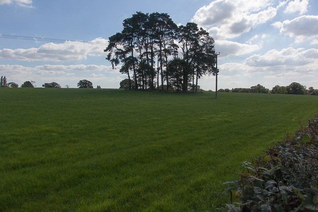
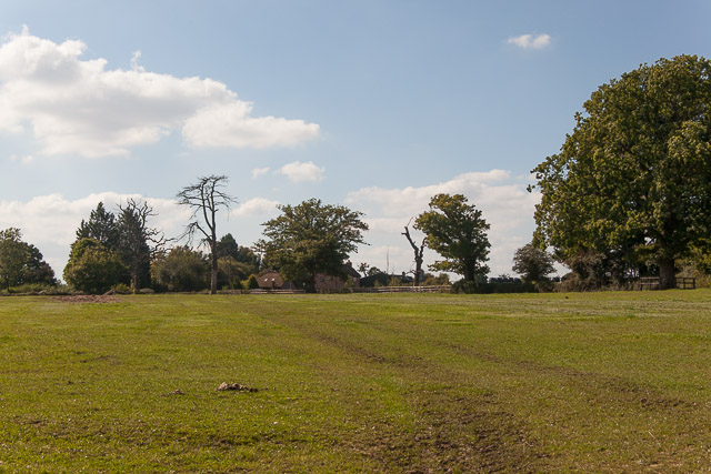
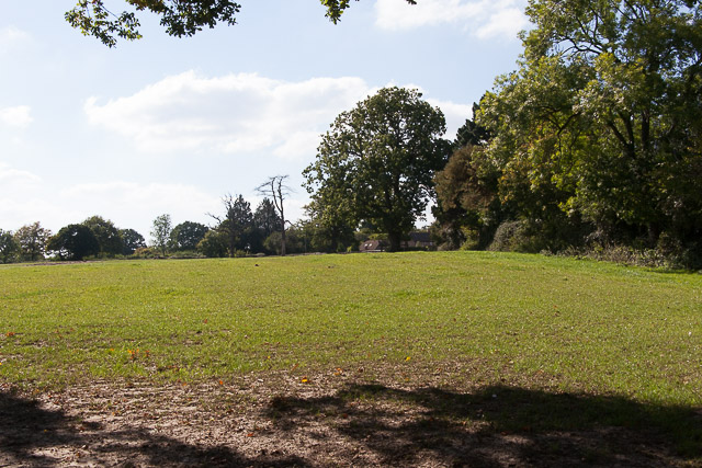
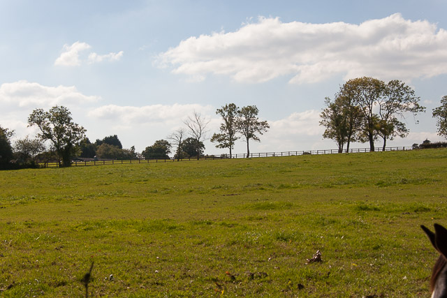
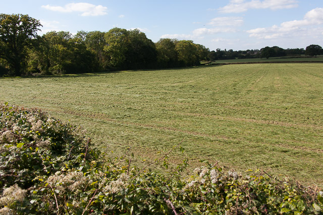
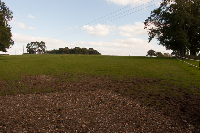
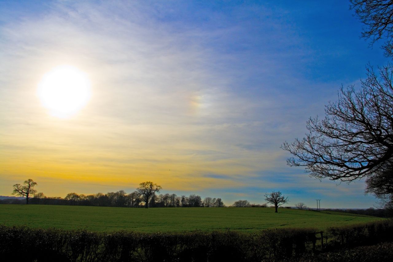
Crowd Hill is a charming hill located in Hampshire, England. Situated in the South East of the country, it forms part of the picturesque landscape of the Hampshire Downs. With an elevation of approximately 120 meters above sea level, Crowd Hill offers breathtaking views of the surrounding countryside.

Covered in lush greenery, this hill is known for its natural beauty and peaceful atmosphere. It boasts a diverse range of flora and fauna, making it a haven for nature enthusiasts and wildlife lovers. The hill is home to various species of birds, butterflies, and small mammals, enhancing its appeal as a tranquil retreat.

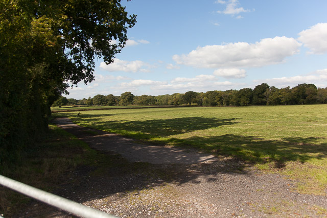
Crowd Hill is a popular destination for outdoor activities such as hiking, walking, and cycling. Its well-maintained trails and pathways provide easy access for visitors to explore the area and enjoy the stunning vistas. The hill's gentle slopes make it suitable for all levels of fitness, ensuring that everyone can appreciate its natural wonders.

Located in close proximity to the historic town of Basingstoke, Crowd Hill offers a convenient escape from the hustle and bustle of city life. Its peaceful ambiance and panoramic views make it an ideal spot for picnics, relaxation, or simply taking in the natural beauty of the Hampshire countryside.

Overall, Crowd Hill is a captivating destination that showcases the beauty of Hampshire's landscape. With its scenic views, abundant wildlife, and accessibility for outdoor activities, it is a must-visit location for both locals and tourists seeking a tranquil retreat in the heart of nature.

If you have any feedback on the listing, please let us know in the comments section below.
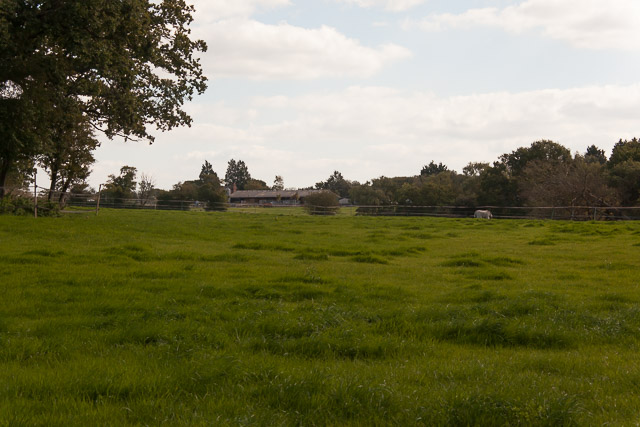
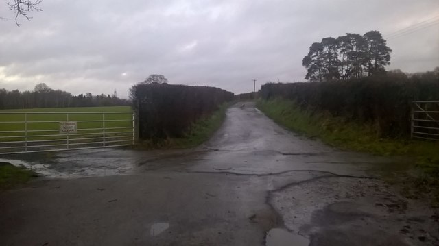
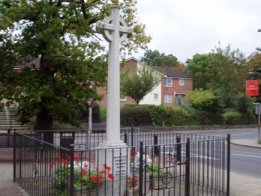
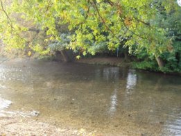
Crowd Hill Images

Images are sourced within 2km of 50.971085/-1.305068 or Grid Reference SU4819. Thanks to Geograph Open Source API. All images are credited.

Trees in field on Hall Lands Farm TEST TEXT PLEASE DO NOT AMEND. WILL BE REPLACED BY PROPER DESCRIPTION LATER.
lambda as numeric code λ and lambda as character ref λ also; lambda is not in windows-1252. dagger as numeric code † and dagger as character ref † also; dagger is in windows-1252 but not in iso-8859-1.
Trees in field on Hall Lands Farm
TEST TEXT PLEASE DO NOT AMEND. WILL BE REPLACED BY PROPER DESCRIPTION LATER. lambda as numeric code λ and lambda as character ref λ also; lambda is not in windows-1252. dagger as numeric code † and dagger as character ref † also; dagger is in windows-1252 but not in iso-8859-1.
Looking towards Pembers Hill Farm Seen from footpath. The Little Dower House is off-picture to the right of the big tree.
Looking towards Pembers Hill Farm
Seen from footpath. The Little Dower House is off-picture to the right of the big tree.
Looking towards The Little Dower House From footpath.
Looking towards The Little Dower House
From footpath.
Field south of Tippers Copse With barn of Pembers Hill Farm in distance. Seen from footpath.
Field south of Tippers Copse
With barn of Pembers Hill Farm in distance. Seen from footpath.
Field and Hall Lands Copse Seen from footpath over Hall Lands Lane.
Field and Hall Lands Copse
Seen from footpath over Hall Lands Lane.
Field north of Hall Lands Copse Seen from footpath over Hall Lands Lane
Field north of Hall Lands Copse
Seen from footpath over Hall Lands Lane
Hall Lands Lane As it passes Hall Lands House on the right.
Hall Lands Lane
As it passes Hall Lands House on the right.
Field east of Hall Lands House With Tippers Copse visible on the horizon.
Field east of Hall Lands House
With Tippers Copse visible on the horizon.
Field east of Hall Lands House With barn of Pembers Hill Farm in distance.
Field east of Hall Lands House
With barn of Pembers Hill Farm in distance.
Hall Lands Lane Looking NE
Hall Lands Lane
Looking NE
B3037 Mortimers Lane Heading into Fairoak.
B3037 Mortimers Lane
Heading into Fairoak.
Bridleway near Park Hills Wood
Path in Knowle Hill Conservation Site
Path on the edge of Park Hills Wood Well, just about a path if you can take big enough steps through the long grass!
Path on the edge of Park Hills Wood
Well, just about a path if you can take big enough steps through the long grass!
Hall Lands Lane
Hall Lands Lane
Newly built housing near the top of Knowle Lane Recent housing in an area currently seeing massive residential expansion.
Newly built housing near the top of Knowle Lane
Recent housing in an area currently seeing massive residential expansion.
View from the trig point View west from the trig point in Knowle Park.
View from the trig point
View west from the trig point in Knowle Park.
Show me another place!

Crowd Hill is located at Grid Ref: SU4819 (Lat: 50.971085, Lng: -1.305068)

Administrative County: Hampshire

District: Eastleigh

Police Authority: Hampshire

What 3 Words

///cling.flying.parade. Near Bishopstoke, Hampshire

Related Wikis

Fair Oak

Fair Oak is a large village to the east of the town of Eastleigh in Hampshire, England. Together with the village of Horton Heath, which lies to the south...

The King's School, Fair Oak

The King's School, on Allington Lane in Fair Oak, Hampshire, is an independent Christian faith school with 229 pupils As of 2023. The school was founded...

Wyvern College, Eastleigh

Wyvern College is a [private education|coeducational]] secondary school with academy status for students in the villages of Fair Oak, Bishopstoke, Horton...

Fair Oak Lodge

Fair Oak Lodge is a former country house in the village of Fair Oak, Hampshire. Much of the original estate has been built upon with modern housing, but...

Bishopstoke

Bishopstoke is a village and civil parish in the Eastleigh district of Hampshire, England. It is recorded as "Stoke" as early as 948 AD when King Eadred...

St Mary's Church, Bishopstoke

The Church of St Mary's is an Anglican Church in Bishopstoke, Hampshire. St Mary's was designed by Edward Prioleau Warren and built during 1890/91 by Wheeler...

Horton Heath, Hampshire

Horton Heath is a semi-rural village which forms part of the civil parish of Fair Oak and Horton Heath in the borough of Eastleigh in Hampshire, England...

Borough of Eastleigh

The Borough of Eastleigh is a local government district with borough status in Hampshire, England. It is named after its main town of Eastleigh, where...

Nearby Amenities

Located within 500m of 50.971085,-1.305068
Communication Mobile Phone: yes
Man Made: tower
Operator: O2
Operator Wikidata: Q7072245
Tower Type: communication
Lat/Long: 50.9712281/-1.3091113
Traffic Calming: hump
Lat/Long: 50.968794/-1.3095098
Bus Stop
Victena Road
Bus: yes
Naptan AtcoCode: 1900HA030271
Naptan NaptanCode: hamdjdtg
Public Transport: platform
Lat/Long: 50.9680859/-1.3037453
Bus Stop
Victena Road
Bus: yes
Naptan AtcoCode: 1900HA030272
Naptan NaptanCode: hamdjdtd
Network: Bluestar
Operator: Go South Coast Limited
Public Transport: platform
Lat/Long: 50.9683278/-1.303802
Bus Stop
Winchester Road
Bus: yes
Naptan AtcoCode: 1900HA030273
Naptan NaptanCode: hamdjgdp
Network: Bluestar
Operator: Go South Coast Limited
Public Transport: platform
Lat/Long: 50.9718062/-1.3024094
Bus Stop
Winchester Road
Bus: yes
Public Transport: platform
Lat/Long: 50.9717525/-1.3022336
Bus Stop
Pyle Hill
Bus: yes
Naptan AtcoCode: 1900HA030275
Naptan Bearing: S
Naptan CommonName: Pyle Hill
Naptan Crossing: Sandy Lane
Naptan NaptanCode: hamdjgmj
Naptan Street: Winchester Road
Naptan Verified: no
Public Transport: platform
Source: naptan_import
Lat/Long: 50.972425/-1.3017183
Bus Stop
Pyle Hill
Bus: yes
Naptan AtcoCode: 1900HA030276
Naptan Bearing: N
Naptan CommonName: Pyle Hill
Naptan Crossing: Sandy Lane
Naptan NaptanCode: hamdjgmd
Naptan Street: Winchester Road
Naptan Verified: no
Public Transport: platform
Source: naptan_import
Lat/Long: 50.9727677/-1.301884
Bus Stop
Witt Road
Bench: yes
Bin: no
Bus: yes
Lit: no
Naptan AtcoCode: 1900HA030283
Naptan NaptanCode: hamdjmdw
Network: Bluestar
Operator: Go South Coast Limited
Public Transport: platform
Shelter: yes
Tactile Paving: no
Lat/Long: 50.9688964/-1.2989502
Post Box
Collection Plate: CP1
Collection Times: Mo-Fr 16:45; Sa 11:30
Ele: 79.000000
Operator: Royal Mail
Post Box Type: pillar
Ref: SO50 368
Royal Cypher: GR
Royal Cypher Wikidata: Q33102273
Lat/Long: 50.9677625/-1.3044146
Post Box
Collection Plate: CP1D
Collection Times: Mo-Fr 09:00; Sa 07:00
Ele: 102.000000
Operator: Royal Mail
Operator Wikidata: Q638098
Post Box Type: lamp
Ref: SO50 381D
Royal Cypher: EIIR
Royal Cypher Wikidata: Q33102113
Lat/Long: 50.9710097/-1.3038373
Addr City: Fair Oak, Eastleigh
Addr Housename: Outside shops
Addr Postcode: SO50 8GF
Addr Street: Sandy Lane
Note: There is a notice dated 20.09.2016 where BT is proposing to remove this payphone.
Operator: BT
Payment Coins: no
Phone: +44 2380 692401
Removed Amenity: telephone
Lat/Long: 50.9677549/-1.3043865
Parking
Lat/Long: 50.968276/-1.3047163
Witt Road
Bus: yes
Network: Bluestar
Operator: Go South Coast Limited
Public Transport: stop_position
Lat/Long: 50.9688776/-1.2990045
Winchester Road
Bus: yes
Network: Bluestar
Operator: Go South Coast Limited
Public Transport: stop_position
Lat/Long: 50.9717285/-1.3023864
Winchester Road
Bus: yes
Public Transport: stop_position
Lat/Long: 50.9718047/-1.3022906
Traffic Calming: choker
Lat/Long: 50.9699071/-1.3094122
Traffic Calming: choker
Lat/Long: 50.9703267/-1.3071133
Turning Circle
Source: Bing
Lat/Long: 50.9702995/-1.3045445
Turning Circle
Source: Bing
Lat/Long: 50.9688286/-1.3027608
Post Box
Collection Plate: CP7D
Collection Times: Mo-Fr 09:00; Sa 07:00
Operator: Royal Mail
Operator Wikidata: Q638098
Post Box Type: lamp
Ref: SO50 657D
Royal Cypher: EIIR
Royal Cypher Wikidata: Q33102113
Lat/Long: 50.9690204/-1.2994822
Sandy News
Shop: convenience
Lat/Long: 50.9679694/-1.3042712
The Co-operative Food
Brand: The Co-operative Food
Brand Wikidata: Q107617274
Check Date Opening Hours: 2023-09-08
Opening Hours: Mo-Su 07:00-22:00
Operator: The Southern Co-operative
Operator Wikidata: Q7569773
Shop: convenience
Website: https://stores.southern.coop/hampshire/eastleigh/50-sandy-lane.html
Lat/Long: 50.9678444/-1.3043677
Fast Food
Sonny's Traditional Fish & Chips
Cuisine: fish_and_chips
Lat/Long: 50.9679086/-1.3043181
Fast Food
Ruby Takeaway
Lat/Long: 50.9679922/-1.3048384
M. Johnson Funeral Directors
Shop: funeral_directors
Lat/Long: 50.9680387/-1.304223
Crossing
Lat/Long: 50.9745209/-1.3053991
Natural: wetland
Lat/Long: 50.9722349/-1.3098345
Crowdill Commerative development structure
Leisure: park
Lat/Long: 50.9714792/-1.3086486
Artwork Type: sculpture
Description: Deer
Tourism: artwork
Lat/Long: 50.9724143/-1.3103625
Artwork Type: sculpture
Tourism: artwork
Lat/Long: 50.9723434/-1.3108614
Artwork Type: sculpture
Tourism: artwork
Lat/Long: 50.9723261/-1.3108328
Traffic Calming: choker
Lat/Long: 50.9690307/-1.3095661
Traffic Calming: hump
Lat/Long: 50.9681246/-1.3095087
Ford: stepping_stones
Surface: wood
Lat/Long: 50.9705608/-1.3119067
Victena Road
Bus: yes
Public Transport: stop_position
Lat/Long: 50.9681176/-1.3038248
Victena Road
Bus: yes
Network: Bluestar
Operator: Go South Coast Limited
Public Transport: stop_position
Lat/Long: 50.9682882/-1.303716
The data included in this document is from www.openstreetmap.org. The data is made available under ODbL.

Have you been to Crowd Hill?

Leave your review of Crowd Hill below (or comments, questions and feedback).