Rooper Hill

Hill, Mountain in Yorkshire Hambleton

England

Rooper Hill

Little Sessay, farm buildings According to the OS benchmark database there is a benchmark cut into the gable end of the first barn. There is a deep pile of spoil against the wall and very healthy climbing ivy. No search was made and it is unknown if the cutmark survives.
Little Sessay, farm buildings Credit: Mel Towler

Rooper Hill, located in Yorkshire, England, is a prominent hill with an elevation of approximately 298 meters (978 feet). It lies within the Nidderdale Area of Outstanding Natural Beauty, offering breathtaking panoramic views of the surrounding countryside. Situated near the village of Brimham, Rooper Hill is a popular destination for nature enthusiasts, hikers, and photographers.

The hill is characterized by its gentle slopes, covered in a patchwork of green fields, meadows, and woodlands. The landscape is interspersed with dry stone walls, adding to the picturesque charm of the area. Rooper Hill is also known for its diverse flora and fauna, with several species of birds, butterflies, and wildflowers making it their habitat.

One of the most notable features of Rooper Hill is its proximity to Brimham Rocks, a collection of natural rock formations sculpted by erosion over millions of years. These unique rocks, renowned for their peculiar shapes and balancing formations, attract thousands of visitors each year. From the top of Rooper Hill, visitors can enjoy stunning vistas of Brimham Rocks, the lush Nidderdale Valley, and the distant Yorkshire Dales National Park.

Rooper Hill offers a tranquil escape from the hustle and bustle of urban life, providing ample opportunities for walking, picnicking, and exploring the surrounding countryside. The hill's serene ambiance, coupled with its impressive views, makes it a cherished destination for both locals and tourists seeking a slice of Yorkshire's natural beauty.

If you have any feedback on the listing, please let us know in the comments section below.

Rooper Hill Images

Images are sourced within 2km of 54.166691/-1.2840689 or Grid Reference SE4674. Thanks to Geograph Open Source API. All images are credited.

Little Sessay, farm buildings According to the OS benchmark database there is a benchmark cut into the gable end of the first barn. There is a deep pile of spoil against the wall and very healthy climbing ivy. No search was made and it is unknown if the cutmark survives.
Little Sessay, farm buildings
According to the OS benchmark database there is a benchmark cut into the gable end of the first barn. There is a deep pile of spoil against the wall and very healthy climbing ivy. No search was made and it is unknown if the cutmark survives.
Little Sessay, Cop Hall Farm There is a benchmark cut into the west facing wall of the farmhouse. It is directly to the left of the wall join with the garden wall, and is cut across the 2nd and 3rd courses.
Little Sessay, Cop Hall Farm
There is a benchmark cut into the west facing wall of the farmhouse. It is directly to the left of the wall join with the garden wall, and is cut across the 2nd and 3rd courses.
Little Sessay, Fullans Farm According to the OS benchmark database there is a benchmark cut into a north-east facing wall of one of the farm's outbuildings. The route of the footpath and the dense vegetation did not allow any view of the building.
Little Sessay, Fullans Farm
According to the OS benchmark database there is a benchmark cut into a north-east facing wall of one of the farm's outbuildings. The route of the footpath and the dense vegetation did not allow any view of the building.
Thormanby, Mill Lane According to the OS benchmark database there was a concrete gatepost at this field entrance with a cutmark. Both posts are now wooden.
Thormanby, Mill Lane
According to the OS benchmark database there was a concrete gatepost at this field entrance with a cutmark. Both posts are now wooden.
Thormanby, Mill Lane According to the OS benchmark database there was a cutmark in the bridge parapet on the north side of the lane. There is no parapet amongst the thick vegetation.
Thormanby, Mill Lane
According to the OS benchmark database there was a cutmark in the bridge parapet on the north side of the lane. There is no parapet amongst the thick vegetation.
Thormanby, Mill Lane According to the OS benchmark database there was a wooden gatepost at this field entrance with a cutmark. The area is used for parking and no wooden gateposts remain.
Thormanby, Mill Lane
According to the OS benchmark database there was a wooden gatepost at this field entrance with a cutmark. The area is used for parking and no wooden gateposts remain.
Little Sessay, Church Lane According to the OS benchmark database there is a concrete block at this location with a benchmark. Nothing was found.
Little Sessay, Church Lane
According to the OS benchmark database there is a concrete block at this location with a benchmark. Nothing was found.
Hutton Sessay, Church Lane According to the OS benchmark database a gatepost at this field entrance had a cutmark. There are no gateposts today.
Hutton Sessay, Church Lane
According to the OS benchmark database a gatepost at this field entrance had a cutmark. There are no gateposts today.
Hutton Sessay, Mount Pleasant According to the OS benchmark database there is a cutmark on the west face of the property. The high boundary hedge prevented any view.
Hutton Sessay, Mount Pleasant
According to the OS benchmark database there is a cutmark on the west face of the property. The high boundary hedge prevented any view.
Hutton Sessay, Chapel Cottage The benchmark is cut into the north-west face of the converted chapel, and is cut across the 9th and 10th courses of brick.
Hutton Sessay, Chapel Cottage
The benchmark is cut into the north-west face of the converted chapel, and is cut across the 9th and 10th courses of brick.
Hutton Sessay, Chapel Cottage There is a benchmark cut into the north-west face of the converted chapel, and the cutmark is cut across the 9th and 10th courses of brick. It is to the right of the arched front door.
Hutton Sessay, Chapel Cottage
There is a benchmark cut into the north-west face of the converted chapel, and the cutmark is cut across the 9th and 10th courses of brick. It is to the right of the arched front door.
Hutton Sessay, The Laurels According to the OS benchmark database there is a cutmark on the outbuilding belonging to this property, and the mark is cut into the south west face. Nothing could be seen from the roadside.
Hutton Sessay, The Laurels
According to the OS benchmark database there is a cutmark on the outbuilding belonging to this property, and the mark is cut into the south west face. Nothing could be seen from the roadside.
Little Sessay, extra classroom The benchmark is cut into the west face of the lone standing extra classroom across the playground.
Little Sessay, extra classroom
The benchmark is cut into the west face of the lone standing extra classroom across the playground.
Little Sessay, additional classroom There is a benchmark cut into the west face of the lone standing extra classroom, across the playground from the other school buildings.
Little Sessay, additional classroom
There is a benchmark cut into the west face of the lone standing extra classroom, across the playground from the other school buildings.
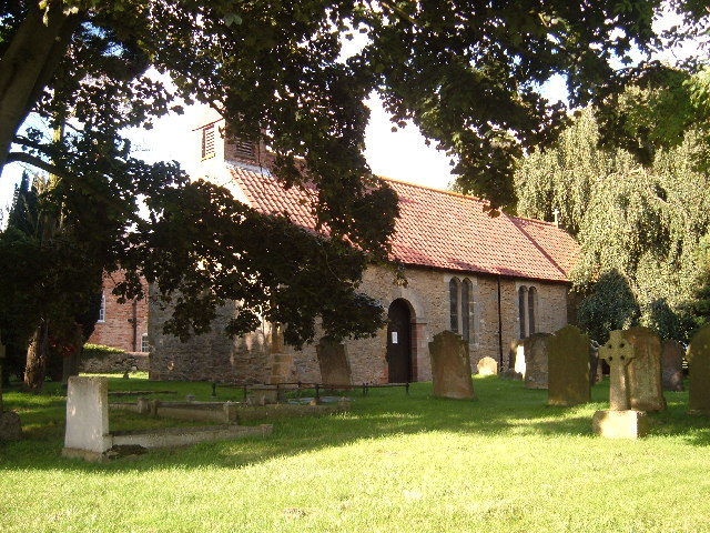
Little Sessay, St Cuthbert's church The damaged benchmark is cut into the west face of the church tower.
Little Sessay, St Cuthbert's church
The damaged benchmark is cut into the west face of the church tower.
Little Sessay, St Cuthbert's church There is a damaged benchmark cut into the west face of the church tower.
Little Sessay, St Cuthbert's church
There is a damaged benchmark cut into the west face of the church tower.
Wheat and woodland
Wheat and woodland
Show me another place!

Rooper Hill is located at Grid Ref: SE4674 (Lat: 54.166691, Lng: -1.2840689)

Division: North Riding

Administrative County: North Yorkshire

District: Hambleton

Police Authority: North Yorkshire

What 3 Words

///decoded.heightens.strutting. Near Easingwold, North Yorkshire

Related Wikis

Hutton Sessay

Hutton Sessay is a village and civil parish in the Hambleton district of North Yorkshire, England. In 2013 the population of the civil parish was estimated...

Sessay

Sessay is a small, linear village and civil parish in North Yorkshire, England. It is situated approximately 4 miles (6 km) south-east from Thirsk, and...

Pilmoor railway station

Pilmoor railway station was in North Yorkshire, England, from 1847 to 1958, at the junction of the Great North of England Railway and the Pilmoor, Boroughbridge...

St Mary's Church, Birdforth

St Mary's Church, or Birdforth Old Chapel, is a former Anglican church in the village of Birdforth, North Yorkshire, England. It is recorded in the National...

Nearby Amenities

Located within 500m of 54.166691,-1.2840689
Little Sessay
Place: village
Lat/Long: 54.1667149/-1.2916959
Fixme: Where does that public footpath go from here?
Lat/Long: 54.168409/-1.2861835
Spilmans
Shop: farm
Lat/Long: 54.1668397/-1.2863369
Passing Place
Lat/Long: 54.167216/-1.2876599
Passing Place
Lat/Long: 54.1673272/-1.2883525
The data included in this document is from www.openstreetmap.org. The data is made available under ODbL.

Have you been to Rooper Hill?

Leave your review of Rooper Hill below (or comments, questions and feedback).