Hill of Catfirth

Hill, Mountain in Shetland

Scotland

Hill of Catfirth

South Nesting View of the road.
South Nesting Credit: Mat Tuck

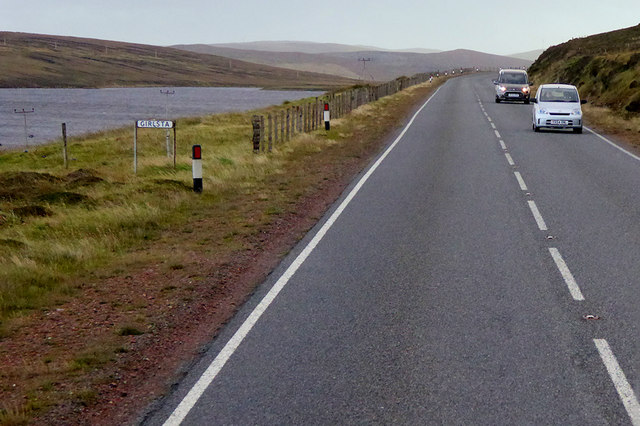
The Hill of Catfirth is a prominent geographical feature located in the Shetland Islands, Scotland. Situated in the parish of Nesting and Lunnasting, this hill stands at an elevation of approximately 226 meters (741 feet) above sea level.

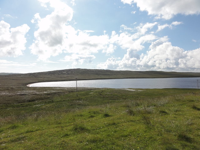
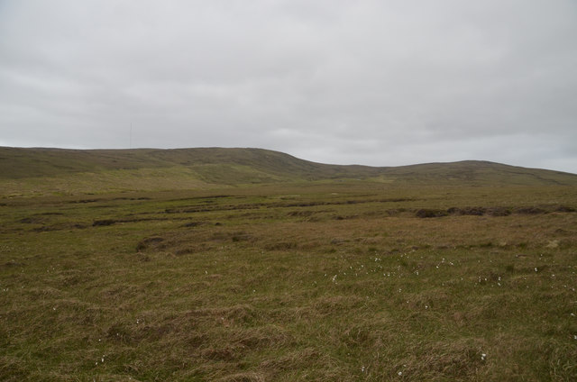
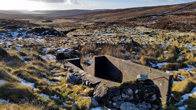
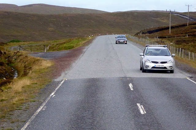
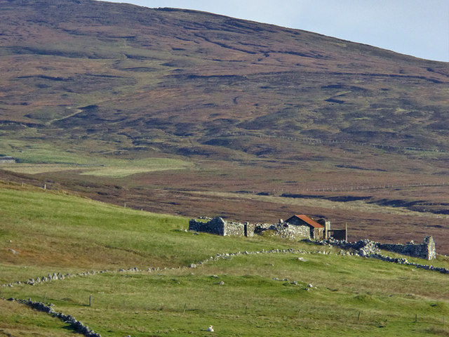
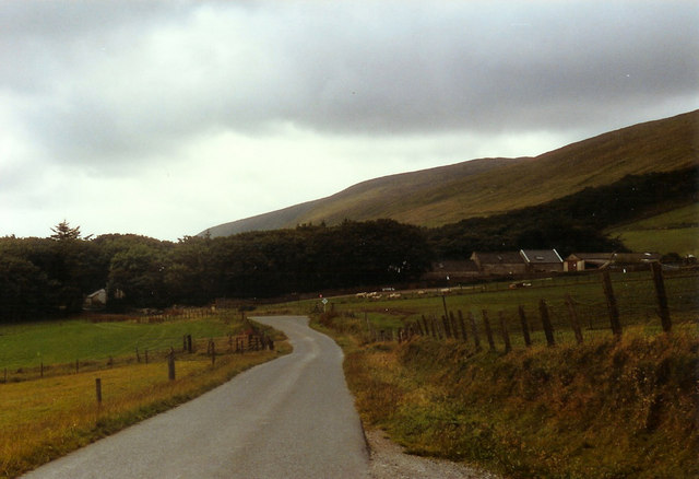
The hill is primarily composed of sandstone and is part of a larger range known as the Nesting Hills. It is characterized by its gently sloping sides and rounded summit, offering panoramic views of the surrounding landscape and the North Sea to the east. The Hill of Catfirth is also home to a variety of vegetation, including heather, grasses, and mosses, adding to its picturesque beauty.

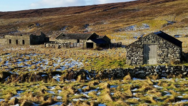
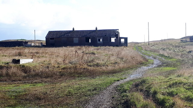
The Catfirth area is known for its rich historical significance, with several archaeological sites found nearby. These include Iron Age settlements, burial grounds, and remnants of Pictish and Viking occupation. The hill itself is often associated with myths and legends, with tales of hidden treasure and ancient rituals adding to its allure.

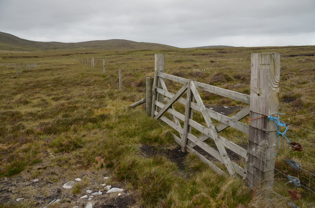
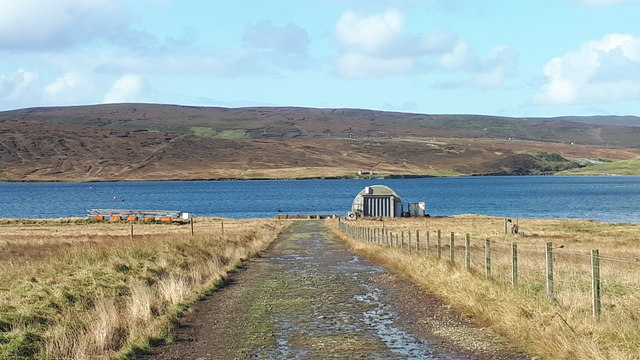
The Hill of Catfirth is a popular destination for outdoor enthusiasts, offering opportunities for hiking, birdwatching, and nature photography. The surrounding area is rich in wildlife, with the possibility of spotting species such as red grouse, golden plovers, and hen harriers. Additionally, the hill provides a peaceful and tranquil setting, making it an ideal spot for those seeking solitude and a connection with nature.

Overall, the Hill of Catfirth in Shetland is a significant landmark that combines natural beauty, historical intrigue, and recreational opportunities, making it a must-visit destination for both locals and tourists alike.

If you have any feedback on the listing, please let us know in the comments section below.

Hill of Catfirth Images

Images are sourced within 2km of 60.274498/-1.2041734 or Grid Reference HU4454. Thanks to Geograph Open Source API. All images are credited.

South Nesting View of the road.
South Nesting
View of the road.
Loch of Girlsta View from the A970 of the Loch of Girlsta
Loch of Girlsta
View from the A970 of the Loch of Girlsta
Moorland at Flamister, Shetland
Moorland Gateway near Flamister, South Nesting, Shetland
Croft at Flamister Croft and outbuildings at Flamister.
Croft at Flamister
Croft and outbuildings at Flamister.
Sheepfold and Dipper Sheepfold shown on OS Maps with more modern sheep dipper built onto it. Croft of Flamister in background.
Sheepfold and Dipper
Sheepfold shown on OS Maps with more modern sheep dipper built onto it. Croft of Flamister in background.
Peat Hags on Dud of Flamister Large volumes of peat have been lost here with grasses beginning to recolonize the stony till underneath. The Loch of Girlsta can be seen in the background.
Peat Hags on Dud of Flamister
Large volumes of peat have been lost here with grasses beginning to recolonize the stony till underneath. The Loch of Girlsta can be seen in the background.
Viking Energy mast One of Viking Energy's masts that dot the central mainland of Shetland.
Viking Energy mast
One of Viking Energy's masts that dot the central mainland of Shetland.
Southbound A970, Girlsta The loch at Girlsta is the deepest in Shetland, at about 65ft deep in places. The name "Girlsta" comes from the Old Norse "Geirhildastadr" - meaning "the place of Geirhilda". Geirhilda was a young Viking princess, daughter of the famous 9th century Viking explorer, Flóki Vilgerðarson. According to local folklore Geirhilda drowned in the loch after falling through the ice and she is buried on the small island within the loch. 
More information about the story at <span class="nowrap"><a title="https://www.shetlandwithlaurie.com/blog/geirhildrs-loch-a-viking-saga" rel="nofollow ugc noopener" href="https://www.shetlandwithlaurie.com/blog/geirhildrs-loch-a-viking-saga">Link</a><img style="margin-left:2px;" alt="External link" title="External link - shift click to open in new window" src="https://s1.geograph.org.uk/img/external.png" width="10" height="10"/></span> (Shetland with Laurie) and <span class="nowrap"><a title="https://madbassist.wixsite.com/hobbitpaw/folklore" rel="nofollow ugc noopener" href="https://madbassist.wixsite.com/hobbitpaw/folklore">Link</a><img style="margin-left:2px;" alt="External link" title="External link - shift click to open in new window" src="https://s1.geograph.org.uk/img/external.png" width="10" height="10"/></span> (Folklore and Shetland Stories)
Southbound A970, Girlsta
The loch at Girlsta is the deepest in Shetland, at about 65ft deep in places. The name "Girlsta" comes from the Old Norse "Geirhildastadr" - meaning "the place of Geirhilda". Geirhilda was a young Viking princess, daughter of the famous 9th century Viking explorer, Flóki Vilgerðarson. According to local folklore Geirhilda drowned in the loch after falling through the ice and she is buried on the small island within the loch. More information about the story at LinkExternal link (Shetland with Laurie) and LinkExternal link (Folklore and Shetland Stories)
Northbound A970 near Girlsta The A970 runs for 71 miles across most of the length of the "Mainland" in the Shetland Islands. It is a good-quality single-carriageway road for most of its route. Travelling from south to north, the road begins at Grutness near Sumburgh Airport and winds around the many hills and inlets passing close to a number of small villages without going through any large ones before Lerwick. After looping around Lerwick, a short spur runs to Scalloway whilst the main route continues northwards towards Brae where it crosses the narrow isthmus of Mavis Grind. At Sandy Lochs the road splits and a four-mile spur goes through Urafirth to Hillswick. The main route continuing to the right towards its northern terminus at Isbister. This last part of the route tends to be narrower with passing places.

<span class="nowrap"><a title="https://www.sabre-roads.org.uk/wiki/index.php?title=A970" rel="nofollow ugc noopener" href="https://www.sabre-roads.org.uk/wiki/index.php?title=A970">Link</a><img style="margin-left:2px;" alt="External link" title="External link - shift click to open in new window" src="https://s1.geograph.org.uk/img/external.png" width="10" height="10"/></span>  SABRE
Northbound A970 near Girlsta
The A970 runs for 71 miles across most of the length of the "Mainland" in the Shetland Islands. It is a good-quality single-carriageway road for most of its route. Travelling from south to north, the road begins at Grutness near Sumburgh Airport and winds around the many hills and inlets passing close to a number of small villages without going through any large ones before Lerwick. After looping around Lerwick, a short spur runs to Scalloway whilst the main route continues northwards towards Brae where it crosses the narrow isthmus of Mavis Grind. At Sandy Lochs the road splits and a four-mile spur goes through Urafirth to Hillswick. The main route continuing to the right towards its northern terminus at Isbister. This last part of the route tends to be narrower with passing places. LinkExternal link SABRE
Moorland near Catfirth A small section of the old (pre-1970s) road is just visible below the peat.
Moorland near Catfirth
A small section of the old (pre-1970s) road is just visible below the peat.
Northbound A970 near Catfirth The A970 runs for 71 miles across most of the length of the "Mainland" in the Shetland Islands. It is a good-quality single-carriageway road for most of its route. Travelling from south to north, the road begins at Grutness near Sumburgh Airport and winds around the many hills and inlets passing close to a number of small villages without going through any large ones before Lerwick. After looping around Lerwick, a short spur runs to Scalloway whilst the main route continues northwards towards Brae where it crosses the narrow isthmus of Mavis Grind. At Sandy Lochs the road splits and a four-mile spur goes through Urafirth to Hillswick. The main route continuing to the right towards its northern terminus at Isbister. This last part of the route tends to be narrower with passing places.

<span class="nowrap"><a title="https://www.sabre-roads.org.uk/wiki/index.php?title=A970" rel="nofollow ugc noopener" href="https://www.sabre-roads.org.uk/wiki/index.php?title=A970">Link</a><img style="margin-left:2px;" alt="External link" title="External link - shift click to open in new window" src="https://s1.geograph.org.uk/img/external.png" width="10" height="10"/></span>  SABRE
Northbound A970 near Catfirth
The A970 runs for 71 miles across most of the length of the "Mainland" in the Shetland Islands. It is a good-quality single-carriageway road for most of its route. Travelling from south to north, the road begins at Grutness near Sumburgh Airport and winds around the many hills and inlets passing close to a number of small villages without going through any large ones before Lerwick. After looping around Lerwick, a short spur runs to Scalloway whilst the main route continues northwards towards Brae where it crosses the narrow isthmus of Mavis Grind. At Sandy Lochs the road splits and a four-mile spur goes through Urafirth to Hillswick. The main route continuing to the right towards its northern terminus at Isbister. This last part of the route tends to be narrower with passing places. LinkExternal link SABRE
Southbound A970 near Catfirth The A970 runs for 71 miles across most of the length of the "Mainland" in the Shetland Islands. It is a good-quality single-carriageway road for most of its route. Travelling from south to north, the road begins at Grutness near Sumburgh Airport and winds around the many hills and inlets passing close to a number of small villages without going through any large ones before Lerwick. After looping around Lerwick, a short spur runs to Scalloway whilst the main route continues northwards towards Brae where it crosses the narrow isthmus of Mavis Grind. At Sandy Lochs the road splits and a four-mile spur goes through Urafirth to Hillswick. The main route continuing to the right towards its northern terminus at Isbister. This last part of the route tends to be narrower with passing places.

<span class="nowrap"><a title="https://www.sabre-roads.org.uk/wiki/index.php?title=A970" rel="nofollow ugc noopener" href="https://www.sabre-roads.org.uk/wiki/index.php?title=A970">Link</a><img style="margin-left:2px;" alt="External link" title="External link - shift click to open in new window" src="https://s1.geograph.org.uk/img/external.png" width="10" height="10"/></span>  SABRE
Southbound A970 near Catfirth
The A970 runs for 71 miles across most of the length of the "Mainland" in the Shetland Islands. It is a good-quality single-carriageway road for most of its route. Travelling from south to north, the road begins at Grutness near Sumburgh Airport and winds around the many hills and inlets passing close to a number of small villages without going through any large ones before Lerwick. After looping around Lerwick, a short spur runs to Scalloway whilst the main route continues northwards towards Brae where it crosses the narrow isthmus of Mavis Grind. At Sandy Lochs the road splits and a four-mile spur goes through Urafirth to Hillswick. The main route continuing to the right towards its northern terminus at Isbister. This last part of the route tends to be narrower with passing places. LinkExternal link SABRE
Northbound A970 near Catfirth The A970 runs for 71 miles across most of the length of the "Mainland" in the Shetland Islands. It is a good-quality single-carriageway road for most of its route. Travelling from south to north, the road begins at Grutness near Sumburgh Airport and winds around the many hills and inlets passing close to a number of small villages without going through any large ones before Lerwick. After looping around Lerwick, a short spur runs to Scalloway whilst the main route continues northwards towards Brae where it crosses the narrow isthmus of Mavis Grind. At Sandy Lochs the road splits and a four-mile spur goes through Urafirth to Hillswick. The main route continuing to the right towards its northern terminus at Isbister. This last part of the route tends to be narrower with passing places.

<span class="nowrap"><a title="https://www.sabre-roads.org.uk/wiki/index.php?title=A970" rel="nofollow ugc noopener" href="https://www.sabre-roads.org.uk/wiki/index.php?title=A970">Link</a><img style="margin-left:2px;" alt="External link" title="External link - shift click to open in new window" src="https://s1.geograph.org.uk/img/external.png" width="10" height="10"/></span>  SABRE
Northbound A970 near Catfirth
The A970 runs for 71 miles across most of the length of the "Mainland" in the Shetland Islands. It is a good-quality single-carriageway road for most of its route. Travelling from south to north, the road begins at Grutness near Sumburgh Airport and winds around the many hills and inlets passing close to a number of small villages without going through any large ones before Lerwick. After looping around Lerwick, a short spur runs to Scalloway whilst the main route continues northwards towards Brae where it crosses the narrow isthmus of Mavis Grind. At Sandy Lochs the road splits and a four-mile spur goes through Urafirth to Hillswick. The main route continuing to the right towards its northern terminus at Isbister. This last part of the route tends to be narrower with passing places. LinkExternal link SABRE
Derelict Croft, Hill of Catfirth
Track to the shore at Catfirth
The remains of Catfirth airfield Only open for about a year at the end of the First World War, but of especial significance to Shetland as the location of the first plane to land in the islands.
The remains of Catfirth airfield
Only open for about a year at the end of the First World War, but of especial significance to Shetland as the location of the first plane to land in the islands.
Show me another place!

Hill of Catfirth is located at Grid Ref: HU4454 (Lat: 60.274498, Lng: -1.2041734)

Unitary Authority: Shetland Islands

Police Authority: Highlands and Islands

What 3 Words

///dote.riding.rang. Near Aith, Shetland Islands

Related Wikis

RAF Catfirth

RAF Catfirth was a First World War seaplane base located on the island of Mainland in the Shetland Islands, Scotland. The base was under the control of...

Freester

Freester is a settlement on Mainland, Shetland, Scotland. It is in the parish of Nesting. == References == == External links == Canmore - Hard Knowe site...

Geopark Shetland

Geopark Shetland is the name used by the Geopark formally established in September 2009 on its entry into the European Geoparks Network. The Geopark extends...

Viking Wind Farm

Viking Wind Farm is a large on-shore wind farm under construction in the Shetland Islands which is being developed by Viking Energy, a partnership between...

Central Mainland

The Central Mainland of the Shetland Islands is the part of the Mainland, the largest of the Shetland Islands, Scotland. It is located between Hellister...

Weisdale

Weisdale is a bay, hamlet and ancient parish on Mainland in Shetland, Scotland. The bay opens near the northern extremity of Scalloway Bay, and strikes...

Nesting, Shetland

Nesting is a parish in the Shetland Islands, Scotland. It includes a part of the east Shetland Mainland, measuring about twelve by four miles (19 by 6...

Brettabister

Brettabister is a settlement on the island of Mainland in Shetland, Scotland. It is in the parish of Nesting. St. Ola's parish church lies to the east...

Nearby Amenities

Located within 500m of 60.274498,-1.2041734
Power: pole
Lat/Long: 60.270704/-1.2090068
The data included in this document is from www.openstreetmap.org. The data is made available under ODbL.

Have you been to Hill of Catfirth?

Leave your review of Hill of Catfirth below (or comments, questions and feedback).