Hill of Hamarsland

Hill, Mountain in Shetland

Scotland

Hill of Hamarsland
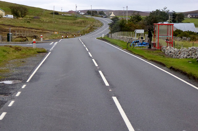
The Junction Bus Stop near Girlsta The A970 runs for 71 miles across most of the length of the "Mainland" in the Shetland Islands. It is a good-quality single-carriageway road for most of its route. Travelling from south to north, the road begins at Grutness near Sumburgh Airport and winds around the many hills and inlets passing close to a number of small villages without going through any large ones before Lerwick. After looping around Lerwick, a short spur runs to Scalloway whilst the main route continues northwards towards Brae where it crosses the narrow isthmus of Mavis Grind. At Sandy Lochs the road splits and a four-mile spur goes through Urafirth to Hillswick. The main route continuing to the right towards its northern terminus at Isbister. This last part of the route tends to be narrower with passing places.

<span class="nowrap"><a title="https://www.sabre-roads.org.uk/wiki/index.php?title=A970" rel="nofollow ugc noopener" href="https://www.sabre-roads.org.uk/wiki/index.php?title=A970">Link</a><img style="margin-left:2px;" alt="External link" title="External link - shift click to open in new window" src="https://s1.geograph.org.uk/img/external.png" width="10" height="10"/></span>  SABRE
The Junction Bus Stop near Girlsta Credit: David Dixon

The requested URL returned error: 429 Too Many Requests

If you have any feedback on the listing, please let us know in the comments section below.

Hill of Hamarsland Images

Images are sourced within 2km of 60.226664/-1.2595979 or Grid Reference HU4149. Thanks to Geograph Open Source API. All images are credited.

The Junction Bus Stop near Girlsta The A970 runs for 71 miles across most of the length of the "Mainland" in the Shetland Islands. It is a good-quality single-carriageway road for most of its route. Travelling from south to north, the road begins at Grutness near Sumburgh Airport and winds around the many hills and inlets passing close to a number of small villages without going through any large ones before Lerwick. After looping around Lerwick, a short spur runs to Scalloway whilst the main route continues northwards towards Brae where it crosses the narrow isthmus of Mavis Grind. At Sandy Lochs the road splits and a four-mile spur goes through Urafirth to Hillswick. The main route continuing to the right towards its northern terminus at Isbister. This last part of the route tends to be narrower with passing places.

<span class="nowrap"><a title="https://www.sabre-roads.org.uk/wiki/index.php?title=A970" rel="nofollow ugc noopener" href="https://www.sabre-roads.org.uk/wiki/index.php?title=A970">Link</a><img style="margin-left:2px;" alt="External link" title="External link - shift click to open in new window" src="https://s1.geograph.org.uk/img/external.png" width="10" height="10"/></span>  SABRE
The Junction Bus Stop near Girlsta
The A970 runs for 71 miles across most of the length of the "Mainland" in the Shetland Islands. It is a good-quality single-carriageway road for most of its route. Travelling from south to north, the road begins at Grutness near Sumburgh Airport and winds around the many hills and inlets passing close to a number of small villages without going through any large ones before Lerwick. After looping around Lerwick, a short spur runs to Scalloway whilst the main route continues northwards towards Brae where it crosses the narrow isthmus of Mavis Grind. At Sandy Lochs the road splits and a four-mile spur goes through Urafirth to Hillswick. The main route continuing to the right towards its northern terminus at Isbister. This last part of the route tends to be narrower with passing places. LinkExternal link SABRE
Motorcyclists on the A970 near Girlsta The A970 runs for 71 miles across most of the length of the "Mainland" in the Shetland Islands. It is a good-quality single-carriageway road for most of its route. Travelling from south to north, the road begins at Grutness near Sumburgh Airport and winds around the many hills and inlets passing close to a number of small villages without going through any large ones before Lerwick. After looping around Lerwick, a short spur runs to Scalloway whilst the main route continues northwards towards Brae where it crosses the narrow isthmus of Mavis Grind. At Sandy Lochs the road splits and a four-mile spur goes through Urafirth to Hillswick. The main route continuing to the right towards its northern terminus at Isbister. This last part of the route tends to be narrower with passing places.

<span class="nowrap"><a title="https://www.sabre-roads.org.uk/wiki/index.php?title=A970" rel="nofollow ugc noopener" href="https://www.sabre-roads.org.uk/wiki/index.php?title=A970">Link</a><img style="margin-left:2px;" alt="External link" title="External link - shift click to open in new window" src="https://s1.geograph.org.uk/img/external.png" width="10" height="10"/></span>  SABRE
Motorcyclists on the A970 near Girlsta
The A970 runs for 71 miles across most of the length of the "Mainland" in the Shetland Islands. It is a good-quality single-carriageway road for most of its route. Travelling from south to north, the road begins at Grutness near Sumburgh Airport and winds around the many hills and inlets passing close to a number of small villages without going through any large ones before Lerwick. After looping around Lerwick, a short spur runs to Scalloway whilst the main route continues northwards towards Brae where it crosses the narrow isthmus of Mavis Grind. At Sandy Lochs the road splits and a four-mile spur goes through Urafirth to Hillswick. The main route continuing to the right towards its northern terminus at Isbister. This last part of the route tends to be narrower with passing places. LinkExternal link SABRE
Girlsta: the Methodist chapel A small chapel in an isolated spot, west of the village on the road towards Whiteness.
Girlsta: the Methodist chapel
A small chapel in an isolated spot, west of the village on the road towards Whiteness.
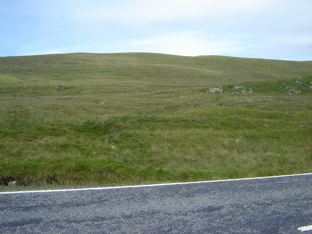
Girsta Service Reservoir I parked near Girlsta Service Reservoir before climbing the moorland HuMP called Hill of Hamarsland.
Girsta Service Reservoir
I parked near Girlsta Service Reservoir before climbing the moorland HuMP called Hill of Hamarsland.
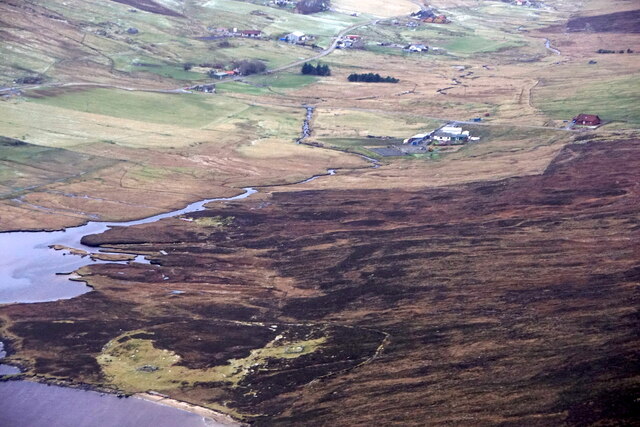
Stromfirth from the air
Girlsta from the air
Stromfirth from the air
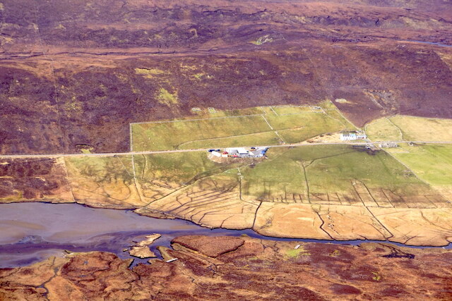
Tirsa Water from the air
Loch of Strom View south from above the bay of Quoy Ness.
Loch of Strom
View south from above the bay of Quoy Ness.
Hill of Hellister from Stromfirth Road
House at Quoyness, by Loch of Strom Beyond the Loch of Strom you can see Whiteness Voe, and in the far distance is the distinctive form of Fitful Head, right at the south end of Mainland Shetland.
House at Quoyness, by Loch of Strom
Beyond the Loch of Strom you can see Whiteness Voe, and in the far distance is the distinctive form of Fitful Head, right at the south end of Mainland Shetland.
Loch of Strom from Quoyness The lochside church can be seen on the left and the remains of a castle are on the small holm. The view south extends as far as Fitful Head, at the very south end of Shetland.
Loch of Strom from Quoyness
The lochside church can be seen on the left and the remains of a castle are on the small holm. The view south extends as far as Fitful Head, at the very south end of Shetland.
Haggersta: Loch Strom from by Quoyness Looking along the southern part of Loch Strom. Although the bay here appears to be the head of the Loch, in fact it extends upstream for another mile and a half, to the left as we look, beyond the headland (Quoy Ness) protruding into the picture.
Haggersta: Loch Strom from by Quoyness
Looking along the southern part of Loch Strom. Although the bay here appears to be the head of the Loch, in fact it extends upstream for another mile and a half, to the left as we look, beyond the headland (Quoy Ness) protruding into the picture.
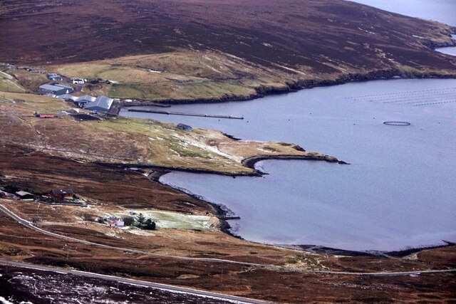
Haggersta: road alongside Loch Strom Looking along the road following the western shore of Loch Strom at the extreme northeast corner of this gridsquare. A fish farm is on the right.
Haggersta: road alongside Loch Strom
Looking along the road following the western shore of Loch Strom at the extreme northeast corner of this gridsquare. A fish farm is on the right.
Loch of Hellister and the Hill of Huxter
Tirsa Water, Weisdale, Shetland High-level small loch above the Weisdale Valley.  Weisdale Hill is in the background.
Tirsa Water, Weisdale, Shetland
High-level small loch above the Weisdale Valley. Weisdale Hill is in the background.
Trees south of Girlsta.
Show me another place!

Hill of Hamarsland is located at Grid Ref: HU4149 (Lat: 60.226664, Lng: -1.2595979)

Unitary Authority: Shetland Islands

Police Authority: Highlands and Islands

What 3 Words

///friction.sectors.crossings. Near Aith, Shetland Islands

Nearby Locations

Hill of Hamarsland

Related Wikis

Greena

Greena is a small island off the west coast of Mainland, Shetland. It is 10m at its highest point, and is north of Flotta, Shetland. It is in Weisdale...

Tingwall Airport

Tingwall Airport (IATA: LWK, ICAO: EGET), also known as Lerwick/Tingwall Airport, is located in the Tingwall valley, near the village of Gott, 4 NM (7...

Weisdale Mill

Weisdale Mill is a watermill in the village of Weisdale, Shetland, Scotland. It is located near the head of Weisdale Voe on the west of the island, a twenty...

Weisdale

Weisdale is a bay, hamlet and ancient parish on Mainland in Shetland, Scotland. The bay opens near the northern extremity of Scalloway Bay, and strikes...

Have you been to Hill of Hamarsland?

Leave your review of Hill of Hamarsland below (or comments, questions and feedback).