Round Hill

Hill, Mountain in Oxfordshire Cherwell

England

Round Hill

Jester's Hill Small hill above Shutford. As well as the survey pillar there is one of the twee beacons so popular on small English hills. This one was erected to celebrate VE day in 1945.
Jester's Hill Credit: Richard Webb

Round Hill is a prominent hill located in the county of Oxfordshire, England. Situated within the picturesque Chiltern Hills, Round Hill stands at an elevation of approximately 259 meters (850 feet) above sea level. It is considered one of the highest points in this region, granting visitors breathtaking panoramic views of the surrounding countryside.

Covered in lush greenery and scattered with ancient beech trees, Round Hill offers a serene and tranquil environment for nature enthusiasts and hikers alike. The hill is a popular destination for outdoor activities, such as walking, hiking, and picnicking, attracting locals and visitors from afar.

Round Hill is also home to a diverse range of wildlife, including various species of birds, mammals, and insects. The hill's distinctive flora and fauna add to its natural charm and appeal. In addition, the area surrounding Round Hill is dotted with charming villages and historic landmarks, providing visitors with opportunities to explore and discover the rich cultural heritage of Oxfordshire.

Due to its elevated position, Round Hill is often shrouded in mist during the cooler months, creating an ethereal atmosphere and adding to its allure. The hill's summit is easily accessible via well-maintained footpaths, making it an ideal destination for both experienced and novice hikers.

Overall, Round Hill in Oxfordshire is a captivating and idyllic location, offering visitors a chance to escape the hustle and bustle of everyday life and immerse themselves in the natural beauty of the English countryside.

If you have any feedback on the listing, please let us know in the comments section below.
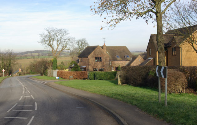
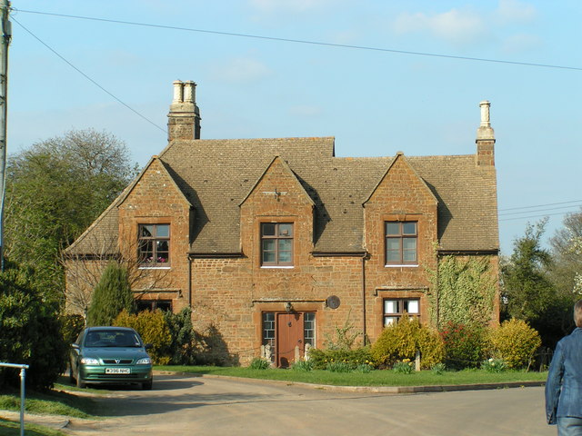
Round Hill Images

Images are sourced within 2km of 52.054599/-1.4422365 or Grid Reference SP3839. Thanks to Geograph Open Source API. All images are credited.

Jester's Hill Small hill above Shutford. As well as the survey pillar there is one of the twee beacons so popular on small English hills. This one was erected to celebrate VE day in 1945.
Jester's Hill
Small hill above Shutford. As well as the survey pillar there is one of the twee beacons so popular on small English hills. This one was erected to celebrate VE day in 1945.
George and Dragon, Shutford yes, there is pub, it's not all church - Hook Norton beers
George and Dragon, Shutford
yes, there is pub, it's not all church - Hook Norton beers
Driveway to Stonepit Cottage The driveway to the cottage from Epwell Road.  The grass has just been cut and the birds seem to be massing on the power lines ready to dive on any disturbed insects.
Driveway to Stonepit Cottage
The driveway to the cottage from Epwell Road. The grass has just been cut and the birds seem to be massing on the power lines ready to dive on any disturbed insects.
Stonepit Cottage sign A place to visit for those tying the knot!
Stonepit Cottage sign
A place to visit for those tying the knot!
Shutford Grounds Farm The driveway to the farm from Epwell Road, with a gate in need of some adjustment.
Shutford Grounds Farm
The driveway to the farm from Epwell Road, with a gate in need of some adjustment.
Wroxton Mill
Wroxton Mill
Golf course at Wroxton Mill This course is not shown on the OS Map and is discreetly hidden away in the little valley above Wroxton Mill.
Golf course at Wroxton Mill
This course is not shown on the OS Map and is discreetly hidden away in the little valley above Wroxton Mill.
View towards Tythe Farm Looking across the square from Shutford Road.
View towards Tythe Farm
Looking across the square from Shutford Road.
Upper Lea Farm
Upper Lea Farm
Shutford Bridge Although named on the OS Map this bridge over a stream in the NE corner of the square is not particularly distinctive.
Shutford Bridge
Although named on the OS Map this bridge over a stream in the NE corner of the square is not particularly distinctive.
B4035 west of Tadmarton The B4035 approaches Tadmarton from the west via a double bend past a small development of modern houses.
B4035 west of Tadmarton
The B4035 approaches Tadmarton from the west via a double bend past a small development of modern houses.
George and Dragon, Shutford Photograph taken 8/2/2007 during increasingly rare significant snow fall, from the bus shelter on Jame Corner. St Martin's church is situated behind the pub in an elevated position.
George and Dragon, Shutford
Photograph taken 8/2/2007 during increasingly rare significant snow fall, from the bus shelter on Jame Corner. St Martin's church is situated behind the pub in an elevated position.
Shutford village Photo taken from Bali Hai in Ivy Lane. At the front left is the old Quaker House. Towards the top right is the old school (grey slate roof), now a dwelling house.
Shutford village
Photo taken from Bali Hai in Ivy Lane. At the front left is the old Quaker House. Towards the top right is the old school (grey slate roof), now a dwelling house.
Old Manor House, Shutford The Old Manor House is reputed to have been an Inn at some time during its life; now a private house.
Old Manor House, Shutford
The Old Manor House is reputed to have been an Inn at some time during its life; now a private house.
Road to Swalcliffe Lea
Village end
Village end
Bridleway
Bridleway
Farmland Swalcliffe church in the distance
Farmland
Swalcliffe church in the distance
Show me another place!

Round Hill is located at Grid Ref: SP3839 (Lat: 52.054599, Lng: -1.4422365)

Administrative County: Oxfordshire

District: Cherwell

Police Authority: Thames Valley

What 3 Words

///cloth.fortified.pure. Near Bloxham, Oxfordshire

Related Wikis

Shutford

Shutford is a village and civil parish about 4.5 miles (7.2 km) west of Banbury in Oxfordshire. The village is about 475 feet (145 m) above sea level....

Sibford

Sibford (or The Sibfords) is the collective name given to the villages of Sibford Gower, Sibford Ferris and Burdrop on the edge of the Cotswolds in north...

Sibford Gower

Sibford Gower is a village and civil parish about 6.5 miles (10.5 km) west of Banbury in Oxfordshire, on the north side of the Sib valley, opposite Sibford...

Tadmarton

Tadmarton is a village and civil parish about 4 miles (6.4 km) west of Banbury, Oxfordshire. The 2011 Census recorded the parish's population as 541, which...

Swalcliffe

Swalcliffe is a village and civil parish about 5 miles (8 km) west of Banbury in Oxfordshire. The parish is about 2+1⁄2 miles (4 km) long north–south and...

Swalcliffe Park School

Swalcliffe Park School is a specialist residential and day school in Oxfordshire, England for boys aged 11–19 who have needs arising from their Autistic...

Balscote

Balscote or Balscott is a village in the civil parish of Wroxton, Oxfordshire, about 4 miles (6.4 km) west of Banbury. The Domesday Book of 1086 records...

Banbury Rural District

Banbury was a rural district in Oxfordshire, England from 1894 to 1974. It was formed under the Local Government Act 1894 from the bulk of the Banbury...

Nearby Amenities

Located within 500m of 52.054599,-1.4422365
Well
Man Made: water_well
Source: OS_OpenData_StreetView
Lat/Long: 52.0587265/-1.4415387
Power: pole
Lat/Long: 52.0589576/-1.4438068
Power: pole
Lat/Long: 52.0588312/-1.4417926
Power: pole
Lat/Long: 52.0587268/-1.4445967
The data included in this document is from www.openstreetmap.org. The data is made available under ODbL.

Have you been to Round Hill?

Leave your review of Round Hill below (or comments, questions and feedback).