South Hill

Hill, Mountain in Shetland

Scotland

South Hill

Working on the landfall of the interconnector, Weisdale Voe The interconnector will carry electricity generated by the Viking Windfarm to mainland Britain.
Working on the landfall of the interconnector, Weisdale Voe Credit: Mike Pennington

South Hill is a prominent hill located in the Shetland Islands, an archipelago in Scotland. This hill, also known as South Ward of Hillswick, is situated on the western coast of the mainland, approximately 30 miles north of Lerwick, the largest town in Shetland. Rising to an impressive height of around 314 meters (1,030 feet), South Hill offers stunning panoramic views of the surrounding landscape.

The hill is characterized by its rugged and rocky terrain, covered in heather and grasses. Its slopes are steep, making it a challenging yet rewarding climb for hikers and outdoor enthusiasts. South Hill is a popular destination for hillwalking and provides an excellent opportunity to immerse oneself in the natural beauty of the Shetland Islands.

The summit of South Hill offers breathtaking vistas, allowing visitors to gaze across the rolling hills, picturesque coastal cliffs, and the vast North Atlantic Ocean. On a clear day, it is even possible to spot neighboring islands such as Muckle Roe and Foula.

South Hill is not only a haven for hikers but also a habitat for various wildlife species. It is home to numerous bird species, including puffins, fulmars, and guillemots, making it a favorite spot for birdwatchers. The hillside is also known to support a diverse range of plant life, with wildflowers adding a splash of color to the landscape during the summer months.

Overall, South Hill in Shetland is a captivating natural landmark, showcasing the rugged beauty and abundant wildlife that the region has to offer. Whether for adventure or tranquility, a visit to South Hill promises an unforgettable experience for nature lovers and outdoor enthusiasts alike.

If you have any feedback on the listing, please let us know in the comments section below.
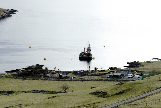
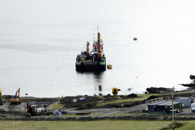
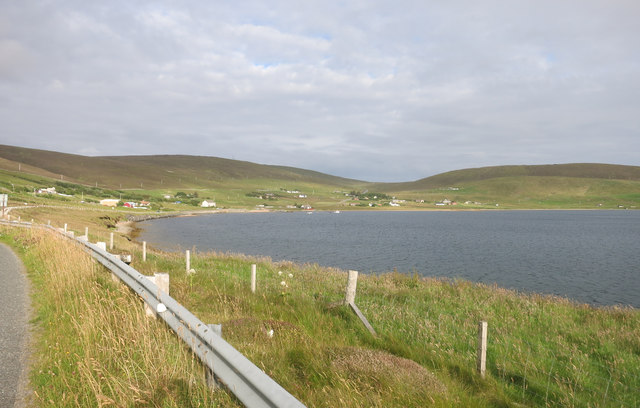
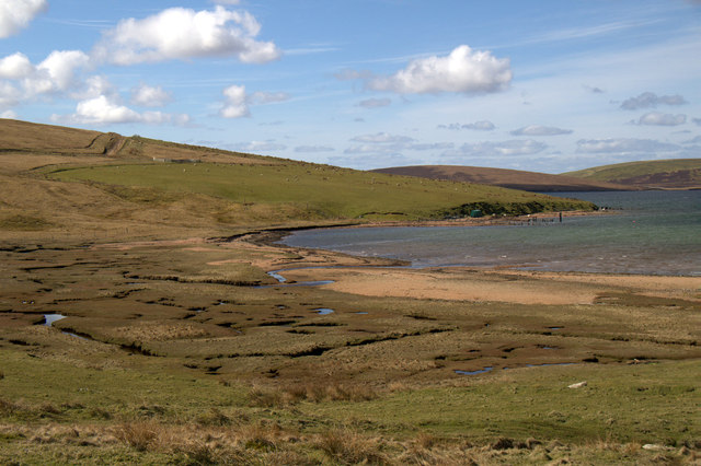
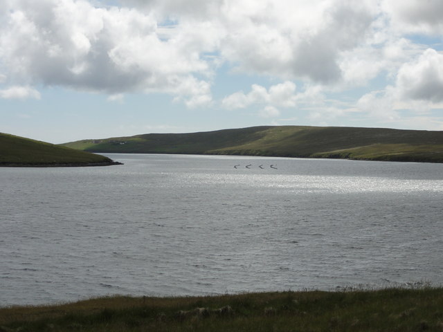
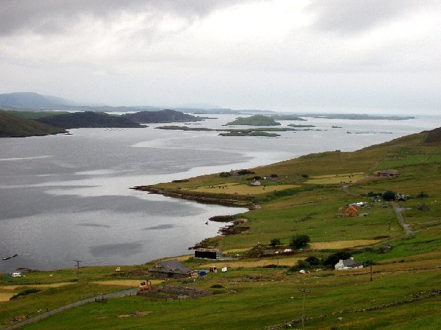
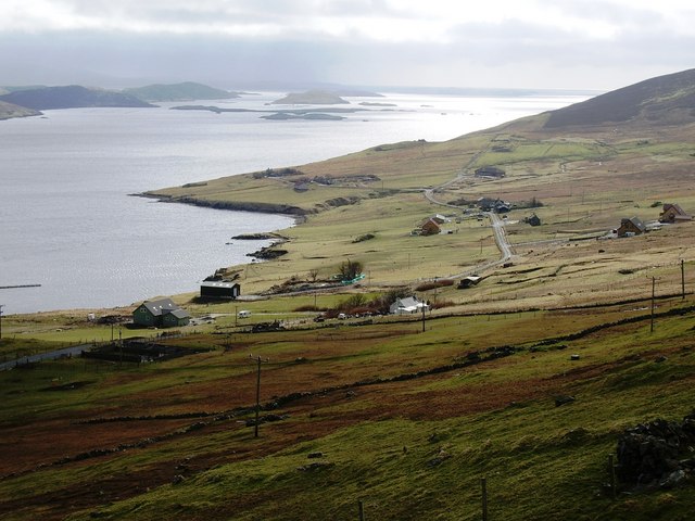
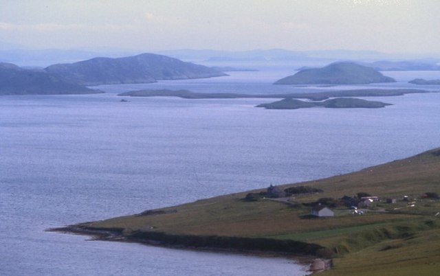
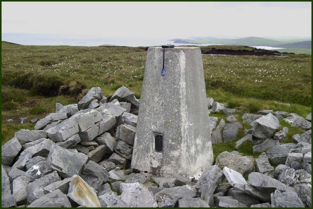
South Hill Images

Images are sourced within 2km of 60.234215/-1.3412585 or Grid Reference HU3650. Thanks to Geograph Open Source API. All images are credited.

Working on the landfall of the interconnector, Weisdale Voe The interconnector will carry electricity generated by the Viking Windfarm to mainland Britain.
Working on the landfall of the interconnector, Weisdale Voe
The interconnector will carry electricity generated by the Viking Windfarm to mainland Britain.
Landfall for the interconnector, Weisdale Voe
Weisdale Voe View Good views all along this bit of road, and just here there's a lay by where you can stop for a proper look around.
Visitor information in the foreground.
Weisdale Voe View
Good views all along this bit of road, and just here there's a lay by where you can stop for a proper look around. Visitor information in the foreground.
Beside Tresta Voe The main road runs beside the shore for a short way along here.
Beside Tresta Voe
The main road runs beside the shore for a short way along here.
Graveyard at Sound, Weisdale Kalliness is across Weisdale Voe.
Graveyard at Sound, Weisdale
Kalliness is across Weisdale Voe.
Ruin amongst trees at Sound, Weisdale Kalliness is across Weisdale Voe.
Ruin amongst trees at Sound, Weisdale
Kalliness is across Weisdale Voe.
Saltmarsh at the head of Tresta Voe Looking across to Lung Ness.
Saltmarsh at the head of Tresta Voe
Looking across to Lung Ness.
New OSBM Bolt Ordnance Survey benchmark bolt described as: NEW OSBM BOLT ROCK 12.1M SW SIDE RD 32.0M NW C DRAIN (114.595m above Lerwick datum, 2nd order, new 1978).
New OSBM Bolt
Ordnance Survey benchmark bolt described as: NEW OSBM BOLT ROCK 12.1M SW SIDE RD 32.0M NW C DRAIN (114.595m above Lerwick datum, 2nd order, new 1978).
Power Distribution Power distribution lines
Power Distribution
Power distribution lines
Fish Farm Fish Farm in Tresta Voe
Fish Farm
Fish Farm in Tresta Voe
Sound from the A971 Hellister across the Weisdale Voe.
Sound from the A971
Hellister across the Weisdale Voe.
Sound, laird's house, chapel and burial ground by the road to Cott from A971 Top of Picture: Historic Environment Scotland Scheduled Monument comprising the remains of an 18th-century laird's house, known as the Haa of Sound, and associated structures, the fishing station of Sound, including böds (fishermen's booths or huts), and a burial ground within which the remains of Our Lady's Chapel are found. The laird's house is Palladian in form and measures 10m by 5m. The building originally had two storeys and three bays, with rear wing to the west and courtyard to the east. The house has a symmetrical façade, which survives almost to the wallhead. The proximity of the house to the fishing station indicates that this was probably the house of a merchant. The fishing station has a beach suitable for the drying and curing of fish. The Haa of Sound was the seat of the Clunies-Ross family, which produced several eminent figures. It was the birthplace (in 1786) of John Clunies-Ross, a sea captain who visited and, in 1827, settled on Direction Island in the Indian Ocean and appointed himself Ross I, King of the Cocos (Keeling) Islands. The monument is of national importance because it has an inherent potential to contribute to our understanding of the past, in particular the construction techniques and domestic life of an early modern laird's house and fishing station.
Sound, laird's house, chapel and burial ground by the road to Cott from A971
Top of Picture: Historic Environment Scotland Scheduled Monument comprising the remains of an 18th-century laird's house, known as the Haa of Sound, and associated structures, the fishing station of Sound, including böds (fishermen's booths or huts), and a burial ground within which the remains of Our Lady's Chapel are found. The laird's house is Palladian in form and measures 10m by 5m. The building originally had two storeys and three bays, with rear wing to the west and courtyard to the east. The house has a symmetrical façade, which survives almost to the wallhead. The proximity of the house to the fishing station indicates that this was probably the house of a merchant. The fishing station has a beach suitable for the drying and curing of fish. The Haa of Sound was the seat of the Clunies-Ross family, which produced several eminent figures. It was the birthplace (in 1786) of John Clunies-Ross, a sea captain who visited and, in 1827, settled on Direction Island in the Indian Ocean and appointed himself Ross I, King of the Cocos (Keeling) Islands. The monument is of national importance because it has an inherent potential to contribute to our understanding of the past, in particular the construction techniques and domestic life of an early modern laird's house and fishing station.
View towards Weisdale Voe, looking southwards
A971 by the Scord of Weisdale Viewpoint
Weisdale Voe A view south
Weisdale Voe
A view south
Cott, Weisdale Voe, Shetland Looking south across the community of Cott on the east side of Russaness Hill and down Weisdale Voe with the islands of Greena, Flotta and the Hoggs of Hoy in the distance.
Cott, Weisdale Voe, Shetland
Looking south across the community of Cott on the east side of Russaness Hill and down Weisdale Voe with the islands of Greena, Flotta and the Hoggs of Hoy in the distance.
Cott and Weisdale Voe The crofts at Cott and beyond the islands at the mouth of Weisdale Voe.
Cott and Weisdale Voe
The crofts at Cott and beyond the islands at the mouth of Weisdale Voe.
Hostaberg top Triangulation point at the top of hill
Hostaberg top
Triangulation point at the top of hill
Show me another place!

South Hill is located at Grid Ref: HU3650 (Lat: 60.234215, Lng: -1.3412585)

Unitary Authority: Shetland Islands

Police Authority: Highlands and Islands

What 3 Words

///woes.flick.hungry. Near Aith, Shetland Islands

Nearby Locations

South Hill

Related Wikis

Westerfield, Shetland

Westerfield is a coastal community on Mainland, in Shetland, Scotland. The community is within the parish of Sandsting.It lies to the west of Tresta on...

Greena

Greena is a small island off the west coast of Mainland, Shetland. It is 10m at its highest point, and is north of Flotta, Shetland. It is in Weisdale...

Sandsting

Sandsting is a parish in the West Mainland of Shetland, Scotland, forming a southern arm of the Walls Peninsula. After the parish of Aithsting was annexed...

Bixter

Bixter is a village on the west side of the Shetland Islands, located more than 160 km (99 mi) off the north coast of mainland Scotland. Bixter is a group...

Nearby Amenities

Located within 500m of 60.234215,-1.3412585
South Hill
Corbett: no
Ele: 156
Graham: no
Marilyn: no
Munro: no
Natural: peak
Lat/Long: 60.2347816/-1.3408402
The data included in this document is from www.openstreetmap.org. The data is made available under ODbL.

Have you been to South Hill?

Leave your review of South Hill below (or comments, questions and feedback).