Orchard Hill

Hill, Mountain in Oxfordshire Cherwell

England

Orchard Hill

East from Windmill Hill Towards Shenlow Hill.
East from Windmill Hill Credit: Derek Harper

Orchard Hill is a picturesque hill located in Oxfordshire, England. Standing at an elevation of approximately 250 meters, it offers stunning panoramic views of the surrounding countryside. The hill lies within the Chiltern Hills Area of Outstanding Natural Beauty, adding to its charm and appeal.

Orchard Hill is known for its verdant orchards and meadows that adorn its slopes, giving it its name. The hill is covered in lush greenery, with an abundance of trees and wildflowers, creating a serene and tranquil atmosphere. It is a popular destination for nature lovers and hikers seeking a peaceful escape.

At the summit of Orchard Hill, visitors are rewarded with breathtaking vistas of the Oxfordshire countryside. On clear days, one can see for miles, with rolling hills, meandering rivers, and charming villages dotting the landscape. This makes it an ideal spot for photography enthusiasts, who can capture the natural beauty of the region.

The hill is also home to a variety of wildlife, including numerous bird species and small mammals. It provides a natural habitat for these creatures, making it an important conservation area within Oxfordshire.

Access to Orchard Hill is easy, with well-maintained footpaths and trails leading to its summit. It is a popular destination for walkers and hikers of all abilities, catering to both leisurely strolls and more challenging hikes.

Overall, Orchard Hill in Oxfordshire offers a captivating blend of natural beauty, tranquility, and stunning views, making it a must-visit destination for nature enthusiasts and those seeking a peaceful retreat.

If you have any feedback on the listing, please let us know in the comments section below.
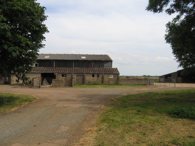
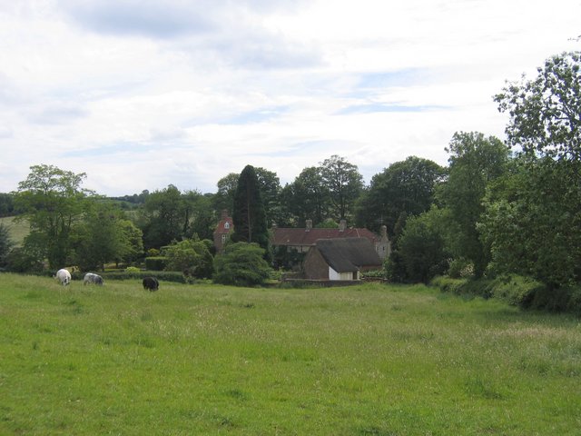
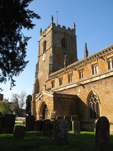
Orchard Hill Images

Images are sourced within 2km of 52.070687/-1.4927338 or Grid Reference SP3441. Thanks to Geograph Open Source API. All images are credited.

East from Windmill Hill Towards Shenlow Hill.
East from Windmill Hill
Towards Shenlow Hill.
Farmland near Upper Tysoe This looks to the right from <a href="https://www.geograph.org.uk/photo/7335645">SP3343 : Tysoe from Windmill Hill</a> and left from <a href="https://www.geograph.org.uk/photo/7335631">SP3342 : East from Windmill Hill</a>. The farm beyond the curving field boundary is Hill Farm (there is another Hill Farm within a kilometre up the hill). The hills form part of the Cotswold scarp.
Farmland near Upper Tysoe
This looks to the right from SP3343 : Tysoe from Windmill Hill and left from SP3342 : East from Windmill Hill. The farm beyond the curving field boundary is Hill Farm (there is another Hill Farm within a kilometre up the hill). The hills form part of the Cotswold scarp.
Farmland near Upper Tysoe Looking right from the foot of the field shown on the left of <a href="https://www.geograph.org.uk/photo/7335728">SP3342 : Towards Upper Tysoe</a>, across an arable field to the road south from Upper Tysoe as it leaves the houses.  Again, the Cotswold scarp forms a backdrop.
Farmland near Upper Tysoe
Looking right from the foot of the field shown on the left of SP3342 : Towards Upper Tysoe, across an arable field to the road south from Upper Tysoe as it leaves the houses. Again, the Cotswold scarp forms a backdrop.
Crossroads Signpost
Crossroads Signpost
Ruins of old farm buildings Labelled Hill Barn on the map, the ruins consist of a barn, other outbuildings and what appears to be the remains of a farm cottage.
Ruins of old farm buildings
Labelled Hill Barn on the map, the ruins consist of a barn, other outbuildings and what appears to be the remains of a farm cottage.
The Chandlers Arms, Epwell Another hook Norton gem.
The Chandlers Arms, Epwell
Another hook Norton gem.
Approaching Winderton Looking along the small valley approaching Winderton from the Compton Wynyates direction.
Approaching Winderton
Looking along the small valley approaching Winderton from the Compton Wynyates direction.
Broomhill Looking across the square to the hill itself on the right whilst the farm with the same name is just visible to the left.
Broomhill
Looking across the square to the hill itself on the right whilst the farm with the same name is just visible to the left.
View from Tysoe Hill The light blue plastic covered bales of hay literally dot the fields, with the houses of Upper Tysoe beyond.
View from Tysoe Hill
The light blue plastic covered bales of hay literally dot the fields, with the houses of Upper Tysoe beyond.
Old airfield and farm buildings at Christmas corner The buildings visible from the road a Christmas Corner are a mixture of relatively modern farm buildings and a variety of buildings left over from the former Shenington Airfield.
Old airfield and farm buildings at Christmas corner
The buildings visible from the road a Christmas Corner are a mixture of relatively modern farm buildings and a variety of buildings left over from the former Shenington Airfield.
Shenington Kart Club The go-karting club shares the old Shenington Airfield with Shenington Gliding club.
Shenington Kart Club
The go-karting club shares the old Shenington Airfield with Shenington Gliding club.
Shenington Gliding Club Seen from the end of the grass runway.  The blue and yellow vehicle beyond the fence is the tractor for winch launching the gliders.
Shenington Gliding Club
Seen from the end of the grass runway. The blue and yellow vehicle beyond the fence is the tractor for winch launching the gliders.
Haymaking at Rough Hill Looking across the square from near Rough Hill Farm as the work progresses.
Haymaking at Rough Hill
Looking across the square from near Rough Hill Farm as the work progresses.
Haymaking at Yarn Hill Freshly cut grass left to dry in the sun.
Haymaking at Yarn Hill
Freshly cut grass left to dry in the sun.
Epwell Mill Seen across the fields from the bend in the lane to Epwell.
Epwell Mill
Seen across the fields from the bend in the lane to Epwell.
White House crossroads Curiously named as the house shows no sign of being white!
White House crossroads
Curiously named as the house shows no sign of being white!
Downs Farm Seen from the road as it descends towards Tysoe.
Downs Farm
Seen from the road as it descends towards Tysoe.
Orchard Hill The grass on half of the hill has been cut for hay whilst the other part is still grazed by cattle.
Orchard Hill
The grass on half of the hill has been cut for hay whilst the other part is still grazed by cattle.
Show me another place!

Orchard Hill is located at Grid Ref: SP3441 (Lat: 52.070687, Lng: -1.4927338)

Administrative County: Oxfordshire

District: Cherwell

Police Authority: Thames Valley

What 3 Words

///sparrows.detect.suffice. Near Lower Brailes, Warwickshire

Related Wikis

Epwell

Epwell is a village and civil parish in the north of Oxfordshire about 6 miles (10 km) west of Banbury. The 2011 Census recorded the parish population...
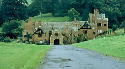
Compton Wynyates

Compton Wynyates is a Tudor country house in Warwickshire, England, a Grade I listed building. The Tudor period house is constructed of red brick and built...

Tysoe

Tysoe is a civil parish in the Stratford-on-Avon District of Warwickshire, England. The parish is on the boundary with Oxfordshire, about 7+1⁄2 miles...

Shenington

Shenington is a village and former civil parish, now in the parish of Shenington with Alkerton, in the Cherwell district, in the county of Oxfordshire...

Compton Wynyates (parish)

Compton Wynyates or Compton Wyniates is an ancient parish and civil parish in Stratford-on-Avon District, Warwickshire, England. It includes the house...

Shenington with Alkerton

Shenington with Alkerton is a civil parish in Oxfordshire, England. It comprises the village of Shenington, which was an exclave of Gloucestershire until...

Alkerton, Oxfordshire

Alkerton is a village and former civil parish, now in the parish of Shenington with Alkerton, in the Cherwell district, in the county of Oxfordshire, England...

Red Horse of Tysoe

The Red Horse of Tysoe was a hill figure in the parish of Tysoe, South Warwickshire, England, cut into the red clay below the escarpment of Edgehill. It...

Nearby Amenities

Located within 500m of 52.070687,-1.4927338
Epwell Hill
Ele: 225
Natural: peak
Source: NPE
Lat/Long: 52.0722084/-1.4863788
Power: tower
Source: visual survey;bing
Lat/Long: 52.0668786/-1.491572
Power: tower
Source: visual survey;bing
Lat/Long: 52.0675926/-1.4877944
Power: pole
Lat/Long: 52.067509/-1.4941044
Power: pole
Lat/Long: 52.0679748/-1.4925742
Power: pole
Lat/Long: 52.0684318/-1.49083
Power: pole
Lat/Long: 52.0691496/-1.487824
Power: pole
Lat/Long: 52.0694645/-1.4867163
Power: pole
Lat/Long: 52.0672529/-1.4952753
Old Quarry Epwell
Power: pole
Transformer: distribution
Voltage Primary: 11000
Lat/Long: 52.0667307/-1.4933641
Power: pole
Lat/Long: 52.0673408/-1.4929752
The data included in this document is from www.openstreetmap.org. The data is made available under ODbL.

Have you been to Orchard Hill?

Leave your review of Orchard Hill below (or comments, questions and feedback).