Gossaford

Hill, Mountain in Shetland

Scotland

Gossaford

Roe Sound and the road to Burn
Roe Sound and the road to Burn Credit: Oliver Dixon

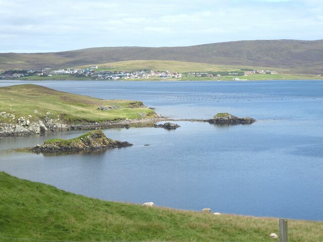
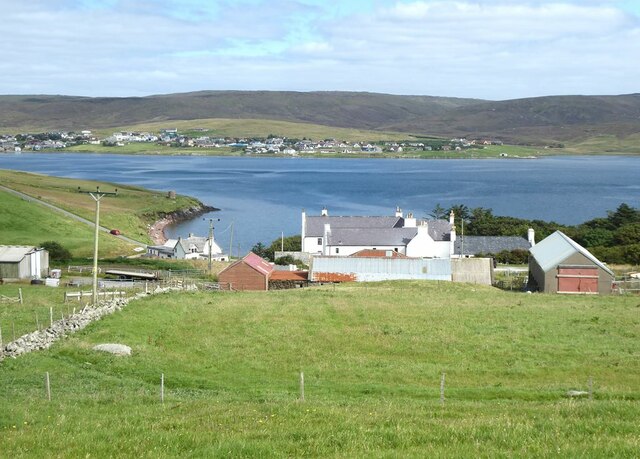
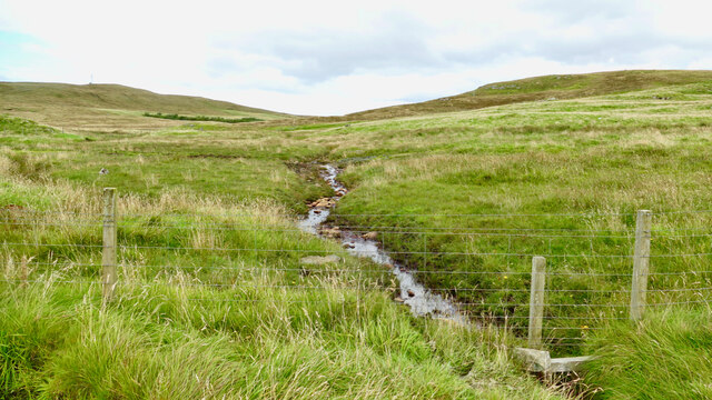
Gossaford, located in Shetland, is a prominent hill/mountain that stands tall amidst the picturesque landscape of the archipelago. With an elevation of approximately 270 meters (886 feet), it offers stunning panoramic views of the surrounding area. Gossaford is situated in the eastern part of Shetland, specifically on the island of Mainland, which is the largest and most populous island in the archipelago.

The hill/mountain is characterized by its rugged terrain, featuring steep slopes and rocky outcrops. Its distinctively jagged silhouette adds to the charm of the Shetland landscape. Gossaford is a popular destination for hikers and nature enthusiasts, attracting both locals and tourists who seek to explore its natural beauty and enjoy the serenity it offers.

The flora and fauna on Gossaford are diverse and unique to the Shetland region. The hill/mountain is home to various plant species, including heather, mosses, and grasses, which create a vibrant tapestry of colors during the summer months. Wildlife such as birds, including the iconic puffins, and small mammals can also be spotted in the area.

Accessible hiking trails lead adventurers to the summit of Gossaford, rewarding them with breathtaking views of the surrounding islands, coastal cliffs, and the vast expanse of the North Sea. The hill/mountain offers a sense of tranquility and solitude, making it an ideal spot for those seeking a peaceful escape from the hustle and bustle of daily life.

Overall, Gossaford in Shetland stands as a testament to the natural beauty and rugged charm of the region, providing visitors with a memorable experience and a chance to immerse themselves in the awe-inspiring landscapes of the archipelago.

If you have any feedback on the listing, please let us know in the comments section below.
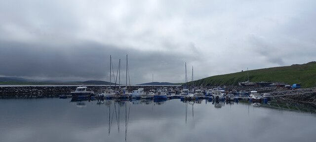
Gossaford Images

Images are sourced within 2km of 60.383812/-1.388377 or Grid Reference HU3366. Thanks to Geograph Open Source API. All images are credited.

Roe Sound and the road to Burn
Muckle Roe Marina The Marina is actually on the Mainland side of Roe Sound. The island of Crog Holm to the left.
Muckle Roe Marina
The Marina is actually on the Mainland side of Roe Sound. The island of Crog Holm to the left.
The Viora (LK177) Six ton shellfish fishing boat at the Muckle Roe Bridge jetty. The road to Brae climbs steeply up the hillside on the far side of the Sound.
The Viora (LK177)
Six ton shellfish fishing boat at the Muckle Roe Bridge jetty. The road to Brae climbs steeply up the hillside on the far side of the Sound.
Fishing paraphernalia  at Muckle Roe Bridge jetty Looking up Roe Sound with the island of Muckle Roe to the left.
Fishing paraphernalia at Muckle Roe Bridge jetty
Looking up Roe Sound with the island of Muckle Roe to the left.
Muckle Roe Bridge The original bridge between Mainland and the island of Muckle Roe (towards camera) was built in 1905, and was replaced in 1999.
Muckle Roe Bridge
The original bridge between Mainland and the island of Muckle Roe (towards camera) was built in 1905, and was replaced in 1999.
Burgastoo The small tidal rock of Burgastoo stands at the eastern entrance to Roe Sound (to the left). The village of Brae <a href="https://www.geograph.org.uk/gridref/HU3567">HU3567</a> can be seen at the head of Busta Voe.
Burgastoo
The small tidal rock of Burgastoo stands at the eastern entrance to Roe Sound (to the left). The village of Brae HU3567 can be seen at the head of Busta Voe.
Muckle Roe Bridge Linking the Mainland with the island of Muckle Roe. The original bridge was built in 1905, and was replaced in 1999.
Muckle Roe Bridge
Linking the Mainland with the island of Muckle Roe. The original bridge was built in 1905, and was replaced in 1999.
Houses at Busta
Houses at Busta
Rear view of the Busta Hotel The village of Brae <a href="https://www.geograph.org.uk/gridref/HU3567">HU3567</a> on the far side of the voe.
Rear view of the Busta Hotel
The village of Brae HU3567 on the far side of the voe.
The road from Busta to Brae
Kilka Water, Muckle Roe, Shetland Also known as the Glen Loch, this is considered by many to be the best fishing loch on the island of Muckle Roe. The loch is surrounded by rough grazing. This view shows the outlet burn.
Kilka Water, Muckle Roe, Shetland
Also known as the Glen Loch, this is considered by many to be the best fishing loch on the island of Muckle Roe. The loch is surrounded by rough grazing. This view shows the outlet burn.
West side of Brae in the snow
Busta House Hotel in the snow from Brae
Route from Orwick Water to Kilka Water, Muckle Roe, Shetland Kilka Water on Muckle Roe lies beyond the little rise, just left of centre.
Route from Orwick Water to Kilka Water, Muckle Roe, Shetland
Kilka Water on Muckle Roe lies beyond the little rise, just left of centre.
Delting Marina, Brae
Mavis Grind This is the narrowest land in the British Isles. The inlet on the right is an arm of the Atlantic Ocean; and on the left is Sullom Voe, which is an inlet of the North Sea.
Mavis Grind
This is the narrowest land in the British Isles. The inlet on the right is an arm of the Atlantic Ocean; and on the left is Sullom Voe, which is an inlet of the North Sea.
Bridge to Muckle Roe, Shetland This bridge links the Mainland to Muckle Roe. Photo taken looking south.
Bridge to Muckle Roe, Shetland
This bridge links the Mainland to Muckle Roe. Photo taken looking south.
Muckle Roe Bridge The older bridge to Muckle Roe.
Muckle Roe Bridge
The older bridge to Muckle Roe.
Show me another place!

Gossaford is located at Grid Ref: HU3366 (Lat: 60.383812, Lng: -1.388377)

Unitary Authority: Shetland Islands

Police Authority: Highlands and Islands

What 3 Words

///bright.rephrase.unlocking. Near Brae, Shetland Islands

Related Wikis

Mavis Grind

Mavis Grind (Old Norse: Mæfeiðs grind or Mæveiðs grind, meaning "gate of the narrow isthmus") is a narrow isthmus joining the Northmavine peninsula to...

Busta Voe

Busta Voe, (HU665350), in the north central Mainland, Shetland, is a sea inlet lying between the village of Brae and the island of Muckle Roe. At the head...

Brae

"Brae" is also the Lowland Scots language word for the slope or brow of a hill.Brae (Old Norse: Breiðeið, meaning "the wide isthmus") is a village on the...

Muckle Roe

Muckle Roe is an island in Shetland, Scotland, in St. Magnus Bay, to the west of Mainland. It has a population of around 130 people, who mainly croft and...

Linga, Busta Voe

Linga is a small, uninhabited island, 1 km (0.62 mi) east of Muckle Roe in the Shetland Islands. The island is roughly circular in shape and its highest...

Delting

Delting is a civil parish and community council area on Mainland, Shetland, Scotland. It includes the Sullom Voe oil terminal and its main settlements...

Papa Little

Papa Little (Scots: Papa Little; Old Norse: Papey Litla, meaning "the little island of the priests") is an island in St Magnus Bay, Shetland, Scotland...

Shetland

Shetland, also called the Shetland Islands and formerly Zetland, is an archipelago in Scotland lying between Orkney, the Faroe Islands, and Norway. It...

Nearby Amenities

Located within 500m of 60.383812,-1.388377
Power: pole
Lat/Long: 60.3855121/-1.3803989
Power: pole
Lat/Long: 60.3849567/-1.3802031
Power: pole
Lat/Long: 60.3843881/-1.3800234
Power: pole
Lat/Long: 60.3838102/-1.3798329
Power: pole
Lat/Long: 60.3833953/-1.3796881
Power: pole
Lat/Long: 60.3795298/-1.385715
The data included in this document is from www.openstreetmap.org. The data is made available under ODbL.

Have you been to Gossaford?

Leave your review of Gossaford below (or comments, questions and feedback).