Galloping Hill
Hill, Mountain in Durham
England
Galloping Hill

Galloping Hill is a prominent hill located in Durham, England. Rising to an elevation of approximately 276 meters (906 feet), it is considered one of the highest points in the region. Situated in the picturesque countryside, Galloping Hill offers breathtaking views of the surrounding landscape, including the Durham Dales and the rolling hills of North East England.
The hill is characterized by its gentle slopes and grassy terrain, making it a popular destination for hikers and nature enthusiasts. A network of well-maintained trails and footpaths allows visitors to explore the area and soak in the natural beauty. The hill is also known for its rich biodiversity, with a diverse range of plant and animal species calling it home.
Galloping Hill has a significant historical and cultural significance in the region. It is believed that the hill derived its name from the practice of galloping horses on its slopes, a tradition that was once popular among local equestrians. The hill also holds archaeological importance, with several prehistoric artifacts found in its vicinity.
The summit of Galloping Hill offers a commanding view of the surrounding countryside, making it an ideal spot for picnicking and relaxation. On clear days, visitors can enjoy panoramic vistas stretching as far as the eye can see. The hill is easily accessible by road and is located a short distance from the city of Durham, attracting both locals and tourists alike.
If you have any feedback on the listing, please let us know in the comments section below.
Galloping Hill Images
Images are sourced within 2km of 54.580657/-1.4881749 or Grid Reference NZ3320. Thanks to Geograph Open Source API. All images are credited.


Galloping Hill is located at Grid Ref: NZ3320 (Lat: 54.580657, Lng: -1.4881749)
Unitary Authority: Darlington
Police Authority: Durham
What 3 Words
///radio.either.paid. Near Bishopton, Co. Durham
Nearby Locations
Related Wikis
Great Stainton
Great Stainton is a village in the borough of Darlington and ceremonial county of County Durham, England. It is situated to the north of Darlington, and...

Newton Ketton Meadow
Newton Ketton Meadow is a Site of Special Scientific Interest in the Darlington district of Durham, England. It is situated alongside a small tributary...
Newton Ketton
Newton Ketton is a small village in County Durham, in England. It is situated to the north of Darlington. == External links == Media related to Newton...
Little Stainton
Little Stainton is a village in the borough of Darlington and the ceremonial county of County Durham, England. It is a township in the parish of Bishopton...

Barmpton
Barmpton is a small village and civil parish in the borough of Darlington and the ceremonial county of County Durham, England. The population taken at...
Bishopton, County Durham
Bishopton is a village in the borough of Darlington and the ceremonial county of County Durham, England. It is situated to the west of Stockton-on-Tees...

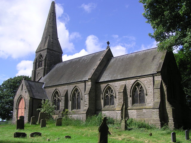
St Peter's Church, Bishopton
St Peter's Church is in the village of Bishopton, County Durham, England. It is an active Anglican parish church in the deanery of Stockton, the archdeaconry...

Bishopton Castle
Bishopton Castle was a medieval castle in Bishopton village, County Durham, England. The surviving motte is a Scheduled Ancient Monument. == Details... ==
Nearby Amenities
Located within 500m of 54.580657,-1.4881749Have you been to Galloping Hill?
Leave your review of Galloping Hill below (or comments, questions and feedback).