Amber Hill

Hill, Mountain in Derbyshire North East Derbyshire

England

Amber Hill

Home Farm Viewed from further down the hill on Whitelea Lane.
Home Farm Credit: Bill Boaden

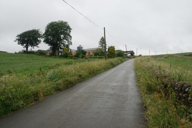
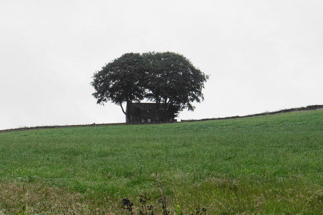
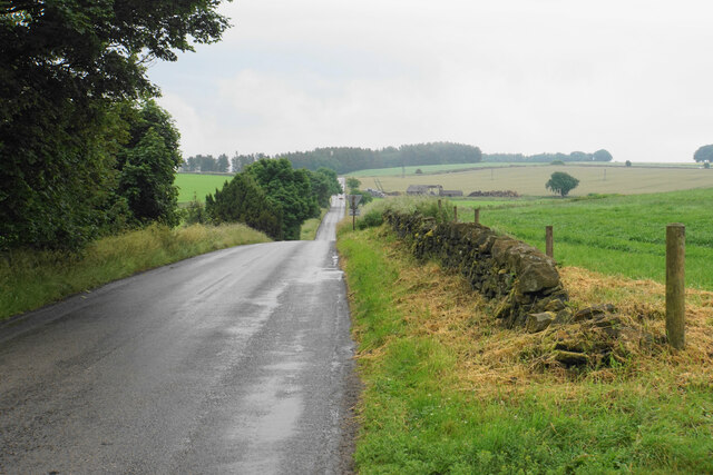
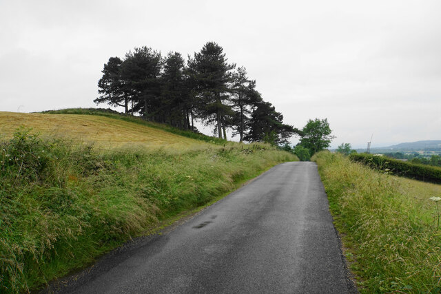
Amber Hill is a prominent hill located in the Derbyshire Dales, England. It stands at an elevation of approximately 383 meters (1,257 feet) above sea level, making it one of the highest points in the region. Situated near the village of Aldwark, Amber Hill offers breathtaking views of the surrounding countryside and is a popular destination for hikers, nature enthusiasts, and photographers.

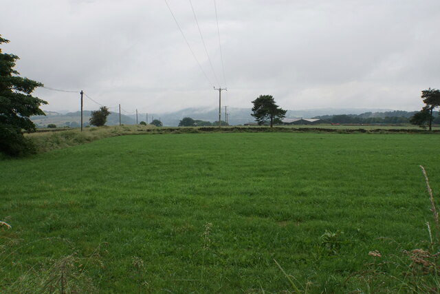
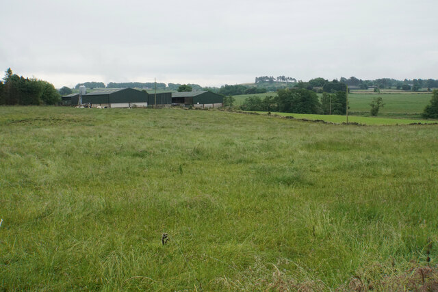
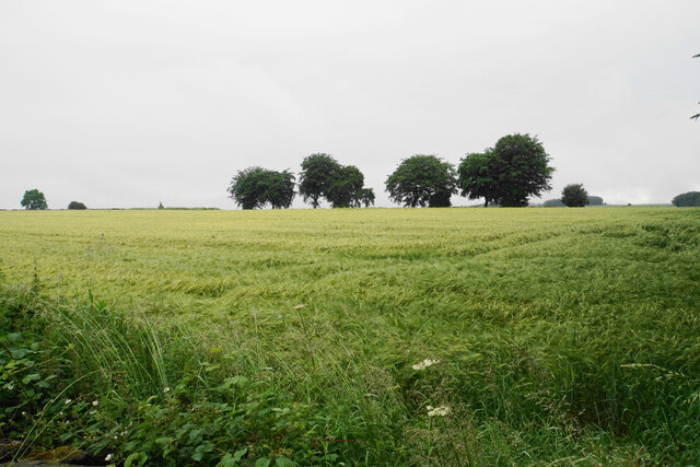
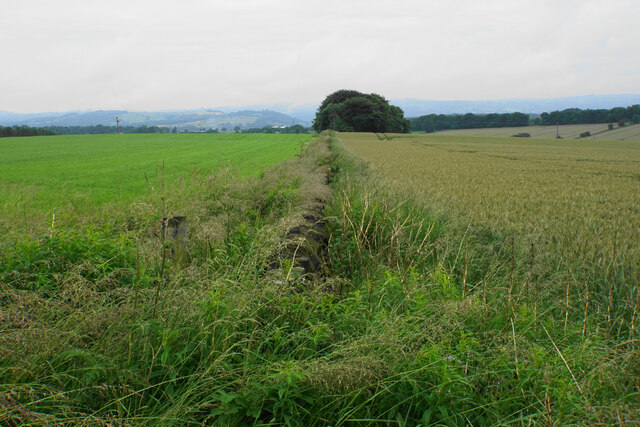
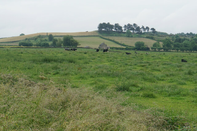
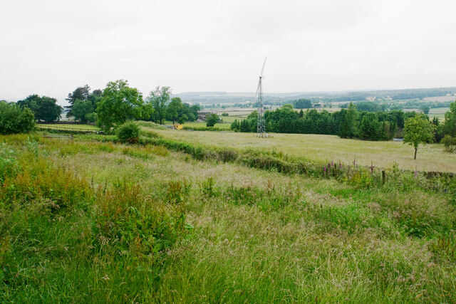
The hill is part of the Peak District National Park, renowned for its natural beauty and diverse wildlife. Amber Hill is predominantly covered in lush greenery, with a mix of grasslands, heathlands, and scattered trees. The area is home to a variety of plant species, including heather, gorse, and wildflowers, which add vibrant colors to the landscape throughout the year.

The summit of Amber Hill provides panoramic views of the surrounding Derbyshire countryside, with sights stretching as far as the eye can see. On clear days, visitors can enjoy vistas of rolling hills, meandering rivers, and picturesque villages nestled in the valleys below. It is also a fantastic spot to witness stunning sunrises and sunsets, creating an idyllic atmosphere.

For outdoor enthusiasts, Amber Hill offers a range of walking and hiking trails suitable for all ages and abilities. From gentle strolls to more challenging treks, there is something to suit every adventurer. The hill is a haven for birdwatchers as well, with various species of birds, including kestrels and buzzards, often spotted soaring above the hillside.

Overall, Amber Hill in Derbyshire is a captivating natural landmark, offering visitors a chance to immerse themselves in the beauty of the Peak District and experience the tranquility of the English countryside.

If you have any feedback on the listing, please let us know in the comments section below.

Amber Hill Images

Images are sourced within 2km of 53.158338/-1.5092195 or Grid Reference SK3262. Thanks to Geograph Open Source API. All images are credited.

Home Farm Viewed from further down the hill on Whitelea Lane.
Home Farm
Viewed from further down the hill on Whitelea Lane.
Barn above Tansley Knoll Seen in profile from down the hill on Whitelea Lane.
Barn above Tansley Knoll
Seen in profile from down the hill on Whitelea Lane.
Field on Tansley Moor Part of a plateau of farmland. The Derwent valley can be seen in the background though the view is still affected by recent rain.
Field on Tansley Moor
Part of a plateau of farmland. The Derwent valley can be seen in the background though the view is still affected by recent rain.
Field by North Carolina Farm A view from Lant Lane with Blakelow Hill in the background.
Field by North Carolina Farm
A view from Lant Lane with Blakelow Hill in the background.
Lant Lodge Farm Viewed from Lant Lane. There are Belted Galloways in the field, quite a common breed locally..
Lant Lodge Farm
Viewed from Lant Lane. There are Belted Galloways in the field, quite a common breed locally..
Barley field by Lant Lane Part of the plateau of farmland between the Amber and Derwent valleys.
Barley field by Lant Lane
Part of the plateau of farmland between the Amber and Derwent valleys.
Passing place on Lant Lane The passing place is marked by the lines on the road, but the road is in fact not any wider here at all.
Passing place on Lant Lane
The passing place is marked by the lines on the road, but the road is in fact not any wider here at all.
Fields below Amber Hill The Amber valley can be seen to the right. The fields slope down towards the valley. Eddlestow Hall Farm is seen straight ahead.
Fields below Amber Hill
The Amber valley can be seen to the right. The fields slope down towards the valley. Eddlestow Hall Farm is seen straight ahead.
Fields below Amber Hill Looking down the side of the A632 as it descends into the Amber valley. Further away you can see it as it begins to climb again through the village of Kelstedge.
Fields below Amber Hill
Looking down the side of the A632 as it descends into the Amber valley. Further away you can see it as it begins to climb again through the village of Kelstedge.
Top Slack Farm Now the site of a children's nursery.
Top Slack Farm
Now the site of a children's nursery.
Holestone Gate Road A fairly narrow and bumpy road that cuts through from the A632 to the A615 to miss out Matlock, but it is mostly straight.
Holestone Gate Road
A fairly narrow and bumpy road that cuts through from the A632 to the A615 to miss out Matlock, but it is mostly straight.
Ramshackle barn off Holestone Gate Road Not in the best state but still providing useful service as a store of silage bales.
Ramshackle barn off Holestone Gate Road
Not in the best state but still providing useful service as a store of silage bales.
Field boundary below Holestone Gate Road Despite the poor weather, the Derwent valley can be seen in the background with Riber Castle overlooking it.
Field boundary below Holestone Gate Road
Despite the poor weather, the Derwent valley can be seen in the background with Riber Castle overlooking it.
Farm buildings at Old Engine Farm A farm off Holestone Gate Road.
Farm buildings at Old Engine Farm
A farm off Holestone Gate Road.
Farm track and a field of oats Looking from Holestone Gate Road up to the top of the ridge near Cocking Tor.
Farm track and a field of oats
Looking from Holestone Gate Road up to the top of the ridge near Cocking Tor.
Cattle near Holestone Farm Blakelow Hill is only a small hill but still stands quite impressively behind the farm.
Cattle near Holestone Farm
Blakelow Hill is only a small hill but still stands quite impressively behind the farm.
Allen Lane On the top of Blakelow Hill.
Allen Lane
On the top of Blakelow Hill.
Access land on Blakelow Hill There is a small plot of access land on the western side of Blakelow Hill but it appears to be impenetrable scrub and there is no obvious way into it. The wind turbine belongs to Blakelow Farm which is in the trees.
Access land on Blakelow Hill
There is a small plot of access land on the western side of Blakelow Hill but it appears to be impenetrable scrub and there is no obvious way into it. The wind turbine belongs to Blakelow Farm which is in the trees.
Show me another place!

Amber Hill is located at Grid Ref: SK3262 (Lat: 53.158338, Lng: -1.5092195)

Administrative County: Derbyshire

District: North East Derbyshire

Police Authority: Derbyshire

What 3 Words

///calls.this.refers. Near Tansley, Derbyshire

Related Wikis

Ashover Butts railway station

Ashover Butts railway station was a railway station serving the village of Ashover in Derbyshire, England. It was the terminus of the 1 ft 11+1⁄2 in (597...

Salter Lane railway station

Salter Lane railway station co-served the village of Ashover, Derbyshire, England, from 1925 to 1936 on the Ashover Light Railway. == History == The station...

All Saints' Church, Ashover

All Saints’ Church, Ashover is a Grade I listed parish church in the Church of England in Ashover, Derbyshire. == History == The porch of the church dates...

Highfields School, Matlock

Highfields School is a coeducational secondary school and sixth form located in Matlock, Derbyshire, England. At the time of its September 2012 Ofsted...

Ashover

Ashover is a village and civil parish in the English county of Derbyshire. It is in the North East Derbyshire district of the county. The population of...

Rattle, Derbyshire

Rattle is a hamlet in the English county of Derbyshire. It is part of the village of Ashover. This portion of the village was the centre of stocking...

Bentley Brook

Bentley Brook is a stream in Derbyshire, England. It rises on Matlock Moor, flowing south through Cuckoostone Dale, under the A632, into Lumsdale, gathering...

Lumsdale Valley

Lumsdale Valley is a steep-sided wooded gorge in the Peak District near Matlock, Derbyshire, in England. It is the location of a series of historic water...

Nearby Amenities

Located within 500m of 53.158338,-1.5092195
Barrier: stile
Material: stone
Stile: stepover
Lat/Long: 53.1541317/-1.5101146
Passing Place
Lat/Long: 53.1560891/-1.510248
Parking
Description: Patch of gravel at side of road
Ele: 282.2706299
Lat/Long: 53.1600981/-1.5100141
Ele: 292
Lat/Long: 53.1598564/-1.5152291
Ele: 281
Lat/Long: 53.1598485/-1.5084551
Ele: 282
Lat/Long: 53.1598429/-1.5087056
Passing Place
Lat/Long: 53.1555095/-1.5102034
Passing Place
Lat/Long: 53.1565937/-1.510295
Passing Place
Lat/Long: 53.1574137/-1.5103713
Bench
Lat/Long: 53.1605564/-1.5076001
Barrier: cattle_grid
Lat/Long: 53.1623775/-1.5099483
Bus Stop
Lant Lane
Bus: yes
Public Transport: platform
Lat/Long: 53.1588684/-1.5113956
Bus Stop
Slack Lane
Bus: yes
Public Transport: platform
Lat/Long: 53.1619676/-1.505163
Bus Stop
Lant Lane
Bus: yes
Naptan AtcoCode: 1000DAHC3034
Naptan NaptanCode: dbsgmtpm
Public Transport: platform
Lat/Long: 53.1593641/-1.5099884
Give Way
Source: survey
Lat/Long: 53.1599052/-1.5093329
Slack Lane
Bus: yes
Public Transport: stop_position
Lat/Long: 53.1619987/-1.5052067
Lant Lane
Bus: yes
Public Transport: stop_position
Lat/Long: 53.1588261/-1.5113495
Lant Lane
Bus: yes
Public Transport: stop_position
Lat/Long: 53.1594039/-1.5100474
The data included in this document is from www.openstreetmap.org. The data is made available under ODbL.

Have you been to Amber Hill?

Leave your review of Amber Hill below (or comments, questions and feedback).