Bottom Moor

Wood, Forest in Derbyshire North East Derbyshire

England

Bottom Moor

Field on Tansley Moor Part of a plateau of farmland. The Derwent valley can be seen in the background though the view is still affected by recent rain.
Field on Tansley Moor Credit: Bill Boaden

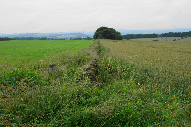
Bottom Moor is a picturesque woodland area located in Derbyshire, England. Spanning over a vast expanse of land, it is renowned for its natural beauty and diverse ecosystem. The wood is situated within the Peak District National Park, making it a popular destination for nature lovers and outdoor enthusiasts.

Bottom Moor is characterized by its dense forest cover, with towering oak, beech, and birch trees dominating the landscape. The woodland floor is carpeted with a rich variety of flora, including bluebells, wild garlic, and ferns, creating a vibrant and enchanting atmosphere. The area is also home to numerous species of wildlife, such as rabbits, deer, and a variety of bird species, making it a haven for nature enthusiasts and birdwatchers.

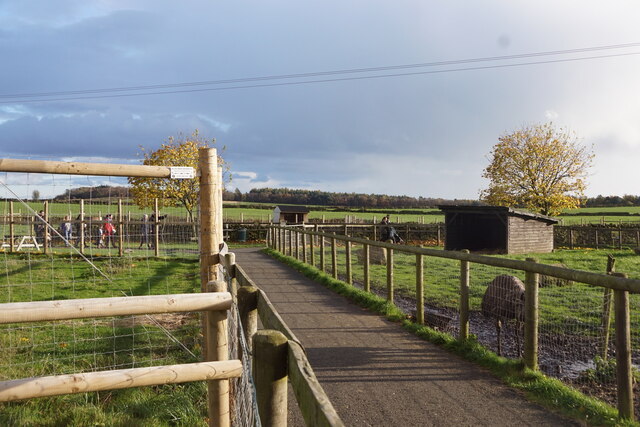
The wood is crisscrossed by a network of footpaths and trails, allowing visitors to explore its beauty at their own pace. These paths provide access to stunning viewpoints, hidden waterfalls, and tranquil ponds, enhancing the overall experience of being immersed in nature. The wood is also intersected by a small stream, adding to its charm and providing a serene ambiance.

Bottom Moor offers a range of recreational activities for visitors to enjoy. These include walking, hiking, cycling, and picnicking, making it an ideal spot for families and individuals seeking a peaceful escape from the hustle and bustle of everyday life. With its stunning natural scenery and abundant wildlife, Bottom Moor truly captures the essence of the English countryside and is a must-visit destination for nature enthusiasts.

If you have any feedback on the listing, please let us know in the comments section below.

Bottom Moor Images

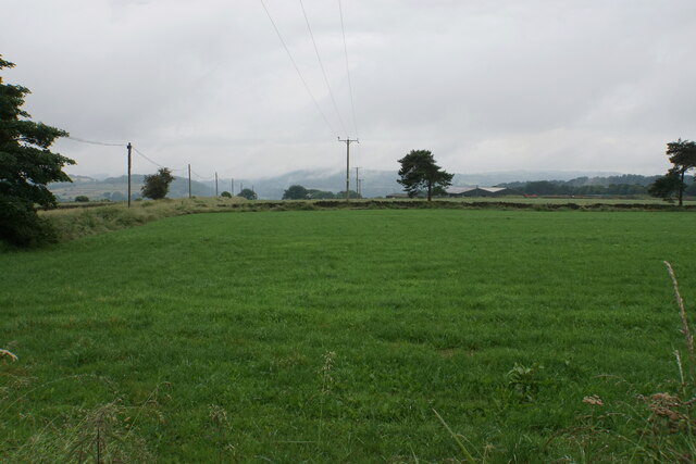
Images are sourced within 2km of 53.162278/-1.5208857 or Grid Reference SK3262. Thanks to Geograph Open Source API. All images are credited.

Field on Tansley Moor Part of a plateau of farmland. The Derwent valley can be seen in the background though the view is still affected by recent rain.
Field on Tansley Moor
Part of a plateau of farmland. The Derwent valley can be seen in the background though the view is still affected by recent rain.
Field by North Carolina Farm A view from Lant Lane with Blakelow Hill in the background.
Field by North Carolina Farm
A view from Lant Lane with Blakelow Hill in the background.
Lant Lodge Farm Viewed from Lant Lane. There are Belted Galloways in the field, quite a common breed locally..
Lant Lodge Farm
Viewed from Lant Lane. There are Belted Galloways in the field, quite a common breed locally..
Barley field by Lant Lane Part of the plateau of farmland between the Amber and Derwent valleys.
Barley field by Lant Lane
Part of the plateau of farmland between the Amber and Derwent valleys.
Passing place on Lant Lane The passing place is marked by the lines on the road, but the road is in fact not any wider here at all.
Passing place on Lant Lane
The passing place is marked by the lines on the road, but the road is in fact not any wider here at all.
Fields below Amber Hill The Amber valley can be seen to the right. The fields slope down towards the valley. Eddlestow Hall Farm is seen straight ahead.
Fields below Amber Hill
The Amber valley can be seen to the right. The fields slope down towards the valley. Eddlestow Hall Farm is seen straight ahead.
Fields below Amber Hill Looking down the side of the A632 as it descends into the Amber valley. Further away you can see it as it begins to climb again through the village of Kelstedge.
Fields below Amber Hill
Looking down the side of the A632 as it descends into the Amber valley. Further away you can see it as it begins to climb again through the village of Kelstedge.
Top Slack Farm Now the site of a children's nursery.
Top Slack Farm
Now the site of a children's nursery.
Holestone Gate Road A fairly narrow and bumpy road that cuts through from the A632 to the A615 to miss out Matlock, but it is mostly straight.
Holestone Gate Road
A fairly narrow and bumpy road that cuts through from the A632 to the A615 to miss out Matlock, but it is mostly straight.
Ramshackle barn off Holestone Gate Road Not in the best state but still providing useful service as a store of silage bales.
Ramshackle barn off Holestone Gate Road
Not in the best state but still providing useful service as a store of silage bales.
Field boundary below Holestone Gate Road Despite the poor weather, the Derwent valley can be seen in the background with Riber Castle overlooking it.
Field boundary below Holestone Gate Road
Despite the poor weather, the Derwent valley can be seen in the background with Riber Castle overlooking it.
Farm buildings at Old Engine Farm A farm off Holestone Gate Road.
Farm buildings at Old Engine Farm
A farm off Holestone Gate Road.
Farm track and a field of oats Looking from Holestone Gate Road up to the top of the ridge near Cocking Tor.
Farm track and a field of oats
Looking from Holestone Gate Road up to the top of the ridge near Cocking Tor.
Matlock Farm Park
Matlock Farm Park
Pumpkins, Matlock Farm Park
Emu, Matlock Farm Park
Meerkats, Matlock Farm Park
Graves in the Halloween Spooky Wood, Matlock Farm Park
Show me another place!

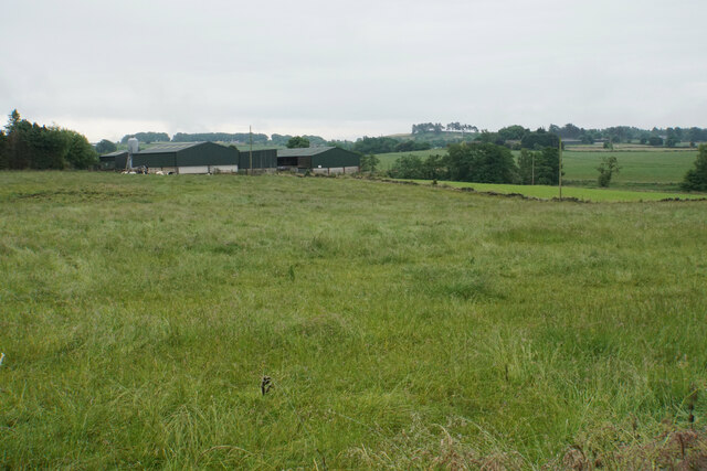
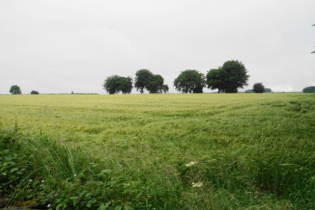
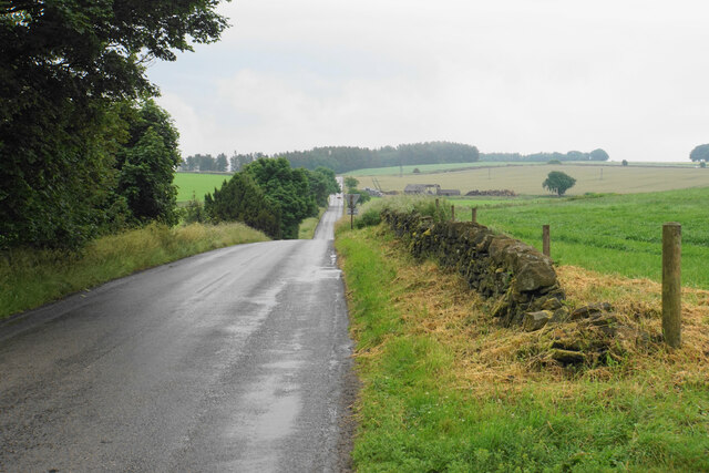
Bottom Moor is located at Grid Ref: SK3262 (Lat: 53.162278, Lng: -1.5208857)

Administrative County: Derbyshire

District: North East Derbyshire

Police Authority: Derbyshire

What 3 Words

///oval.stow.seated. Near Tansley, Derbyshire

Related Wikis

Highfields School, Matlock

Highfields School is a coeducational secondary school and sixth form located in Matlock, Derbyshire, England. At the time of its September 2012 Ofsted...

Ashover Butts railway station

Ashover Butts railway station was a railway station serving the village of Ashover in Derbyshire, England. It was the terminus of the 1 ft 11+1⁄2 in (597...

Bentley Brook

Bentley Brook is a stream in Derbyshire, England. It rises on Matlock Moor, flowing south through Cuckoostone Dale, under the A632, into Lumsdale, gathering...

Lumsdale Valley

Lumsdale Valley is a steep-sided wooded gorge in the Peak District near Matlock, Derbyshire, in England. It is the location of a series of historic water...

Salter Lane railway station

Salter Lane railway station co-served the village of Ashover, Derbyshire, England, from 1925 to 1936 on the Ashover Light Railway. == History == The station...

Rattle, Derbyshire

Rattle is a hamlet in the English county of Derbyshire. It is part of the village of Ashover. This portion of the village was the centre of stocking...

All Saints' Church, Ashover

All Saints’ Church, Ashover is a Grade I listed parish church in the Church of England in Ashover, Derbyshire. == History == The porch of the church dates...

Farley, Derbyshire

Farley is a hamlet in the Derbyshire Dales district, in the English county of Derbyshire. It is near the town of Matlock. The nearest main road is the...

Nearby Amenities

Located within 500m of 53.162278,-1.5208857
Parking
Description: Patch of dirt N and S of road
Ele: 313.0325928
Lat/Long: 53.1659636/-1.5207021
Parking
Lat/Long: 53.1657739/-1.5209703
Barrier: stile
Stile: squeezer
Lat/Long: 53.1658089/-1.5178301
Barrier: stile
Ele: 305.8228760
Steps: 2
Stile: stepover
Lat/Long: 53.1647415/-1.5160887
Ele: 302
Lat/Long: 53.1634069/-1.5153023
Ele: 291.8837891
Lat/Long: 53.1608601/-1.5236821
Ele: 292.6047363
Lat/Long: 53.1624806/-1.5260957
Ele: 307.5051270
Lat/Long: 53.1644061/-1.5233591
Ele: 319.2812500
Lat/Long: 53.1656907/-1.5212341
Ele: 312.3116455
Lat/Long: 53.1655235/-1.5248934
Ele: 293.8063965
Lat/Long: 53.1625588/-1.520674
Ele: 303.1791992
Lat/Long: 53.1638602/-1.5182734
Ele: 271.6962891
Lat/Long: 53.1612009/-1.5281182
Ele: 285.3950195
Lat/Long: 53.1628105/-1.5270677
Ele: 285.3950195
Lat/Long: 53.1627116/-1.526492
Ele: 292
Lat/Long: 53.1598564/-1.5152291
Ele: 275.0609131
Lat/Long: 53.1583303/-1.5237461
Parking
Description: Patch of gravel at side of road
Lat/Long: 53.1662501/-1.5213875
Ele: 272
Lat/Long: 53.1584133/-1.5241135
Ele: 270
Lat/Long: 53.1589615/-1.5253894
Parking
Description: Patch of gravel
Ele: 307.0000000
Lat/Long: 53.1646268/-1.5185022
Ele: 303.0000000
Lat/Long: 53.1634404/-1.5173899
Give Way
Source: survey
Lat/Long: 53.1641746/-1.5178353
Barrier: entrance
Source: survey;gps
Lat/Long: 53.1640303/-1.5179469
The data included in this document is from www.openstreetmap.org. The data is made available under ODbL.

Have you been to Bottom Moor?

Leave your review of Bottom Moor below (or comments, questions and feedback).