Mollington Hill

Hill, Mountain in Warwickshire Warwick

England

Mollington Hill

Othello Avenue  Sunrise following snow
Othello Avenue Credit: Timothy Santon

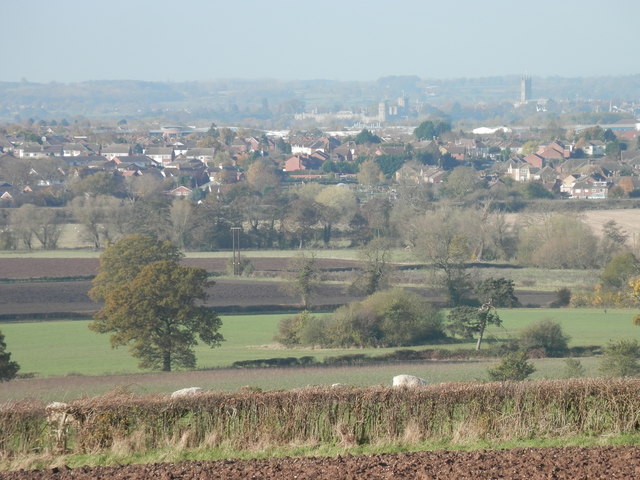
Mollington Hill is a prominent geographical feature located in the county of Warwickshire, England. Situated near the village of Mollington, the hill is part of the wider landscape of the North Warwickshire countryside. While it would be more accurate to classify Mollington Hill as a prominent local hill rather than a mountain, it still holds great significance in the local topography.

Rising to an elevation of about 150 meters, Mollington Hill offers breathtaking panoramic views of the surrounding countryside. The hill is distinctively shaped, with a gentle slope on one side and a steeper incline on the other. This unique formation makes it a popular spot for hikers, walkers, and nature enthusiasts alike.

Mollington Hill is covered in lush green vegetation, with a combination of grasses, shrubs, and trees adorning its slopes. The hill is home to a diverse range of flora and fauna, attracting wildlife such as rabbits, deer, and various bird species.

The hill has historical significance as well, with evidence of human habitation dating back to ancient times. Archaeological surveys have identified the presence of Iron Age settlements in the surrounding area, indicating that Mollington Hill may have played a role in ancient communities.

Overall, Mollington Hill is a picturesque and historically rich landmark of Warwickshire. Its natural beauty and cultural heritage make it a must-visit destination for those seeking to explore the region's scenic countryside.

If you have any feedback on the listing, please let us know in the comments section below.

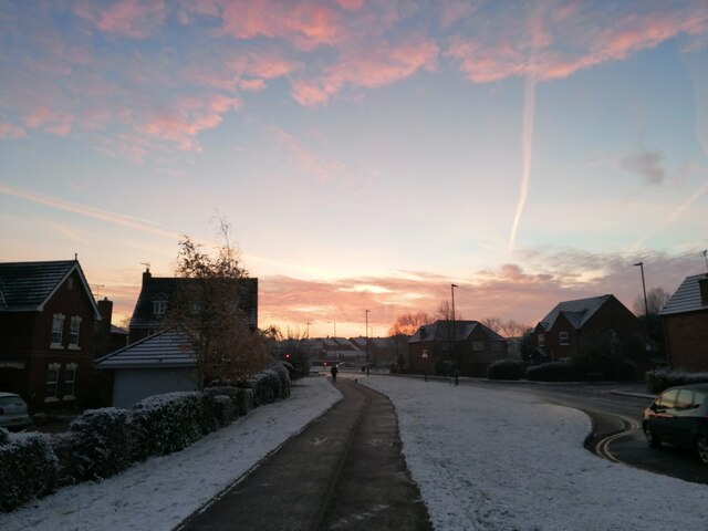
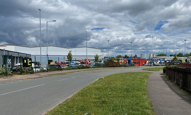
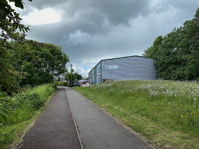
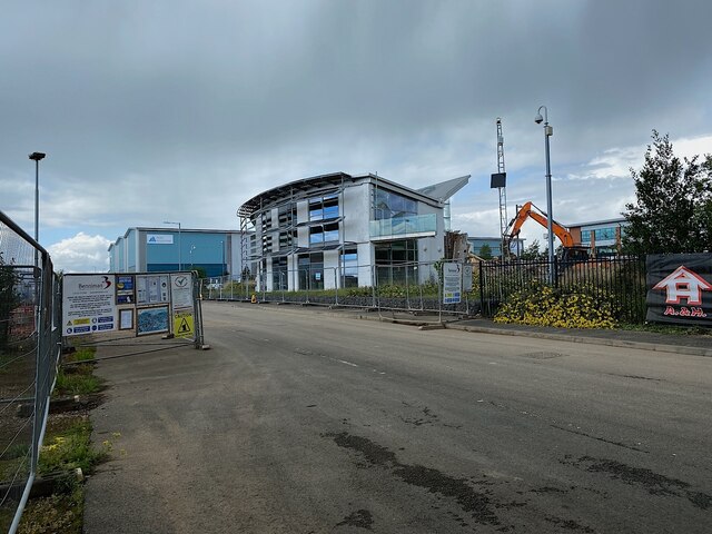
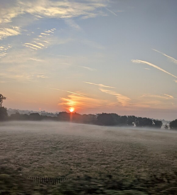
Mollington Hill Images

Images are sourced within 2km of 52.257878/-1.5205916 or Grid Reference SP3262. Thanks to Geograph Open Source API. All images are credited.

Othello Avenue  Sunrise following snow
Othello Avenue
Sunrise following snow
Bus depot, Poseidon Way, Royal Leamington Spa With the development of the land north of Leamington Spa station – De Normanville Avenue flats and houses <a href="https://www.geograph.org.uk/photo/7011163">SP3165 : West on De Normanville Avenue, Royal Leamington Spa</a> – Stagecoach has moved its bus depot to an industrial estate in south Leamington.
Bus depot, Poseidon Way, Royal Leamington Spa
With the development of the land north of Leamington Spa station – De Normanville Avenue flats and houses SP3165 : West on De Normanville Avenue, Royal Leamington Spa – Stagecoach has moved its bus depot to an industrial estate in south Leamington.
Leafy start to a footpath and cycleway, Trident Park, south Leamington The nearest unit is for Presto Music, who have a shop in the town centre <span class="nowrap"><a title="https://www.prestomusic.com/shop" rel="nofollow ugc noopener" href="https://www.prestomusic.com/shop">Link</a><img style="margin-left:2px;" alt="External link" title="External link - shift click to open in new window" src="https://s1.geograph.org.uk/img/external.png" width="10" height="10"/></span>
Here's how the scene looked in 2015 <a href="https://www.geograph.org.uk/photo/5204482">SP3163 : Shared path between Tachbrook Road and the Trident Business Centre, Whitnash</a>.
Leafy start to a footpath and cycleway, Trident Park, south Leamington
The nearest unit is for Presto Music, who have a shop in the town centre LinkExternal link Here's how the scene looked in 2015 SP3163 : Shared path between Tachbrook Road and the Trident Business Centre, Whitnash.
Estate road into Spa Park, south Leamington Spa Park is a large industrial estate. At the time of the photo there were signs at entrances advertising units of 30,000-290,000 square feet to let for offices, R&D, production and distribution, and 4 new speculative units of 24,000-50,000 square feet to let from Q4 2022. Ahead in the photo is the demolition of the Sustainable Building Centre <a href="https://www.geograph.org.uk/photo/1422731">SP3163 : Sustainable Building Centre, Wolseley site, Spa Park, south Leamington</a>. It showcased products from Wolseley UK, the building and plumbing supplies behemoth that had opened warehouses and its HQ here. Outside the UK and Canada it is Ferguson plc. Wolseley UK was sold to a private equity firm in 2021 <span class="nowrap"><a title="https://en.wikipedia.org/wiki/Ferguson_plc" rel="nofollow ugc noopener" href="https://en.wikipedia.org/wiki/Ferguson_plc">Link</a><img style="margin-left:2px;" alt="External link" title="External link - shift click to open in new window" src="https://s1.geograph.org.uk/img/external.png" width="10" height="10"/></span>. The big shed in the background bears the logo of Iron Mountain, a data storage company.
Estate road into Spa Park, south Leamington
Spa Park is a large industrial estate. At the time of the photo there were signs at entrances advertising units of 30,000-290,000 square feet to let for offices, R&D, production and distribution, and 4 new speculative units of 24,000-50,000 square feet to let from Q4 2022. Ahead in the photo is the demolition of the Sustainable Building Centre SP3163 : Sustainable Building Centre, Wolseley site, Spa Park, south Leamington. It showcased products from Wolseley UK, the building and plumbing supplies behemoth that had opened warehouses and its HQ here. Outside the UK and Canada it is Ferguson plc. Wolseley UK was sold to a private equity firm in 2021 LinkExternal link. The big shed in the background bears the logo of Iron Mountain, a data storage company.
Rehabilitation Hospital, Heathcote, Leamington One of the two vehicular entrances to the site. The hospital has expanded over the years, taking patients from beyond Warwickshire. There are units for treating brain injuries and strokes. <span class="nowrap"><a title="https://www.swft.nhs.uk/our-hospitals/leamington-spa-hospital" rel="nofollow ugc noopener" href="https://www.swft.nhs.uk/our-hospitals/leamington-spa-hospital">Link</a><img style="margin-left:2px;" alt="External link" title="External link - shift click to open in new window" src="https://s1.geograph.org.uk/img/external.png" width="10" height="10"/></span>
Rehabilitation Hospital, Heathcote, Leamington
One of the two vehicular entrances to the site. The hospital has expanded over the years, taking patients from beyond Warwickshire. There are units for treating brain injuries and strokes. LinkExternal link
Whitnash Lodge and Heathcote Lane, Leamington The extended Whitnash Lodge is believed to be the unit of the Rehabilitation Hospital that treats brain injuries. For a little history see <a title="https://www.geograph.org.uk/photo/6414082" href="https://www.geograph.org.uk/photo/6414082">Link</a> The Central England Brain Injury Charity raises funds to enhance the facilities at the Central England Rehabilitation Unit (CERU): <span class="nowrap"><a title="http://www.ceru.co.uk/?fbclid=IwAR111-mmr13zPvnIB-EobP1Or5cAJ-UHjMqGAann2suHG6FAatv-Dj72CQQ" rel="nofollow ugc noopener" href="http://www.ceru.co.uk/?fbclid=IwAR111-mmr13zPvnIB-EobP1Or5cAJ-UHjMqGAann2suHG6FAatv-Dj72CQQ">Link</a><img style="margin-left:2px;" alt="External link" title="External link - shift click to open in new window" src="https://s1.geograph.org.uk/img/external.png" width="10" height="10"/></span>
Whitnash Lodge and Heathcote Lane, Leamington
The extended Whitnash Lodge is believed to be the unit of the Rehabilitation Hospital that treats brain injuries. For a little history see Link The Central England Brain Injury Charity raises funds to enhance the facilities at the Central England Rehabilitation Unit (CERU): LinkExternal link
Circulation and parking, Leamington Rehab Hospital Also known as Heathcote Hospital; for a little history see <a title="https://www.geograph.org.uk/photo/6414082" href="https://www.geograph.org.uk/photo/6414082">Link</a>
Access to the fenced compound, left, is clearly restricted, arousing curiosity, but there are no clues.
Circulation and parking, Leamington Rehab Hospital
Also known as Heathcote Hospital; for a little history see Link Access to the fenced compound, left, is clearly restricted, arousing curiosity, but there are no clues.
Shed, industrial estate, Leamington The access is from Delphi Close. All the roads have a Greek flavour.
Shed, industrial estate, Leamington
The access is from Delphi Close. All the roads have a Greek flavour.
Exchange Place, business park, Leamington
Townside stand at Leamington FC Part of the Townside stand at Leamington FC
Townside stand at Leamington FC
Part of the Townside stand at Leamington FC
Sheepside, Leamington FC A photo of the Mick Brady Stand on the Sheepside of Leamington FC
Sheepside, Leamington FC
A photo of the Mick Brady Stand on the Sheepside of Leamington FC
Mick Brady Stand, Leamington FC A photo of the Mick Brady stand and dugouts at Leamington FC
Mick Brady Stand, Leamington FC
A photo of the Mick Brady stand and dugouts at Leamington FC
Sunrise over mist covered field, Witnash
Whitnash from Crown Hill Warwick Castle and St.Mary's Church, Warwick in background.
Whitnash from Crown Hill
Warwick Castle and St.Mary's Church, Warwick in background.
Warwick Gates Community Church and church hall, Cressida Close, Leamington This is part of a local centre for the Warwick Gates estate and passing trade on Heathcote Lane. There's a doctor's surgery to the left and local shops, including a Co-op convenience store, to the right.
Warwick Gates Community Church and church hall, Cressida Close, Leamington
This is part of a local centre for the Warwick Gates estate and passing trade on Heathcote Lane. There's a doctor's surgery to the left and local shops, including a Co-op convenience store, to the right.
Junction of Poseidon Way and Heathcote Lane, south Leamington Business and industry in south Leamington are still undergoing a slow transformation. On the left, Exchange Place, possibly home to the Focus Learning Trust; some websites say it is available to rent. The long white fascia is on the ageing single-storey premises of Caparo. Beyond it the colossal Wolseley warehouse for building materials and components, dating from just before the financial crisis of 2008: unfortunate timing <a href="https://www.geograph.org.uk/photo/1419432">SP3164 : Wolseley, loading bays, Spa Park, Leamington Spa</a>. The fence on the right is to the garden of the more recent Royal Horse public house.
Junction of Poseidon Way and Heathcote Lane, south Leamington
Business and industry in south Leamington are still undergoing a slow transformation. On the left, Exchange Place, possibly home to the Focus Learning Trust; some websites say it is available to rent. The long white fascia is on the ageing single-storey premises of Caparo. Beyond it the colossal Wolseley warehouse for building materials and components, dating from just before the financial crisis of 2008: unfortunate timing SP3164 : Wolseley, loading bays, Spa Park, Leamington Spa. The fence on the right is to the garden of the more recent Royal Horse public house.
Garden of the Royal Horse public house, Heathcote Lane, Leamington The shiny building on the right is the new Engineering Facility for Warwick Trident College, part of the Warwickshire College Group. The church spire on the skyline is of St John's, Tachbrook Street. There are glimpses of businesses and industry in the area.
Garden of the Royal Horse public house, Heathcote Lane, Leamington
The shiny building on the right is the new Engineering Facility for Warwick Trident College, part of the Warwickshire College Group. The church spire on the skyline is of St John's, Tachbrook Street. There are glimpses of businesses and industry in the area.
Engineering Facility, Warwick Trident College, Poseidon Way, Leamington It's part of the Warwickshire College Group of further education sites in the county. In the background is another, older part of the group, the Trident Technology and Business Centre.
Engineering Facility, Warwick Trident College, Poseidon Way, Leamington
It's part of the Warwickshire College Group of further education sites in the county. In the background is another, older part of the group, the Trident Technology and Business Centre.
Show me another place!

Mollington Hill is located at Grid Ref: SP3262 (Lat: 52.257878, Lng: -1.5205916)

Administrative County: Warwickshire

District: Warwick

Police Authority: Warwickshire

What 3 Words

///will.agent.maps. Near Royal Leamington Spa, Warwickshire

Related Wikis

Nearby Amenities

Located within 500m of 52.257878,-1.5205916
Direction: both
Surface: paving_stones
Traffic Calming: table
Lat/Long: 52.2596244/-1.5248999
Direction: both
Surface: paving_stones
Traffic Calming: table
Lat/Long: 52.2594654/-1.5263044
Barrier: kerb
Kerb: lowered
Tactile Paving: no
Lat/Long: 52.2619324/-1.523552
Barrier: kerb
Kerb: lowered
Tactile Paving: no
Lat/Long: 52.2610547/-1.5242141
Direction: both
Surface: paving_stones
Traffic Calming: table
Lat/Long: 52.2605633/-1.5252287
Give Way
Direction: 70
Road Marking: GB:1003A
Lat/Long: 52.2596972/-1.5263969
Barrier: kerb
Kerb: lowered
Tactile Paving: yes
Lat/Long: 52.259753/-1.5263849
Give Way
Direction: 255
Road Marking: GB:1003A
Lat/Long: 52.2600008/-1.5251949
Barrier: kerb
Kerb: lowered
Tactile Paving: yes
Lat/Long: 52.2599516/-1.5266766
Give Way
Direction: 245
Road Marking: GB:1003A
Lat/Long: 52.2599363/-1.5266208
Barrier: kerb
Kerb: lowered
Tactile Paving: yes
Lat/Long: 52.2598994/-1.526649
Barrier: kerb
Kerb: raised
Tactile Paving: no
Lat/Long: 52.2613875/-1.5251253
Give Way
Direction: 270
Road Marking: GB:1003A
Lat/Long: 52.2613352/-1.5251126
Barrier: kerb
Kerb: raised
Tactile Paving: no
Lat/Long: 52.2593041/-1.5270911
Barrier: kerb
Kerb: lowered
Tactile Paving: no
Lat/Long: 52.2601834/-1.5239863
Barrier: kerb
Kerb: lowered
Tactile Paving: no
Lat/Long: 52.2601771/-1.524288
Barrier: kerb
Kerb: raised
Tactile Paving: no
Lat/Long: 52.2598921/-1.5242103
Noexit: yes
Lat/Long: 52.2610298/-1.5241627
Give Way
Direction: 70
Road Marking: GB:1003A
Lat/Long: 52.2601805/-1.5266807
Barrier: kerb
Kerb: lowered
Tactile Paving: yes
Lat/Long: 52.2605433/-1.5251411
Give Way
Direction: 90
Road Marking: GB:1003A
Lat/Long: 52.2605637/-1.525189
Barrier: kerb
Kerb: lowered
Tactile Paving: yes
Lat/Long: 52.2605958/-1.5251372
Barrier: kerb
Kerb: raised
Tactile Paving: no
Lat/Long: 52.2618444/-1.5238437
Barrier: kerb
Kerb: lowered
Tactile Paving: no
Lat/Long: 52.2612256/-1.5243303
Barrier: kerb
Kerb: lowered
Tactile Paving: no
Lat/Long: 52.2610514/-1.5241781
Barrier: kerb
Kerb: raised
Tactile Paving: no
Lat/Long: 52.2610581/-1.5242505
Barrier: kerb
Kerb: lowered
Tactile Paving: yes
Lat/Long: 52.2594798/-1.5263926
Give Way
Direction: 250
Lat/Long: 52.2594562/-1.5263377
Barrier: kerb
Kerb: lowered
Tactile Paving: yes
Lat/Long: 52.2594234/-1.5263579
Give Way
Direction: 65
Road Marking: GB:1003A
Lat/Long: 52.2596334/-1.5248693
Barrier: kerb
Kerb: lowered
Tactile Paving: no
Lat/Long: 52.2589675/-1.5256819
Direction: both
Surface: paving_stones
Traffic Calming: hump
Lat/Long: 52.2601684/-1.5251924
Barrier: kerb
Kerb: raised
Tactile Paving: no
Lat/Long: 52.2621713/-1.5197776
Barrier: bollard
Bollard: removable
Material: metal
Lat/Long: 52.2599146/-1.5241886
Barrier: bollard
Bollard: removable
Material: metal
Lat/Long: 52.2599096/-1.5242158
Barrier: bollard
Bollard: removable
Material: metal
Lat/Long: 52.2601282/-1.5242045
Barrier: bollard
Bollard: removable
Material: metal
Lat/Long: 52.2601277/-1.5242286
Barrier: kerb
Kerb: raised
Tactile Paving: no
Lat/Long: 52.259341/-1.5267868
Crossing
Crossing: unmarked
Crossing Island: no
Crossing Markings: no
Kerb: lowered
Tactile Paving: yes
Lat/Long: 52.2599256/-1.5266628
Barrier: kerb
Kerb: raised
Tactile Paving: no
Lat/Long: 52.2601491/-1.5241954
Barrier: kerb
Kerb: lowered
Tactile Paving: no
Lat/Long: 52.2601506/-1.5241126
Brand: National Grid
Brand Wikidata: Q1465461
Material: metal
Operator: National Grid Electricity Distribution
Operator Old: Western Power Distribution
Operator Wikidata: Q7988183
Owner: National Grid Electricity Distribution (East Midlands) Plc
Owner Wikidata: Q114348127
Power: tower
Structure: lattice
Lat/Long: 52.2535431/-1.5198517
Brand: National Grid
Brand Wikidata: Q1465461
Material: metal
Operator: National Grid Electricity Distribution
Operator Old: Western Power Distribution
Operator Wikidata: Q7988183
Owner: National Grid Electricity Distribution (East Midlands) Plc
Owner Wikidata: Q114348127
Power: tower
Source: bing
Structure: lattice
Lat/Long: 52.2559143/-1.5224452
Brand: National Grid
Brand Wikidata: Q1465461
Location Transition: yes
Material: metal
Operator: National Grid Electricity Distribution
Operator Old: Western Power Distribution
Operator Wikidata: Q7988183
Owner: National Grid Electricity Distribution (East Midlands) Plc
Owner Wikidata: Q114348127
Power: tower
Ref: DK 15
Source: bing
Structure: lattice
Lat/Long: 52.2581822/-1.5257822
Barrier: height_restrictor
Maxheight: 1.98
Lat/Long: 52.2550093/-1.524929
Barrier: kerb
Kerb: lowered
Tactile Paving: yes
Lat/Long: 52.2619046/-1.5179466
Noexit: yes
Lat/Long: 52.2608348/-1.5171807
Crossing
Crossing: unmarked
Crossing Island: no
Crossing Markings: no
Kerb: lowered
Tactile Paving: yes
Lat/Long: 52.2594494/-1.5263736
Crossing
Crossing: unmarked
Crossing Island: no
Crossing Markings: no
Kerb: lowered
Tactile Paving: yes
Lat/Long: 52.259706/-1.5263579
Crossing
Crossing: unmarked
Crossing Island: no
Crossing Markings: no
Kerb: lowered
Tactile Paving: yes
Lat/Long: 52.2601909/-1.5266414
Direction: forward
Traffic Sign: GB:816.1
Traffic Sign Direction: forward
Traffic Sign Forward: GB:816.1
Lat/Long: 52.259646/-1.5248226
Crossing
Crossing: unmarked
Crossing Island: no
Crossing Markings: no
Kerb: lowered
Tactile Paving: yes
Lat/Long: 52.2599937/-1.525239
Crossing
Crossing: unmarked
Crossing Island: no
Crossing Markings: no
Kerb: lowered
Tactile Paving: yes
Lat/Long: 52.2605643/-1.5251393
Crossing
Crossing: unmarked
Crossing Island: no
Crossing Markings: no
Kerb: raised
Tactile Paving: no
Lat/Long: 52.2613361/-1.5251356
Barrier: kerb
Kerb: lowered
Tactile Paving: yes
Lat/Long: 52.26133/-1.5177731
Noexit: yes
Lat/Long: 52.2617478/-1.5172923
Barrier: kerb
Kerb: lowered
Tactile Paving: yes
Lat/Long: 52.2615272/-1.518009
Street Lamp
Direction: 290
Lamp Mount: straight_mast
Lamp Type: led
Man Made: utility_pole
Material: steel
Ref: 4
Support: pole
Lat/Long: 52.2618435/-1.5178428
Street Lamp
Direction: 210
Lamp Mount: straight_mast
Lamp Type: led
Man Made: utility_pole
Material: steel
Ref: 1
Support: pole
Lat/Long: 52.2619495/-1.5181099
Street Lamp
Direction: 210
Lamp Mount: straight_mast
Lamp Type: led
Man Made: utility_pole
Material: steel
Ref: 2
Support: pole
Lat/Long: 52.2620724/-1.5184847
Street Lamp
Direction: 30
Lamp Mount: straight_mast
Lamp Type: led
Man Made: utility_pole
Material: steel
Ref: 3
Support: pole
Lat/Long: 52.2621235/-1.5188758
Street Lamp
Direction: 270
Lamp Mount: straight_mast
Lamp Type: led
Man Made: utility_pole
Material: steel
Ref: 5
Support: pole
Lat/Long: 52.2615508/-1.5178729
Street Lamp
Direction: 350
Lamp Mount: straight_mast
Lamp Type: led
Man Made: utility_pole
Material: steel
Ref: 1
Support: pole
Lat/Long: 52.2614336/-1.5181782
Street Lamp
Direction: 200
Lamp Mount: straight_mast
Lamp Type: led
Man Made: utility_pole
Material: steel
Ref: 2
Support: pole
Lat/Long: 52.2615594/-1.5185577
Street Lamp
Direction: 20
Lamp Mount: straight_mast
Lamp Type: led
Man Made: utility_pole
Material: steel
Ref: 3
Support: pole
Lat/Long: 52.2615958/-1.5190994
Street Lamp
Direction: 60
Lamp Mount: straight_mast
Lamp Type: led
Man Made: utility_pole
Material: steel
Ref: 4
Support: pole
Lat/Long: 52.2615769/-1.5194882
Barrier: bollard
Bollard: fixed
Material: wood
Lat/Long: 52.2615159/-1.5186974
Barrier: bollard
Bollard: fixed
Material: wood
Lat/Long: 52.261508/-1.5186629
Barrier: bollard
Bollard: fixed
Material: wood
Lat/Long: 52.2614994/-1.518624
Barrier: bollard
Bollard: fixed
Material: wood
Lat/Long: 52.2614774/-1.518516
Barrier: bollard
Bollard: fixed
Material: wood
Lat/Long: 52.2614666/-1.5184461
Street Lamp
Direction: 70
Lamp Mount: straight_mast
Lamp Type: led
Man Made: utility_pole
Material: steel
Ref: 6
Support: pole
Lat/Long: 52.2612774/-1.5179135
Street Lamp
Direction: 110
Lamp Mount: straight_mast
Lamp Type: led
Man Made: utility_pole
Material: steel
Ref: 7
Support: pole
Lat/Long: 52.2610212/-1.5179194
Street Lamp
Direction: 20
Lamp Mount: straight_mast
Lamp Type: led
Light Method: LED
Man Made: utility_pole
Material: steel
Ref: 1
Support: pole
Lat/Long: 52.2608447/-1.5181173
Street Lamp
Direction: 0
Lamp Mount: straight_mast
Lamp Type: led
Light Colour: white
Light Count: 1
Light Method: LED
Man Made: utility_pole
Material: steel
Ref: 2
Support: pole
Lat/Long: 52.2609323/-1.5185796
Street Lamp
Direction: 60
Lamp Mount: straight_mast
Lamp Type: led
Light Colour: white
Light Count: 1
Light Method: LED
Man Made: utility_pole
Material: steel
Ref: 3
Support: pole
Lat/Long: 52.2608776/-1.5190145
Street Lamp
Direction: 180
Lamp Mount: straight_mast
Lamp Type: led
Man Made: utility_pole
Material: steel
Ref: 1
Support: pole
Lat/Long: 52.2610241/-1.517565
Street Lamp
Direction: 15
Lamp Mount: straight_mast
Lamp Type: led
Man Made: utility_pole
Material: steel
Ref: 2
Support: pole
Lat/Long: 52.2609373/-1.517272
Street Lamp
Direction: 350
Lamp Mount: straight_mast
Lamp Type: led
Man Made: utility_pole
Material: steel
Ref: 3
Support: pole
Lat/Long: 52.2609133/-1.516882
Street Lamp
Direction: 350
Lamp Mount: straight_mast
Lamp Type: led
Man Made: utility_pole
Material: steel
Ref: 1
Support: pole
Lat/Long: 52.2612896/-1.5175802
Street Lamp
Direction: 350
Lamp Mount: straight_mast
Lamp Type: led
Man Made: utility_pole
Material: steel
Ref: 2
Support: pole
Lat/Long: 52.2614339/-1.5171582
Street Lamp
Direction: 170
Lamp Mount: straight_mast
Lamp Type: led
Man Made: utility_pole
Material: steel
Ref: 3
Support: pole
Lat/Long: 52.2615575/-1.5168173
Street Lamp
Direction: 260
Lamp Mount: straight_mast
Lamp Type: led
Man Made: utility_pole
Material: steel
Ref: 1
Support: pole
Lat/Long: 52.2616447/-1.5169895
Street Lamp
Direction: 350
Lamp Mount: straight_mast
Lamp Type: led
Man Made: utility_pole
Material: steel
Ref: 3
Support: pole
Lat/Long: 52.2617283/-1.5171909
Street Lamp
Direction: 350
Lamp Mount: straight_mast
Lamp Type: led
Man Made: utility_pole
Material: steel
Ref: 2
Support: pole
Lat/Long: 52.2617612/-1.5169574
Street Lamp
Direction: 85
Lamp Mount: bent_mast
Lamp Type: led
Man Made: utility_pole
Material: steel
Operator: Warwickshire County Council
Ref: 29
Support: pole
Lat/Long: 52.2622158/-1.5198071
Waste Basket
Operator: Warwick District Council
Waste: trash
Lat/Long: 52.2622031/-1.519804
Bench
Backrest: yes
Material: wood
Seats: 3
Lat/Long: 52.2609088/-1.5177235
Bench
Backrest: yes
Material: wood
Seats: 3
Lat/Long: 52.2607886/-1.5174469
Waste Basket
Colour: green
Operator: Warwick District Council
Waste: trash;dog_excrement;cigarettes
Lat/Long: 52.2608847/-1.5173313
Waste Basket
Colour: green
Operator: Warwick District Council
Waste: trash;dog_excrement;cigarettes
Lat/Long: 52.2609308/-1.5177623
Barrier: bollard
Bollard: fixed
Material: wood
Lat/Long: 52.262231/-1.5191497
Barrier: bollard
Bollard: fixed
Material: wood
Lat/Long: 52.2622278/-1.5191892
Grit Bin
Seasonal: no
Lat/Long: 52.2621716/-1.5197868
Street Lamp
Direction: 70
Lamp Mount: straight_mast
Lamp Type: led
Light Colour: white
Light Method: LED
Man Made: utility_pole
Material: steel
Ref: 30
Support: pole
Lat/Long: 52.2617985/-1.5197846
Colour: green
Hinge: vertical
Man Made: street_cabinet
Operator: Virgin Media
Ref: LS011 17
Utility: television
Lat/Long: 52.2623333/-1.519647
Golf Club
Brand: National Grid
Brand Wikidata: Q1465461
Frequency: 50
Location: outdoor
Operator: National Grid Electricity Distribution
Operator Old: Western Power Distribution
Operator Wikidata: Q7988183
Owner: National Grid Electricity Distribution (East Midlands) Plc
Owner Wikidata: Q114348127
Power: substation
Substation: minor_distribution
Voltage: 11000
Lat/Long: 52.2590993/-1.5179018
Man Made: manhole
Manhole: telecom
Material: concrete
Operator: Virgin Media
Shape: rectangular
Lat/Long: 52.2623276/-1.5196621
Street Lamp
Lamp Mount: straight_mast
Lamp Type: led
Man Made: utility_pole
Material: steel
Operator: Warwickshire County Council
Ref: 1
Lat/Long: 52.2602024/-1.5264301
Street Lamp
Lamp Mount: straight_mast
Lamp Type: led
Man Made: utility_pole
Material: steel
Operator: Warwickshire County Council
Ref: 2
Lat/Long: 52.2603551/-1.526065
Street Lamp
Lamp Mount: straight_mast
Lamp Type: led
Man Made: utility_pole
Material: steel
Operator: Warwickshire County Council
Ref: 3
Lat/Long: 52.2606048/-1.526062
Street Lamp
Lamp Mount: straight_mast
Lamp Type: led
Man Made: utility_pole
Material: steel
Operator: Warwickshire County Council
Ref: 4
Lat/Long: 52.2607808/-1.5261317
Street Lamp
Lamp Mount: straight_mast
Lamp Type: led
Man Made: utility_pole
Material: steel
Operator: Warwickshire County Council
Ref: 2
Lat/Long: 52.2614892/-1.5241561
Street Lamp
Lamp Mount: straight_mast
Lamp Type: led
Man Made: utility_pole
Material: steel
Operator: Warwickshire County Council
Ref: 3
Lat/Long: 52.2611653/-1.5241268
Street Lamp
Lamp Mount: straight_mast
Lamp Type: led
Man Made: utility_pole
Material: steel
Ref: 4
Lat/Long: 52.2613424/-1.5249813
Street Lamp
Lamp Mount: straight_mast
Lamp Type: led
Man Made: utility_pole
Material: steel
Ref: 5
Lat/Long: 52.2610777/-1.5250496
Street Lamp
Lamp Mount: straight_mast
Lamp Type: led
Man Made: utility_pole
Material: steel
Ref: 6
Lat/Long: 52.2609794/-1.5252229
Street Lamp
Lamp Mount: straight_mast
Lamp Type: led
Man Made: utility_pole
Material: steel
Ref: 7
Lat/Long: 52.26072/-1.5251237
Street Lamp
Lamp Mount: straight_mast
Lamp Type: led
Man Made: utility_pole
Material: steel
Ref: 8
Lat/Long: 52.2605542/-1.5253006
Street Lamp
Lamp Mount: straight_mast
Lamp Type: led
Man Made: utility_pole
Material: steel
Ref: 9
Lat/Long: 52.2604438/-1.525147
Street Lamp
Lamp Mount: straight_mast
Lamp Type: led
Man Made: utility_pole
Material: steel
Ref: 10
Lat/Long: 52.2601787/-1.5252603
Street Lamp
Lamp Mount: straight_mast
Lamp Type: led
Man Made: utility_pole
Material: steel
Ref: 11
Lat/Long: 52.2600233/-1.5250933
Street Lamp
Lamp Mount: straight_mast
Lamp Type: led
Man Made: utility_pole
Material: steel
Ref: 12
Lat/Long: 52.2598747/-1.5251745
Street Lamp
Lamp Mount: straight_mast
Lamp Type: led
Man Made: utility_pole
Material: steel
Ref: 13
Lat/Long: 52.2596381/-1.5249964
Street Lamp
Lamp Mount: straight_mast
Lamp Type: led
Man Made: utility_pole
Material: steel
Ref: 17
Lat/Long: 52.2595245/-1.5247518
Street Lamp
Lamp Mount: straight_mast
Lamp Type: led
Man Made: utility_pole
Material: steel
Ref: 18
Lat/Long: 52.2593162/-1.5246117
Street Lamp
Lamp Mount: straight_mast
Lamp Type: led
Man Made: utility_pole
Material: steel
Ref: 14
Lat/Long: 52.2597021/-1.5247711
Street Lamp
Lamp Mount: straight_mast
Lamp Type: led
Man Made: utility_pole
Material: steel
Ref: 15
Lat/Long: 52.2597096/-1.5243514
Street Lamp
Lamp Mount: straight_mast
Lamp Type: led
Man Made: utility_pole
Material: steel
Ref: 16
Lat/Long: 52.2597936/-1.524105
Street Lamp
Lamp Mount: straight_mast
Lamp Type: led
Man Made: utility_pole
Material: steel
Operator: Warwickshire County Council
Ref: 1
Lat/Long: 52.2606009/-1.5249731
Street Lamp
Lamp Mount: straight_mast
Lamp Type: led
Man Made: utility_pole
Material: steel
Operator: Warwickshire County Council
Ref: 2
Lat/Long: 52.2605344/-1.5245727
Street Lamp
Lamp Mount: straight_mast
Lamp Type: led
Man Made: utility_pole
Material: steel
Operator: Warwickshire County Council
Ref: 3
Lat/Long: 52.2605755/-1.5240946
Street Lamp
Lamp Mount: straight_mast
Lamp Type: led
Man Made: utility_pole
Material: steel
Operator: Warwickshire County Council
Ref: 4
Lat/Long: 52.2603304/-1.5242061
Street Lamp
Lamp Mount: straight_mast
Lamp Type: led
Man Made: utility_pole
Material: steel
Operator: Warwickshire County Council
Ref: 5
Lat/Long: 52.2601364/-1.524164
Street Lamp
Lamp Mount: straight_mast
Lamp Type: led
Man Made: utility_pole
Material: steel
Operator: Warwickshire County Council
Ref: 6
Lat/Long: 52.2600167/-1.5242382
Street Lamp
Lamp Mount: straight_mast
Lamp Type: led
Man Made: utility_pole
Material: steel
Operator: Warwickshire County Council
Ref: 5
Lat/Long: 52.2618519/-1.5235892
Street Lamp
Lamp Mount: straight_mast
Lamp Type: led
Man Made: utility_pole
Material: steel
Operator: Warwickshire County Council
Ref: 1
Lat/Long: 52.2617192/-1.5239701
Street Lamp
Lamp Mount: straight_mast
Lamp Type: led
Man Made: utility_pole
Material: steel
Ref: 4
Lat/Long: 52.2599382/-1.5253462
Street Lamp
Lamp Mount: straight_mast
Lamp Type: led
Man Made: utility_pole
Material: steel
Ref: 3
Lat/Long: 52.2599486/-1.5256693
Street Lamp
Lamp Mount: straight_mast
Lamp Type: led
Man Made: utility_pole
Material: steel
Ref: 2
Lat/Long: 52.2598017/-1.5258696
Street Lamp
Lamp Mount: straight_mast
Lamp Type: led
Man Made: utility_pole
Material: steel
Ref: 1
Lat/Long: 52.2596905/-1.5262709
Street Lamp
Lamp Mount: straight_mast
Lamp Type: led
Man Made: utility_pole
Material: steel
Ref: 1
Lat/Long: 52.2593459/-1.5266593
Street Lamp
Lamp Mount: straight_mast
Lamp Type: led
Man Made: utility_pole
Material: steel
Ref: 2
Lat/Long: 52.259386/-1.5269072
Street Lamp
Lamp Mount: straight_mast
Lamp Type: led
Man Made: utility_pole
Material: steel
Ref: 1
Lat/Long: 52.2598526/-1.5268615
Street Lamp
Lamp Mount: straight_mast
Lamp Type: led
Man Made: utility_pole
Material: steel
Ref: 8
Lat/Long: 52.2601495/-1.5268138
Street Lamp
Lamp Mount: straight_mast
Lamp Type: led
Man Made: utility_pole
Material: steel
Ref: 9
Lat/Long: 52.2599591/-1.5265134
Street Lamp
Lamp Mount: straight_mast
Lamp Type: led
Man Made: utility_pole
Material: steel
Ref: 10
Lat/Long: 52.2596525/-1.5264853
Street Lamp
Lamp Mount: straight_mast
Lamp Type: led
Man Made: utility_pole
Material: steel
Ref: 11
Lat/Long: 52.2594711/-1.5262351
Street Lamp
Lamp Mount: straight_mast
Lamp Type: led
Man Made: utility_pole
Material: steel
Ref: 12
Lat/Long: 52.2592938/-1.5262271
Street Lamp
Lamp Mount: straight_mast
Lamp Type: led
Man Made: utility_pole
Material: steel
Ref: 13
Lat/Long: 52.2590576/-1.5259857
Street Lamp
Lamp Mount: straight_mast
Lamp Type: led
Man Made: utility_pole
Material: steel
Ref: 14
Lat/Long: 52.2588702/-1.5257269
Man Made: utility_pole
Material: wood
Operator: Openreach
Utility: telecom
Lat/Long: 52.2605808/-1.5189496
Brand: National Grid
Brand Wikidata: Q1465461
Material: wood
Operator: National Grid Electricity Distribution
Operator Old: Western Power Distribution
Operator Wikidata: Q7988183
Owner: National Grid Electricity Distribution (East Midlands) Plc
Owner Wikidata: Q114348127
Power: pole
Lat/Long: 52.2601449/-1.5172007
Brand: National Grid
Brand Wikidata: Q1465461
Material: wood
Operator: National Grid Electricity Distribution
Operator Old: Western Power Distribution
Operator Wikidata: Q7988183
Owner: National Grid Electricity Distribution (East Midlands) Plc
Owner Wikidata: Q114348127
Power: pole
Lat/Long: 52.2600793/-1.5175145
Man Made: utility_pole
Material: wood
Operator: Openreach
Utility: telecom
Lat/Long: 52.2602442/-1.5186462
Man Made: utility_pole
Material: wood
Operator: Openreach
Utility: telecom
Lat/Long: 52.2599086/-1.5184001
Man Made: utility_pole
Material: wood
Operator: Openreach
Utility: telecom
Lat/Long: 52.2595807/-1.5181415
Location Transition: yes
Man Made: utility_pole
Material: wood
Operator: Openreach
Ref: DP1564
Utility: telecom
Lat/Long: 52.2615954/-1.51959
Man Made: utility_pole
Material: wood
Operator: Openreach
Utility: telecom
Lat/Long: 52.2609222/-1.5191647
Brand: National Grid
Brand Wikidata: Q1465461
Material: wood
Operator: National Grid Electricity Distribution
Operator Old: Western Power Distribution
Operator Wikidata: Q7988183
Owner: National Grid Electricity Distribution (East Midlands) Plc
Owner Wikidata: Q114348127
Power: pole
Lat/Long: 52.2599778/-1.5179453
Street Lamp
Brand: National Grid
Brand Wikidata: Q1465461
Direction: 65
Lamp Mount: suspended
Lamp Type: led
Location Transition: yes
Material: wood
Operator: National Grid Electricity Distribution
Operator Old: Western Power Distribution
Operator Wikidata: Q7988183
Owner: National Grid Electricity Distribution (East Midlands) Plc
Owner Wikidata: Q114348127
Power: pole
Lat/Long: 52.2598295/-1.5184041
Man Made: utility_pole
Material: wood
Operator: Openreach
Utility: telecom
Lat/Long: 52.261257/-1.5193732
Man Made: manhole
Manhole: telecom
Operator: Openreach
Lat/Long: 52.2615807/-1.5195833
Man Made: manhole
Manhole: telecom
Operator: Openreach
Lat/Long: 52.2615872/-1.5187067
Man Made: manhole
Lat/Long: 52.2616519/-1.5191218
Man Made: manhole
Lat/Long: 52.2615031/-1.5179285
Man Made: manhole
Lat/Long: 52.2614735/-1.518275
Fire Hydrant
Emergency: fire_hydrant
Fire Hydrant Diameter Signed: no
Fire Hydrant Position: sidewalk
Fire Hydrant Type: underground
Operator: Severn Trent Water
Water Source: main
Lat/Long: 52.2616942/-1.519464
Man Made: manhole
Lat/Long: 52.2616266/-1.5191049
Man Made: manhole
Manhole: telecom
Operator: Openreach
Lat/Long: 52.2616519/-1.5194257
Man Made: manhole
Lat/Long: 52.2616035/-1.5194263
Man Made: manhole
Manhole: telecom
Operator: b
Lat/Long: 52.261539/-1.5187584
Man Made: manhole
Manhole: telecom
Operator: Openreach
Lat/Long: 52.2615251/-1.5180341
Man Made: manhole
Lat/Long: 52.261512/-1.5179605
Fire Hydrant
Emergency: fire_hydrant
Fire Hydrant Diameter Signed: no
Fire Hydrant Position: sidewalk
Fire Hydrant Type: underground
Operator: Severn Trent Water
Water Source: main
Lat/Long: 52.2618116/-1.5179897
Man Made: manhole
Lat/Long: 52.2614565/-1.5182316
Man Made: manhole
Manhole: telecom
Operator: Openreach
Lat/Long: 52.2615342/-1.5193307
Man Made: manhole
Manhole: telecom
Operator: Openreach
Lat/Long: 52.2614445/-1.5179809
Man Made: manhole
Material: metal
Shape: square
Lat/Long: 52.2620047/-1.5184146
Man Made: manhole
Manhole: telecom
Material: concrete
Operator: Openreach
Shape: rectangular
Lat/Long: 52.2619129/-1.5179873
Man Made: manhole
Manhole: telecom
Material: concrete
Operator: Openreach
Shape: rectangular
Lat/Long: 52.2618714/-1.5178121
Man Made: manhole
Manhole: drain
Material: metal
Operator: Warwickshire County Council
Shape: rectangular
Lat/Long: 52.2620293/-1.5183827
Man Made: manhole
Material: metal
Shape: square
Lat/Long: 52.2619856/-1.5176775
Man Made: manhole
Manhole: telecom
Material: concrete
Operator: Openreach
Shape: rectangular
Lat/Long: 52.261869/-1.5180687
Man Made: manhole
Manhole: telecom
Material: concrete
Operator: Openreach
Shape: rectangular
Lat/Long: 52.2621114/-1.5188156
Man Made: manhole
Material: metal
Shape: square
Lat/Long: 52.2620219/-1.5184331
Man Made: manhole
Material: metal
Shape: square
Lat/Long: 52.2619676/-1.5176824
Man Made: manhole
Manhole: telecom
Operator: Openreach
Lat/Long: 52.2609617/-1.5169773
Man Made: manhole
Lat/Long: 52.2609636/-1.518457
Man Made: manhole
Manhole: telecom
Operator: Openreach
Lat/Long: 52.2608915/-1.5188208
Man Made: manhole
Lat/Long: 52.260965/-1.5185414
Man Made: manhole
Lat/Long: 52.2608711/-1.5180022
Man Made: manhole
Lat/Long: 52.261026/-1.5178355
Man Made: manhole
Manhole: telecom
Operator: Openreach
Lat/Long: 52.2608422/-1.5180464
Man Made: manhole
Manhole: telecom
Operator: Openreach
Lat/Long: 52.2608987/-1.5180248
Man Made: manhole
Lat/Long: 52.2610099/-1.5178187
Man Made: manhole
Lat/Long: 52.2608597/-1.5180133
Man Made: manhole
Manhole: telecom
Operator: Openreach
Lat/Long: 52.2613354/-1.5177672
Man Made: manhole
Lat/Long: 52.261168/-1.5178177
Man Made: manhole
Lat/Long: 52.2608905/-1.5179069
Man Made: manhole
Lat/Long: 52.2611835/-1.5177969
Man Made: manhole
Lat/Long: 52.2609062/-1.5179212
Man Made: manhole
Manhole: telecom
Operator: Openreach
Lat/Long: 52.2610141/-1.5176937
Man Made: manhole
Lat/Long: 52.2615132/-1.517003
Man Made: manhole
Manhole: telecom
Operator: Openreach
Lat/Long: 52.261465/-1.5170322
Man Made: manhole
Lat/Long: 52.2617729/-1.5170643
Man Made: manhole
Lat/Long: 52.2617852/-1.5171061
Man Made: manhole
Manhole: telecom
Operator: Openreach
Lat/Long: 52.2615497/-1.5167972
Man Made: manhole
Lat/Long: 52.2614956/-1.5169712
Man Made: manhole
Manhole: telecom
Operator: Openreach
Lat/Long: 52.2617785/-1.5172973
Man Made: manhole
Manhole: telecom
Operator: Openreach
Lat/Long: 52.2615525/-1.5170536
Coopers Caravans
Brand: National Grid
Brand Wikidata: Q1465461
Frequency: 50
Location Transition: yes
Material: wood
Operator: National Grid Electricity Distribution
Operator Old: Western Power Distribution
Operator Wikidata: Q7988183
Owner: National Grid Electricity Distribution (East Midlands) Plc
Owner Wikidata: Q114348127
Power: pole
Ref: 935295
Transformer: distribution
Voltage: 11000
Voltage Primary: 11000
Voltage Secondary: 400
Lat/Long: 52.2565881/-1.5141679
Anderson Drive
Brand: National Grid
Brand Wikidata: Q1465461
Frequency: 50
Operator: National Grid Electricity Distribution
Operator Old: Western Power Distribution
Operator Wikidata: Q7988183
Owner: National Grid Electricity Distribution (East Midlands) Plc
Owner Wikidata: Q114348127
Power: substation
Ref: 42D 1738
Substation: minor_distribution
Voltage: 11000
Lat/Long: 52.2596552/-1.5265426
Man Made: street_cabinet
Lat/Long: 52.2611747/-1.5251777
Man Made: street_cabinet
Lat/Long: 52.2612133/-1.5251721
Access: private
Door: hinged
Entrance: home
Level: 0
Lat/Long: 52.2621425/-1.5193501
Direction: forward
Traffic Sign: GB:816.1
Traffic Sign Direction: forward
Traffic Sign Forward: GB:816.1
Lat/Long: 52.2605653/-1.5251119
Direction: forward
Hazard: bump
Traffic Sign: GB:557.1
Traffic Sign 2: GB:557.3
Traffic Sign 2 Arrow: through
Traffic Sign 2 Direction: forward
Traffic Sign 2 Distance: 210 yards
Traffic Sign Direction: forward
Traffic Sign Forward: GB:557.1
Lat/Long: 52.2610826/-1.525116
Direction: forward
Traffic Sign: GB:816.1
Traffic Sign Direction: forward
Traffic Sign Forward: GB:816.1
Lat/Long: 52.2601996/-1.5266093
Direction: forward
Traffic Sign: GB:816.1
Traffic Sign Direction: forward
Traffic Sign Forward: GB:816.1
Lat/Long: 52.2599111/-1.5267278
Direction: forward
Traffic Sign: GB:816.1
Traffic Sign Direction: forward
Traffic Sign Forward: GB:816.1
Lat/Long: 52.2594383/-1.5264287
Direction: forward
Hazard: bump
Traffic Sign: GB:557.1
Traffic Sign 2: GB:557.3
Traffic Sign 2 Arrow: through
Traffic Sign 2 Direction: forward
Traffic Sign 2 Distance: 230 yards
Traffic Sign Direction: forward
Traffic Sign Forward: GB:557.1
Lat/Long: 52.2599538/-1.5265861
Access: private
Door: hinged
Entrance: home
Lat/Long: 52.2619797/-1.5186425
Access: private
Door: hinged
Entrance: home
Lat/Long: 52.2621089/-1.518946
Access: private
Door: hinged
Entrance: home
Lat/Long: 52.2619937/-1.5186859
Access: private
Door: hinged
Entrance: home
Lat/Long: 52.262134/-1.5186339
Access: private
Door: hinged
Entrance: home
Lat/Long: 52.2620286/-1.5187876
Access: private
Door: hinged
Entrance: home
Lat/Long: 52.2620773/-1.5188509
Access: private
Door: hinged
Entrance: home
Lat/Long: 52.2619548/-1.5185638
Access: private
Door: hinged
Entrance: home
Lat/Long: 52.2622164/-1.5186406
Access: private
Door: hinged
Entrance: home
Lat/Long: 52.2619307/-1.5183448
Access: private
Door: hinged
Entrance: home
Lat/Long: 52.2619197/-1.5183123
Access: private
Door: hinged
Entrance: home
Lat/Long: 52.2619546/-1.5184169
Access: private
Door: overhead
Entrance: garage
Lat/Long: 52.2621286/-1.5182946
Access: private
Door: hinged
Entrance: home
Lat/Long: 52.2620223/-1.5182665
Access: private
Door: hinged
Entrance: home
Lat/Long: 52.2618372/-1.5181091
Access: private
Door: overhead
Entrance: garage
Lat/Long: 52.262138/-1.5183227
Access: private
Door: hinged
Entrance: home
Lat/Long: 52.261643/-1.5177523
Access: private
Door: hinged
Entrance: home
Lat/Long: 52.2617269/-1.5177486
Access: private
Door: hinged
Entrance: home
Lat/Long: 52.2616671/-1.5177516
Access: private
Door: hinged
Entrance: home
Lat/Long: 52.2619297/-1.5176863
Access: private
Door: hinged
Entrance: home
Lat/Long: 52.2618371/-1.517767
Access: private
Door: hinged
Entrance: home
Lat/Long: 52.2619511/-1.5179627
Access: private
Door: hinged
Entrance: home
Lat/Long: 52.2617238/-1.5180848
Access: private
Door: hinged
Entrance: home
Lat/Long: 52.2616926/-1.5180856
Access: private
Door: hinged
Entrance: home
Lat/Long: 52.2615905/-1.5180454
Access: private
Door: hinged
Entrance: home
Lat/Long: 52.2616076/-1.5180451
Access: private
Door: hinged
Entrance: home
Lat/Long: 52.2614735/-1.5177445
Access: private
Door: hinged
Entrance: home
Lat/Long: 52.2615194/-1.5177633
Access: private
Door: hinged
Entrance: home
Lat/Long: 52.2613465/-1.5180405
Access: private
Door: hinged
Entrance: home
Lat/Long: 52.2613684/-1.5180502
Access: private
Door: hinged
Entrance: home
Lat/Long: 52.2612379/-1.5179921
Access: private
Door: hinged
Entrance: home
Lat/Long: 52.2612827/-1.5180121
Access: private
Door: hinged
Entrance: home
Lat/Long: 52.2614085/-1.5180681
Access: private
Door: overhead
Entrance: garage
Lat/Long: 52.2608775/-1.5185221
Access: private
Door: hinged
Entrance: home
Lat/Long: 52.260884/-1.5183738
Access: private
Door: overhead
Entrance: garage
Lat/Long: 52.2608727/-1.5184976
Access: private
Door: overhead
Entrance: garage
Lat/Long: 52.2610531/-1.5183248
Access: private
Door: overhead
Entrance: garage
Lat/Long: 52.2610474/-1.5182971
Access: private
Door: hinged
Entrance: home
Lat/Long: 52.2610245/-1.5184525
Access: private
Door: hinged
Entrance: home
Lat/Long: 52.2614028/-1.5177116
Access: private
Door: hinged
Entrance: home
Lat/Long: 52.2612279/-1.5177117
Access: private
Door: hinged
Entrance: home
Lat/Long: 52.260818/-1.5180456
Access: private
Door: hinged
Entrance: home
Lat/Long: 52.2610803/-1.5179886
Access: private
Door: overhead
Entrance: garage
Lat/Long: 52.26117/-1.5175308
Access: private
Door: hinged
Entrance: yes
Lat/Long: 52.2610829/-1.5177011
Access: private
Door: overhead
Entrance: garage
Lat/Long: 52.2611891/-1.5175384
Access: private
Door: hinged
Entrance: home
Lat/Long: 52.2609689/-1.518013
Access: private
Door: hinged
Entrance: home
Lat/Long: 52.261128/-1.5179629
Access: private
Door: hinged
Entrance: home
Lat/Long: 52.2609908/-1.5188989
Access: private
Door: overhead
Entrance: garage
Lat/Long: 52.261032/-1.5190351
Access: private
Door: overhead
Entrance: garage
Lat/Long: 52.2610249/-1.5190626
Access: private
Door: hinged
Entrance: home
Lat/Long: 52.2608237/-1.5187908
Access: private
Door: overhead
Entrance: garage
Lat/Long: 52.2615841/-1.5183689
Access: private
Door: hinged
Entrance: home
Lat/Long: 52.2614231/-1.5186612
Access: private
Door: hinged
Entrance: home
Lat/Long: 52.2614778/-1.5187521
Access: private
Door: overhead
Entrance: garage
Lat/Long: 52.2613219/-1.5183529
Access: private
Door: hinged
Entrance: home
Lat/Long: 52.2615651/-1.5184823
Access: private
Door: hinged
Entrance: home
Lat/Long: 52.2614276/-1.5184482
Access: private
Door: overhead
Entrance: garage
Lat/Long: 52.2610446/-1.5187876
Access: private
Door: overhead
Entrance: garage
Lat/Long: 52.2610519/-1.5187612
Access: private
Door: hinged
Entrance: home
Lat/Long: 52.261025/-1.5186386
Access: private
Door: overhead
Entrance: garage
Lat/Long: 52.2617626/-1.5188822
Access: private
Door: hinged
Entrance: home
Lat/Long: 52.261687/-1.5190369
Access: private
Door: overhead
Entrance: garage
Lat/Long: 52.2616846/-1.5187065
Access: private
Door: hinged
Entrance: home
Lat/Long: 52.2615729/-1.5191982
Access: private
Door: hinged
Entrance: home
Lat/Long: 52.2616217/-1.5186575
Access: private
Door: hinged
Entrance: home
Lat/Long: 52.261531/-1.5189953
Access: private
Door: overhead
Entrance: garage
Lat/Long: 52.2618032/-1.519083
Access: private
Door: overhead
Entrance: garage
Lat/Long: 52.2614593/-1.5189296
Access: private
Door: overhead
Entrance: garage
Lat/Long: 52.2614647/-1.5189589
Access: private
Door: overhead
Entrance: garage
Lat/Long: 52.2615014/-1.5191188
Access: private
Door: hinged
Entrance: home
Lat/Long: 52.2616404/-1.5188423
Access: private
Door: overhead
Entrance: garage
Lat/Long: 52.2618317/-1.5176109
Access: private
Door: overhead
Entrance: garage
Lat/Long: 52.2610449/-1.5181333
Access: private
Door: overhead
Entrance: garage
Lat/Long: 52.2617956/-1.5192981
Access: private
Door: overhead
Entrance: garage
Lat/Long: 52.26192/-1.5175135
Access: private
Door: overhead
Entrance: garage
Lat/Long: 52.2620144/-1.5192088
Access: private
Door: overhead
Entrance: garage
Lat/Long: 52.2606722/-1.5182927
Access: private
Door: overhead
Entrance: garage
Lat/Long: 52.260802/-1.5186697
Access: private
Door: overhead
Entrance: garage
Lat/Long: 52.2613613/-1.5191257
Access: private
Door: overhead
Entrance: garage
Lat/Long: 52.2606939/-1.5186209
Access: private
Door: overhead
Entrance: garage
Lat/Long: 52.2617638/-1.5192998
Access: private
Door: hinged
Entrance: home
Lat/Long: 52.2611114/-1.517459
Access: private
Door: overhead
Entrance: garage
Lat/Long: 52.2613214/-1.5185601
Access: private
Door: overhead
Entrance: garage
Lat/Long: 52.2616548/-1.5171307
Access: private
Door: hinged
Entrance: home
Lat/Long: 52.261032/-1.517316
Access: private
Door: hinged
Entrance: home
Lat/Long: 52.2610574/-1.5174588
Access: private
Door: overhead
Entrance: garage
Lat/Long: 52.262049/-1.5180431
Man Made: manhole
Material: metal
Shape: square
Lat/Long: 52.2618851/-1.5177504
Man Made: manhole
Material: metal
Shape: square
Lat/Long: 52.2619108/-1.5182558
Man Made: manhole
Material: metal
Shape: square
Lat/Long: 52.261981/-1.5184733
Man Made: manhole
Material: metal
Shape: square
Lat/Long: 52.2619784/-1.5184978
Fire Hydrant
Emergency: fire_hydrant
Fire Hydrant Diameter Signed: no
Fire Hydrant Position: lane
Fire Hydrant Type: underground
Operator: Severn Trent Water
Water Source: main
Lat/Long: 52.2621817/-1.5196867
Man Made: manhole
Material: metal
Shape: square
Lat/Long: 52.2620896/-1.5188123
Man Made: manhole
Material: metal
Shape: square
Lat/Long: 52.2616168/-1.5178127
Man Made: manhole
Material: metal
Shape: square
Lat/Long: 52.2617534/-1.5180173
Man Made: manhole
Material: metal
Shape: square
Lat/Long: 52.2621399/-1.5189753
Man Made: manhole
Material: metal
Shape: square
Lat/Long: 52.2620983/-1.5188589
Man Made: manhole
Material: metal
Shape: square
Lat/Long: 52.2616273/-1.5177965
Man Made: manhole
Material: metal
Shape: square
Lat/Long: 52.2618306/-1.5178088
Barrier: kerb
Kerb: raised
Tactile Paving: no
Lat/Long: 52.2612692/-1.5251538
Barrier: kerb
Kerb: lowered
Tactile Paving: yes
Lat/Long: 52.2599534/-1.5252309
Crossing
Crossing: unmarked
Crossing Island: no
Crossing Markings: no
Kerb: lowered
Tactile Paving: yes
Lat/Long: 52.2618716/-1.5179767
Barrier: kerb
Kerb: lowered
Tactile Paving: yes
Lat/Long: 52.2618471/-1.5179991
Crossing
Crossing: unmarked
Crossing Island: no
Crossing Markings: no
Kerb: lowered
Tactile Paving: yes
Lat/Long: 52.2614936/-1.5180073
Barrier: kerb
Kerb: lowered
Tactile Paving: yes
Lat/Long: 52.2614625/-1.5180057
Crossing
Crossing: unmarked
Crossing Markings: no
Kerb: no
Tactile Paving: no
Lat/Long: 52.2616806/-1.5194975
Crossing
Crossing: unmarked
Crossing Island: no
Crossing Markings: no
Kerb: lowered
Tactile Paving: yes
Lat/Long: 52.2613031/-1.5177645
Barrier: kerb
Kerb: lowered
Tactile Paving: yes
Lat/Long: 52.2612723/-1.5177556
Barrier: kerb
Kerb: lowered
Tactile Paving: yes
Lat/Long: 52.2608952/-1.5180048
Crossing
Crossing: unmarked
Crossing Island: no
Crossing Markings: no
Kerb: lowered
Tactile Paving: yes
Lat/Long: 52.2608703/-1.5180188
Barrier: kerb
Kerb: lowered
Tactile Paving: yes
Lat/Long: 52.2608444/-1.5180326
Barrier: kerb
Kerb: lowered
Tactile Paving: yes
Lat/Long: 52.2609673/-1.5178079
Crossing
Crossing: unmarked
Crossing Island: no
Crossing Markings: no
Kerb: lowered
Tactile Paving: yes
Lat/Long: 52.2610011/-1.5177899
Barrier: kerb
Kerb: lowered
Tactile Paving: yes
Lat/Long: 52.2610417/-1.5177666
Crossing
Crossing: unmarked
Crossing Markings: no
Kerb: no
Tactile Paving: no
Lat/Long: 52.2609627/-1.5167945
Barrier: kerb
Kerb: raised
Tactile Paving: no
Lat/Long: 52.2615433/-1.5169498
Crossing
Crossing: unmarked
Crossing Island: no
Crossing Markings: no
Kerb: raised
Tactile Paving: no
Lat/Long: 52.2615371/-1.5169976
Barrier: kerb
Kerb: raised
Tactile Paving: no
Lat/Long: 52.2615309/-1.517045
Crossing
Crossing: unmarked
Crossing Markings: no
Kerb: no
Tactile Paving: no
Lat/Long: 52.2615293/-1.5167908
Barrier: kerb
Kerb: lowered
Tactile Paving: yes
Lat/Long: 52.2600349/-1.5252472
Barrier: kerb
Kerb: lowered
Tactile Paving: yes
Lat/Long: 52.2596728/-1.5263388
Barrier: kerb
Kerb: raised
Tactile Paving: no
Lat/Long: 52.2591013/-1.5259101
Barrier: kerb
Kerb: lowered
Tactile Paving: yes
Lat/Long: 52.260221/-1.5266645
Barrier: kerb
Kerb: lowered
Tactile Paving: yes
Lat/Long: 52.2601646/-1.5266189
Man Made: manhole
Manhole: drain
Operator: Warwickshire County Council
Lat/Long: 52.2616083/-1.5179055
Man Made: manhole
Manhole: drain
Operator: Warwickshire County Council
Lat/Long: 52.2618136/-1.5179712
Man Made: manhole
Manhole: drain
Operator: Warwickshire County Council
Lat/Long: 52.2611687/-1.5178447
Man Made: manhole
Manhole: drain
Material: steel
Operator: Warwickshire County Council
Lat/Long: 52.2623073/-1.5195169
Man Made: manhole
Manhole: drain
Material: steel
Operator: Warwickshire County Council
Lat/Long: 52.2622572/-1.5194836
Man Made: manhole
Manhole: drain
Operator: Warwickshire County Council
Lat/Long: 52.2609901/-1.5185588
Man Made: manhole
Manhole: drain
Operator: Warwickshire County Council
Lat/Long: 52.2609616/-1.5182764
Man Made: manhole
Manhole: drain
Operator: Warwickshire County Council
Lat/Long: 52.2609215/-1.5181732
Man Made: manhole
Manhole: drain
Operator: Warwickshire County Council
Lat/Long: 52.261794/-1.5171229
Man Made: manhole
Manhole: drain
Operator: Warwickshire County Council
Lat/Long: 52.2617953/-1.5171126
Man Made: manhole
Lat/Long: 52.2618697/-1.5179293
Man Made: manhole
Manhole: drain
Operator: Warwickshire County Council
Lat/Long: 52.2609441/-1.5178581
Man Made: manhole
Manhole: drain
Operator: Warwickshire County Council
Lat/Long: 52.2613661/-1.5178448
Man Made: manhole
Manhole: drain
Operator: Warwickshire County Council
Lat/Long: 52.2613559/-1.517918
Man Made: manhole
Manhole: drain
Operator: Warwickshire County Council
Lat/Long: 52.2615618/-1.5186187
Man Made: manhole
Manhole: drain
Operator: Warwickshire County Council
Lat/Long: 52.2619941/-1.5182045
Man Made: manhole
Manhole: drain
Operator: Warwickshire County Council
Lat/Long: 52.2615011/-1.5183227
Man Made: manhole
Manhole: drain
Operator: Warwickshire County Council
Lat/Long: 52.262135/-1.518705
Man Made: manhole
Manhole: drain
Operator: Warwickshire County Council
Lat/Long: 52.2619445/-1.5181227
Man Made: manhole
Manhole: drain
Operator: Warwickshire County Council
Lat/Long: 52.2619723/-1.5177632
Man Made: manhole
Manhole: drain
Operator: Warwickshire County Council
Lat/Long: 52.2614291/-1.5179477
Man Made: manhole
Manhole: drain
Operator: Warwickshire County Council
Lat/Long: 52.2609615/-1.517923
Man Made: manhole
Manhole: drain
Operator: Warwickshire County Council
Lat/Long: 52.2616092/-1.5179737
Man Made: manhole
Manhole: drain
Operator: Warwickshire County Council
Lat/Long: 52.2614532/-1.5178877
Man Made: manhole
Manhole: drain
Operator: Warwickshire County Council
Lat/Long: 52.261996/-1.517827
Man Made: manhole
Manhole: drain
Operator: Warwickshire County Council
Lat/Long: 52.2610057/-1.5175961
Man Made: manhole
Manhole: drain
Operator: Warwickshire County Council
Lat/Long: 52.2609737/-1.5168242
Man Made: manhole
Manhole: drain
Operator: Warwickshire County Council
Lat/Long: 52.2609751/-1.5168139
Man Made: manhole
Manhole: drain
Operator: Warwickshire County Council
Lat/Long: 52.2613288/-1.517736
Man Made: manhole
Manhole: drain
Operator: Warwickshire County Council
Lat/Long: 52.261544/-1.5168349
Man Made: manhole
Manhole: drain
Operator: Warwickshire County Council
Lat/Long: 52.2614845/-1.5172334
Man Made: manhole
Manhole: drain
Operator: Warwickshire County Council
Lat/Long: 52.2615447/-1.5168254
Man Made: manhole
Manhole: drain
Operator: Warwickshire County Council
Lat/Long: 52.2613731/-1.5175144
Man Made: manhole
Lat/Long: 52.2622678/-1.5197163
Direction: forward
Traffic Sign: GB:816.1
Traffic Sign Direction: forward
Traffic Sign Forward: GB:816.1
Lat/Long: 52.2614876/-1.5180523
Direction: forward
Traffic Sign: GB:816.1
Traffic Sign Direction: forward
Traffic Sign Forward: GB:816.1
Lat/Long: 52.2609895/-1.5177256
Direction: forward
Traffic Sign: GB:816.1
Traffic Sign Direction: forward
Traffic Sign Forward: GB:816.1
Lat/Long: 52.2608692/-1.5179738
Direction: backward
Traffic Sign: GB:816.1
Traffic Sign Backward: GB:816.1
Traffic Sign Direction: backward
Lat/Long: 52.2615803/-1.5170153
Street Lamp
Barrier: bollard
Bollard: fixed
Material: metal
Lat/Long: 52.2617256/-1.5194662
Street Lamp
Barrier: bollard
Bollard: fixed
Material: metal
Lat/Long: 52.2618605/-1.5194651
Street Lamp
Barrier: bollard
Bollard: fixed
Material: metal
Lat/Long: 52.2619652/-1.5194127
Street Lamp
Barrier: bollard
Bollard: fixed
Material: metal
Lat/Long: 52.2620859/-1.5194543
Street Lamp
Barrier: bollard
Bollard: fixed
Material: metal
Lat/Long: 52.2611726/-1.5190879
Street Lamp
Barrier: bollard
Bollard: fixed
Material: metal
Lat/Long: 52.2613277/-1.5191656
Street Lamp
Barrier: bollard
Bollard: fixed
Material: metal
Support: pedestal
Lat/Long: 52.2606314/-1.5187889
Street Lamp
Barrier: bollard
Bollard: fixed
Material: metal
Support: pedestal
Lat/Long: 52.2607269/-1.5188456
Street Lamp
Barrier: bollard
Bollard: fixed
Material: metal
Support: pedestal
Lat/Long: 52.2604702/-1.5187215
Access: private
Entrance: garage
Lat/Long: 52.2602033/-1.5237809
Access: private
Entrance: garage
Lat/Long: 52.2601783/-1.5237804
Access: private
Entrance: garage
Lat/Long: 52.2601552/-1.52378
Access: private
Entrance: garage
Lat/Long: 52.260134/-1.5237796
Access: private
Door: overhead
Entrance: garage
Lat/Long: 52.2620461/-1.5191664
Access: private
Door: hinged
Entrance: home
Lat/Long: 52.2610533/-1.5172028
Material: metal
Playground: slide
Lat/Long: 52.2608049/-1.5175963
Access: private
Door: hinged
Entrance: home
Lat/Long: 52.2605832/-1.5181866
Access: private
Door: hinged
Entrance: home
Lat/Long: 52.2610511/-1.5168286
Access: private
Door: hinged
Entrance: home
Lat/Long: 52.2610942/-1.5164584
Access: private
Door: hinged
Entrance: home
Lat/Long: 52.2610844/-1.5165279
Baby: yes
Material: wood
Playground: swing
Lat/Long: 52.2608711/-1.5177224
Access: private
Door: overhead
Entrance: garage
Lat/Long: 52.262068/-1.5191656
Access: private
Door: overhead
Entrance: garage
Lat/Long: 52.2607539/-1.5181964
Access: private
Door: hinged
Entrance: home
Lat/Long: 52.26106/-1.5167604
Access: private
Door: hinged
Entrance: home
Lat/Long: 52.2610731/-1.5166612
Material: wood
Playground: swing
Lat/Long: 52.2608214/-1.5174374
Brand: National Grid
Brand Wikidata: Q1465461
Material: wood
Operator: National Grid Electricity Distribution
Operator Old: Western Power Distribution
Operator Wikidata: Q7988183
Owner: National Grid Electricity Distribution (East Midlands) Plc
Owner Wikidata: Q114348127
Power: pole
Lat/Long: 52.2597586/-1.5165641
Access: private
Door: hinged
Entrance: home
Lat/Long: 52.2610257/-1.5170638
Material: wood
Playground: swing
Lat/Long: 52.2608855/-1.5176961
Access: private
Door: overhead
Entrance: garage
Lat/Long: 52.2607734/-1.5181852
Access: private
Door: hinged
Entrance: home
Lat/Long: 52.2610405/-1.5171376
Access: private
Door: hinged
Entrance: home
Lat/Long: 52.2606694/-1.5180903
Material: metal
Playground: slide
Lat/Long: 52.2608448/-1.5177431
Access: private
Door: hinged
Entrance: home
Lat/Long: 52.2610466/-1.5168631
Access: private
Door: hinged
Entrance: home
Lat/Long: 52.2610791/-1.5165656
Crossing
Crossing: unmarked
Crossing Markings: no
Kerb: no
Tactile Paving: no
Lat/Long: 52.2614927/-1.5193609
Crossing
Crossing: unmarked
Crossing Markings: no
Kerb: no
Tactile Paving: no
Lat/Long: 52.2607774/-1.5188833
Crossing
Crossing: unmarked
Crossing Markings: no
Kerb: no
Tactile Paving: no
Lat/Long: 52.260839/-1.5179379
Waste Basket
Lat/Long: 52.2592147/-1.5272182
Barrier: cycle_barrier
Cycle Barrier: double
Cycle Barrier Installation: fixed
Material: metal
Lat/Long: 52.2592374/-1.527237
Man Made: manhole
Manhole: drain
Operator: Warwickshire County Council
Lat/Long: 52.2609893/-1.5185484
Waste Basket
Waste: cigarettes;trash
Lat/Long: 52.2622094/-1.5198056
Man Made: utility_pole
Material: wood
Operator: Openreach
Utility: telecom
Lat/Long: 52.2591138/-1.5179156
Man Made: utility_pole
Material: wood
Operator: Openreach
Utility: telecom
Lat/Long: 52.2591648/-1.5178145
Sports Pavillion Whitnash
Brand: National Grid
Brand Wikidata: Q1465461
Frequency: 50
Location Transition: yes
Material: wood
Operator: National Grid Electricity Distribution
Operator Old: Western Power Distribution
Operator Wikidata: Q7988183
Owner: National Grid Electricity Distribution (East Midlands) Plc
Owner Wikidata: Q114348127
Power: pole
Ref: 935493
Transformer: distribution
Voltage Primary: 11000
Voltage Secondary: 400
Lat/Long: 52.2556185/-1.5264283
Noexit: yes
Lat/Long: 52.26221/-1.5190341
Noexit: yes
Lat/Long: 52.2609704/-1.5190139
Street Lamp
Barrier: bollard
Bollard: fixed
Material: metal
Lat/Long: 52.2606983/-1.5180261
Street Lamp
Barrier: bollard
Bollard: fixed
Material: metal
Lat/Long: 52.2605925/-1.5181428
Fire Hydrant
Emergency: fire_hydrant
Fire Hydrant Diameter Signed: no
Fire Hydrant Position: sidewalk
Fire Hydrant Type: underground
Water Source: main
Lat/Long: 52.2602081/-1.5242581
Generator Method: photovoltaic
Generator Output Electricity: yes
Generator Source: solar
Generator Type: solar_photovoltaic_panel
Location: roof
Power: generator
Lat/Long: 52.2600046/-1.5268432
The data included in this document is from www.openstreetmap.org. The data is made available under ODbL.

Have you been to Mollington Hill?

Leave your review of Mollington Hill below (or comments, questions and feedback).