Chattis Hill
Hill, Mountain in Hampshire Test Valley
England
Chattis Hill

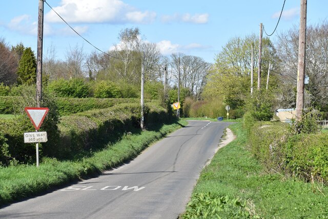
Chattis Hill, located in the county of Hampshire, England, is a small hill that forms part of the beautiful South Downs National Park. Standing at an elevation of approximately 200 meters, it does not quite meet the criteria to be classified as a mountain but offers stunning panoramic views of the surrounding countryside.
The hill is characterized by its rolling green slopes, covered in a patchwork of fields and meadows, which are typical of this picturesque region. Chattis Hill is known for its diverse flora and fauna, with wildflowers, including bluebells and buttercups, dotting the landscape during the spring and summer months.
The area surrounding Chattis Hill is rich in history, with evidence of human habitation dating back thousands of years. Archeological discoveries, including ancient burial sites and remains of a Roman villa, have been found nearby, providing insight into the area's past.
Visitors to Chattis Hill can enjoy a variety of outdoor activities, such as hiking and nature walks, with several well-marked trails leading to the summit. On a clear day, the views from the top are simply breathtaking, stretching across the South Downs and beyond.
The hill is easily accessible, with a small car park located at the base for those arriving by car. Alternatively, it can be reached by foot or bicycle from nearby villages. Chattis Hill offers a peaceful retreat from the hustle and bustle of everyday life, providing a serene and tranquil environment for all who visit.
If you have any feedback on the listing, please let us know in the comments section below.
Chattis Hill Images
Images are sourced within 2km of 51.126347/-1.5405662 or Grid Reference SU3236. Thanks to Geograph Open Source API. All images are credited.


Chattis Hill is located at Grid Ref: SU3236 (Lat: 51.126347, Lng: -1.5405662)
Administrative County: Hampshire
District: Test Valley
Police Authority: Hampshire
What 3 Words
///curly.closets.tuck. Near Abbotts Ann, Hampshire
Nearby Locations
Related Wikis

Danebury
Danebury is an Iron Age hillfort in Hampshire, England, about 19 kilometres (12 mi) north-west of Winchester (grid reference SU323376). The site, covering...

Chattis Hill
Chattis Hill is a hamlet in the Test Valley district of Hampshire, England. The village lies approximately 2 miles (3.3 km) west from Stockbridge, which...

Danebury Hill
Danebury Hill is a 13.7-hectare (34-acre) biological Site of Special Scientific Interest north-east of Nether Wallop in Hampshire. It is part of Danebury...
Battle of Guoloph
The Battle of Guoloph, also known as the Battle of Wallop, took place in the 5th century. Various dates have been put forward: 440 AD by Alfred Anscombe...

Nether Wallop
Nether Wallop is a village and civil parish in the Test Valley district of Hampshire, England. It is located approximately 3.7 miles (6 km) northwest of...

Middle Wallop
Middle Wallop is a village in the civil parish of Nether Wallop in Hampshire, England, on the A343 road. At the 2011 Census the population was included...
Test Valley School
Test Valley School is a comprehensive secondary school with Specialist Status in Mathematics and Computing located in Stockbridge, Hampshire, England....
Houghton Down
Houghton Down is a hamlet in the civil parish of Houghton in the Test Valley district of Hampshire, England. Its nearest town is Stockbridge, which lies...
Nearby Amenities
Located within 500m of 51.126347,-1.5405662Have you been to Chattis Hill?
Leave your review of Chattis Hill below (or comments, questions and feedback).