Mid Ward

Hill, Mountain in Shetland

Scotland

Mid Ward

The Burn of Scarfataing
The Burn of Scarfataing Credit: Oliver Dixon

Mid Ward is a prominent hill located in the Shetland Islands, an archipelago in Scotland, United Kingdom. Rising to an elevation of approximately 288 meters (945 feet), it is one of the highest points in the region. The hill is situated in the central part of Shetland, on the mainland, and is part of a range of hills known as the Ward of Scousburgh.

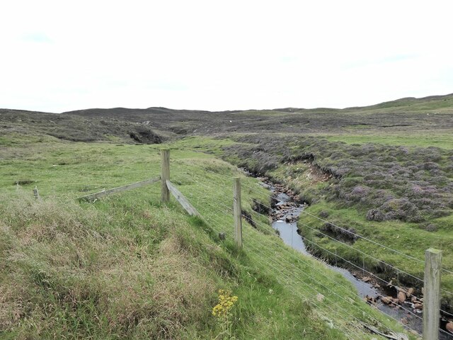
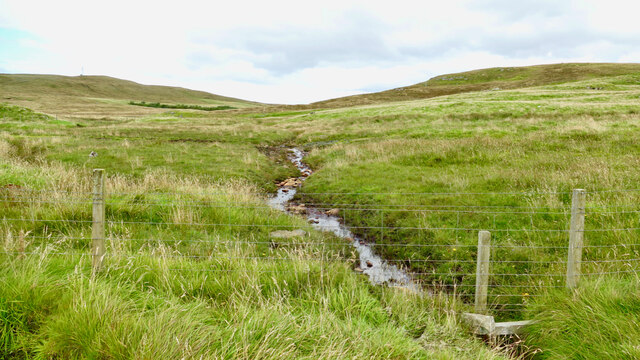
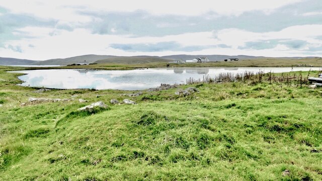
Mid Ward is characterized by its distinct rugged and rocky terrain, covered in patches of heather and grass. The hill offers panoramic views of the surrounding landscape, including the nearby Loch of Spiggie and the North Atlantic Ocean. On clear days, one can even catch a glimpse of the neighboring islands.

Hikers and outdoor enthusiasts are drawn to Mid Ward due to its accessibility and the rewarding vistas it offers. Several well-established walking trails lead to the summit, allowing visitors to explore the hill's natural beauty. The ascent to the top can be challenging at times, with steep sections and uneven ground, but the effort is rewarded with breathtaking views.

The hill is also home to a variety of bird species, including the rare and protected red-throated diver. Birdwatchers often flock to Mid Ward in hopes of catching a glimpse of these elusive creatures.

Overall, Mid Ward is a captivating hill in Shetland, offering outdoor enthusiasts the chance to explore its rugged beauty, while providing stunning views of the surrounding landscape.

If you have any feedback on the listing, please let us know in the comments section below.
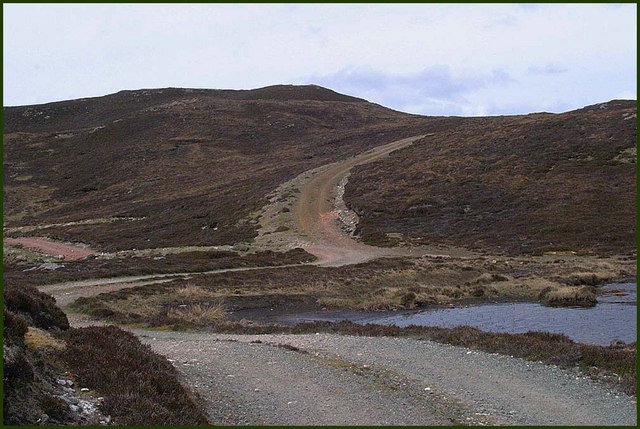
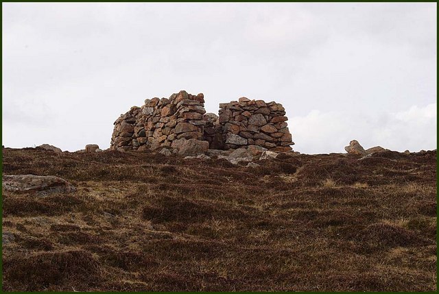
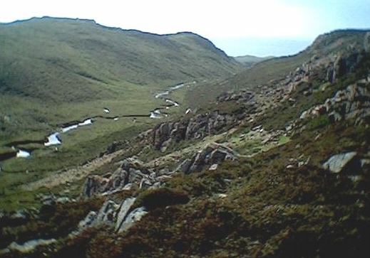
Mid Ward Images

Images are sourced within 2km of 60.369711/-1.42144 or Grid Reference HU3265. Thanks to Geograph Open Source API. All images are credited.

The Burn of Scarfataing
Muckle Roe Cemetery Up a track some distance inland. The cemetery allegedly includes war grave(s) but we couldn't identify any.
Muckle Roe Cemetery
Up a track some distance inland. The cemetery allegedly includes war grave(s) but we couldn't identify any.
Roe Sound and the road to Burn
Kilka Water, Muckle Roe, Shetland Also known as the Glen Loch, this is considered by many to be the best fishing loch on the island of Muckle Roe. The loch is surrounded by rough grazing. This view shows the outlet burn.
Kilka Water, Muckle Roe, Shetland
Also known as the Glen Loch, this is considered by many to be the best fishing loch on the island of Muckle Roe. The loch is surrounded by rough grazing. This view shows the outlet burn.
Route from Orwick Water to Kilka Water, Muckle Roe, Shetland Kilka Water on Muckle Roe lies beyond the little rise, just left of centre.
Route from Orwick Water to Kilka Water, Muckle Roe, Shetland
Kilka Water on Muckle Roe lies beyond the little rise, just left of centre.
Orwick Water, Muckle Roe, Shetland Unlike the other waters on the island of Muckle Roe, this one seemed heavily weeded. There was a collection of livestock handling installations beside where this photo was taken. Possibly runoff might be increasing the fertility. The teal on the loch didn't seem to mind.
Orwick Water, Muckle Roe, Shetland
Unlike the other waters on the island of Muckle Roe, this one seemed heavily weeded. There was a collection of livestock handling installations beside where this photo was taken. Possibly runoff might be increasing the fertility. The teal on the loch didn't seem to mind.
Burki Waters There are two Burki Waters here, this is the one furthest west.
Burki Waters
There are two Burki Waters here, this is the one furthest west.
Lairds Loch Lairds Loch, Muckle Roe, view from Giffords Hill.
Lairds Loch
Lairds Loch, Muckle Roe, view from Giffords Hill.
Loch of Rodageo Loch of Rodageo, Muckle Roe, looking north to the Ward of Breiness.
Loch of Rodageo
Loch of Rodageo, Muckle Roe, looking north to the Ward of Breiness.
Rough Track North Ward, Muckle Roe, left frame.
Rough Track
North Ward, Muckle Roe, left frame.
Cliffs above Otter Ayre
Haystacks at Glen farm, Muckle Roe
Access Track Track up into the hill leading to Burki Waters. Track off to left leads down to Little Ayre.
Access Track
Track up into the hill leading to Burki Waters. Track off to left leads down to Little Ayre.
South Ward Top Stone walls surround the triangulation point on top of South Ward
South Ward Top
Stone walls surround the triangulation point on top of South Ward
Mid Ward The summit of Mid Ward one of Shetland's Marilyn's with small cairn and westside coastline behind
Mid Ward
The summit of Mid Ward one of Shetland's Marilyn's with small cairn and westside coastline behind
Mill Loch, Muckle Roe. Mill Loch, west shore and outflow burn.
Mill Loch, Muckle Roe.
Mill Loch, west shore and outflow burn.
Outflow Burn. Outflow from Mill Loch, Muckle Roe.
Outflow Burn.
Outflow from Mill Loch, Muckle Roe.
Vodafone Tower at Muckle Roe Extremely remote radio mast at Muckle Roe (unmarked on the current 1:50,000 map). There's no road up to it, so they must have used a helicopter when they were building.
Vodafone Tower at Muckle Roe
Extremely remote radio mast at Muckle Roe (unmarked on the current 1:50,000 map). There's no road up to it, so they must have used a helicopter when they were building.
Show me another place!

Mid Ward is located at Grid Ref: HU3265 (Lat: 60.369711, Lng: -1.42144)

Unitary Authority: Shetland Islands

Police Authority: Highlands and Islands

What 3 Words

///flatten.solved.polygraph. Near Brae, Shetland Islands

Nearby Locations

Mid Ward

Related Wikis

Muckle Roe

Muckle Roe is an island in Shetland, Scotland, in St. Magnus Bay, to the west of Mainland. It has a population of around 130 people, who mainly croft and...

Linga, Busta Voe

Linga is a small, uninhabited island, 1 km (0.62 mi) east of Muckle Roe in the Shetland Islands. The island is roughly circular in shape and its highest...

Mavis Grind

Mavis Grind (Old Norse: Mæfeiðs grind or Mæveiðs grind, meaning "gate of the narrow isthmus") is a narrow isthmus joining the Northmavine peninsula to...

Busta Voe

Busta Voe, (HU665350), in the north central Mainland, Shetland, is a sea inlet lying between the village of Brae and the island of Muckle Roe. At the head...

Nearby Amenities

Located within 500m of 60.369711,-1.42144
Mid Ward
Corbett: no
Ele: 169
Graham: no
Marilyn: yes
Munro: no
Natural: peak
Prominence: 169
Lat/Long: 60.3656189/-1.4216283
The data included in this document is from www.openstreetmap.org. The data is made available under ODbL.

Have you been to Mid Ward?

Leave your review of Mid Ward below (or comments, questions and feedback).