Crog Hill

Hill, Mountain in Berkshire Vale of White Horse

England

Crog Hill

Gallop, Lambourn, Berkshire
Gallop, Lambourn, Berkshire Credit: Oswald Bertram

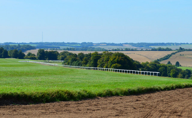
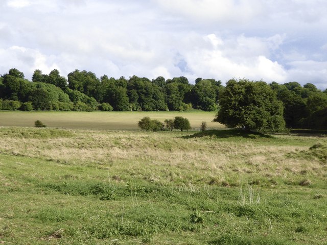
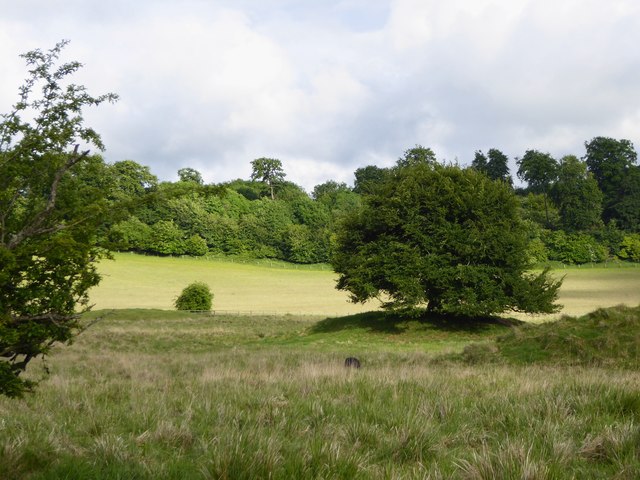
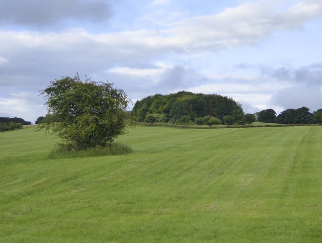
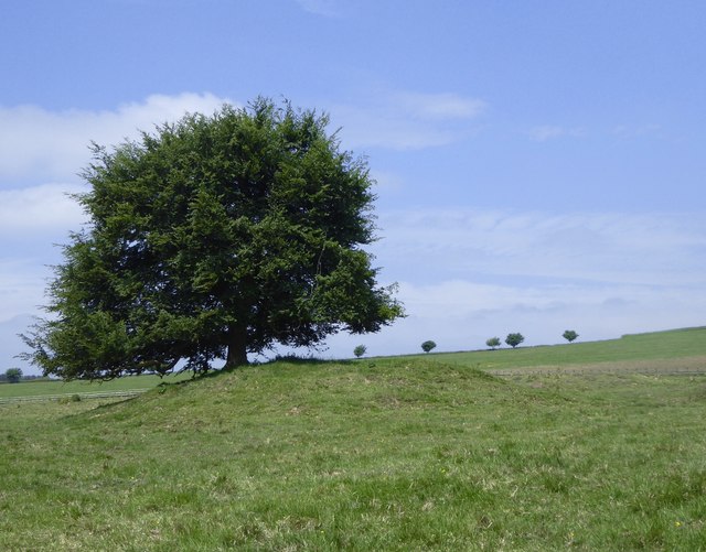
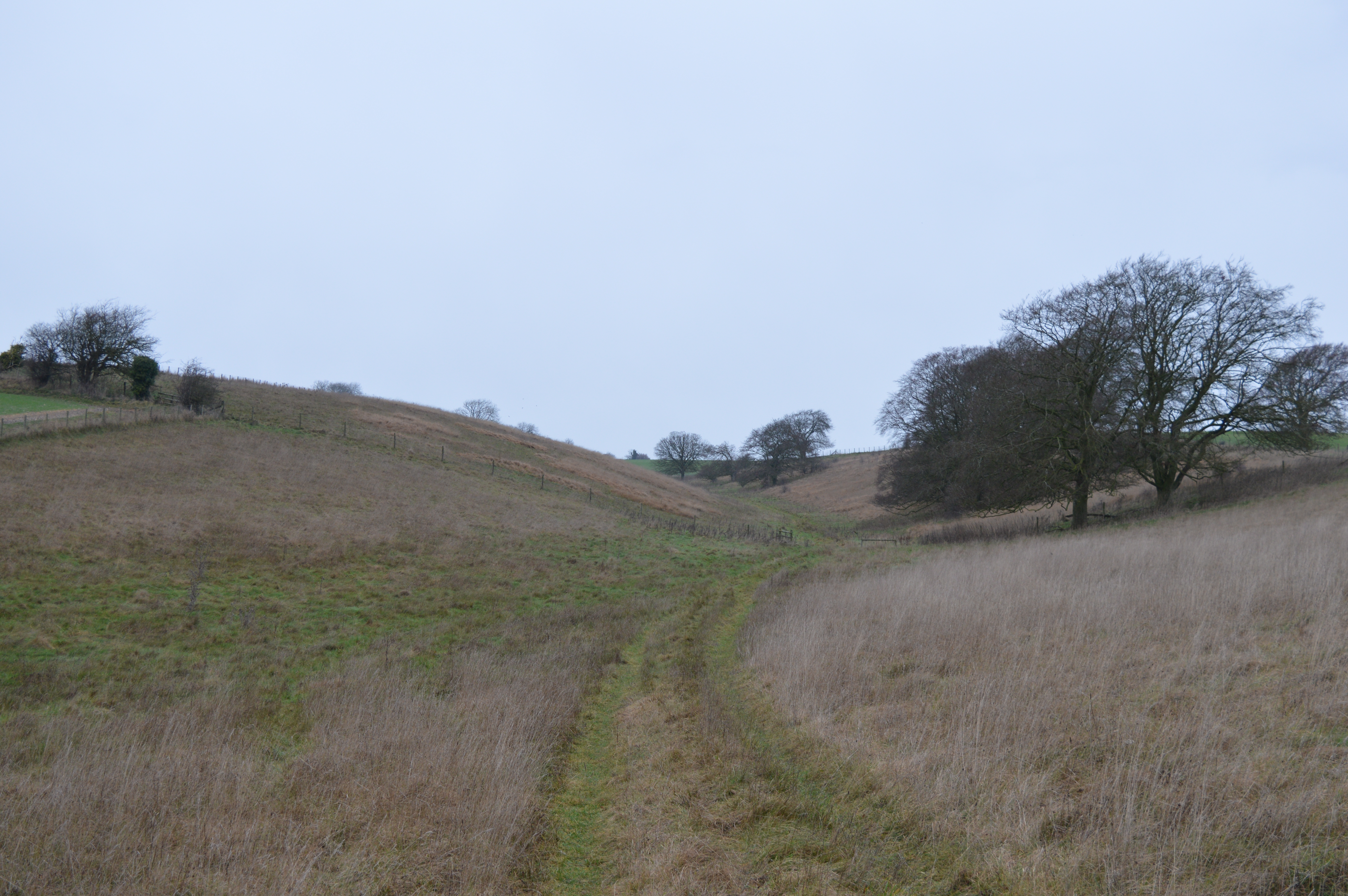
Crog Hill is a prominent hill located in Berkshire, England. Rising to an elevation of 261 meters (856 feet), it is considered one of the highest points in the county. Situated within the Berkshire Downs, Crog Hill offers breathtaking panoramic views of the surrounding landscape.

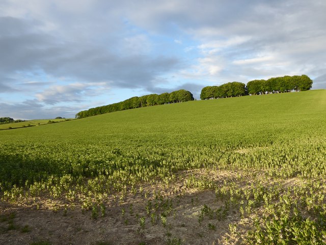
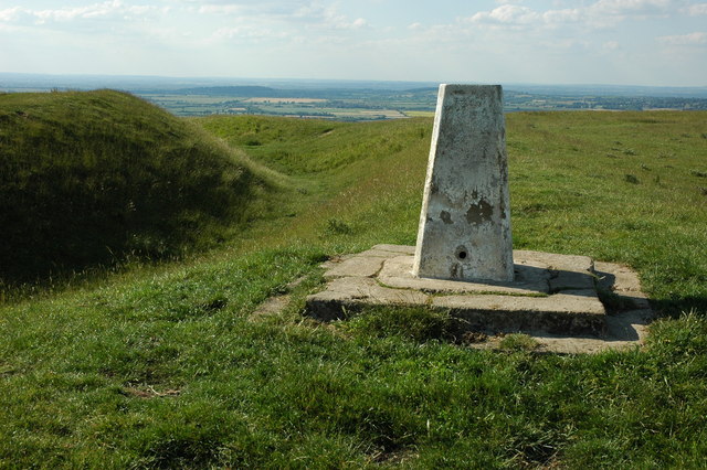
This hill is primarily composed of chalk and forms part of the North Wessex Downs Area of Outstanding Natural Beauty. Its distinct rounded shape is a result of centuries of erosion by wind and rain, giving it a unique and picturesque appearance. The summit of Crog Hill is adorned with a trig point, which serves as a marker for surveying and mapping purposes.

The area surrounding Crog Hill is rich in history and archaeology. Traces of ancient settlements, including Iron Age hillforts, have been discovered on its slopes. These remnants provide insight into the hill's significance as a defensive site during ancient times.

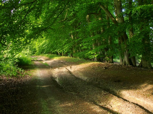
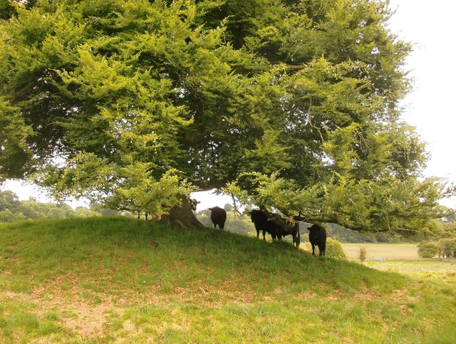
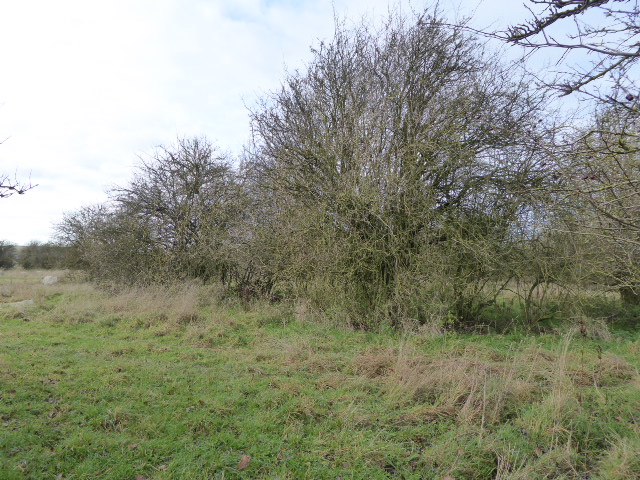
Today, Crog Hill is a popular destination for outdoor enthusiasts and nature lovers. The hill offers various walking trails and footpaths, allowing visitors to explore the beautiful countryside and enjoy the breathtaking views. Wildlife, including birds of prey and rare flora, can often be spotted in the area.

Access to Crog Hill is relatively easy, with nearby parking facilities and public transportation options available. Local authorities have taken measures to preserve the natural beauty of the area and maintain the trails for visitors to enjoy.

In summary, Crog Hill in Berkshire is a stunning natural landmark, offering panoramic views, a rich historical background, and opportunities for outdoor recreation.

If you have any feedback on the listing, please let us know in the comments section below.
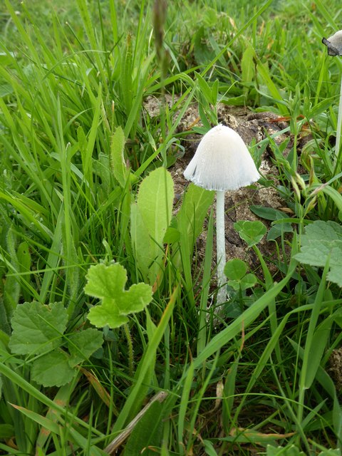
Crog Hill Images

Images are sourced within 2km of 51.552323/-1.5402567 or Grid Reference SU3183. Thanks to Geograph Open Source API. All images are credited.

Gallop, Lambourn, Berkshire
Downland, near Lambourn, Berkshire
Downland arable north of Seven Barrows Taken on a showery evening, in rapidly changing light.

The line of trees on the left marks the route of the road to Kingston Lisle; higher, on the right, is Hill Barn Clump.  The stormy clouds hang over the crest of the downs and the Vale of the White Horse.
Downland arable north of Seven Barrows
Taken on a showery evening, in rapidly changing light. The line of trees on the left marks the route of the road to Kingston Lisle; higher, on the right, is Hill Barn Clump. The stormy clouds hang over the crest of the downs and the Vale of the White Horse.
A field of beans on the flank of Sparsholt Down The crop here - vast acres of it - is broad beans.  The narrow strip of woodland runs along the crest of Sparsholt Down.
A field of beans on the flank of Sparsholt Down
The crop here - vast acres of it - is broad beans. The narrow strip of woodland runs along the crest of Sparsholt Down.
Byway on Pit Down Here running north-east and uphill, shaded by a plantation of beeches.  Behind the camera the track leads downhill to Seven Barrows and the road to Lambourn.
Byway on Pit Down
Here running north-east and uphill, shaded by a plantation of beeches. Behind the camera the track leads downhill to Seven Barrows and the road to Lambourn.
Seven Barrows: cattle sheltering from rain One of the most prominent barrows has a beech tree growing on top of it, and these bullocks were huddling beneath it during a drizzly spell.  They soon emerged when the sun came out.

Walking round the enclosed area of Seven Barrows nature reserve, I soon realised that there were more than seven mounds. I've seen estimates of two dozen and more - though they may refer to an area larger than the enclosed reserve.
Seven Barrows: cattle sheltering from rain
One of the most prominent barrows has a beech tree growing on top of it, and these bullocks were huddling beneath it during a drizzly spell. They soon emerged when the sun came out. Walking round the enclosed area of Seven Barrows nature reserve, I soon realised that there were more than seven mounds. I've seen estimates of two dozen and more - though they may refer to an area larger than the enclosed reserve.
The Seven Barrows nature reserve This is the site of a Bronze Age barrow cemetery, lying in a hollow on the Lambourn Downs.  Walking round the site you soon realise that there are more barrows than the name suggests.  My guess would be that the name dates from the centuries when mystical significance was assigned to the number seven (hence Seven Stars, Seven Seas, Seven Deadly Sins, Seven Ages of Man).

The enclosed nature reserve is managed by the Berks., Bucks. & Oxon. Wildlife Trust, chiefly to conserve a small population of the Marsh Fritillary butterfly - a scarce species whose distribution has retreated westwards in the last half-century.
The Seven Barrows nature reserve
This is the site of a Bronze Age barrow cemetery, lying in a hollow on the Lambourn Downs. Walking round the site you soon realise that there are more barrows than the name suggests. My guess would be that the name dates from the centuries when mystical significance was assigned to the number seven (hence Seven Stars, Seven Seas, Seven Deadly Sins, Seven Ages of Man). The enclosed nature reserve is managed by the Berks., Bucks. & Oxon. Wildlife Trust, chiefly to conserve a small population of the Marsh Fritillary butterfly - a scarce species whose distribution has retreated westwards in the last half-century.
Seven Barrows This hollow in the Lambourn Downs is the site of a Bronze Age round-barrow cemetery.  There are a good many mounds (certainly more than seven) but they are crowded together, and many sit in shallow depressions.  An individual barrow may appear out of the long grass only as you approach it.  The mound with the beech tree is perhaps the most isolated, and certainly the easiest to pick out at a distance.

The picture was taken in rapidly changing light (after rain), and the light and shade helps emphasise the uneven relief.
Seven Barrows
This hollow in the Lambourn Downs is the site of a Bronze Age round-barrow cemetery. There are a good many mounds (certainly more than seven) but they are crowded together, and many sit in shallow depressions. An individual barrow may appear out of the long grass only as you approach it. The mound with the beech tree is perhaps the most isolated, and certainly the easiest to pick out at a distance. The picture was taken in rapidly changing light (after rain), and the light and shade helps emphasise the uneven relief.
View from the Lambourn-Kingston Lisle road, north of Seven Barrows The tree marks the remains of a barrow, but the evenness of the ground suggests that the area was formerly ploughed.  These days much of the area is race-horse gallops - pretty much permanent grass.
View from the Lambourn-Kingston Lisle road, north of Seven Barrows
The tree marks the remains of a barrow, but the evenness of the ground suggests that the area was formerly ploughed. These days much of the area is race-horse gallops - pretty much permanent grass.
Byway heading uphill from Seven Barrows The byway heads NE from Seven Barrows to reach the B4001 Faringdon road.  Shaun Ferguson's contribution <a href="https://www.geograph.org.uk/photo/2206300">SU3382 : Byway heading up Pit Down</a> shows the same byway - but the photo was taken a little further up the slope.  The four (puzzling) ruts were still there when I visited in June 2017, though somewhat hidden by the long grass of early summer.

My own contribution <a href="https://www.geograph.org.uk/photo/5418704">SU3383 : Byway on Pit Down</a> shows the byway a little further ahead, as it passes a beech clump.

The main land-use here is as race-horse gallops.
Byway heading uphill from Seven Barrows
The byway heads NE from Seven Barrows to reach the B4001 Faringdon road. Shaun Ferguson's contribution SU3382 : Byway heading up Pit Down shows the same byway - but the photo was taken a little further up the slope. The four (puzzling) ruts were still there when I visited in June 2017, though somewhat hidden by the long grass of early summer. My own contribution SU3383 : Byway on Pit Down shows the byway a little further ahead, as it passes a beech clump. The main land-use here is as race-horse gallops.
Stormy sky over the downs Photo taken about an hour before sunset on a showery day in early June.

The lie-of-the-land may be undramatic and prairie-like, but you are quite high up here - the 190m contour runs right across the picture.  The trees mark the alignment of the Lambourn-Kingston Lisle road.
Stormy sky over the downs
Photo taken about an hour before sunset on a showery day in early June. The lie-of-the-land may be undramatic and prairie-like, but you are quite high up here - the 190m contour runs right across the picture. The trees mark the alignment of the Lambourn-Kingston Lisle road.
Farmland  east of Scary Hill
Farmland east of Scary Hill
Beech tree on a barrow, Seven Barrows However many barrows there may be at this site - and there are certainly more than seven - this seems to be the highest and the most prominent.  Many of the others sit in their own shallow circular depressions- saucer-barrows and bowl-barrows, as they are known.
Beech tree on a barrow, Seven Barrows
However many barrows there may be at this site - and there are certainly more than seven - this seems to be the highest and the most prominent. Many of the others sit in their own shallow circular depressions- saucer-barrows and bowl-barrows, as they are known.
Coprinus fungus at Seven Barrows The name of this genus of fungus reflects the fact that it thrives on dung.   Compare, for instance:  <a href="https://www.geograph.org.uk/photo/4519425">SU1950 : Inkcap fungus growing from a cow-pat, Haxton Down</a>
Coprinus fungus at Seven Barrows
The name of this genus of fungus reflects the fact that it thrives on dung. Compare, for instance: SU1950 : Inkcap fungus growing from a cow-pat, Haxton Down
Farmland, Lambourn A public bridleway follows what is now the boundary between West Berkshire and Oxfordshire.
Farmland, Lambourn
A public bridleway follows what is now the boundary between West Berkshire and Oxfordshire.
Downland, Uffington A restricted byway to the south of Idlebush Barrow makes its way through an area of horse gallops.
Downland, Uffington
A restricted byway to the south of Idlebush Barrow makes its way through an area of horse gallops.
Idlebush Barrow Probable Bronze Age burial tumulus, much reduced, and situated alongside the Lambourn Valley Way long distance path and between racehorse gallops. The mound is mentioned by Thomas Hughes and Edward Thomas. There is much speculation as to how the name came about, but no-one seems to know.
Idlebush Barrow
Probable Bronze Age burial tumulus, much reduced, and situated alongside the Lambourn Valley Way long distance path and between racehorse gallops. The mound is mentioned by Thomas Hughes and Edward Thomas. There is much speculation as to how the name came about, but no-one seems to know.
Farmland, Kingston Warren Down
Show me another place!

Crog Hill is located at Grid Ref: SU3183 (Lat: 51.552323, Lng: -1.5402567)

Administrative County: Oxfordshire

District: Vale of White Horse

Police Authority: Thames Valley

What 3 Words

///quit.relief.fully. Near Lambourn, Berkshire

Nearby Locations

Crog Hill

Related Wikis

Seven Barrows

Seven Barrows is a Bronze Age bowl barrow cemetery, 4-hectare (9.9-acre) of which are designated a biological Site of Special Scientific Interest, at Upper...

Croker's Hole

Croker's Hole is a 4.4-hectare (11-acre) biological Site of Special Scientific Interest north of Upper Lambourn in Berkshire.The site is a narrow grassland...

Park Farm Down

Park Farm Down or Parkfarm Down is a 3.3-hectare (8.2-acre) biological Site of Special Scientific Interest north-west of Lambourn in Berkshire. It is in...

Uffington Castle

Uffington Castle is an early Iron Age (with underlying Bronze Age) univallate hillfort in Oxfordshire, England. It covers about 32,000 square metres and...

Have you been to Crog Hill?

Leave your review of Crog Hill below (or comments, questions and feedback).