Elly Hill

Hill, Mountain in Durham

England

Elly Hill

Houses in Great Burdon Great Burdon is a small village within the unitary authority of Darlington, located at the north-eastern corner of that town. The houses face on to a green on the north side of Stockton Road.
Houses in Great Burdon Credit: Trevor Littlewood

Elly Hill, located in Durham County, is a prominent hill/mountain that offers breathtaking views and is a popular destination for outdoor enthusiasts. Rising to an elevation of approximately 1,250 feet (380 meters), it is one of the highest points in the region.

The hill is characterized by its rolling landscape, lush greenery, and diverse flora and fauna. It is home to a variety of plant species, including heather, gorse, and bilberry, creating a vibrant and colorful environment. The hill's slopes are covered in grass and scattered with rocky outcrops, adding to its natural beauty.

Elly Hill is a haven for hikers, walkers, and nature lovers. Several trails and footpaths wind their way up the hill, offering different levels of difficulty and stunning views along the way. The summit rewards visitors with panoramic vistas of the surrounding countryside and beyond, with picturesque views of Durham's rural landscapes stretching out for miles.

The hill also holds historical significance, with remnants of ancient settlements and burial mounds found in its vicinity. These archaeological sites add an intriguing element to the area, attracting history enthusiasts and researchers.

Elly Hill, with its natural beauty, rich biodiversity, and historical significance, serves as a popular recreational spot for locals and tourists alike. Whether it's a leisurely stroll, a challenging hike, or simply enjoying the scenery, Elly Hill offers a serene and rejuvenating experience for all who visit.

If you have any feedback on the listing, please let us know in the comments section below.
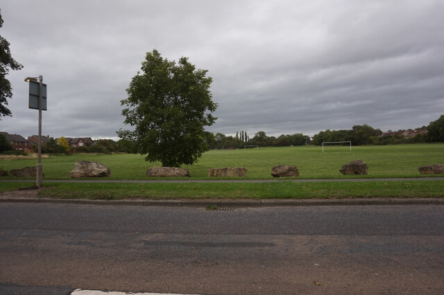
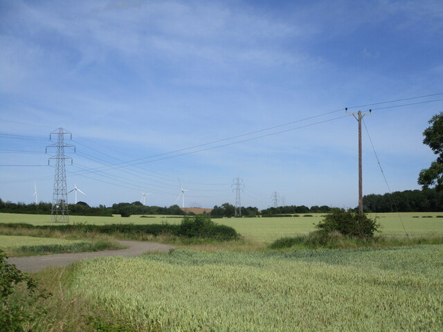
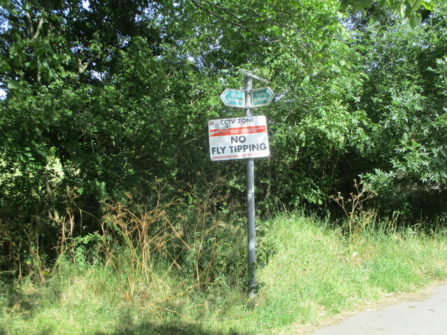
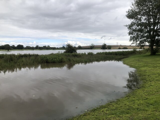
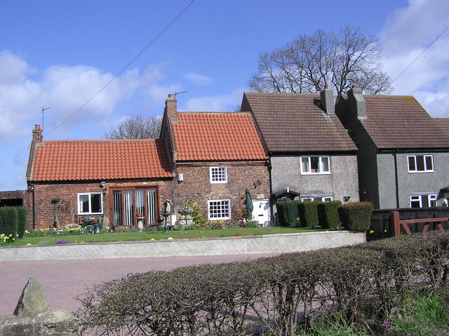
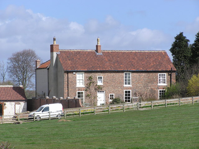
Elly Hill Images

Images are sourced within 2km of 54.553489/-1.5098514 or Grid Reference NZ3117. Thanks to Geograph Open Source API. All images are credited.

Houses in Great Burdon Great Burdon is a small village within the unitary authority of Darlington, located at the north-eastern corner of that town. The houses face on to a green on the north side of Stockton Road.
Houses in Great Burdon
Great Burdon is a small village within the unitary authority of Darlington, located at the north-eastern corner of that town. The houses face on to a green on the north side of Stockton Road.
Pipe over the River Skerne Pipe over the River Skerne
Pipe over the River Skerne
River Skerne at Barmpton River Skerne at Barmpton
River Skerne at Barmpton
Old apple tree at Skerningham Manor Old apple tree at track to Skerningham Manor
Old apple tree at Skerningham Manor
Old apple tree at track to Skerningham Manor
Old Milestone by the A1150 in Great Burdon Carved stone post by the A1150, in parish of GREAT BURDON (DARLINGTON District), The Green, 15m West of No. 2, on grass verge beside newer post <a href="https://www.geograph.org.uk/photo/6414958">NZ3116 : Old Milepost by the A1150 in Great Burdon</a>, on North side of road. Durham county stone erected by the Stockton & Barnard Castle turnpike trust in the 19th century. 

Inscription once read:-
: (Darlington / 2) : : (Stockton / 9) : 

Grade II Listed. List Entry Number: 1299444
<span class="nowrap"><a title="https://historicengland.org.uk/listing/the-list/list-entry/1299444" rel="nofollow ugc noopener" href="https://historicengland.org.uk/listing/the-list/list-entry/1299444">Link</a><img style="margin-left:2px;" alt="External link" title="External link - shift click to open in new window" src="https://s1.geograph.org.uk/img/external.png" width="10" height="10"/></span>

Milestone Society National ID: DU_DAST02A.
Old Milestone by the A1150 in Great Burdon
Carved stone post by the A1150, in parish of GREAT BURDON (DARLINGTON District), The Green, 15m West of No. 2, on grass verge beside newer post NZ3116 : Old Milepost by the A1150 in Great Burdon, on North side of road. Durham county stone erected by the Stockton & Barnard Castle turnpike trust in the 19th century. Inscription once read:- : (Darlington / 2) : : (Stockton / 9) : Grade II Listed. List Entry Number: 1299444 LinkExternal link Milestone Society National ID: DU_DAST02A.
Farmland south of Peartree House Looking across the valley of the River Skerne from Ketton Lane, with the <a href="https://www.geograph.org.uk/photo/161090">NZ3019 : Ketton Packhorse  Bridge</a> (photographed by Hugh Mortimer) on the right.
Farmland south of Peartree House
Looking across the valley of the River Skerne from Ketton Lane, with the NZ3019 : Ketton Packhorse Bridge (photographed by Hugh Mortimer) on the right.
Old Milepost by the A1150 in Great Burdon Cast iron post by the A1150, in parish of GREAT BURDON (DARLINGTON District), The Green, 15m W of No. 2, on grass verge, on North side of road. In front of older stone. Durham County iron casting, erected by the County Council in the 19th/20th century. 

Inscription reads:- : STOCKTON / 9 : : DARLINGTON / 2 : : DURHAM COUNTY :

Listed. 

Milestone Society National ID: DU_DAST02.
Old Milepost by the A1150 in Great Burdon
Cast iron post by the A1150, in parish of GREAT BURDON (DARLINGTON District), The Green, 15m W of No. 2, on grass verge, on North side of road. In front of older stone. Durham County iron casting, erected by the County Council in the 19th/20th century. Inscription reads:- : STOCKTON / 9 : : DARLINGTON / 2 : : DURHAM COUNTY : Listed. Milestone Society National ID: DU_DAST02.
Springfield Park on Salters Lane
Field on Low Skerningham Lane
Signs on Green Lane Two public bridleway signs and a no fly tipping sign on Green Lane
Signs on Green Lane
Two public bridleway signs and a no fly tipping sign on Green Lane
Brampton Lane meeting Whinbush Way
Old Milepost by A1150, The Green, 15m West of No. 2 The Milepost is located on grass verge on the North of the road.  Parish of Great Burdon (Darlington District). Cast iron post, Durham county iron casting design, erected by the County Council in the 19/20th Century. 

Inscription reads:-  
STOCKTON / 9  : : DARLINGTON / 2 : : DURHAM COUNTY  

Grade II listed. List Entry Number: 1299444 <span class="nowrap"><a title="https://historicengland.org.uk/listing/the-list/list-entry/1299444" rel="nofollow ugc noopener" href="https://historicengland.org.uk/listing/the-list/list-entry/1299444">Link</a><img style="margin-left:2px;" alt="External link" title="External link - shift click to open in new window" src="https://s1.geograph.org.uk/img/external.png" width="10" height="10"/></span> 

Milestone Society National ID: DU_DAST02
Old Milepost by A1150, The Green, 15m West of No. 2
The Milepost is located on grass verge on the North of the road.  Parish of Great Burdon (Darlington District). Cast iron post, Durham county iron casting design, erected by the County Council in the 19/20th Century.  Inscription reads:- STOCKTON / 9 : : DARLINGTON / 2 : : DURHAM COUNTY Grade II listed. List Entry Number: 1299444 LinkExternal link Milestone Society National ID: DU_DAST02
Flooding on the River Skerne
East coast mainline from Green Lane railway bridge View of the east coast mainline from Green Lane railway bridge
East coast mainline from Green Lane railway bridge
View of the east coast mainline from Green Lane railway bridge
The  Springfield Salters Lane North.
The Springfield
Salters Lane North.
Blacksmiths Cottage:  Great Burdon Village Great Burdon Village dates from the post-medieval period. In 1541 Henry VIII left the village to the Prior and Convent of Durham. The village originally had three farms, a mill, a blacksmith shop, a pub and several cottages.
Blacksmiths Cottage: Great Burdon Village
Great Burdon Village dates from the post-medieval period. In 1541 Henry VIII left the village to the Prior and Convent of Durham. The village originally had three farms, a mill, a blacksmith shop, a pub and several cottages.
Elly Hill House  Farm
Elly Hill House Farm
Phone Mast : Ely Hill
Show me another place!

Elly Hill is located at Grid Ref: NZ3117 (Lat: 54.553489, Lng: -1.5098514)

Unitary Authority: Darlington

Police Authority: Durham

What 3 Words

///coherent.liability.tops. Near Coatham Mundeville, Co. Durham

Related Wikis

Barmpton

Barmpton is a small village and civil parish in the borough of Darlington and the ceremonial county of County Durham, England. The population taken at...

Lingfield, County Durham

Whinfield is a place in County Durham, England. It is situated to the east of Darlington. The population of this Darlington ward taken at the 2011 census...

Whinfield

Whinfield is a suburb of Darlington, in the Borough of Darlington in County Durham, England. It is situated to the north of Darlington. == Transport... ==

Great Burdon

Great Burdon is a village in the borough of Darlington and the ceremonial county of County Durham, England. It is situated to the north-east of Darlington...

Haughton-le-Skerne

Haughton-le-Skerne is a village in the borough of Darlington in the ceremonial county of County Durham, England. It is situated in the north east of Darlington...

Haughton Academy

Haughton Academy (formerly Haughton Community School) is a coeducational secondary school located in the Haughton-le-Skerne area of Darlington, County...

Sadberge

Sadberge () is a village in County Durham, England, situated between Darlington and Stockton-on-Tees. It is administered as part of the borough of Darlington...
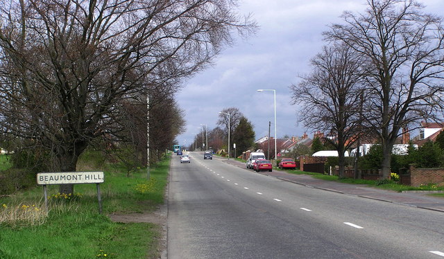
Beaumont Hill

Beaumont Hill is a village in the borough of Darlington and the traditional and ceremonial counties of Durham in England, situated directly to the north...

Nearby Amenities

Located within 500m of 54.553489,-1.5098514
Barmpton
Place: hamlet
Source: NPE
Wikidata: Q2857974
Wikipedia: en:Barmpton
Lat/Long: 54.5562432/-1.5103612
Barrier: swing_gate
Foot: designated
Motor Vehicle: private
Lat/Long: 54.5528827/-1.5144021
Barrier: kissing_gate
Lat/Long: 54.5572292/-1.5141497
Communication Mobile Phone: yes
Man Made: mast
Tower Type: communication
Lat/Long: 54.5535015/-1.509088
Waste Basket
Waste: dog_excrement
Lat/Long: 54.5555053/-1.5126793
Waste Basket
Waste: dog_excrement
Lat/Long: 54.5562083/-1.5123574
Barrier: kissing_gate
Lat/Long: 54.5562553/-1.5123162
Power: pole
Lat/Long: 54.5539852/-1.5142183
Power: pole
Lat/Long: 54.5540575/-1.5151785
Power: pole
Lat/Long: 54.5541244/-1.5160422
Barrier: entrance
Lat/Long: 54.5572531/-1.5138619
Barrier: entrance
Lat/Long: 54.5563388/-1.5110398
Post Box
Operator: Royal Mail
Post Box Mounting: telegraph_pole
Post Box Type: meter
Ref: DL1 286
Lat/Long: 54.556306/-1.5107817
Barmpton Grange Farm
Place: farm
Source Name: OS_OpenData_StreetView
Lat/Long: 54.5568558/-1.5106389
Barmpton Hall Farm
Place: farm
Source Name: OS_OpenData_StreetView
Lat/Long: 54.556876/-1.5120927
Fixme: Missing line
Power: pole
Lat/Long: 54.5563231/-1.5132554
Barrier: kissing_gate
Lat/Long: 54.5562775/-1.5124761
Barrier: kissing_gate
Lat/Long: 54.556827/-1.5082289
NE Horse Box Hire
Addr City: Darlington
Addr Housename: Meadowside Stables
Addr Postcode: DL1 3JG
Addr Suburb: Barmpton
Office: company
Website: http://nehorseboxhire.co.uk/
Lat/Long: 54.5563145/-1.5081954
Barrier: entrance
Lat/Long: 54.5571389/-1.5126494
The data included in this document is from www.openstreetmap.org. The data is made available under ODbL.

Have you been to Elly Hill?

Leave your review of Elly Hill below (or comments, questions and feedback).