Atley Hill
Hill, Mountain in Yorkshire Hambleton
England
Atley Hill
Atley Hill is a picturesque hill located in the county of Yorkshire, England. Situated near the village of Hilton, it is known for its stunning natural beauty and breathtaking views of the surrounding countryside. Although relatively modest in size, Atley Hill's elevation offers a notable prominence, making it a popular destination for hikers, nature enthusiasts, and photographers.
Covered in lush greenery, the hill boasts a diverse range of flora and fauna, with wildflowers and meadows dotting its slopes. The landscape is characterized by rolling hills, providing a gentle incline for those who wish to explore its trails. The summit offers panoramic vistas of the nearby North York Moors National Park, showcasing the area's stunning countryside and charming villages.
The hill is easily accessible, with a well-maintained footpath leading to the top. Along the way, visitors can enjoy the tranquility of the area, appreciating the sounds of nature and the occasional sighting of local wildlife, including rabbits, deer, and various bird species.
Atley Hill also holds historical significance, with remnants of ancient settlements and burial mounds found in the vicinity. These archaeological features offer a glimpse into the area's rich past, dating back thousands of years.
Overall, Atley Hill provides a serene and picturesque escape from the hustle and bustle of modern life. Its natural beauty, coupled with its accessibility and historical significance, make it a captivating destination for visitors seeking a tranquil retreat in the heart of Yorkshire.
If you have any feedback on the listing, please let us know in the comments section below.
Atley Hill Images
Images are sourced within 2km of 54.419028/-1.559614 or Grid Reference NZ2802. Thanks to Geograph Open Source API. All images are credited.


![The end of a bridleway Go through the gate and one is heading roughly north west along path number 10.134/1. Heading east along the adjoining path, one has just crossed the boundary from Richmondshire [area 20] into Hambleton [10].](https://s0.geograph.org.uk/geophotos/07/40/30/7403084_caf3d0aa.jpg)


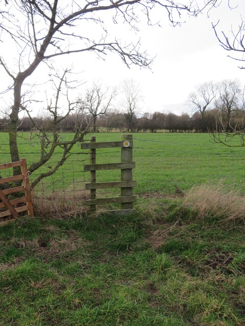
![Where's the path? Trying to follow the line marked on the map across this field of old ridge and furrow as well as remains of a medieval village site. The path is shown crossing the farm track midway between a corner and the farm buildings, but the track is lined by barbed wire fencing with no visible means of crossing. Way down to the left is a flimsy stile [left of photo] from where there is a usable route along a hedge line.](https://s2.geograph.org.uk/geophotos/07/40/33/7403342_36806446.jpg)


Atley Hill is located at Grid Ref: NZ2802 (Lat: 54.419028, Lng: -1.559614)
Division: North Riding
Administrative County: North Yorkshire
District: Hambleton
Police Authority: North Yorkshire
What 3 Words
///stated.detained.graphic. Near Scorton, North Yorkshire
Nearby Locations
Related Wikis

Atley Hill
Atley Hill is a hamlet in the Hambleton district of North Yorkshire, England. It is situated on the B1263 road between the A167 and the village of Scorton...
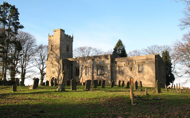
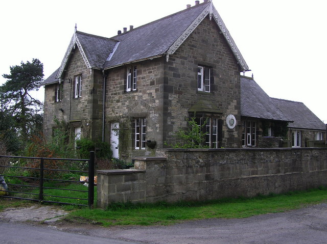
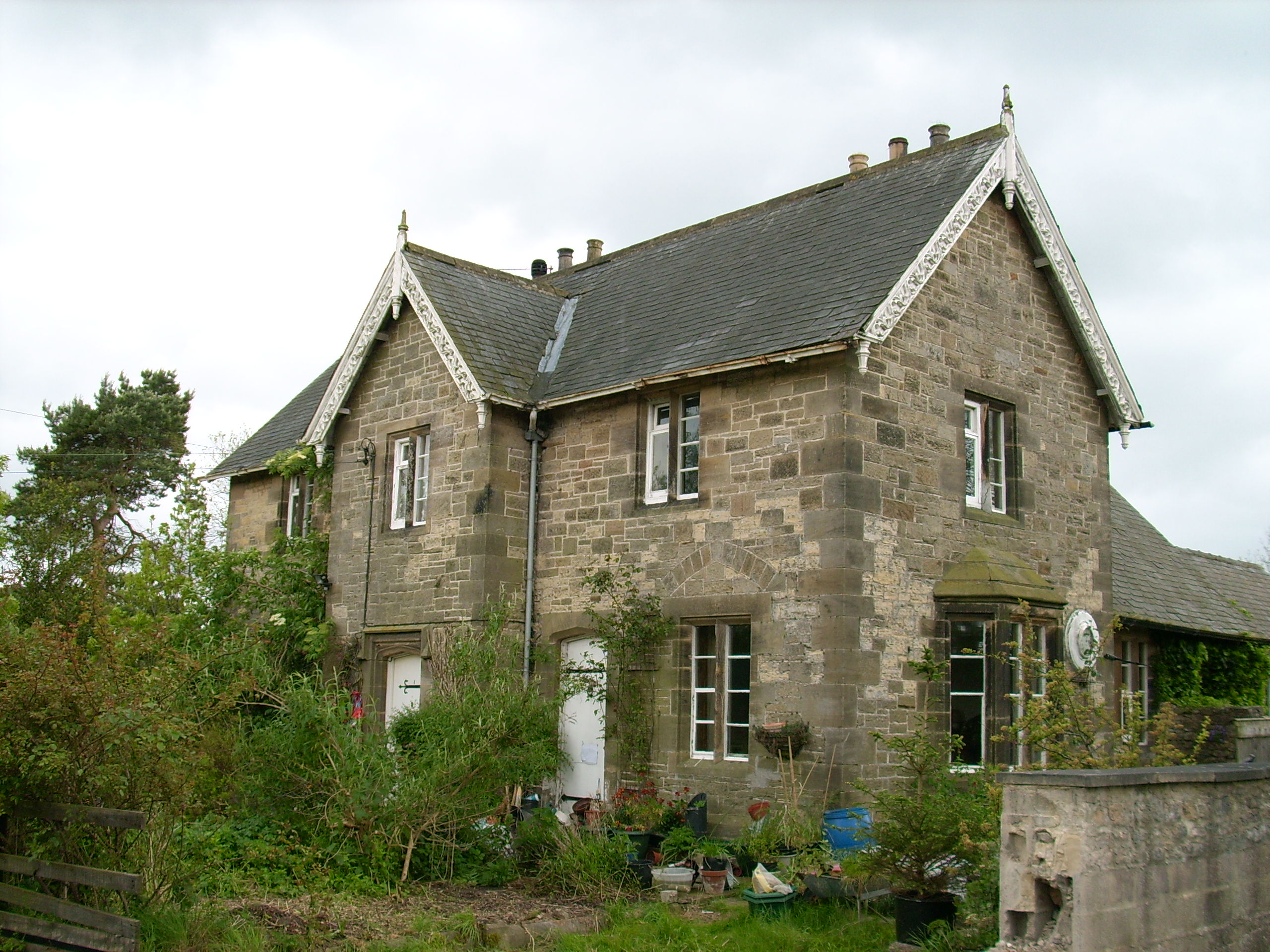
St Mary's Church, South Cowton
St Mary's Church is a redundant Anglican church standing in open countryside in the former village of South Cowton, near Scotch Corner in North Yorkshire...
South Cowton
South Cowton is a village and civil parish located on the site of an abandoned medieval village in the Hambleton district of North Yorkshire in England...

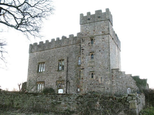
South Cowton Castle
South Cowton Castle is a 15th-century fortified dwelling house in the Richmondshire district of North Yorkshire, England. It is situated on the land that...

North Cowton
North Cowton is a village and civil parish, located in Richmondshire, North Yorkshire, England. It is 8 miles (13 km) north-west of the county town of...

Temple Cowton Preceptory
Temple Cowton Preceptory was a priory in North Yorkshire, England. The preceptory was in the village of East Cowton, 5 miles (8 km) north west of Northallerton...
Moulton End
Moulton End is a hamlet in North Yorkshire, in England. The hamlet gradually built up around the now disused railway station formerly serving North Cowton...
Moulton railway station (North Yorkshire)
Moulton railway station was a railway station in what is now the Richmondshire district of North Yorkshire, England. It was situated near the village of...
Nearby Amenities
Located within 500m of 54.419028,-1.559614Have you been to Atley Hill?
Leave your review of Atley Hill below (or comments, questions and feedback).