Blackim Hill

Hill, Mountain in Durham

England

Blackim Hill

Angel Of The North, Gateshead With Me for Scale :) I am 6ft 3. I had to sprint up the hill as only had 10 seconds. 

The steel sculpture is 20 metres (66 ft) tall, with wings measuring 54 metres (177 ft) across. Sculpted by Antony Gormley and was installed on 15 February 1998

<span class="nowrap"><a title="https://en.wikipedia.org/wiki/Angel_of_the_North" rel="nofollow ugc noopener" href="https://en.wikipedia.org/wiki/Angel_of_the_North">Link</a><img style="margin-left:2px;" alt="External link" title="External link - shift click to open in new window" src="https://s1.geograph.org.uk/img/external.png" width="10" height="10"/></span>
Angel Of The North, Gateshead Credit: Brian Deegan

Blackim Hill is a prominent hill located in County Durham, England. It is situated in the northern part of the county, near the village of Wolsingham. Rising to an elevation of approximately 1,234 feet (376 meters), Blackim Hill is considered one of the highest points in the region and offers stunning panoramic views of the surrounding countryside.

The hill is part of the larger North Pennines Area of Outstanding Natural Beauty, renowned for its rugged landscapes, diverse wildlife, and rich cultural heritage. Blackim Hill is primarily composed of Millstone Grit, a rugged sandstone formation that contributes to its distinctive appearance.

The summit of Blackim Hill is marked by a trig point, providing a focal point for hikers and walkers who venture to the top. The hill is a popular destination for outdoor enthusiasts, offering a variety of walking routes and trails that cater to different levels of experience. The ascent to the summit can be challenging for some due to its steep incline, but the reward of reaching the top is well worth the effort.

The surrounding area is abundant in flora and fauna, with heather and grasses covering the lower slopes and moorland. Wildlife such as red grouse, curlews, and lapwings can frequently be spotted in the vicinity. Additionally, the hill is home to a number of archaeological sites, including burial mounds and prehistoric settlements, providing insights into the area's ancient past.

Overall, Blackim Hill is a remarkable natural landmark in County Durham, offering visitors a chance to immerse themselves in the beauty of the North Pennines while enjoying breathtaking views from its summit.

If you have any feedback on the listing, please let us know in the comments section below.

Blackim Hill Images

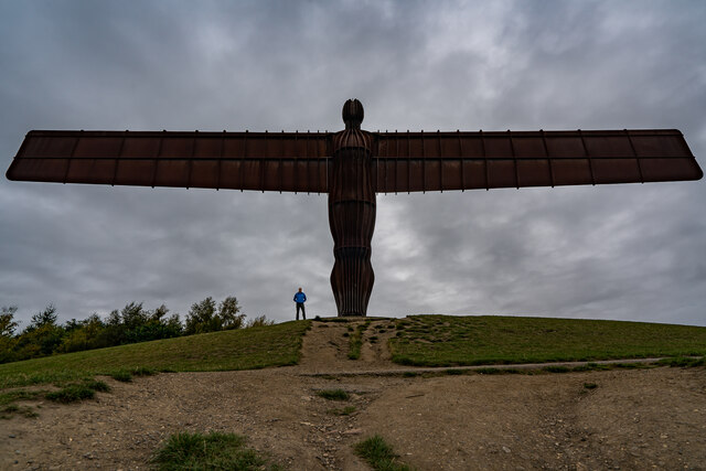
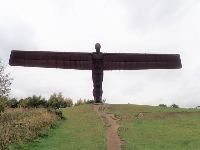
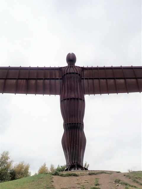
Images are sourced within 2km of 54.916318/-1.5620042 or Grid Reference NZ2858. Thanks to Geograph Open Source API. All images are credited.

Angel Of The North, Gateshead With Me for Scale :) I am 6ft 3. I had to sprint up the hill as only had 10 seconds. 

The steel sculpture is 20 metres (66 ft) tall, with wings measuring 54 metres (177 ft) across. Sculpted by Antony Gormley and was installed on 15 February 1998

<span class="nowrap"><a title="https://en.wikipedia.org/wiki/Angel_of_the_North" rel="nofollow ugc noopener" href="https://en.wikipedia.org/wiki/Angel_of_the_North">Link</a><img style="margin-left:2px;" alt="External link" title="External link - shift click to open in new window" src="https://s1.geograph.org.uk/img/external.png" width="10" height="10"/></span>
Angel Of The North, Gateshead
With Me for Scale :) I am 6ft 3. I had to sprint up the hill as only had 10 seconds. The steel sculpture is 20 metres (66 ft) tall, with wings measuring 54 metres (177 ft) across. Sculpted by Antony Gormley and was installed on 15 February 1998 LinkExternal link
The Angel of the North, Gateshead
Pond and fields near Sheddon's Hill Looking northward from The Mill House Car Park. The pond would seem to be a recent addition to the landscape. Whilst shown on current OS mapping it is not on my earlier Explorer map. The other possible giveaway are the tops of the fence posts - once a field boundary?
Pond and fields near Sheddon's Hill
Looking northward from The Mill House Car Park. The pond would seem to be a recent addition to the landscape. Whilst shown on current OS mapping it is not on my earlier Explorer map. The other possible giveaway are the tops of the fence posts - once a field boundary?
Golf Course View The view from the George Washington Hotel in Washington.
Golf Course View
The view from the George Washington Hotel in Washington.
Hotel Scene The view from the George Washington Hotel in Washington, towards the Golf Course.
Hotel Scene
The view from the George Washington Hotel in Washington, towards the Golf Course.
Parsons Road The view up the Washington Road.
Parsons Road
The view up the Washington Road.
The Angel of the North A contemporary sculpture by Antony Gormley, it is believed to be the largest sculpture of an angel in the world. Despite considerable opposition during its design and construction phases, it is now widely recognised as an iconic example of public art and as a symbol of Gateshead. It can withstand wind speeds over 100 mph.
The Angel of the North
A contemporary sculpture by Antony Gormley, it is believed to be the largest sculpture of an angel in the world. Despite considerable opposition during its design and construction phases, it is now widely recognised as an iconic example of public art and as a symbol of Gateshead. It can withstand wind speeds over 100 mph.
Prayers and wishes Just south of the Angel of the North, people have left tributes and mementos of lost loved ones hanging on the trees and bushes.
Prayers and wishes
Just south of the Angel of the North, people have left tributes and mementos of lost loved ones hanging on the trees and bushes.
Up close to the Angel of the North Missing half its wingspan of 175 ft when so close
Up close to the Angel of the North
Missing half its wingspan of 175 ft when so close
Information Board - Angel of the North An information board relating the birth of the concept, its construction and various facts.
Information Board - Angel of the North
An information board relating the birth of the concept, its construction and various facts.
Angel of the North A contemporary sculpture by Antony Gormley, it is believed to be the largest sculpture of an angel in the world. Despite considerable opposition during its design and construction phases, it is now widely recognised as an iconic example of public art and as a symbol of Gateshead. It can withstand wind speeds over 100 mph.
Angel of the North
A contemporary sculpture by Antony Gormley, it is believed to be the largest sculpture of an angel in the world. Despite considerable opposition during its design and construction phases, it is now widely recognised as an iconic example of public art and as a symbol of Gateshead. It can withstand wind speeds over 100 mph.
Angel of the North In silhouette
Angel of the North
In silhouette
Ordnance Survey Cut Mark This mark can be found on the roadside wall of the Mill House Inn.
The recorded details give a height of 121.1838 metres above sea level.
For more detail see : <span class="nowrap"><a title="https://www.bench-marks.org.uk/bm174641" rel="nofollow ugc noopener" href="https://www.bench-marks.org.uk/bm174641">Link</a><img style="margin-left:2px;" alt="External link" title="External link - shift click to open in new window" src="https://s1.geograph.org.uk/img/external.png" width="10" height="10"/></span>
Ordnance Survey Cut Mark
This mark can be found on the roadside wall of the Mill House Inn. The recorded details give a height of 121.1838 metres above sea level. For more detail see : LinkExternal link
Esso filling station on east side of A167
Betty Pit electricity substation on east side of A167
Footbridge over Durham Road (A167)
Parapet of bridge taking A167 over track of dismantled railway The track is now a footpath. Ordnance Survey records indicate that a benchmark was levelled at 88.115m above Newlyn Datum on the near end of a parapet of a bridge here
Parapet of bridge taking A167 over track of dismantled railway
The track is now a footpath. Ordnance Survey records indicate that a benchmark was levelled at 88.115m above Newlyn Datum on the near end of a parapet of a bridge here
Benchmark on wall bounding grounds of Eighton Lodge Ordnance Survey cut mark benchmark levelled at 80.751m above Newlyn Datum verified 1962
Benchmark on wall bounding grounds of Eighton Lodge
Ordnance Survey cut mark benchmark levelled at 80.751m above Newlyn Datum verified 1962
Show me another place!

Blackim Hill is located at Grid Ref: NZ2858 (Lat: 54.916318, Lng: -1.5620042)

Unitary Authority: Sunderland

Police Authority: Northumbria

What 3 Words

///remain.games.emerge. Near Lamesley, Tyne & Wear

Nearby Locations

Blackim Hill Springwell

Related Wikis

Eighton Banks

Eighton Banks is a small village in the Metropolitan Borough of Gateshead, which is located around 4.5 miles (7 km) from Newcastle upon Tyne. The village...
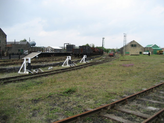
Bowes Railway

The Bowes Railway, built by George Stephenson in 1826, is the world's only operational preserved standard gauge cable railway system. It was built to transport...

Springwell Village

Springwell Village is a village in the City of Sunderland, bordering Gateshead, approximately 7.6 miles (12.2 km) from Newcastle upon Tyne, 9 miles (14...

Springwell Estate

Springwell Estate is a council estate located in the eastern part of Wrekenton in Gateshead, England. == References ==

Nearby Amenities

Located within 500m of 54.916318,-1.5620042
Tyne and Wear
Gns Classification: ADM1
Gns Uni: -3588578
Is In Country: United Kingdom
Is In Country Code: GB
Place: county
Source: GNS
Lat/Long: 54.916667/-1.566667
Mount Moor Colliery
Historic: mine
Mineral: coal
Source: NPE
Lat/Long: 54.9129447/-1.5662984
Bus Stop
EIGHTON BANKS
Local Ref: S
Naptan AtcoCode: 410000022082
Naptan Bearing: S
Naptan CommonName: EIGHTON BANKS
Naptan Indicator: S
Naptan Landmark: OUTSIDE HAWTHORN TERRACE
Naptan NaptanCode: twrdptdj
Naptan Street: EIGHTON BANKS
Naptan Verified: no
Source: naptan_import
Lat/Long: 54.9170566/-1.5679895
Bus Stop
ROCKCLIFFE WAY-LAMBTON ARMS-S/B
Bench: no
Covered: no
Local Ref: E
Naptan AtcoCode: 410000022083
Naptan Bearing: E
Naptan CommonName: ROCKCLIFFE WAY-LAMBTON ARMS-S/B
Naptan Indicator: E
Naptan Landmark: OUTSIDE THE LAMBTON ARMS PUBLIC HOUSE
Naptan NaptanCode: twrdptdm
Naptan Street: ROCKCLIFFE WAY
Naptan Verified: no
Shelter: no
Source: naptan_import
Lat/Long: 54.9151291/-1.5635947
Bus Stop
EIGHTON ROAD-NURSERY-S/B
Local Ref: S
Naptan AtcoCode: 410000022084
Naptan Bearing: S
Naptan CommonName: EIGHTON ROAD-NURSERY-S/B
Naptan Indicator: S
Naptan Landmark: OPPOSITE COTTAGE GARDEN NURSERY
Naptan NaptanCode: twrdptdp
Naptan Street: EIGHTON ROAD
Naptan Verified: no
Source: naptan_import
Lat/Long: 54.9127052/-1.5624517
Bus Stop
EIGHTON ROAD-NURSERY-N/B
Local Ref: N
Naptan AtcoCode: 410000022085
Naptan Bearing: N
Naptan CommonName: EIGHTON ROAD-NURSERY-N/B
Naptan Indicator: N
Naptan Landmark: OUTSIDE COTTAGE GARDEN NURSERY
Naptan NaptanCode: twrdptdt
Naptan Street: EIGHTON ROAD
Naptan Verified: no
Source: naptan_import
Lat/Long: 54.9132897/-1.562539
Bus Stop
Rockcliffe Way
Bus: yes
Departures Board: timetable
Local Ref: N
Naptan AtcoCode: 410000022086
Naptan Bearing: N
Naptan CommonName: ROCKCLIFFE WAY-PROSPECT TERRACE-N/B
Naptan Indicator: N
Naptan Landmark: OPPOSITE PROSPECT TERRACE
Naptan NaptanCode: twrdptdw
Naptan Street: ROCKCLIFFE WAY
Naptan Verified: no
Public Transport: platform
Shelter: yes
Source: naptan_import
Lat/Long: 54.9156014/-1.5658778
Bus Stop
MOUNT LANE-MOUNT LONNEN-W/B
Local Ref: W
Naptan AtcoCode: 410000022160
Naptan Bearing: W
Naptan CommonName: MOUNT LANE-MOUNT LONNEN-W/B
Naptan Indicator: W
Naptan Landmark: OUTSIDE THE WILLOWMEE AND PIGGERY
Naptan NaptanCode: twrdpwmt
Naptan Street: MOUNT LANE
Naptan Verified: no
Source: naptan_import
Lat/Long: 54.913984/-1.5606907
Bus Stop
MOUNT LANE-MOUNT LONNEN-E/B
Local Ref: E
Naptan AtcoCode: 410000022161
Naptan Bearing: E
Naptan CommonName: MOUNT LANE-MOUNT LONNEN-E/B
Naptan Indicator: E
Naptan Landmark: OUTSIDE MOUNT LONNEN
Naptan NaptanCode: twrdpwmw
Naptan Street: MOUNT LANE
Naptan Verified: no
Source: naptan_import
Lat/Long: 54.914115/-1.5596597
Bus Stop
EIGHTON BANKS
Local Ref: E
Naptan AtcoCode: 410000060110
Naptan Bearing: E
Naptan CommonName: EIGHTON BANKS
Naptan Indicator: E
Naptan Landmark: 50M EAST OF THE WAGGON INN PUBLIC HOUSE
Naptan NaptanCode: twrgptpm
Naptan Street: SANDY LANE
Naptan Verified: no
Source: naptan_import
Lat/Long: 54.9182703/-1.5656208
Crossing: pedestrian
Crossing Barrier: no
Fixme: None
Railway: crossing
Lat/Long: 54.9185914/-1.5643125
Pub
The Lambton Arms
Addr Street: Rockcliffe Way
Lat/Long: 54.9154706/-1.5651326
Traffic Calming: choker
Lat/Long: 54.9153314/-1.565024
Railway: crossing
Lat/Long: 54.9177953/-1.5603253
Blackim Hill
Natural: peak
Source: OS 1:25k
Lat/Long: 54.9158327/-1.5610878
Railway: switch
Lat/Long: 54.9185671/-1.5598026
Post Box
Operator: Royal Mail
Ref: NE9 49
Lat/Long: 54.9177214/-1.5671856
Turning Circle
Lat/Long: 54.9180268/-1.5562408
Pub
The Ship
Addr City: Gateshead
Addr Housename: The Ship
Addr Postcode: NE9 7YP
Addr Street: Mount Road
Addr Suburb: Eighton Banks
Fhrs Id: 1294207
Website: http://www.shipeightonbanks.co.uk/
Lat/Long: 54.914671/-1.5606696
Post Box
Ref: NE9 23
Lat/Long: 54.9151198/-1.5635073
Generator Method: photovoltaic
Generator Output Electricity: yes
Generator Source: solar
Generator Type: solar_photovoltaic_panel
Location: roof
Power: generator
Lat/Long: 54.9178366/-1.5555582
Generator Method: photovoltaic
Generator Output Electricity: yes
Generator Source: solar
Generator Type: solar_photovoltaic_panel
Location: roof
Power: generator
Lat/Long: 54.9179738/-1.5556012
Generator Method: photovoltaic
Generator Output Electricity: yes
Generator Source: solar
Generator Type: solar_photovoltaic_panel
Location: roof
Power: generator
Lat/Long: 54.9179938/-1.5556441
Generator Method: photovoltaic
Generator Output Electricity: yes
Generator Source: solar
Generator Type: solar_photovoltaic_panel
Location: roof
Power: generator
Lat/Long: 54.9180508/-1.5556146
Generator Method: photovoltaic
Generator Output Electricity: yes
Generator Source: solar
Generator Type: solar_photovoltaic_panel
Location: roof
Power: generator
Lat/Long: 54.9179738/-1.5574143
Railway: switch
Lat/Long: 54.9180882/-1.5600961
Railway: switch
Lat/Long: 54.9176746/-1.5604154
Railway: switch
Lat/Long: 54.9191602/-1.5592946
Railway: switch
Lat/Long: 54.9187209/-1.5596857
Give Way
Direction: backward
Lat/Long: 54.9153752/-1.5652248
The data included in this document is from www.openstreetmap.org. The data is made available under ODbL.

Have you been to Blackim Hill?

Leave your review of Blackim Hill below (or comments, questions and feedback).