Snoddington Down

Hill, Mountain in Hampshire Test Valley

England

Snoddington Down

A338 Salisbury Road Towards Tidworth.
A338 Salisbury Road Credit: Robin Webster

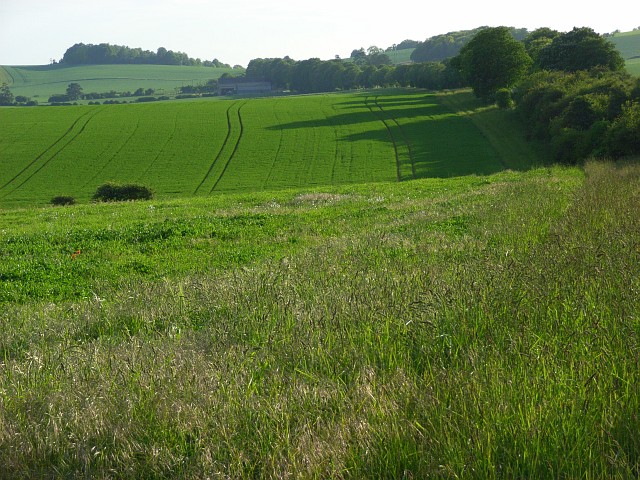
Snoddington Down is a prominent hill located in the county of Hampshire, in southern England. With an elevation of approximately 200 meters (656 feet), it is often referred to as a hill rather than a mountain due to its relatively moderate height. Nevertheless, its commanding presence and breathtaking views have made it a popular destination for hikers, nature enthusiasts, and locals alike.

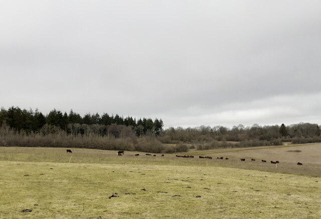
Situated near the village of Snoddington, the hill is characterized by its gently sloping sides and lush greenery. Its summit offers panoramic vistas of the surrounding countryside, allowing visitors to admire the picturesque landscapes of Hampshire's rolling hills and meandering rivers.

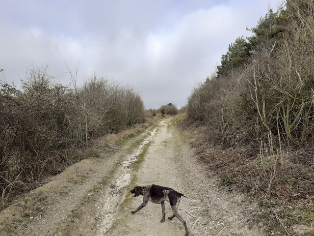
The hill is known for its rich biodiversity, with a variety of plant and animal species calling it home. Its slopes are covered with dense woodlands, providing habitats for a range of wildlife, including deer, foxes, and a diverse array of bird species. Walking along the well-maintained trails, visitors may also come across vibrant wildflowers and rare plant species that thrive in the area's fertile soil.

Snoddington Down is easily accessible, with a network of footpaths and trails leading up to its summit. The hill's tranquil and serene atmosphere makes it a perfect spot for a leisurely stroll, a family picnic, or even a challenging hike for more adventurous individuals.

Overall, Snoddington Down offers a captivating blend of natural beauty, tranquility, and outdoor recreational opportunities, making it a cherished landmark in the Hampshire countryside.

If you have any feedback on the listing, please let us know in the comments section below.

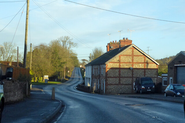
Snoddington Down Images

Images are sourced within 2km of 51.206499/-1.6485454 or Grid Reference SU2445. Thanks to Geograph Open Source API. All images are credited.

A338 Salisbury Road Towards Tidworth.
A338 Salisbury Road
Towards Tidworth.
Cottages on A338, Shipton Bellinger Most of the village is off to the left.
Cottages on A338, Shipton Bellinger
Most of the village is off to the left.
A338 Salisbury Road at county border Crossing from Hampshire to Wiltshire.
A338 Salisbury Road at county border
Crossing from Hampshire to Wiltshire.
View towards Thruxton Farm Taken just to the south of the A303.
View towards Thruxton Farm
Taken just to the south of the A303.
A303 Looking across the A303 at the end of the cutting on Thruxton Hill.
A303
Looking across the A303 at the end of the cutting on Thruxton Hill.
Entrance to Old Coach Road from A338 Seen from A338 at Shipton Bellinger. This is a restricted byway. I am not sure if "Old Coach Road" is the name of the byway or if it is just a description of its origin. The white notice at left is the standard Salisbury Plain Military Lands Byelaws 1981.
Entrance to Old Coach Road from A338
Seen from A338 at Shipton Bellinger. This is a restricted byway. I am not sure if "Old Coach Road" is the name of the byway or if it is just a description of its origin. The white notice at left is the standard Salisbury Plain Military Lands Byelaws 1981.
Public Footpath running north from Old Coach Road The woodland on the right is Shipton Plantation. This footpath climbs steadily up the western side of this hill, which I guess is the southern end of Furze Hill.
Public Footpath running north from Old Coach Road
The woodland on the right is Shipton Plantation. This footpath climbs steadily up the western side of this hill, which I guess is the southern end of Furze Hill.
Public Footpath along western edge of Shipton Plantation Climbing quite steeply up the side slopes of what I guess is the southern part of Furze Hill.
Public Footpath along western edge of Shipton Plantation
Climbing quite steeply up the side slopes of what I guess is the southern part of Furze Hill.
Public Footpath and tank crossing on western edge of Shipton Plantation The tank track comes up from the valley at left after crossing the A338, and continues rightwards.
Public Footpath and tank crossing on western edge of Shipton Plantation
The tank track comes up from the valley at left after crossing the A338, and continues rightwards.
View across valley containing the A338 and the River Bourne Also showing a tank track.
View across valley containing the A338 and the River Bourne
Also showing a tank track.
Entering Ashdown Copse from the south on a public footpath There are numerous tracks in Ashdown Copse, few of which are public rights of way, but this one is. There doesn't appear to be any visible constraint upon using the other tracks.
Entering Ashdown Copse from the south on a public footpath
There are numerous tracks in Ashdown Copse, few of which are public rights of way, but this one is. There doesn't appear to be any visible constraint upon using the other tracks.
Wooden platform in Ashdown Copse Apparently part of a mountain bike circuit, judging by the TFTUNED advertisement on it, and the narrow up and down exposed-chalk paths in the area. Whether this is military or commercial I don't know.
Wooden platform in Ashdown Copse
Apparently part of a mountain bike circuit, judging by the TFTUNED advertisement on it, and the narrow up and down exposed-chalk paths in the area. Whether this is military or commercial I don't know.
Track junction in Ashdown Copse
Track junction at Kimpton Gorse The Wiltshire County Council public footpath sign had been rotated here through ninety degrees to give  misleading picture of the right of way. I rotated it back. The real public footpath does not follow any of the grassy tracks seen here. Rather, it runs diagonally across the hillside from here towards the second tiny clump of trees just seen on the horizon near the left of this photo.
Track junction at Kimpton Gorse
The Wiltshire County Council public footpath sign had been rotated here through ninety degrees to give misleading picture of the right of way. I rotated it back. The real public footpath does not follow any of the grassy tracks seen here. Rather, it runs diagonally across the hillside from here towards the second tiny clump of trees just seen on the horizon near the left of this photo.
Looking along public footpath towards Kimpton Gorse The hillside here seemed to have been dug up or had a crop on it recently. There was no trace of the public footpath, so I followed by GPS.
Looking along public footpath towards Kimpton Gorse
The hillside here seemed to have been dug up or had a crop on it recently. There was no trace of the public footpath, so I followed by GPS.
Public footpath from Klimpton Gorse towards Ashdown Copse The footpath passes in a straight line to the right of the disused pit seen in the distance. The line of scrub seen in the foreground is not marked on the 1:25K OS map. The footpath here is undiscernible but can be followed by GPS.
Public footpath from Klimpton Gorse towards Ashdown Copse
The footpath passes in a straight line to the right of the disused pit seen in the distance. The line of scrub seen in the foreground is not marked on the 1:25K OS map. The footpath here is undiscernible but can be followed by GPS.
Fearsome horned cattle blocking public footpath The indiscernible public footpath is climbing towards Ashdown Copse. I was following it by GPS. The cattle were enclosed by an electric fence. I deviated southwards from the footpath to avoid the cattle.
Fearsome horned cattle blocking public footpath
The indiscernible public footpath is climbing towards Ashdown Copse. I was following it by GPS. The cattle were enclosed by an electric fence. I deviated southwards from the footpath to avoid the cattle.
Public footpath south of Ashdown Copse The footpath does not follow any of the many grassy tracks hereabouts.
Public footpath south of Ashdown Copse
The footpath does not follow any of the many grassy tracks hereabouts.
Show me another place!

Snoddington Down is located at Grid Ref: SU2445 (Lat: 51.206499, Lng: -1.6485454)

Administrative County: Hampshire

District: Test Valley

Police Authority: Hampshire

What 3 Words

///consoled.apron.blanked. Near Tidworth, Wiltshire

Related Wikis

Snoddington

Snoddington is a small hamlet in Hampshire and close to the border of Wiltshire near to Thruxton Aerodrome and first mentioned in the eleventh century...

A338 road

The A338 is a major primary route in southern England, that runs from the junction with the A35 at Poole in Dorset to the junction with the A420 at Besselsleigh...

Shipton Bellinger

Shipton Bellinger is a village and civil parish in Hampshire, England. Shipton Bellinger is about 5 miles (8 km) north-east of the town of Amesbury and...

Battle of the Beanfield

The Battle of the Beanfield took place over several hours on 1 June 1985, when Wiltshire Police prevented The Peace Convoy, a convoy of several hundred...

Tedworth House

Tedworth House, also known as South Tidworth House, is a 19th-century country house in Tidworth, Wiltshire, England. It is a Grade II* listed building...

St Mary's Church, South Tidworth

St Mary's Church in South Tidworth, Wiltshire, England, was built in 1878. It is recorded in the National Heritage List for England as a designated Grade...

Quarley

Quarley is a village and civil parish in the Test Valley district of Hampshire, England. It is about 7 mi (11 km) west of Andover and according to the...

Quarley Hill Fort

Quarley Hill Fort is a 3.5-hectare (8.6-acre) biological Site of Special Scientific Interest west of Grateley in Hampshire.Quarley hillfort is a hillfort...

Nearby Amenities

Located within 500m of 51.206499,-1.6485454
Power: tower
Lat/Long: 51.2079118/-1.6505023
Power: tower
Lat/Long: 51.2070783/-1.6527982
Power: tower
Lat/Long: 51.2104102/-1.6457263
Power: tower
Lat/Long: 51.2089537/-1.648378
Access: private
Ele: 174
Man Made: survey_point
Natural: peak
Lat/Long: 51.2064642/-1.6485399
The data included in this document is from www.openstreetmap.org. The data is made available under ODbL.

Have you been to Snoddington Down?

Leave your review of Snoddington Down below (or comments, questions and feedback).