Burtree Hill

Hill, Mountain in Yorkshire Harrogate

England

Burtree Hill

Farmland near Spring House Farm Looking across towards the farm in the distance from Brimham Rocks Road.
Farmland near Spring House Farm Credit: DS Pugh

Burtree Hill, located in Yorkshire, England, is a notable hill that forms part of the stunning landscape of the region. It is situated in the northern part of the county, near the village of Piercebridge. Rising to an elevation of approximately 285 meters (935 feet), Burtree Hill is considered a prominent landmark in the area.

The hill is primarily composed of sedimentary rock, featuring layers of sandstone and limestone that have been shaped by millions of years of geological processes. The slopes of Burtree Hill are covered in a patchwork of vegetation, including grasses, shrubs, and scattered trees, which contribute to its picturesque appearance.

Visitors to Burtree Hill can enjoy breathtaking panoramic views of the surrounding countryside, with rolling hills, meandering rivers, and charming villages dotting the landscape. On a clear day, it is possible to see as far as the Yorkshire Dales National Park in the distance, adding to the allure of this natural wonder.

The area around Burtree Hill has a rich history, with archaeological evidence suggesting human activity in the region dating back thousands of years. There are several ancient burial mounds and other remnants from different historical periods in close proximity to the hill, providing insight into the area's past.

For nature enthusiasts and hikers, Burtree Hill offers a range of walking trails and pathways that allow visitors to explore its beauty up close. The hill's tranquil atmosphere and scenic vistas make it an ideal destination for those seeking a peaceful retreat amidst Yorkshire's captivating countryside.

If you have any feedback on the listing, please let us know in the comments section below.
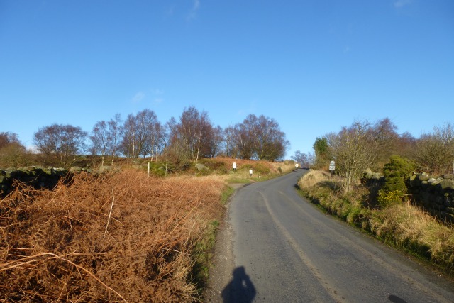
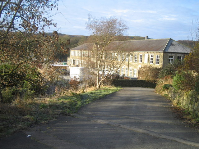
Burtree Hill Images

Images are sourced within 2km of 54.066389/-1.6651288 or Grid Reference SE2263. Thanks to Geograph Open Source API. All images are credited.

Farmland near Spring House Farm Looking across towards the farm in the distance from Brimham Rocks Road.
Farmland near Spring House Farm
Looking across towards the farm in the distance from Brimham Rocks Road.
Fields in low winter sun Looking across farmland near Spring House Farm.
Fields in low winter sun
Looking across farmland near Spring House Farm.
Along Brimham Rocks Road Looking in the direction towards Burnt Yates.
Along Brimham Rocks Road
Looking in the direction towards Burnt Yates.
Farmland near Brimham Hall Farm Looking across farmland from Brimham Rocks Road.
Farmland near Brimham Hall Farm
Looking across farmland from Brimham Rocks Road.
Fiddler's Green Looking across from Brimham Rocks Road towards the farm.
Fiddler's Green
Looking across from Brimham Rocks Road towards the farm.
Fields near Kimberley House Farm Looking along Brimham Rocks Road.
Fields near Kimberley House Farm
Looking along Brimham Rocks Road.
Towards Brimham Beacon Looking over farmland towards Brimham Beacon at Brimham Rocks.
Towards Brimham Beacon
Looking over farmland towards Brimham Beacon at Brimham Rocks.
Brimham Rocks Road by the crossroads The road up to Brimham Rocks from Burnt Yates.
Brimham Rocks Road by the crossroads
The road up to Brimham Rocks from Burnt Yates.
Road near Kimberly House Farm Brimham Rocks Road approaching Brimham Rocks.
Road near Kimberly House Farm
Brimham Rocks Road approaching Brimham Rocks.
Over moorland from the entrance to Brimham Rocks Looking across the moorland below Brimham Rocks.
Over moorland from the entrance to Brimham Rocks
Looking across the moorland below Brimham Rocks.
Brimham Rocks A path heads across the moorland towards the visitors centre.
Brimham Rocks
A path heads across the moorland towards the visitors centre.
Brimham Moor Looking across the moorland at Brimham Rocks.
Brimham Moor
Looking across the moorland at Brimham Rocks.
Millstone Grit Looking up towards some of the rocks at Brimham Rocks.
Millstone Grit
Looking up towards some of the rocks at Brimham Rocks.
Down Brimham Rocks Road The road through Brimham Rocks.
Down Brimham Rocks Road
The road through Brimham Rocks.
Missing Sundial, St Jude's Churchyard, Hartwith Grade II listed; "Sundial. Dated 1826. Gritstone. Circular base, vase baluster with splayed
foot and roll mouldings to base and neck. Quarter round mouldings with
fillet to cap with incised date; bronze plate and gnomon".
Missing Sundial, St Jude's Churchyard, Hartwith
Grade II listed; "Sundial. Dated 1826. Gritstone. Circular base, vase baluster with splayed foot and roll mouldings to base and neck. Quarter round mouldings with fillet to cap with incised date; bronze plate and gnomon".
Riva Hill near Summerbridge A rocky summit, apparently with traces of Bronze Age activity.
Riva Hill near Summerbridge
A rocky summit, apparently with traces of Bronze Age activity.
Brimham Rocks near Summerbridge (1) A dramatic display of Millstone Grit eroded into fantastic shapes, rather like a dinky version of the rock formations commonly found in Arizona and surrounding states. Unlike most others, these rocks have tended to remain standing due to an inward tilt. A Site of Special Scientific Interest, owned by the National Trust.
Brimham Rocks near Summerbridge (1)
A dramatic display of Millstone Grit eroded into fantastic shapes, rather like a dinky version of the rock formations commonly found in Arizona and surrounding states. Unlike most others, these rocks have tended to remain standing due to an inward tilt. A Site of Special Scientific Interest, owned by the National Trust.
Brimham Rocks near Summerbridge (2) A dramatic display of Millstone Grit eroded into fantastic shapes, rather like a dinky version of the rock formations commonly found in Arizona and surrounding states. Unlike most others, these rocks have tended to remain standing due to an inward tilt. A Site of Special Scientific Interest, owned by the National Trust.
Brimham Rocks near Summerbridge (2)
A dramatic display of Millstone Grit eroded into fantastic shapes, rather like a dinky version of the rock formations commonly found in Arizona and surrounding states. Unlike most others, these rocks have tended to remain standing due to an inward tilt. A Site of Special Scientific Interest, owned by the National Trust.
Show me another place!

Burtree Hill is located at Grid Ref: SE2263 (Lat: 54.066389, Lng: -1.6651288)

Division: West Riding

Administrative County: North Yorkshire

District: Harrogate

Police Authority: North Yorkshire

What 3 Words

///stared.shady.heartless. Near Pateley Bridge, North Yorkshire

Nearby Locations

Brimham Lodge Burtree Hill

Related Wikis

Hartwith cum Winsley

Hartwith cum Winsley is a civil parish in Harrogate district, North Yorkshire, England. Historically it was a township in the ancient parish of Kirkby...

Warsill

Warsill is a settlement and civil parish in the Harrogate district, in the county of North Yorkshire, England. It consists of a few scattered farms 5 miles...

Brimham Rocks

Brimham Rocks, once known as Brimham Crags, is a 183.9-hectare (454-acre) biological Site of Special Scientific Interest (SSSI) and Geological Conservation...

New York, North Yorkshire

New York is a settlement in Nidderdale in the Harrogate district of North Yorkshire, England. It is on the River Nidd, near Summerbridge, and about 2...

Nearby Amenities

Located within 500m of 54.066389,-1.6651288
Fiddler's Green
Building: yes
Source: NPE
Lat/Long: 54.0665736/-1.671019
Ford: yes
Lat/Long: 54.0658005/-1.6595932
The data included in this document is from www.openstreetmap.org. The data is made available under ODbL.

Have you been to Burtree Hill?

Leave your review of Burtree Hill below (or comments, questions and feedback).