Bale Hill

Hill, Mountain in Yorkshire Harrogate

England

Bale Hill

B6265 near Braithwaite Syke This looks north east along the B6265 between Glasshouses and Fellbeck
B6265 near Braithwaite Syke Credit: Chris Heaton

Bale Hill is a prominent hill located in the Yorkshire Dales, a stunning area of natural beauty in northern England. Situated in the county of Yorkshire, this hill is part of the Pennine range and stands at an elevation of approximately 1,968 feet (600 meters) above sea level.

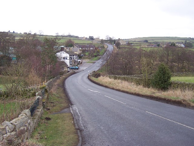
The hill is characterized by its distinctive shape, with a gently sloping western side and a steeper eastern face. It offers breathtaking panoramic views of the surrounding countryside, including the rolling hills, verdant valleys, and picturesque villages that dot the landscape. On clear days, it is even possible to see as far as the distant Yorkshire coast.

Bale Hill is a popular destination among outdoor enthusiasts, attracting hikers, walkers, and nature lovers from near and far. There are several well-defined footpaths and trails that lead up to the summit, allowing visitors to explore the hill at their own pace. The ascent to the top can be challenging in sections, particularly on the eastern side, but the rewarding views make it well worth the effort.

Wildlife thrives on Bale Hill, with a variety of species inhabiting the area. Birds such as peregrine falcons, kestrels, and curlews can often be spotted soaring above, while sheep and cows graze peacefully on the lower slopes.

Overall, Bale Hill is an idyllic natural landmark that showcases the beauty of the Yorkshire Dales. Its rugged terrain, stunning vistas, and abundant wildlife make it a must-visit destination for anyone seeking a true taste of Yorkshire's natural splendor.

If you have any feedback on the listing, please let us know in the comments section below.

Bale Hill Images

Images are sourced within 2km of 54.090826/-1.6784473 or Grid Reference SE2166. Thanks to Geograph Open Source API. All images are credited.

B6265 near Braithwaite Syke This looks north east along the B6265 between Glasshouses and Fellbeck
B6265 near Braithwaite Syke
This looks north east along the B6265 between Glasshouses and Fellbeck
Fellbeck Looking north east along the B6265 as it descends to cross Fell Beck by the Half Moon Inn, centre of the scattered community bearing the same name as the watercourse
Fellbeck
Looking north east along the B6265 as it descends to cross Fell Beck by the Half Moon Inn, centre of the scattered community bearing the same name as the watercourse
Fields running down to Fell Beck Roughly eastern aspect while walking towards Fell Beck en route to Brimham Rocks from the nearby B6265
Fields running down to Fell Beck
Roughly eastern aspect while walking towards Fell Beck en route to Brimham Rocks from the nearby B6265
Peacock near Mill house This Peacock was roaming freely in the woods near Mill House.
Peacock near Mill house
This Peacock was roaming freely in the woods near Mill House.
The Half Moon, Fellbeck Step inside for a pint of Black Sheep, some decent food and a roaring fire.
The Half Moon, Fellbeck
Step inside for a pint of Black Sheep, some decent food and a roaring fire.
Fellbeck Farms Looking towards Park Crag past first Brookside Farm and then The Grange Farm.
Fellbeck Farms
Looking towards Park Crag past first Brookside Farm and then The Grange Farm.
Fellbeck House
Fellbeck House
Footbridge near to Mill House The vehicle gate on the left allows vehicle access to an adjoining Ford
Footbridge near to Mill House
The vehicle gate on the left allows vehicle access to an adjoining Ford
Ford near to Mill House
White Houses Farm Buildings Stone walls along the path are common in this part of the Dales
White Houses Farm Buildings
Stone walls along the path are common in this part of the Dales
Footpath to White Houses
View across Fell Beck valley The well wooded valley of Fell Beck with Mill House in the middle distance.
View across Fell Beck valley
The well wooded valley of Fell Beck with Mill House in the middle distance.
Line of path, east of White Houses Path number 15.58/23 heads down the side of this field from White Houses towards Fell Beck.  I'd not walked this path before, and definitely won't be walking it again. The slope steepens until one drops into in a boggy area close by the beck, across which there is no bridge, so the only option is either a paddle in fast flowing cold water, or retreat. This contributor did neither, but the escape route must remain a secret.  A few of the rock outcrops at Brimham can be seen on the skyline.
Line of path, east of White Houses
Path number 15.58/23 heads down the side of this field from White Houses towards Fell Beck. I'd not walked this path before, and definitely won't be walking it again. The slope steepens until one drops into in a boggy area close by the beck, across which there is no bridge, so the only option is either a paddle in fast flowing cold water, or retreat. This contributor did neither, but the escape route must remain a secret. A few of the rock outcrops at Brimham can be seen on the skyline.
View east of B6265 with fog dropping over the hills
Half Moon Inn
Half Moon Inn
The Grange Farm
The Grange Farm
The Entrance to Fellbeck Caravan Park
The Half Moon Inn, Fellbeck On the B6265.
The Half Moon Inn, Fellbeck
On the B6265.
Show me another place!

Bale Hill is located at Grid Ref: SE2166 (Lat: 54.090826, Lng: -1.6784473)

Division: West Riding

Administrative County: North Yorkshire

District: Harrogate

Police Authority: North Yorkshire

What 3 Words

///prone.reverses.inhabited. Near Pateley Bridge, North Yorkshire

Nearby Locations

Collarstoop Moor Bale Hill

Related Wikis

Brimham Rocks

Brimham Rocks, once known as Brimham Crags, is a 183.9-hectare (454-acre) biological Site of Special Scientific Interest (SSSI) and Geological Conservation...

Warsill

Warsill is a settlement and civil parish in the Harrogate district, in the county of North Yorkshire, England. It consists of a few scattered farms 5 miles...

Eavestone

Eavestone is a hamlet and civil parish in the Harrogate district of North Yorkshire, England. It is situated near Brimham Rocks, 3 miles (4.8 km) east...
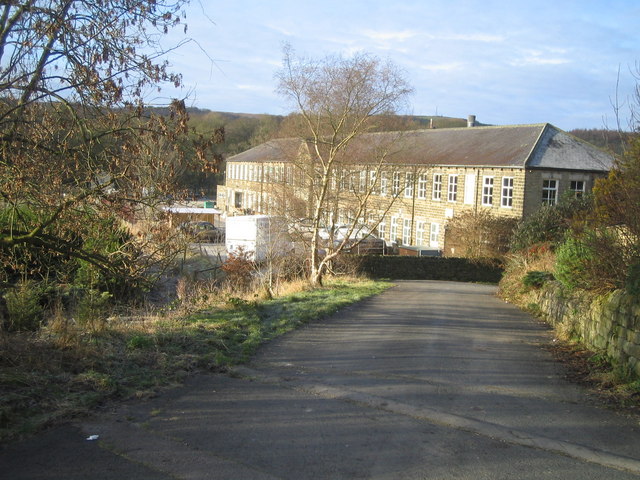
Smelthouses

Smelthouses is a hamlet in Nidderdale in North Yorkshire, England. It lies about 2.3 miles (4 km) south-east of Pateley Bridge, on either side of Fell...

Wilsill

Wilsill is a village in Nidderdale in the Harrogate district of North Yorkshire, England. It is about 2 miles (3 km) east of Pateley Bridge on the B6165...

New York, North Yorkshire

New York is a settlement in Nidderdale in the Harrogate district of North Yorkshire, England. It is on the River Nidd, near Summerbridge, and about 2...

Hartwith cum Winsley

Hartwith cum Winsley is a civil parish in Harrogate district, North Yorkshire, England. Historically it was a township in the ancient parish of Kirkby...

Glasshouses, North Yorkshire

Glasshouses is a small village in Nidderdale, North Yorkshire, England. It lies 1 mile (1.6 km) south-east of Pateley Bridge on the east side of Nidderdale...

Nearby Amenities

Located within 500m of 54.090826,-1.6784473
Barrier: cattle_grid
Lat/Long: 54.0876283/-1.6757804
Building: yes
Lat/Long: 54.0898679/-1.6823606
Springhill Farm
Addr City: Harrogate
Addr Postcode: HG3 5EX
Addr Suburb: Fellbeck
Place: farm
Source Name: OS_OpenData_StreetView
Source Postcode: CodePoint Open
Lat/Long: 54.0940334/-1.6780047
Image: https://www.geograph.org.uk/photo/3882938
Information: guidepost
Tourism: information
Lat/Long: 54.0887172/-1.675411
The data included in this document is from www.openstreetmap.org. The data is made available under ODbL.

Have you been to Bale Hill?

Leave your review of Bale Hill below (or comments, questions and feedback).