Poulton Downs
Hill, Mountain in Wiltshire
England
Poulton Downs
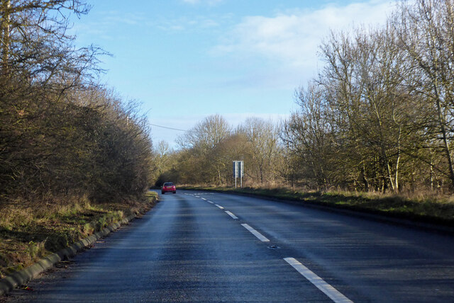
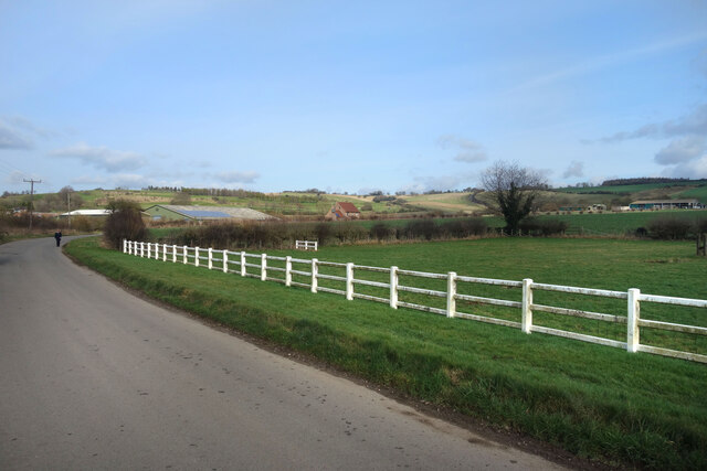
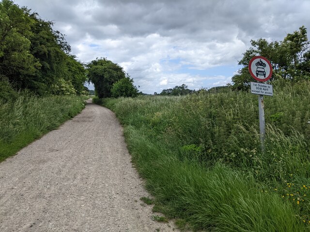
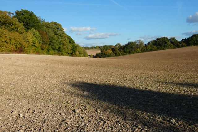
Poulton Downs, located in Wiltshire, England, is a prominent hill situated within the Marlborough Downs. With an elevation of approximately 261 meters (856 feet), it offers breathtaking views of the surrounding countryside. Poulton Downs is part of the North Wessex Downs Area of Outstanding Natural Beauty, renowned for its picturesque landscapes and rich biodiversity.
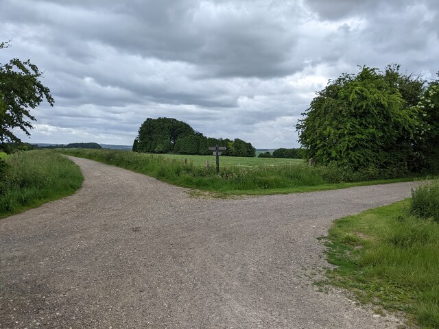
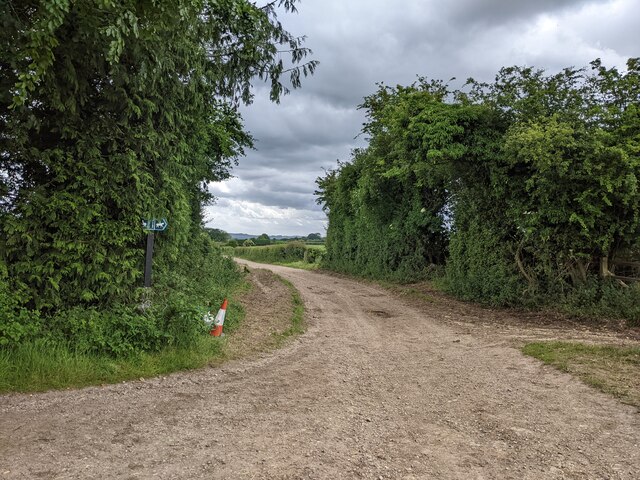
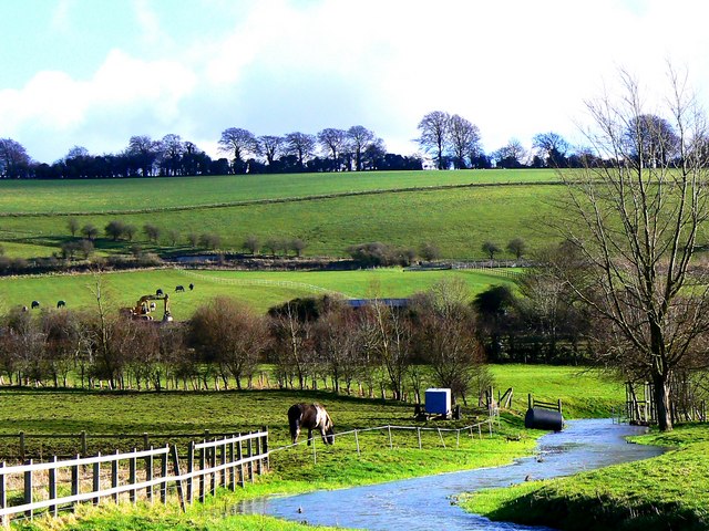
The hill is characterized by its gently rolling slopes and lush green meadows, adorned with vibrant wildflowers during the summer months. It is predominantly covered in a patchwork of agricultural fields and scattered woodlands, contributing to its rural charm. Poulton Downs is a popular destination for outdoor enthusiasts, offering various recreational activities such as walking, hiking, and cycling.
The summit of Poulton Downs provides panoramic vistas of the surrounding area, including the nearby historic town of Marlborough, nestled in the valley below. On clear days, visitors can even catch a glimpse of the renowned prehistoric monument, Avebury Stone Circle, which lies a few miles to the west.
The hill is also home to a diverse range of wildlife, including several bird species such as skylarks, kestrels, and buzzards. Additionally, it supports a variety of flora, including rare orchids and wild thyme, adding to its ecological significance.
Poulton Downs is a cherished natural landmark in Wiltshire, offering a tranquil escape from the hustle and bustle of daily life, and serving as a reminder of the region's rich natural heritage.
If you have any feedback on the listing, please let us know in the comments section below.
Poulton Downs Images
Images are sourced within 2km of 51.450504/-1.7095492 or Grid Reference SU2072. Thanks to Geograph Open Source API. All images are credited.


![Ogbourne St George houses [11] Park Cottage, High Street, was built in the early 19th century. Constructed of stone under a thatch roof.
Ogbourne St George is a village in the valley of the River Og in Wiltshire. It is sited just off the Roman Road from Cirencester to Winchester, about 7 miles south of Swindon and some 3¼ miles north of Marlborough. The name derives from the Saxon 'Oceburnan' or 'Oc[c]a's stream'. There is a great deal of evidence of prehistoric, Roman and medieval activity including Neolithic flint tools, Iron Age coins, Romano-British coins and pottery and medieval pottery fragments. Ogbourne St George today is a commuter village.](https://s2.geograph.org.uk/geophotos/07/40/99/7409902_29a60c37.jpg)
![Ogbourne St George ways [3] From High Street, this footpath leads, via a network of Rights of Way, to Southend and on to Ogbourne St Andrew.
Ogbourne St George is a village in the valley of the River Og in Wiltshire. It is sited just off the Roman Road from Cirencester to Winchester, about 7 miles south of Swindon and some 3¼ miles north of Marlborough. The name derives from the Saxon 'Oceburnan' or 'Oc[c]a's stream'. There is a great deal of evidence of prehistoric, Roman and medieval activity including Neolithic flint tools, Iron Age coins, Romano-British coins and pottery and medieval pottery fragments. Ogbourne St George today is a commuter village.](https://s0.geograph.org.uk/geophotos/07/40/99/7409904_5adda0eb.jpg)
![Ogbourne St George houses [12] The Park, formerly Park House, High Street, is set gable end to the street. The rear range was built in the late 18th or early 19th century of diaper brick. The front range, seen here, in red brick with a rendered facade, is mid 19th century. There is a late 19th century wing to the right. All are under tile roofs. There is a fine Tuscan portico with flanking bay windows. There is another image of the house at <a href="https://www.geograph.org.uk/photo/7410627">SU2074 : Ogbourne St George houses [13]</a>. Listed, grade II, with details at: <span class="nowrap"><a title="https://historicengland.org.uk/listing/the-list/list-entry/1365941" rel="nofollow ugc noopener" href="https://historicengland.org.uk/listing/the-list/list-entry/1365941">Link</a><img style="margin-left:2px;" alt="External link" title="External link - shift click to open in new window" src="https://s1.geograph.org.uk/img/external.png" width="10" height="10"/></span>
Ogbourne St George is a village in the valley of the River Og in Wiltshire. It is sited just off the Roman Road from Cirencester to Winchester, about 7 miles south of Swindon and some 3¼ miles north of Marlborough. The name derives from the Saxon &#039;Oceburnan&#039; or &#039;Oc[c]a&#039;s stream&#039;. There is a great deal of evidence of prehistoric, Roman and medieval activity including Neolithic flint tools, Iron Age coins, Romano-British coins and pottery and medieval pottery fragments. Ogbourne St George today is a commuter village.](https://s2.geograph.org.uk/geophotos/07/41/06/7410626_f9ffaef2.jpg)
![Ogbourne St George houses [13] The Park, formerly Park House, High Street, is set gable end to the street. The rear range, seen here, was built in the late 18th or early 19th century of diaper brick. The front range in red brick with a rendered facade is mid 19th century. There is a late 19th century wing to the right. All are under tile roofs. There is a fine Tuscan portico with flanking bay windows. There is another image of the house at <a href="https://www.geograph.org.uk/photo/7410626">SU2074 : Ogbourne St George houses [12]</a>. Listed, grade II, with details at: <span class="nowrap"><a title="https://historicengland.org.uk/listing/the-list/list-entry/1365941" rel="nofollow ugc noopener" href="https://historicengland.org.uk/listing/the-list/list-entry/1365941">Link</a><img style="margin-left:2px;" alt="External link" title="External link - shift click to open in new window" src="https://s1.geograph.org.uk/img/external.png" width="10" height="10"/></span>
Ogbourne St George is a village in the valley of the River Og in Wiltshire. It is sited just off the Roman Road from Cirencester to Winchester, about 7 miles south of Swindon and some 3¼ miles north of Marlborough. The name derives from the Saxon &#039;Oceburnan&#039; or &#039;Oc[c]a&#039;s stream&#039;. There is a great deal of evidence of prehistoric, Roman and medieval activity including Neolithic flint tools, Iron Age coins, Romano-British coins and pottery and medieval pottery fragments. Ogbourne St George today is a commuter village.](https://s3.geograph.org.uk/geophotos/07/41/06/7410627_000e1ac3.jpg)
![Ogbourne St George features [5] There is a play area amongst the modern houses of Pooles Meadow.
Ogbourne St George is a village in the valley of the River Og in Wiltshire. It is sited just off the Roman Road from Cirencester to Winchester, about 7 miles south of Swindon and some 3¼ miles north of Marlborough. The name derives from the Saxon &#039;Oceburnan&#039; or &#039;Oc[c]a&#039;s stream&#039;. There is a great deal of evidence of prehistoric, Roman and medieval activity including Neolithic flint tools, Iron Age coins, Romano-British coins and pottery and medieval pottery fragments. Ogbourne St George today is a commuter village.](https://s0.geograph.org.uk/geophotos/07/41/06/7410628_816a3dbf.jpg)
![Ogbourne St George buildings [2] The Parklands Hotel is seen here in the process of conversion to 3 separate dwellings. Built circa 1750 of rendered brick under a slate roof. Originally a public house, later a hotel.
Ogbourne St George is a village in the valley of the River Og in Wiltshire. It is sited just off the Roman Road from Cirencester to Winchester, about 7 miles south of Swindon and some 3¼ miles north of Marlborough. The name derives from the Saxon &#039;Oceburnan&#039; or &#039;Oc[c]a&#039;s stream&#039;. There is a great deal of evidence of prehistoric, Roman and medieval activity including Neolithic flint tools, Iron Age coins, Romano-British coins and pottery and medieval pottery fragments. Ogbourne St George today is a commuter village.](https://s1.geograph.org.uk/geophotos/07/41/06/7410629_deadaf04.jpg)
![Ogbourne St George buildings [3] The former village stores and post office, High Street, is now a private dwelling. The business became tearooms circa 1990 and closed completely circa 1999. Constructed of red brick under a tile roof.
Ogbourne St George is a village in the valley of the River Og in Wiltshire. It is sited just off the Roman Road from Cirencester to Winchester, about 7 miles south of Swindon and some 3¼ miles north of Marlborough. The name derives from the Saxon &#039;Oceburnan&#039; or &#039;Oc[c]a&#039;s stream&#039;. There is a great deal of evidence of prehistoric, Roman and medieval activity including Neolithic flint tools, Iron Age coins, Romano-British coins and pottery and medieval pottery fragments. Ogbourne St George today is a commuter village.](https://s0.geograph.org.uk/geophotos/07/41/06/7410632_9db980a9.jpg)
![Ogbourne St George houses [14] Bramley Cottage, High Street, was built in the late 17th or early 18th century. The left bay is timber framed, the right bay, in brick, is probably a rebuild.
All under a thatch roof. There is a lean-to extension on the left, over which the thatch has been swept down. Listed, grade II, with details at: <span class="nowrap"><a title="https://historicengland.org.uk/listing/the-list/list-entry/1365584" rel="nofollow ugc noopener" href="https://historicengland.org.uk/listing/the-list/list-entry/1365584">Link</a><img style="margin-left:2px;" alt="External link" title="External link - shift click to open in new window" src="https://s1.geograph.org.uk/img/external.png" width="10" height="10"/></span>
Ogbourne St George is a village in the valley of the River Og in Wiltshire. It is sited just off the Roman Road from Cirencester to Winchester, about 7 miles south of Swindon and some 3¼ miles north of Marlborough. The name derives from the Saxon &#039;Oceburnan&#039; or &#039;Oc[c]a&#039;s stream&#039;. There is a great deal of evidence of prehistoric, Roman and medieval activity including Neolithic flint tools, Iron Age coins, Romano-British coins and pottery and medieval pottery fragments. Ogbourne St George today is a commuter village.](https://s1.geograph.org.uk/geophotos/07/41/06/7410633_ca1153d9.jpg)
Poulton Downs is located at Grid Ref: SU2072 (Lat: 51.450504, Lng: -1.7095492)
Unitary Authority: Wiltshire
Police Authority: Wiltshire
What 3 Words
///mysteries.locate.absorb. Near Mildenhall, Wiltshire
Nearby Locations
Related Wikis

Ogbourne Priory
Ogbourne Priory was a priory in Wiltshire, England, from the 12th century until the early 15th. There may have been a priory building in the 13th century...
Ogbourne St Andrew
Ogbourne St Andrew is a civil parish and small village in Wiltshire, England, 2 miles (3.2 km) north of Marlborough. The parish is on the banks of the...

Ogbourne Maizey
Ogbourne Maizey is a hamlet in Wiltshire, England 1.6 miles (2.6 km) north of the town of Marlborough and 0.4 miles (0.64 km) south of the village of Ogbourne...

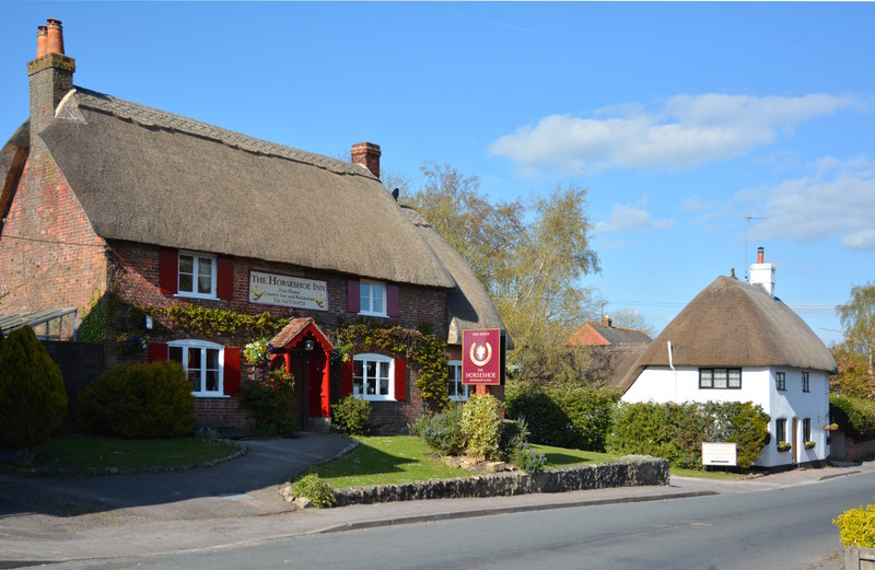
Ogbourne St George
Ogbourne St George is a village and civil parish on the River Og about 3 miles (4.8 km) north of Marlborough, Wiltshire, England. == History == Domesday...
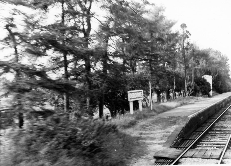
Ogbourne railway station
Ogbourne railway station was on the Midland and South Western Junction Railway in Wiltshire, England. The station opened on 27 July 1881 on the Swindon...
Mildenhall, Wiltshire
Mildenhall ( MY-nəl) is a village and civil parish in the Kennet Valley in Wiltshire, England, immediately east of the market town of Marlborough. The...

Cunetio
Cunetio was a large walled town in a valley of the River Kennet in modern-day Wiltshire, England. The settlement was occupied from the 2nd century CE by...
Cunetio Hoard
The Cunetio Hoard, also known as the Mildenhall Hoard, is the largest hoard of Roman coins found in Britain. It was discovered in 1978 at the site of the...
Have you been to Poulton Downs?
Leave your review of Poulton Downs below (or comments, questions and feedback).