Greygarth Hill

Hill, Mountain in Yorkshire Harrogate

England

Greygarth Hill

Greygarth Monument Erected to celebrate Queen Victoria's Diamond Jubilee in 1897.  This spot affords tremendous views on a clear day, particularly to the east, over the Vale of York to the White Horse of Kilburn and the North York Moors.
Greygarth Monument Credit: Chris Heaton

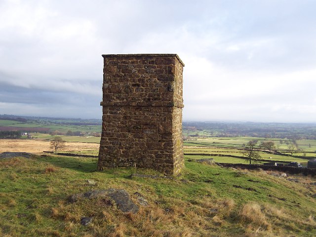
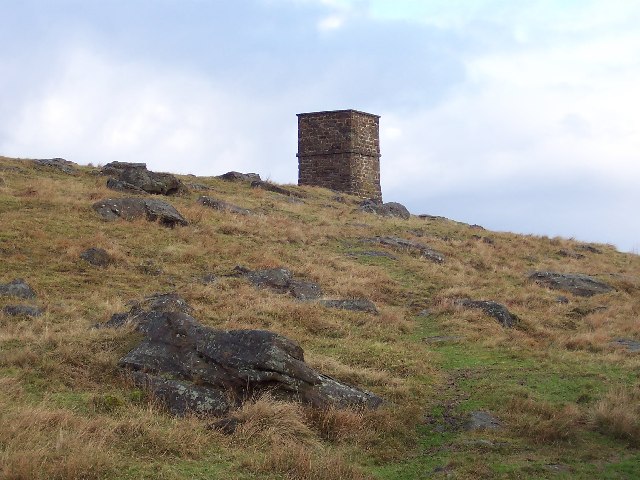
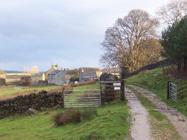
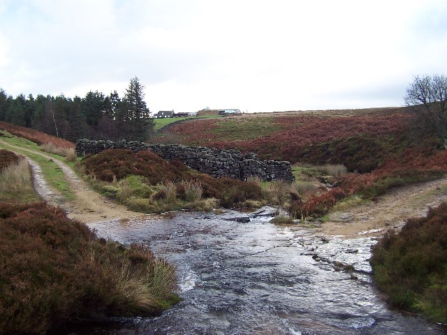
Greygarth Hill is a prominent natural landmark located in the county of Yorkshire, England. With an elevation of approximately 450 meters (1,476 feet), it is classified as a hill rather than a mountain. Situated in the picturesque North York Moors National Park, Greygarth Hill offers breathtaking panoramic views of the surrounding countryside.

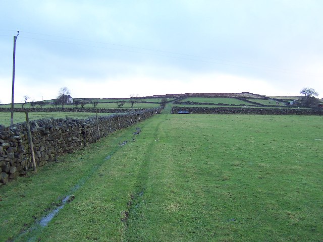
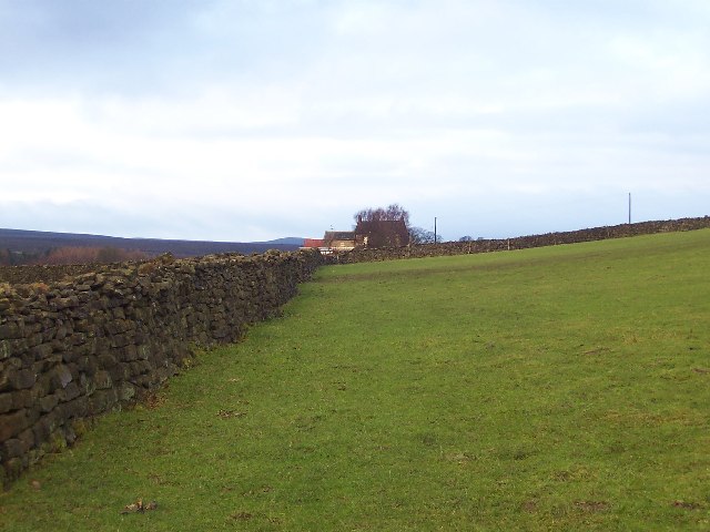
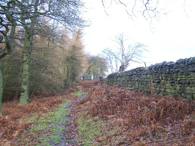
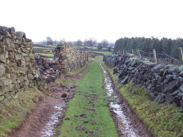
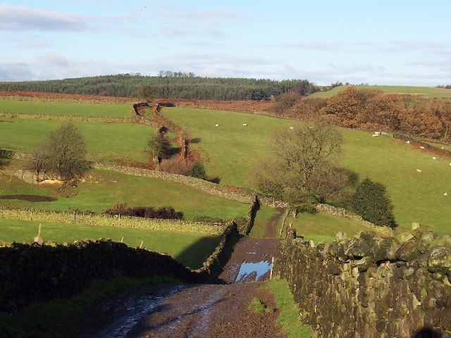
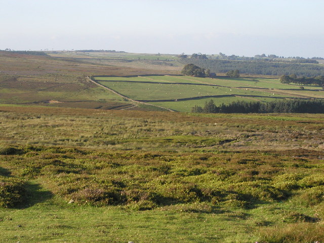
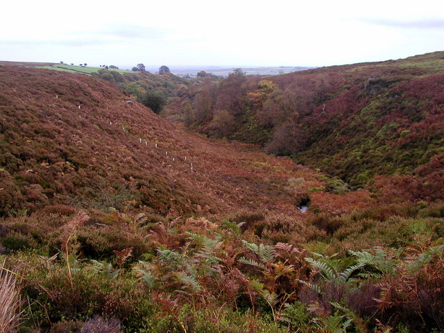
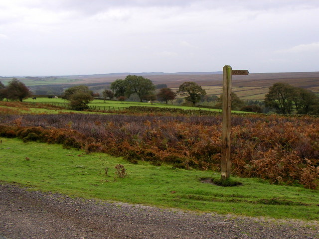
Covered in heather and grass, the hill is a haven for wildlife and hikers alike. The terrain consists of gentle slopes and rocky outcrops, making it accessible to both experienced and novice walkers. The hill's distinct silhouette can be seen from miles away, adding to its allure and commanding presence in the landscape.

At the summit, visitors are rewarded with stunning vistas of the rolling Yorkshire Moors, dotted with quaint villages and patchwork fields. On clear days, the view extends as far as the North Sea coast, providing a captivating glimpse of the vastness of the region.

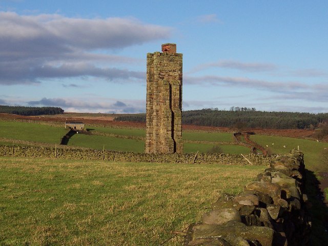
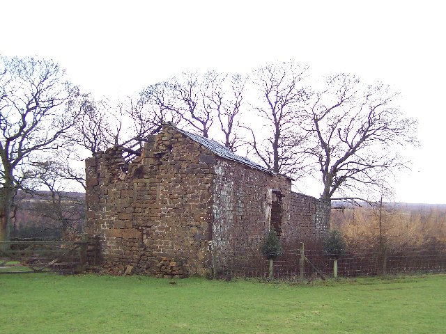
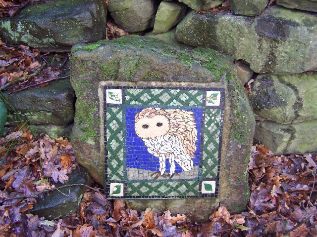
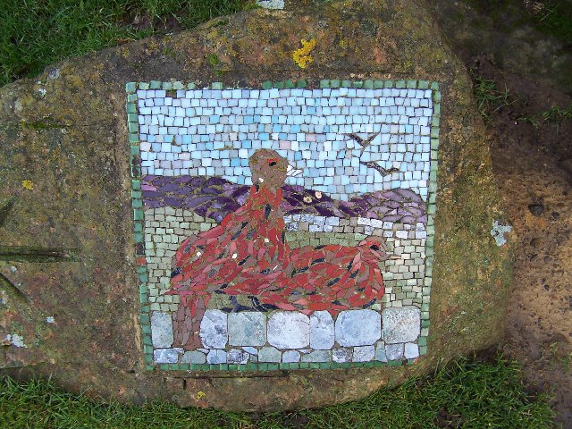
Greygarth Hill is also steeped in history, with traces of ancient settlements and burial mounds scattered across its slopes. Its name is believed to be derived from Old Norse, reflecting the Viking influence in the area. Today, the hill serves as a popular destination for outdoor enthusiasts, offering opportunities for hiking, birdwatching, and photography.

Overall, Greygarth Hill is a magnificent natural feature that showcases the raw beauty of Yorkshire's countryside. Its accessibility, stunning views, and historical significance make it a must-visit destination for those seeking a connection with nature and a deeper understanding of the region's rich heritage.

If you have any feedback on the listing, please let us know in the comments section below.

Greygarth Hill Images

Images are sourced within 2km of 54.147251/-1.7181057 or Grid Reference SE1872. Thanks to Geograph Open Source API. All images are credited.

Greygarth Monument Erected to celebrate Queen Victoria's Diamond Jubilee in 1897.  This spot affords tremendous views on a clear day, particularly to the east, over the Vale of York to the White Horse of Kilburn and the North York Moors.
Greygarth Monument
Erected to celebrate Queen Victoria's Diamond Jubilee in 1897. This spot affords tremendous views on a clear day, particularly to the east, over the Vale of York to the White Horse of Kilburn and the North York Moors.
Approach to Greygarth Monument There is a right of way over Greygarth Hill to reach the monument from the west.
Approach to Greygarth Monument
There is a right of way over Greygarth Hill to reach the monument from the west.
Green Lane leading away from Dallowgill to Greygarth Pleasant preamble through upland pastures near Greygarth.
Green Lane leading away from Dallowgill to Greygarth
Pleasant preamble through upland pastures near Greygarth.
Approaching Bents House Crossing upland pastures from the east, above the valley of Dallowgill to reach the farm known as Bents House
Approaching Bents House
Crossing upland pastures from the east, above the valley of Dallowgill to reach the farm known as Bents House
Dallow Collection of houses that make up the hamlet of Dallow, from the west.
Dallow
Collection of houses that make up the hamlet of Dallow, from the west.
Ford over Carlesmoor Beck This track fords Carlesmoor Beck on Hawsett Riggs, just below the confluence of Fortress Dyke and Wandley Gill.
Ford over Carlesmoor Beck
This track fords Carlesmoor Beck on Hawsett Riggs, just below the confluence of Fortress Dyke and Wandley Gill.
Sighting Tower, near Carlesmoor Whatever the purpose of this structure it appears abandoned now, and falling into disrepair. See Colsterdale towers on Wikipedia <span class="nowrap"><a title="http://en.wikipedia.org/wiki/Colsterdale_towers" rel="nofollow ugc noopener" href="http://en.wikipedia.org/wiki/Colsterdale_towers">Link</a><img style="margin-left:2px;" alt="External link" title="External link - shift click to open in new window" src="https://s1.geograph.org.uk/img/external.png" width="10" height="10"/></span>
Sighting Tower, near Carlesmoor
Whatever the purpose of this structure it appears abandoned now, and falling into disrepair. See Colsterdale towers on Wikipedia LinkExternal link
Abandoned Farm Buildings, Dallowgill Close to Bents House, and above the wooded cleft of Dallowgill.
Abandoned Farm Buildings, Dallowgill
Close to Bents House, and above the wooded cleft of Dallowgill.
Woods in Dallowgill
Woods in Dallowgill
Art near Stang Brae, Dallowgill Supplemental, I agree.  The area around Dallowgill has several of these mosaics in odd places, almost like a treasure hunt.  Someone with an artistic flair has gone to much trouble.
Art near Stang Brae, Dallowgill
Supplemental, I agree. The area around Dallowgill has several of these mosaics in odd places, almost like a treasure hunt. Someone with an artistic flair has gone to much trouble.
Mosaic on Hawset Rigg Another masterpiece around Dallowgill.  This one has an arrow indicator.
Mosaic on Hawset Rigg
Another masterpiece around Dallowgill. This one has an arrow indicator.
Mosaic on edge of Kirkby Malzeard Moor I must have seen about 10 of these works of art during a walk around Dallowgill.  This one is at the point where the green lane west of Carlesmoor House Farm enters Kirkby Malzeard Moor.
Mosaic on edge of Kirkby Malzeard Moor
I must have seen about 10 of these works of art during a walk around Dallowgill. This one is at the point where the green lane west of Carlesmoor House Farm enters Kirkby Malzeard Moor.
Green Lane near Carlesmoor House Farm Looking east, walking from Kirkby Malzeard Moor towards Carlesmoor
Green Lane near Carlesmoor House Farm
Looking east, walking from Kirkby Malzeard Moor towards Carlesmoor
Green Lane from Carlesmoor to Newlands Excellent example of a green lane. This one is heading north from Carlesmoor to Newlands Plantation
Green Lane from Carlesmoor to Newlands
Excellent example of a green lane. This one is heading north from Carlesmoor to Newlands Plantation
Kirkby Malzeard Moor This is the view NE from MR: SE173728 on a lovely summer's evening.
Kirkby Malzeard Moor
This is the view NE from MR: SE173728 on a lovely summer's evening.
Saint Peter's Church, Dallowgill. A springtime view of a secluded chapel within Southern Nidderdale.
Saint Peter's Church, Dallowgill.
A springtime view of a secluded chapel within Southern Nidderdale.
North Gill Beck Taken later in the year to my last photograph - the colours are completely different!
North Gill Beck
Taken later in the year to my last photograph - the colours are completely different!
Bridleway to Dallowgill
Show me another place!

Greygarth Hill is located at Grid Ref: SE1872 (Lat: 54.147251, Lng: -1.7181057)

Division: West Riding

Administrative County: North Yorkshire

District: Harrogate

Police Authority: North Yorkshire

What 3 Words

///dumpling.duplicity.jetting. Near Pateley Bridge, North Yorkshire

Related Wikis

Dallowgill

Dallowgill (historically also Dallaghill) is a village in Harrogate district in North Yorkshire, England. It consists of a number of scattered settlements...

Laverton, North Yorkshire

Laverton is a village and civil parish in the Harrogate district of North Yorkshire, England, about 7 miles (11 km) west of Ripon. The population of this...

High and Low Bishopside

High and Low Bishopside is a civil parish in Nidderdale in the Harrogate district, in the county of North Yorkshire, England. It includes the town of Pateley...

Kirkby Malzeard

Kirkby Malzeard () is a village and civil parish in the Harrogate district of North Yorkshire, England. There has been a creamery in the village making...

Grantley, North Yorkshire

Grantley is a village (also known as High Grantley) and civil parish in North Yorkshire, England. It lies 5 miles (8 km) west of Ripon. The parish also...

Eavestone

Eavestone is a hamlet and civil parish in the Harrogate district of North Yorkshire, England. It is situated near Brimham Rocks, 3 miles (4.8 km) east...

Roundhill Reservoir

Roundhill Reservoir is situated near Leighton Reservoir in North Yorkshire, England. It was constructed by Harrogate Corporation early in the 20th century...

Ilton, North Yorkshire

Ilton is a village in North Yorkshire, England, 3 miles south-west of Masham. It is the principal settlement in the civil parish of Ilton cum Pott, in...

Nearby Amenities

Located within 500m of 54.147251,-1.7181057
Swetton Moor
Is In: UK,Yorkshire,North Yorkshire,Nidderdale
Is In Country: UK
Is In County: North Yorkshire
Is In Historical County: Yorkshire
Natural: moor
Source: NPE
Lat/Long: 54.1497626/-1.7143514
Greygarth Hill
Is In Country: UK
Is In County: North Yorkshire
Is In Historical County: Yorkshire
Natural: peak
Source: OS OpenData StreetView
Lat/Long: 54.1476833/-1.7158976
Greygarth
Is In Country: UK
Is In Country Code: GB
Is In County: North Yorkshire
Is In Historical County: Yorkshire
Place: hamlet
Source: OS OpenData StreetView
Lat/Long: 54.1460746/-1.7128399
Place: farm
Lat/Long: 54.1457465/-1.7200993
Building: yes
Lat/Long: 54.1470662/-1.7218802
Place: farm
Lat/Long: 54.1465509/-1.7134903
The data included in this document is from www.openstreetmap.org. The data is made available under ODbL.

Have you been to Greygarth Hill?

Leave your review of Greygarth Hill below (or comments, questions and feedback).