Swetton Moor

Downs, Moorland in Yorkshire Harrogate

England

Swetton Moor

Ford at Hedge Nook This ford is found on Aresmor Beck along Drift Lane at Hedge Nook.
Ford at Hedge Nook Credit: John Walton

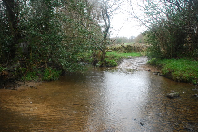
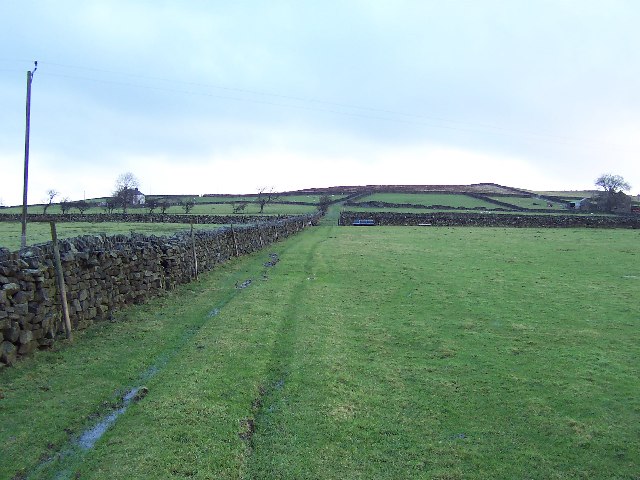
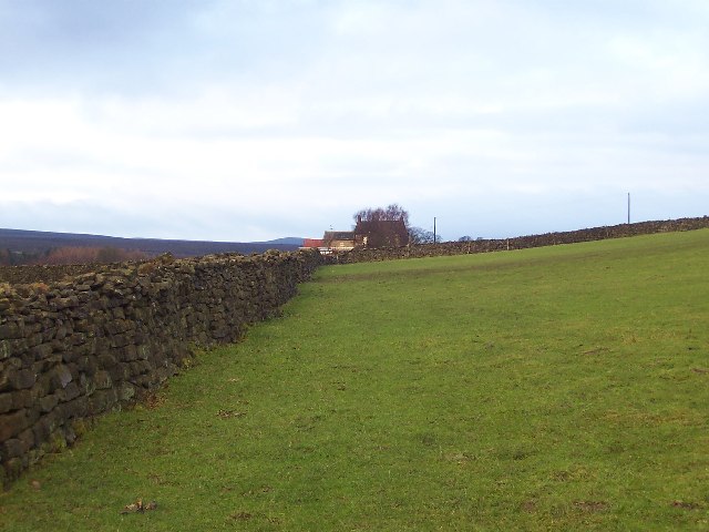
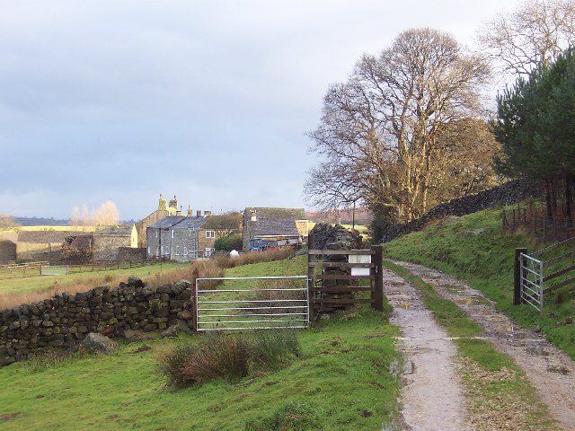
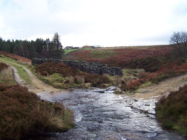
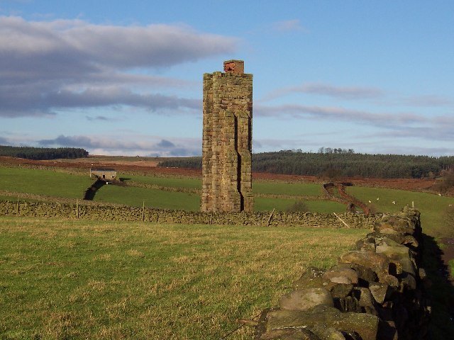
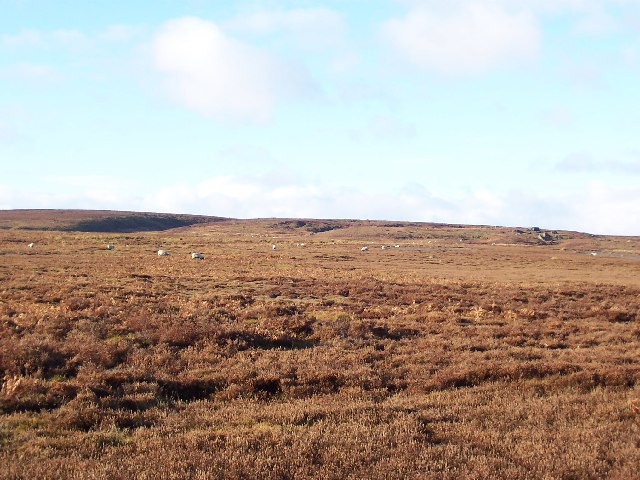
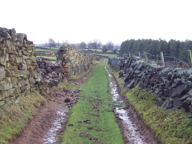
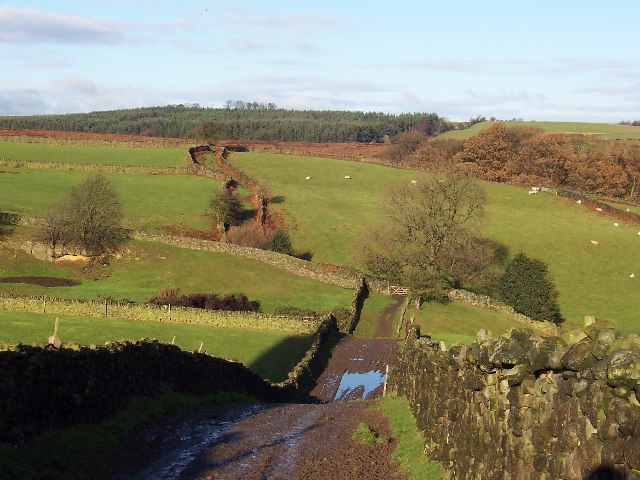
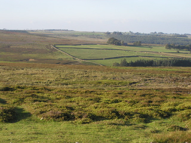
Swetton Moor is a picturesque area located in the county of Yorkshire, England. Situated on the Yorkshire Downs, this region boasts stunning moorland landscapes that attract visitors from far and wide. Spanning over several square miles, Swetton Moor is known for its rugged terrain, heather-clad hills, and breathtaking views.

The moorland is characterized by its rich biodiversity, with a variety of plant and animal species calling it home. Walking along the marked trails, visitors can spot rare bird species such as the red grouse, curlew, and lapwing. The vibrant purple heather that blankets the moorland during the summer months adds a touch of beauty to the already stunning scenery.

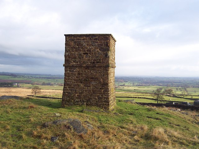
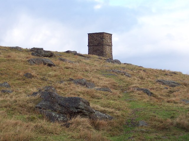
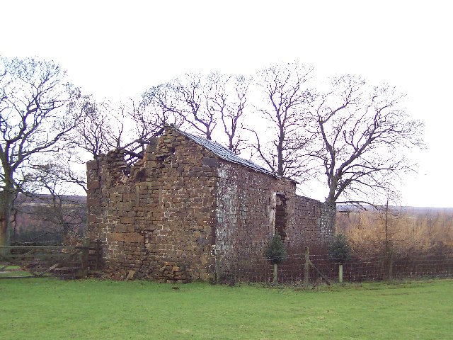
Swetton Moor is also renowned for its historical significance. The area is scattered with remnants of ancient settlements, including Bronze Age burial mounds and stone circles. These archaeological sites offer a glimpse into the region's past and provide a fascinating insight into the lives of its early inhabitants.

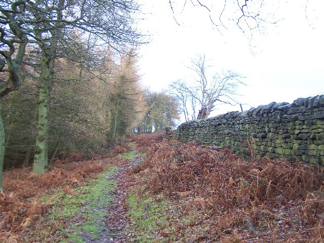
For outdoor enthusiasts, Swetton Moor offers ample opportunities for activities such as hiking, birdwatching, and photography. The well-maintained trails cater to all levels of fitness, allowing visitors to explore the moorland at their own pace. In addition, the tranquil atmosphere and stunning vistas make it an ideal spot for those seeking solace and a break from the hustle and bustle of everyday life.

Overall, Swetton Moor in Yorkshire is a place of natural beauty and historical importance. With its diverse flora and fauna, captivating landscapes, and rich heritage, it is a must-visit destination for anyone looking to immerse themselves in the wonders of Yorkshire's countryside.

If you have any feedback on the listing, please let us know in the comments section below.
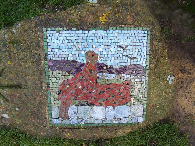
Swetton Moor Images

Images are sourced within 2km of 54.150111/-1.7152386 or Grid Reference SE1872. Thanks to Geograph Open Source API. All images are credited.

Ford at Hedge Nook This ford is found on Aresmor Beck along Drift Lane at Hedge Nook.
Ford at Hedge Nook
This ford is found on Aresmor Beck along Drift Lane at Hedge Nook.
Greygarth Monument Erected to celebrate Queen Victoria's Diamond Jubilee in 1897.  This spot affords tremendous views on a clear day, particularly to the east, over the Vale of York to the White Horse of Kilburn and the North York Moors.
Greygarth Monument
Erected to celebrate Queen Victoria's Diamond Jubilee in 1897. This spot affords tremendous views on a clear day, particularly to the east, over the Vale of York to the White Horse of Kilburn and the North York Moors.
Approach to Greygarth Monument There is a right of way over Greygarth Hill to reach the monument from the west.
Approach to Greygarth Monument
There is a right of way over Greygarth Hill to reach the monument from the west.
Green Lane leading away from Dallowgill to Greygarth Pleasant preamble through upland pastures near Greygarth.
Green Lane leading away from Dallowgill to Greygarth
Pleasant preamble through upland pastures near Greygarth.
Approaching Bents House Crossing upland pastures from the east, above the valley of Dallowgill to reach the farm known as Bents House
Approaching Bents House
Crossing upland pastures from the east, above the valley of Dallowgill to reach the farm known as Bents House
Dallow Collection of houses that make up the hamlet of Dallow, from the west.
Dallow
Collection of houses that make up the hamlet of Dallow, from the west.
Ford over Carlesmoor Beck This track fords Carlesmoor Beck on Hawsett Riggs, just below the confluence of Fortress Dyke and Wandley Gill.
Ford over Carlesmoor Beck
This track fords Carlesmoor Beck on Hawsett Riggs, just below the confluence of Fortress Dyke and Wandley Gill.
Sighting Tower, near Carlesmoor Whatever the purpose of this structure it appears abandoned now, and falling into disrepair. See Colsterdale towers on Wikipedia <span class="nowrap"><a title="http://en.wikipedia.org/wiki/Colsterdale_towers" rel="nofollow ugc noopener" href="http://en.wikipedia.org/wiki/Colsterdale_towers">Link</a><img style="margin-left:2px;" alt="External link" title="External link - shift click to open in new window" src="https://s1.geograph.org.uk/img/external.png" width="10" height="10"/></span>
Sighting Tower, near Carlesmoor
Whatever the purpose of this structure it appears abandoned now, and falling into disrepair. See Colsterdale towers on Wikipedia LinkExternal link
Wolf Crags and Stock Beck Moor The edge of Kirkby Malzeard Moor, which is itself part of a huge swathe of moorland between Nidderdale and Wensleydale.
Wolf Crags and Stock Beck Moor
The edge of Kirkby Malzeard Moor, which is itself part of a huge swathe of moorland between Nidderdale and Wensleydale.
Abandoned Farm Buildings, Dallowgill Close to Bents House, and above the wooded cleft of Dallowgill.
Abandoned Farm Buildings, Dallowgill
Close to Bents House, and above the wooded cleft of Dallowgill.
Woods in Dallowgill
Woods in Dallowgill
Art near Stang Brae, Dallowgill Supplemental, I agree.  The area around Dallowgill has several of these mosaics in odd places, almost like a treasure hunt.  Someone with an artistic flair has gone to much trouble.
Art near Stang Brae, Dallowgill
Supplemental, I agree. The area around Dallowgill has several of these mosaics in odd places, almost like a treasure hunt. Someone with an artistic flair has gone to much trouble.
Mosaic on Hawset Rigg Another masterpiece around Dallowgill.  This one has an arrow indicator.
Mosaic on Hawset Rigg
Another masterpiece around Dallowgill. This one has an arrow indicator.
Mosaic on edge of Kirkby Malzeard Moor I must have seen about 10 of these works of art during a walk around Dallowgill.  This one is at the point where the green lane west of Carlesmoor House Farm enters Kirkby Malzeard Moor.
Mosaic on edge of Kirkby Malzeard Moor
I must have seen about 10 of these works of art during a walk around Dallowgill. This one is at the point where the green lane west of Carlesmoor House Farm enters Kirkby Malzeard Moor.
Green Lane near Carlesmoor House Farm Looking east, walking from Kirkby Malzeard Moor towards Carlesmoor
Green Lane near Carlesmoor House Farm
Looking east, walking from Kirkby Malzeard Moor towards Carlesmoor
Green Lane from Carlesmoor to Newlands Excellent example of a green lane. This one is heading north from Carlesmoor to Newlands Plantation
Green Lane from Carlesmoor to Newlands
Excellent example of a green lane. This one is heading north from Carlesmoor to Newlands Plantation
Kirkby Malzeard Moor This is the view NE from MR: SE173728 on a lovely summer's evening.
Kirkby Malzeard Moor
This is the view NE from MR: SE173728 on a lovely summer's evening.
Saint Peter's Church, Dallowgill. A springtime view of a secluded chapel within Southern Nidderdale.
Saint Peter's Church, Dallowgill.
A springtime view of a secluded chapel within Southern Nidderdale.
Show me another place!

Swetton Moor is located at Grid Ref: SE1872 (Lat: 54.150111, Lng: -1.7152386)

Division: West Riding

Administrative County: North Yorkshire

District: Harrogate

Police Authority: North Yorkshire

What 3 Words

///ranted.fragment.skewing. Near Pateley Bridge, North Yorkshire

Related Wikis

Dallowgill

Dallowgill (historically also Dallaghill) is a village in Harrogate district in North Yorkshire, England. It consists of a number of scattered settlements...

Skelding, North Yorkshire

Skelding is a civil parish in North Yorkshire, England. It lies 6 miles (10 km) west of Ripon, on the north bank of the River Skell. There is no village...

Laverton, North Yorkshire

Laverton is a village and civil parish in the Harrogate district of North Yorkshire, England, about 7 miles (11 km) west of Ripon. The population of this...

Kirkby Malzeard

Kirkby Malzeard () is a village and civil parish in the Harrogate district of North Yorkshire, England. There has been a creamery in the village making...

Nearby Amenities

Located within 500m of 54.150111,-1.7152386
Swetton Moor
Is In: UK,Yorkshire,North Yorkshire,Nidderdale
Is In Country: UK
Is In County: North Yorkshire
Is In Historical County: Yorkshire
Natural: moor
Source: NPE
Lat/Long: 54.1497626/-1.7143514
Greygarth Hill
Is In Country: UK
Is In County: North Yorkshire
Is In Historical County: Yorkshire
Natural: peak
Source: OS OpenData StreetView
Lat/Long: 54.1476833/-1.7158976
Greygarth
Is In Country: UK
Is In Country Code: GB
Is In County: North Yorkshire
Is In Historical County: Yorkshire
Place: hamlet
Source: OS OpenData StreetView
Lat/Long: 54.1460746/-1.7128399
Place: farm
Lat/Long: 54.1465509/-1.7134903
The data included in this document is from www.openstreetmap.org. The data is made available under ODbL.

Have you been to Swetton Moor?

Leave your review of Swetton Moor below (or comments, questions and feedback).