Diddersley Hill

Hill, Mountain in Yorkshire Richmondshire

England

Diddersley Hill

Lane to Hartforth Saw Mill Now a bed and breakfast establishment.
Lane to Hartforth Saw Mill Credit: Mick Garratt

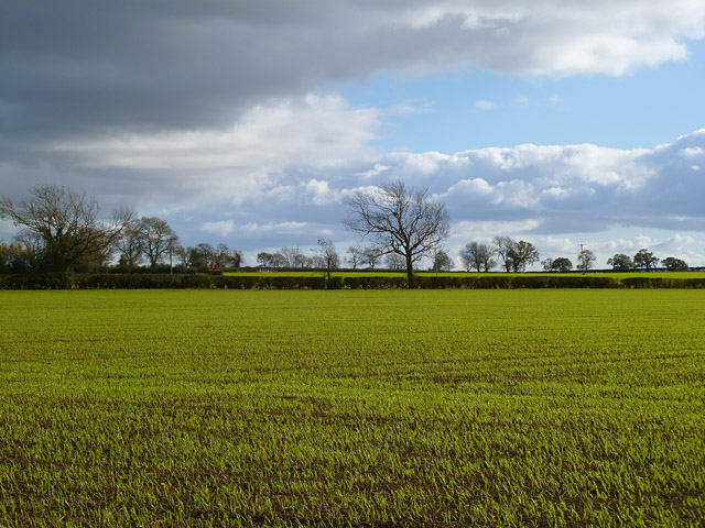
Diddersley Hill, located in the county of Yorkshire, England, is a prominent hill in the region. With an elevation reaching approximately 350 meters (1,150 feet), it is considered one of the notable hills in the area. The hill is situated near the village of Diddersley, which lies in the northern part of Yorkshire.

Diddersley Hill offers breathtaking views of the surrounding countryside, with its rolling hills and picturesque scenery. As it is relatively tall compared to other nearby hills, it provides an excellent vantage point for visitors to take in the beauty of the landscape.

The hill is covered in lush green vegetation, featuring a mix of grasses, shrubs, and trees. The natural beauty of the area attracts many nature enthusiasts and hikers, who enjoy exploring the various trails and paths that crisscross the hill. These trails cater to different skill levels, offering options for both beginners and experienced hikers.

Birdwatchers also flock to Diddersley Hill, as it provides an ideal habitat for a variety of bird species. The hill's diverse flora and fauna make it a haven for birdlife, and visitors can spot numerous species throughout the year.

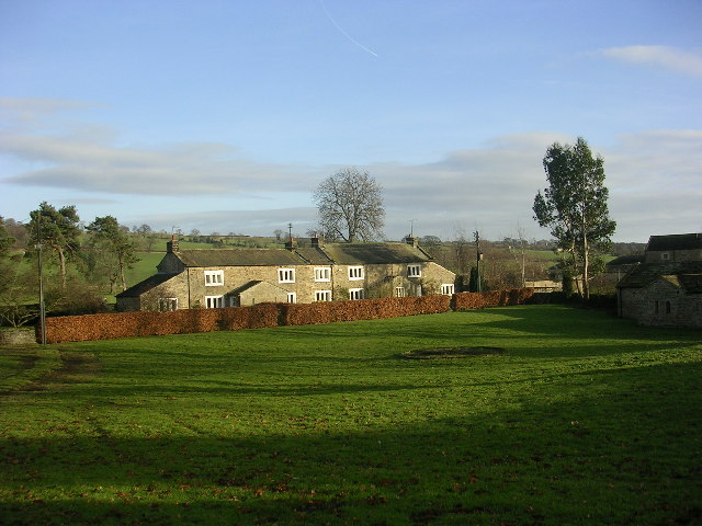
Moreover, the hill's location near the village of Diddersley makes it easily accessible. Visitors can reach the hill by foot, bike, or car, and there are parking facilities available nearby. Additionally, the village offers various amenities, including accommodations, restaurants, and shops, making it a convenient base for those wishing to explore Diddersley Hill and its surroundings.

In conclusion, Diddersley Hill in Yorkshire is a stunning natural landmark that provides visitors with breathtaking views, diverse flora and fauna, and a range of recreational activities.

If you have any feedback on the listing, please let us know in the comments section below.

Diddersley Hill Images

Images are sourced within 2km of 54.465962/-1.7327073 or Grid Reference NZ1707. Thanks to Geograph Open Source API. All images are credited.

Lane to Hartforth Saw Mill Now a bed and breakfast establishment.
Lane to Hartforth Saw Mill
Now a bed and breakfast establishment.
Tree in a Field Near Hartforth Wood.
Tree in a Field
Near Hartforth Wood.
View of Hartforth Hall From across the meadows of Hatforth Beck.
View of Hartforth Hall
From across the meadows of Hatforth Beck.
Hartforth Hall Now a hotel.
Hartforth Hall
Now a hotel.
Jagger Lane An ancient pannierway linking the lead smelting mills with Melsonby and beyond. The name derives from the local name of the sturdy German horses used to carry the smelted ore to the Tees ports of Yarm and Worsall for shipment to London.

Lead has been quarried and smelted in these parts since the Roman times.
Jagger Lane
An ancient pannierway linking the lead smelting mills with Melsonby and beyond. The name derives from the local name of the sturdy German horses used to carry the smelted ore to the Tees ports of Yarm and Worsall for shipment to London. Lead has been quarried and smelted in these parts since the Roman times.
Bridge over Hartforth Beck Carrying the ancient track, Jagger Lane.
Bridge over Hartforth Beck
Carrying the ancient track, Jagger Lane.
Home Farm A new build architecturally designed to blend in with the adjacent listed Georgian farm buildings, apparently. The architects were Francis Johnson and Partners and the design won a prestigious architectural award in 2009. Local opinion is somewhat divided.

In the foreground a JCB is working on Hartforth Beck and producing much exhaust fumes.
Home Farm
A new build architecturally designed to blend in with the adjacent listed Georgian farm buildings, apparently. The architects were Francis Johnson and Partners and the design won a prestigious architectural award in 2009. Local opinion is somewhat divided. In the foreground a JCB is working on Hartforth Beck and producing much exhaust fumes.
Farmland, Hartforth A view across arable farmland and plantations from the footpath at Pond Dale Farm.
Farmland, Hartforth
A view across arable farmland and plantations from the footpath at Pond Dale Farm.
Farmland, Hartforth A cereal crop and the edge of Hartforth Wood.
Farmland, Hartforth
A cereal crop and the edge of Hartforth Wood.
Farmland and farm road, Hartforth The bridleway heading away from Pond Dale Farm.
Farmland and farm road, Hartforth
The bridleway heading away from Pond Dale Farm.
Farmland, Melsonby A wall separates pasture from arable land. The trees are on Jagger Lane.
Farmland, Melsonby
A wall separates pasture from arable land. The trees are on Jagger Lane.
Farmland, Hartforth A view across arable fields separated by Hartforth Lane. Moor End Plantation is to the right of picture.
Farmland, Hartforth
A view across arable fields separated by Hartforth Lane. Moor End Plantation is to the right of picture.
Pasture, Hartforth Sheep on the southern flank of Diddersley Hill viewed from beside the A66 where there is now a bridleway.
Pasture, Hartforth
Sheep on the southern flank of Diddersley Hill viewed from beside the A66 where there is now a bridleway.
Farmland, Carkin Arable fields viewed from beside the B6274. The hedgerow in the foreground is beside the road to Carkin Moor with the trees in the next field boundary to the south.
Farmland, Carkin
Arable fields viewed from beside the B6274. The hedgerow in the foreground is beside the road to Carkin Moor with the trees in the next field boundary to the south.
Farmland, Carkin A crop of oil-seed rape growing to the west of the B6274. Houses on the edge of East Layton are just visible.
Farmland, Carkin
A crop of oil-seed rape growing to the west of the B6274. Houses on the edge of East Layton are just visible.
Farmland, Melsonby A distant view of the Cleveland Hills over a crop of oil-seed rape growing beside the footpath (quarry road) at Low Grange.
Farmland, Melsonby
A distant view of the Cleveland Hills over a crop of oil-seed rape growing beside the footpath (quarry road) at Low Grange.
Pasture, Melsonby Sheep grazing in a field to the west of Bracken House with a view over the Tees valley.
Pasture, Melsonby
Sheep grazing in a field to the west of Bracken House with a view over the Tees valley.
Farmland, Melsonby Cereal crops in fields to the south of Jagger Lane.
Farmland, Melsonby
Cereal crops in fields to the south of Jagger Lane.
Show me another place!

Diddersley Hill is located at Grid Ref: NZ1707 (Lat: 54.465962, Lng: -1.7327073)

Division: North Riding

Administrative County: North Yorkshire

District: Richmondshire

Police Authority: North Yorkshire

What 3 Words

///contour.loft.laminated. Near Hutton Magna, Co. Durham

Nearby Locations

Diddersley Hill Black Hill

Related Wikis

Hartforth

Hartforth is a small village in the Richmondshire district of North Yorkshire, England. The village is situated approximately 9 miles (14 km) south-west...

Carkin

Carkin is a civil parish in North Yorkshire, England. It was created from the separation of the parish of Forcett and Carkin into "Carkin" and "Forcett...

East Layton

East Layton is a village and civil parish in the Richmondshire district of North Yorkshire, England, close to the border with County Durham and a few miles...

Melsonby

Melsonby is a village and civil parish in the Richmondshire district of North Yorkshire, England. It lies a 1.2 miles (2 km) west of the A1(M) motorway...

St James' Church, Melsonby

St James' Church is in the village of Melsonby, North Yorkshire, England. It is an Anglican parish church in the deanery of Richmond, the archdeaconry...

Scot's Dyke

Scot’s Dyke, also known as the Scots Dyke or the Scots Dike, is a linear earthwork in the district of Richmondshire in the county of North Yorkshire, England...

Whashton

Whashton is a village and civil parish in the Richmondshire district of North Yorkshire, England. == History == The name is of an uncertain origin and...

Gilling West

Gilling West is a village about 3.5 miles (5.6 km) north of Richmond in the Richmondshire district of North Yorkshire, England. It is located in the civil...

Nearby Amenities

Located within 500m of 54.465962,-1.7327073
Black Hill
Place: locality
Lat/Long: 54.4624702/-1.7339909
The data included in this document is from www.openstreetmap.org. The data is made available under ODbL.

Have you been to Diddersley Hill?

Leave your review of Diddersley Hill below (or comments, questions and feedback).