Kilhallon
Settlement in Cornwall
England
Kilhallon

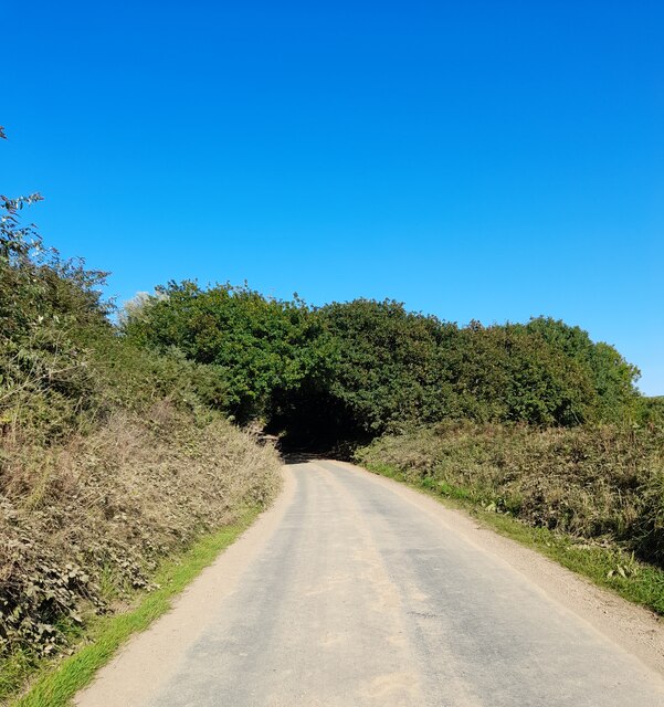
Kilhallon is a small village located in the county of Cornwall, England. Situated near the town of St Austell, Kilhallon is surrounded by picturesque countryside and is just a short drive away from the stunning coastline of the South West of England.
The village is known for its charming traditional Cornish stone cottages, many of which date back to the 18th and 19th centuries. The village has a close-knit community and a peaceful, rural atmosphere, making it a popular destination for those looking to escape the hustle and bustle of city life.
Kilhallon is also a great base for exploring the surrounding area, with plenty of walking and cycling trails nearby. The nearby Eden Project, a world-renowned botanical garden housed in futuristic biomes, is a popular attraction for visitors to the area.
Overall, Kilhallon offers a tranquil and picturesque setting for those looking to experience the beauty of the Cornish countryside while still being within easy reach of amenities and attractions.
If you have any feedback on the listing, please let us know in the comments section below.
Kilhallon Images
Images are sourced within 2km of 50.362419/-4.710079 or Grid Reference SX0754. Thanks to Geograph Open Source API. All images are credited.


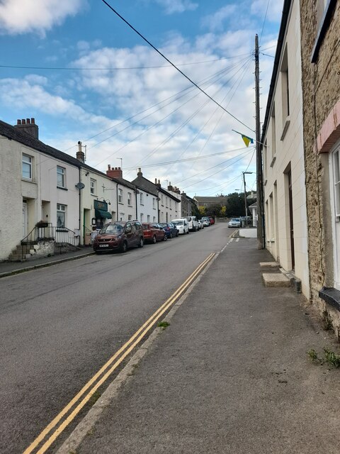


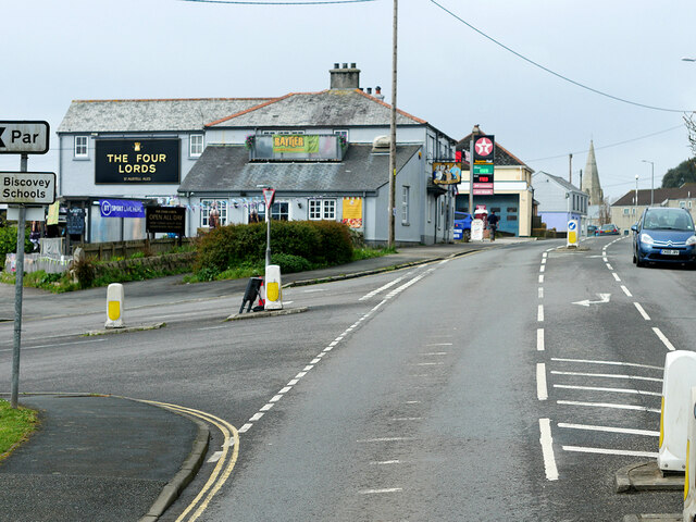
![Bridge Street, St Blazey St Blazey (Cornish: Lanndreth) is a small town in Cornwall, 3 miles (4.8 km) east of St Austell. The town takes its name from the Armenian Saint Blaise who, in Christian tradition, is believed to have "cure[d] toothache, sore throats and cattle diseases".
The local mining industries once dominated the town; historically copper and tin were mined in and around the parish, whilst more recently china clay has been the principal commodity mined. <a href="https://www.geograph.org.uk/photo/1701065">SX0554 : The Eden Project</a> is located about a mile and a half (2 km) from the centre of the town and the large number of visitors this attracts has led to the development of tourism in the town.
St Blazey. (2022, April 23). In Wikipedia. <span class="nowrap"><a title="https://en.wikipedia.org/wiki/St_Blazey" rel="nofollow ugc noopener" href="https://en.wikipedia.org/wiki/St_Blazey">Link</a><img style="margin-left:2px;" alt="External link" title="External link - shift click to open in new window" src="https://s1.geograph.org.uk/img/external.png" width="10" height="10"/></span>](https://s3.geograph.org.uk/geophotos/07/34/75/7347531_986ab475.jpg)
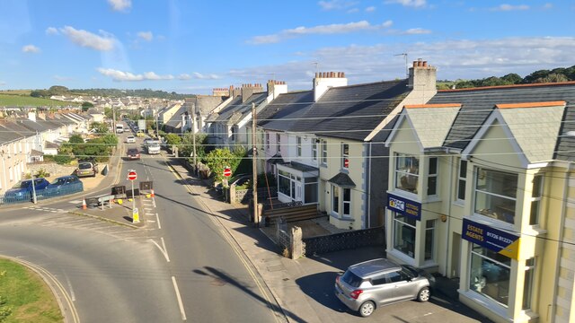
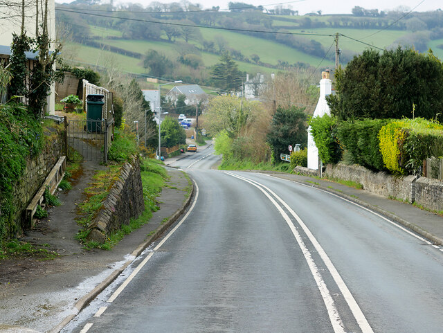
![Rose Hill, St Blazey St Blazey (Cornish: Lanndreth) is a small town in Cornwall, 3 miles (4.8 km) east of St Austell. The town takes its name from the Armenian Saint Blaise who, in Christian tradition, is believed to have &quot;cure[d] toothache, sore throats and cattle diseases&quot;.
The local mining industries once dominated the town; historically copper and tin were mined in and around the parish, whilst more recently china clay has been the principal commodity mined. <a href="https://www.geograph.org.uk/photo/1701065">SX0554 : The Eden Project</a> is located about a mile and a half (2 km) from the centre of the town and the large number of visitors this attracts has led to the development of tourism in the town.
St Blazey. (2022, April 23). In Wikipedia. <span class="nowrap"><a title="https://en.wikipedia.org/wiki/St_Blazey" rel="nofollow ugc noopener" href="https://en.wikipedia.org/wiki/St_Blazey">Link</a><img style="margin-left:2px;" alt="External link" title="External link - shift click to open in new window" src="https://s1.geograph.org.uk/img/external.png" width="10" height="10"/></span>](https://s1.geograph.org.uk/geophotos/07/34/75/7347541_fcb16d1e.jpg)
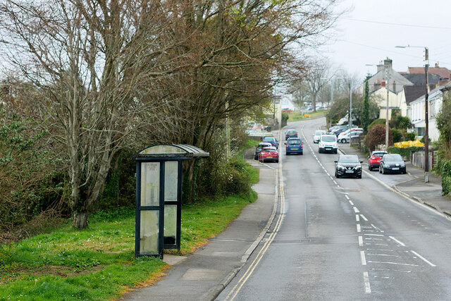
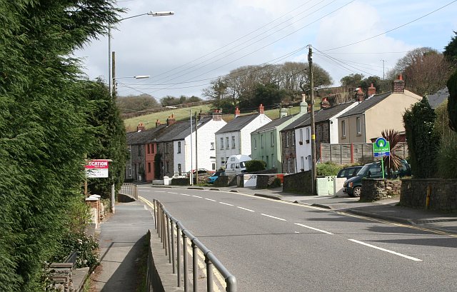
![Church Hill, St Blazey St Blazey (Cornish: Lanndreth) is a small town in Cornwall, 3 miles (4.8 km) east of St Austell. The town takes its name from the Armenian Saint Blaise who, in Christian tradition, is believed to have &quot;cure[d] toothache, sore throats and cattle diseases&quot;. The church, which was built between 1440 and 1445, is dedicated to Saint Blaise. It is a Grade II* listed building (List Entry Number:
1289700 <span class="nowrap"><a title="https://historicengland.org.uk/listing/the-list/list-entry/1289700" rel="nofollow ugc noopener" href="https://historicengland.org.uk/listing/the-list/list-entry/1289700">Link</a><img style="margin-left:2px;" alt="External link" title="External link - shift click to open in new window" src="https://s1.geograph.org.uk/img/external.png" width="10" height="10"/></span> Historic England).
The local mining industries once dominated the town; historically copper and tin were mined in and around the parish, whilst more recently china clay has been the principal commodity mined. <a href="https://www.geograph.org.uk/photo/1701065">SX0554 : The Eden Project</a> is located about a mile and a half (2 km) from the centre of the town and the large number of visitors this attracts has led to the development of tourism in the town.
St Blazey. (2022, April 23). In Wikipedia. <span class="nowrap"><a title="https://en.wikipedia.org/wiki/St_Blazey" rel="nofollow ugc noopener" href="https://en.wikipedia.org/wiki/St_Blazey">Link</a><img style="margin-left:2px;" alt="External link" title="External link - shift click to open in new window" src="https://s1.geograph.org.uk/img/external.png" width="10" height="10"/></span>](https://s3.geograph.org.uk/geophotos/07/34/75/7347543_38528efc.jpg)
Kilhallon is located at Grid Ref: SX0754 (Lat: 50.362419, Lng: -4.710079)
Unitary Authority: Cornwall
Police Authority: Devon and Cornwall
What 3 Words
///denote.signal.surnames. Near Par, Cornwall
Nearby Locations
Related Wikis
Kilhallon
Kilhallon is a hamlet in the civil parish of Tywardreath and Par, Cornwall, England. == References ==

St Blazey A.F.C.
St Blazey Association Football Club is an English football club based in St Blazey, Cornwall. They compete in the Western League Premier Division. The...

St Blazey
St Blazey (Cornish: Lanndreth) is a small town in Cornwall, England, United Kingdom. St Blaise is the civil parish in which St Blazey is situated; the...
Tywardreath Highway
Originally a small mining hamlet, after expansion during the 20th century, Tywardreath Highway now directly adjoins St Blazey and is within the same electoral...
Nearby Amenities
Located within 500m of 50.362419,-4.710079Have you been to Kilhallon?
Leave your review of Kilhallon below (or comments, questions and feedback).