Bracken Hill

Hill, Mountain in Yorkshire

England

Bracken Hill

Potter Brow Road, Baildon Moor
Potter Brow Road, Baildon Moor Credit: habiloid

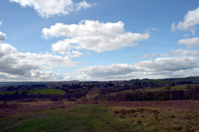
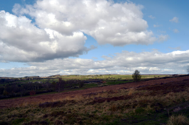
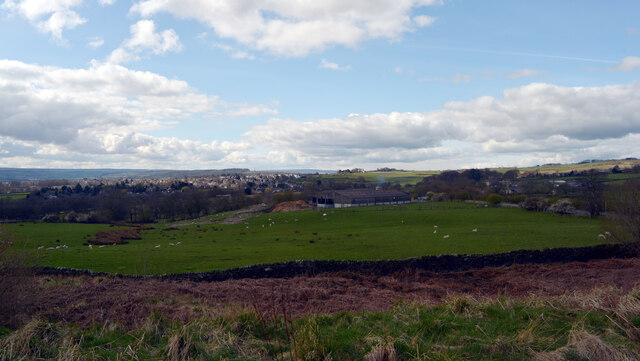
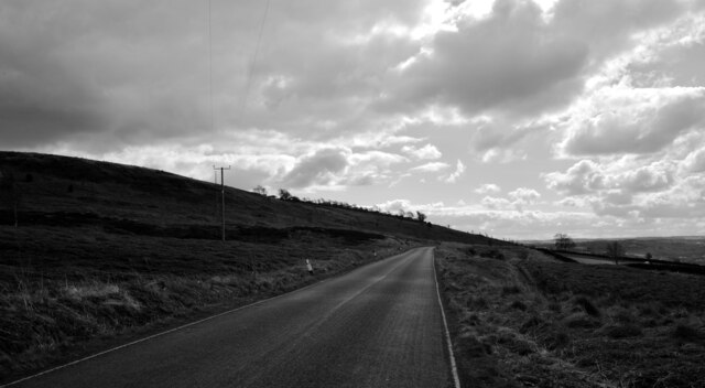
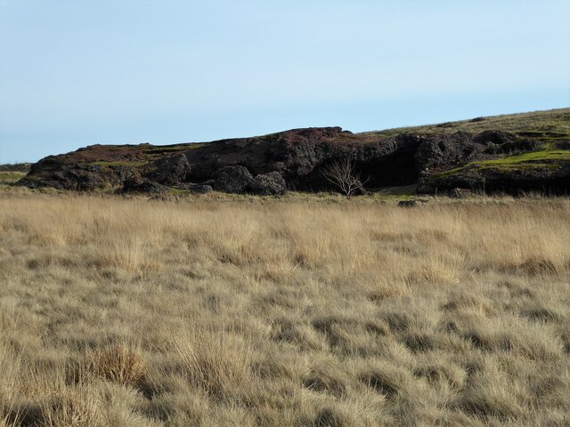
Bracken Hill is a prominent geographic feature located in Yorkshire, England. Situated in the northern part of the county, this hill stands tall and proud, offering breathtaking views of the surrounding landscape. Rising to an elevation of approximately 500 meters above sea level, it is considered one of the higher peaks in the region.

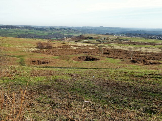
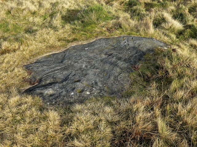
The hill is characterized by its lush and verdant vegetation, predominantly covered in dense bracken, from which it derives its name. This abundant plant life adds to the hill's beauty, especially during the warmer months when it flourishes with vibrant greens. Bracken Hill is also home to a variety of other flora and fauna, making it a haven for nature enthusiasts and wildlife.

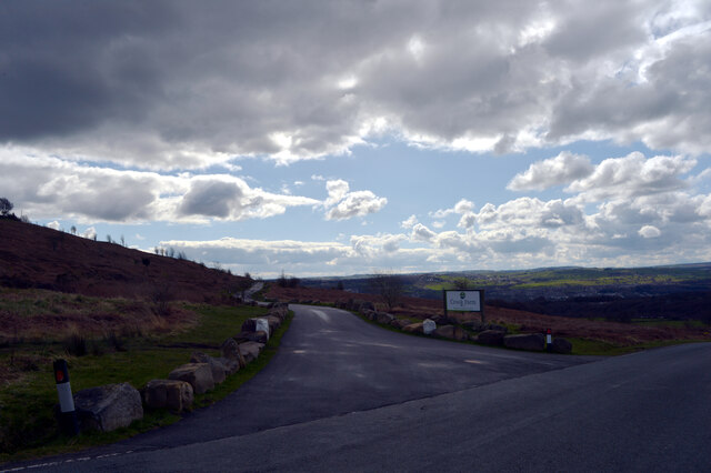
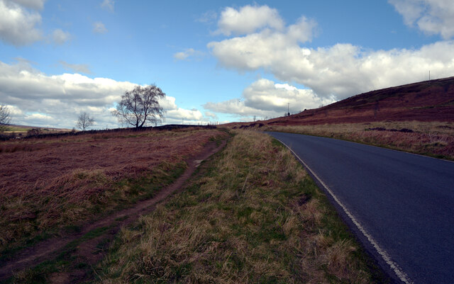
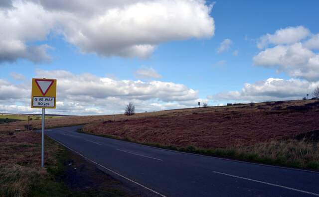
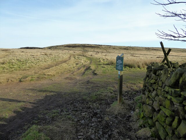
The ascent to the summit of Bracken Hill can be challenging but rewarding. The hill's slopes are steep, and the path to the top is often narrow and winding. However, those who brave the climb are rewarded with panoramic views that stretch for miles around, showcasing the picturesque Yorkshire countryside.

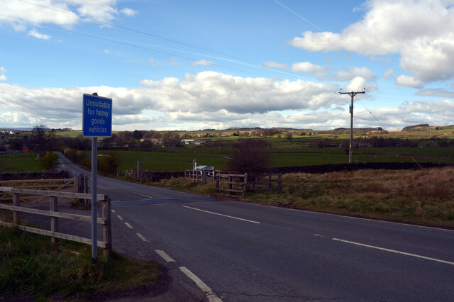
The hill is a popular destination for outdoor activities such as hiking and wildlife spotting. Its location within the Yorkshire Dales National Park further enhances its appeal, attracting tourists and locals alike. Visitors can enjoy leisurely walks along the hill's trails, taking in the fresh air and spectacular scenery.

Bracken Hill's beauty and natural allure make it a true gem of Yorkshire. Whether one seeks adventure or simply wishes to immerse themselves in the tranquility of nature, this hill offers an unforgettable experience that captures the essence of the region.

If you have any feedback on the listing, please let us know in the comments section below.
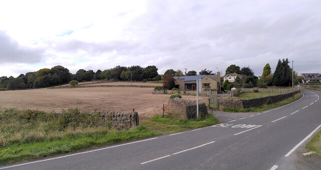
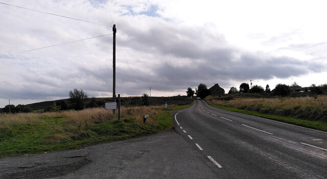
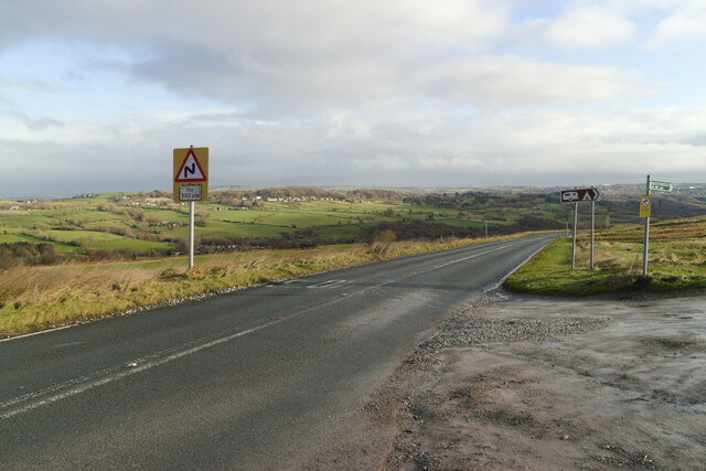
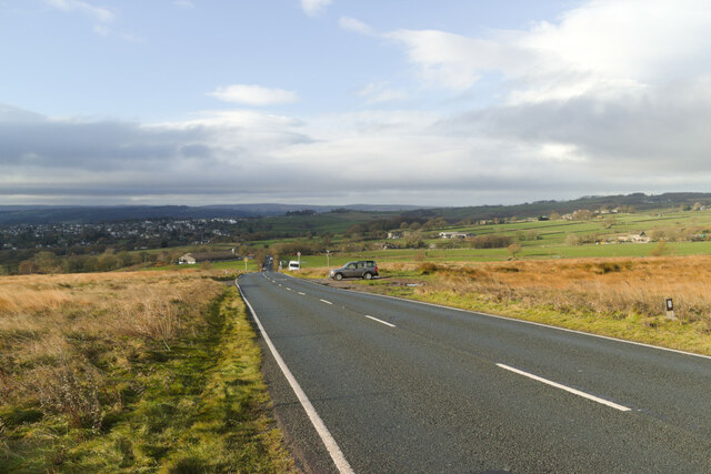
Bracken Hill Images

Images are sourced within 2km of 53.862221/-1.7762517 or Grid Reference SE1440. Thanks to Geograph Open Source API. All images are credited.

Potter Brow Road, Baildon Moor
Hawksworth Road, Baildon Moor
Bingley Road, Baildon Moor Approaching the bends near Baildon Golf Club.
Bingley Road, Baildon Moor
Approaching the bends near Baildon Golf Club.
Bingley Road approaching Glovershaw Farm
A view towards Eldwick from Glen Road, Baildon
A view from Glen Road, Baildon
Rood to Crook Farm seen from Glen Road, Baildon
Glen Road, Baildon
Glen Road, Baildon
Looking towards Glovershaw Farm from Glen Road, Baildon
Glen Road, Baildon
Glen Road, Baildon
Glovershaw Lane, Baildon
Junction of Bingley Road and Glen Road, Baildon
Glen Road, Baildon
Glen Road, Baildon
Modern milestone On the north-west corner of the cross roads west of Hawksworth, Hillings Lane/Old Lane/Mill Lane/Goose Lane.  When this was set up in 2002 the faces were painted white with the top and lettering in black.
Modern milestone
On the north-west corner of the cross roads west of Hawksworth, Hillings Lane/Old Lane/Mill Lane/Goose Lane. When this was set up in 2002 the faces were painted white with the top and lettering in black.
Old Bell Pit remains View from the bridleway to Dobrudden with the disused Baildon reservoir embankments beyond the pit hollows
Old Bell Pit remains
View from the bridleway to Dobrudden with the disused Baildon reservoir embankments beyond the pit hollows
Bridleway to Baildon Hill At the corner of Dobrudden Caravan Park where bridleways cross one another, with Baildon Hill ahead.
Bridleway to Baildon Hill
At the corner of Dobrudden Caravan Park where bridleways cross one another, with Baildon Hill ahead.
The Cinder Caves An old tip of furnace type waste on Baildon Moor that appears like a lava flow  with hollows and 'caves'.
The Cinder Caves
An old tip of furnace type waste on Baildon Moor that appears like a lava flow with hollows and 'caves'.
Cup marked rock On Baildon Moor described as having four clear cups and one possible cup, possible ring & groove
Cup marked rock
On Baildon Moor described as having four clear cups and one possible cup, possible ring & groove
Show me another place!

Bracken Hill is located at Grid Ref: SE1440 (Lat: 53.862221, Lng: -1.7762517)

Division: West Riding

Unitary Authority: Bradford

Police Authority: West Yorkshire

What 3 Words

///yoga.retain.buyers. Near Baildon, West Yorkshire

Related Wikis

Baildon Urban District

Baildon was an urban district in the West Riding of Yorkshire, England between 1894 and 1974. It was enlarged on 1 April 1937 by gaining part of Wharfedale...

Colne Valley Urban District

Colne Valley was an urban district in the West Riding of Yorkshire, England between 1937 and 1974. It takes its name from the River Colne which rises above...

Baildon

Baildon is a town and civil parish in the Bradford Metropolitan Borough in West Yorkshire, England and within the historic boundaries of the West Riding...

Baildon railway station

Baildon railway station serves the town of Baildon near Shipley in West Yorkshire, England. The station reopened under British Rail on 5 January 1973,...

Hawksworth, Guiseley

Hawksworth is a village 1 mile (1.6 km) west of the town of Guiseley in West Yorkshire, England. It is located to the south of Menston and north of Baildon...

Shipley (UK Parliament constituency)

Shipley is a constituency represented in the House of Commons of the UK Parliament since 2005 by Philip Davies, a Conservative. == Boundaries == 1885...

Eldwick

Eldwick is a small village near Bingley in the City of Bradford district in West Yorkshire. It is split up into two main parts, Eldwick, the main populated...

Bracken Hall Countryside Centre and Museum

Bracken Hall Countryside Centre and Museum is a children's museum, natural history education centre and nature centre established in 1989 at Bracken Hall...

Nearby Amenities

Located within 500m of 53.862221,-1.7762517
Parking
Access: yes
Fee: no
Parking: surface
Lat/Long: 53.8611185/-1.770304
Archaeological Site: mineral_extraction
Historic: mine_shaft
Source: OS 1:25k
Lat/Long: 53.864814/-1.7768683
Archaeological Site: mineral_extraction
Historic: mine_shaft
Source: OS 1:25k
Lat/Long: 53.8637258/-1.7747869
Archaeological Site: mineral_extraction
Historic: mine_shaft
Source: OS 1:25k
Lat/Long: 53.8640295/-1.7769113
Archaeological Site: mineral_extraction
Historic: mine_shaft
Source: OS 1:25k
Lat/Long: 53.8630551/-1.7771473
Archaeological Site: mineral_extraction
Historic: mine_shaft
Source: OS 1:25k
Lat/Long: 53.8647887/-1.7773404
Archaeological Site: mineral_extraction
Historic: mine_shaft
Source: OS 1:25k
Lat/Long: 53.8623845/-1.7762032
Archaeological Site: mineral_extraction
Historic: mine_shaft
Source: OS 1:25k
Lat/Long: 53.8655099/-1.7791214
Historic: mine_shaft
Source: OS 1:25k
Lat/Long: 53.8623971/-1.7774906
Archaeological Site: mineral_extraction
Historic: mine_shaft
Source: OS 1:25k
Lat/Long: 53.8642832/-1.7748299
Archaeological Site: mineral_extraction
Historic: mine_shaft
Source: OS 1:25k
Lat/Long: 53.8621693/-1.7781558
Acrehowe Hill
Natural: peak
Source: OS 1:25k
Lat/Long: 53.8614752/-1.7824302
Archaeological Site: mineral_extraction
Historic: mine_shaft
Source: OS 1:25k
Lat/Long: 53.8635486/-1.7755594
Historic: mine_shaft
Source: OS 1:25k
Lat/Long: 53.8624098/-1.7784562
Archaeological Site: mineral_extraction
Historic: mine_shaft
Source: OS 1:25k
Lat/Long: 53.8644217/-1.7773833
Archaeological Site: mineral_extraction
Historic: mine_shaft
Source: OS 1:25k
Lat/Long: 53.8639668/-1.7757311
Historic: mine_shaft
Note: tentative
Source: Bing
Lat/Long: 53.8626129/-1.7783478
Historic: mine_shaft
Note: tentative
Source: Bing
Lat/Long: 53.8588277/-1.7774941
Historic: mine_shaft
Note: tentative
Source: Bing
Lat/Long: 53.862632/-1.7787287
Historic: mine_shaft
Note: tentative
Source: Bing
Lat/Long: 53.8599698/-1.7803211
Historic: mine_shaft
Note: tentative
Source: Bing
Lat/Long: 53.8580336/-1.7763086
Historic: mine_shaft
Note: tentative
Source: Bing
Lat/Long: 53.8625687/-1.7785678
Historic: mine_shaft
Note: tentative
Source: Bing
Lat/Long: 53.8579167/-1.7748977
Historic: mine_shaft
Note: tentative
Source: Bing
Lat/Long: 53.859916/-1.7799081
Historic: mine_shaft
Note: tentative
Source: Bing
Lat/Long: 53.8586412/-1.7772151
Historic: mine_shaft
Note: tentative
Source: Bing
Lat/Long: 53.8608919/-1.7761753
Historic: mine_shaft
Note: tentative
Source: Bing
Lat/Long: 53.8584797/-1.7762603
Historic: mine_shaft
Note: tentative
Source: Bing
Lat/Long: 53.8595174/-1.7776336
Historic: mine_shaft
Note: tentative
Source: Bing
Lat/Long: 53.8603273/-1.7778106
Historic: mine_shaft
Note: tentative
Source: Bing
Lat/Long: 53.8577994/-1.775917
Historic: mine_shaft
Note: tentative
Source: Bing
Lat/Long: 53.8627204/-1.778954
Historic: mine_shaft
Note: tentative
Source: Bing
Lat/Long: 53.8610627/-1.7773662
Historic: mine_shaft
Note: tentative
Source: Bing
Lat/Long: 53.8604507/-1.7790927
Historic: mine_shaft
Note: tentative
Source: Bing
Lat/Long: 53.8610975/-1.7751131
Historic: mine_shaft
Note: tentative
Source: Bing
Lat/Long: 53.8601092/-1.7826708
Historic: mine_shaft
Note: tentative
Source: Bing
Lat/Long: 53.8581127/-1.7792
Historic: mine_shaft
Note: tentative
Source: Bing
Lat/Long: 53.8610898/-1.7796399
Historic: mine_shaft
Note: tentative
Source: Bing
Lat/Long: 53.8605521/-1.7792751
Historic: mine_shaft
Note: tentative
Source: Bing
Lat/Long: 53.8599888/-1.7817749
Historic: mine_shaft
Note: tentative
Source: Bing
Lat/Long: 53.8587329/-1.7773278
Historic: mine_shaft
Note: tentative
Source: Bing
Lat/Long: 53.8587613/-1.7770757
Historic: mine_shaft
Note: tentative
Source: Bing
Lat/Long: 53.8621067/-1.7775485
Historic: mine_shaft
Note: tentative
Source: Bing
Lat/Long: 53.8630304/-1.7743833
Historic: mine_shaft
Note: tentative
Source: Bing
Lat/Long: 53.857771/-1.7753912
Historic: mine_shaft
Note: tentative
Source: Bing
Lat/Long: 53.8580715/-1.7757775
Historic: mine_shaft
Note: tentative
Source: Bing
Lat/Long: 53.8591029/-1.7787386
Historic: mine_shaft
Note: tentative
Source: Bing
Lat/Long: 53.859429/-1.7790391
Historic: mine_shaft
Note: tentative
Source: Bing
Lat/Long: 53.8618411/-1.7776344
Historic: mine_shaft
Note: tentative
Source: Bing
Lat/Long: 53.8612859/-1.7793448
Historic: mine_shaft
Note: tentative
Source: Bing
Lat/Long: 53.8628976/-1.7799035
Historic: mine_shaft
Note: tentative
Source: Bing
Lat/Long: 53.8606753/-1.7791249
Historic: mine_shaft
Note: tentative
Source: Bing
Lat/Long: 53.8628913/-1.7795924
Historic: mine_shaft
Note: tentative
Source: Bing
Lat/Long: 53.8628155/-1.7790345
Historic: mine_shaft
Note: tentative
Source: Bing
Lat/Long: 53.8603939/-1.7782237
Historic: mine_shaft
Note: tentative
Source: Bing
Lat/Long: 53.8582645/-1.7768772
Historic: mine_shaft
Note: tentative
Source: Bing
Lat/Long: 53.8627679/-1.7800913
Historic: mine_shaft
Note: tentative
Source: Bing
Lat/Long: 53.8607196/-1.7795487
Historic: mine_shaft
Note: tentative
Source: Bing
Lat/Long: 53.8603496/-1.7784436
Historic: mine_shaft
Note: tentative
Source: Bing
Lat/Long: 53.8601471/-1.7817964
Historic: mine_shaft
Note: tentative
Source: Bing
Lat/Long: 53.8625624/-1.77838
Historic: mine_shaft
Note: tentative
Source: Bing
Lat/Long: 53.86161/-1.7773125
Historic: mine_shaft
Note: tentative
Source: Bing
Lat/Long: 53.8579829/-1.775402
Historic: mine_shaft
Note: tentative
Source: Bing
Lat/Long: 53.8585241/-1.7768504
Historic: mine_shaft
Note: tentative
Source: Bing
Lat/Long: 53.8608715/-1.7792
Historic: mine_shaft
Note: tentative
Source: Bing
Lat/Long: 53.8586442/-1.7787816
Historic: mine_shaft
Note: tentative
Source: Bing
Lat/Long: 53.8619928/-1.7779187
Historic: mine_shaft
Note: tentative
Source: Bing
Lat/Long: 53.8603811/-1.7780466
Historic: mine_shaft
Note: tentative
Source: Bing
Lat/Long: 53.8580367/-1.7750372
Historic: mine_shaft
Note: tentative
Source: Bing
Lat/Long: 53.8628882/-1.7786375
Historic: mine_shaft
Note: tentative
Source: Bing
Lat/Long: 53.8604349/-1.7782666
Historic: mine_shaft
Note: tentative
Source: Bing
Lat/Long: 53.8616891/-1.7774037
Historic: mine_shaft
Note: tentative
Source: Bing
Lat/Long: 53.8627679/-1.7792437
Historic: mine_shaft
Note: tentative
Source: Bing
Lat/Long: 53.8629136/-1.77838
Historic: mine_shaft
Note: tentative
Source: Bing
Lat/Long: 53.8603558/-1.7779608
Historic: mine_shaft
Note: tentative
Source: Bing
Lat/Long: 53.8625149/-1.778439
Historic: mine_shaft
Note: tentative
Source: Bing
Lat/Long: 53.8577648/-1.776389
Historic: mine_shaft
Note: tentative
Source: Bing
Lat/Long: 53.8597847/-1.7712773
Historic: mine_shaft
Note: tentative
Source: Bing
Lat/Long: 53.8597814/-1.7709715
Access: permissive
Barrier: stile
Bicycle: no
Horse: no
Material: stone
Motor Vehicle: no
Step Count: 1
Stile: squeezer
Lat/Long: 53.8665689/-1.7766727
Access: no
Barrier: stile
Foot: yes
Material: stone
Stile: squeezer
Lat/Long: 53.8619258/-1.7696158
Access: no
Barrier: stile
Foot: yes
Material: wood
Stile: squeezer
Lat/Long: 53.8619903/-1.7692213
Low Hill
Place: hamlet
Lat/Long: 53.863907/-1.7724681
stile
Access: permissive
Barrier: stile
Bicycle: no
Gate Type: door
Horse: no
Material: stone
Motor Vehicle: no
Stile: squeezer
Lat/Long: 53.8664348/-1.7776995
The data included in this document is from www.openstreetmap.org. The data is made available under ODbL.

Have you been to Bracken Hill?

Leave your review of Bracken Hill below (or comments, questions and feedback).