Acrehowe Hill

Hill, Mountain in Yorkshire

England

Acrehowe Hill

Potter Brow Road, Baildon Moor
Potter Brow Road, Baildon Moor Credit: habiloid

Acrehowe Hill is a prominent geographical feature located in the county of Yorkshire, England. Situated in the southern part of the county, it forms part of the stunning landscape of the Yorkshire Dales National Park. With an elevation of approximately 500 meters (1,640 feet), it is classified as a hill rather than a mountain.

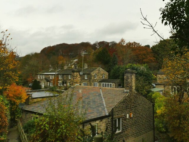
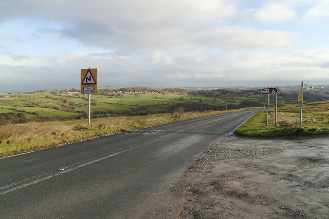
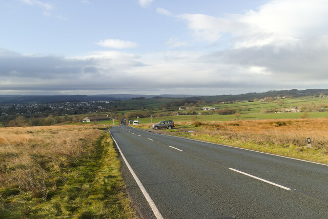
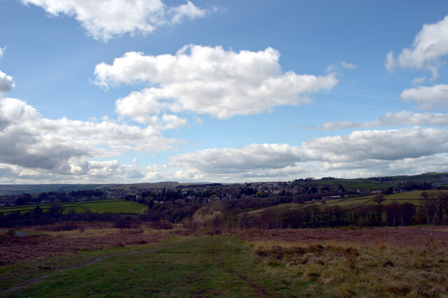
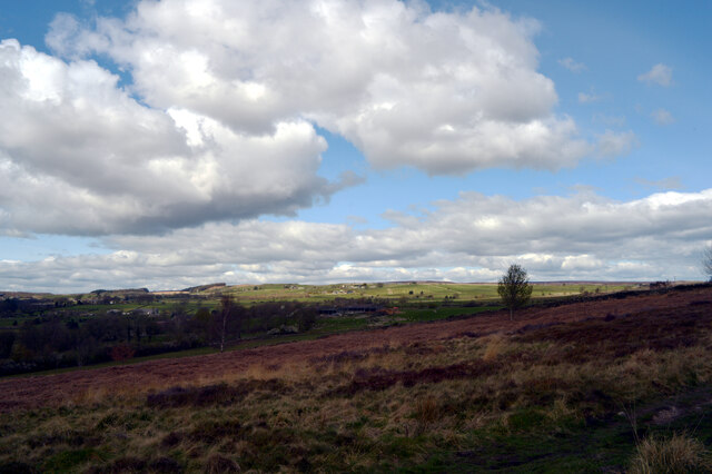
The hill is characterized by its rugged and rolling terrain, covered in lush green vegetation and scattered with rocky outcrops. It offers breathtaking panoramic views of the surrounding countryside, including the picturesque valleys and moorland that define the Yorkshire Dales.

Acrehowe Hill is a popular destination for outdoor enthusiasts, particularly hikers and walkers, who are drawn to its natural beauty and challenging trails. There are various routes to the summit, catering to different fitness levels and preferences. The ascent can be steep at times, requiring a moderate level of fitness.

At the top of Acrehowe Hill, visitors are rewarded with stunning vistas and the opportunity to take in the tranquility of the countryside. On a clear day, it is possible to see far-reaching views of the rolling hills and distant peaks that make up the Yorkshire Dales.

Acrehowe Hill is also home to a diverse range of wildlife, including various bird species, foxes, and rabbits. Its natural habitat provides a haven for biodiversity and supports a rich ecosystem.

Overall, Acrehowe Hill offers a nature lover's paradise, combining breathtaking scenery, challenging trails, and an abundance of wildlife. It is a must-visit destination for those seeking to explore the beauty of Yorkshire's countryside.

If you have any feedback on the listing, please let us know in the comments section below.

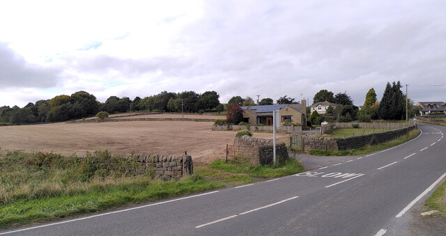
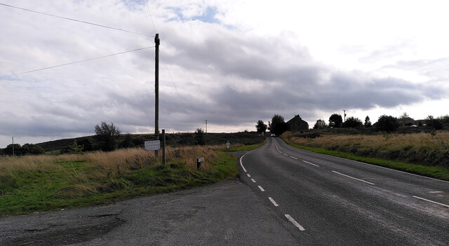
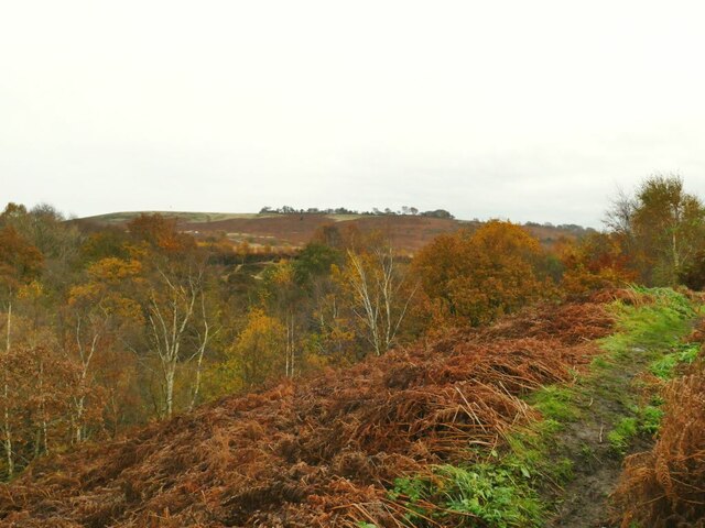
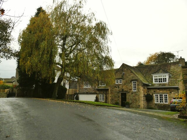
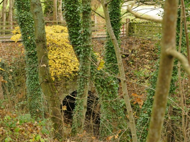
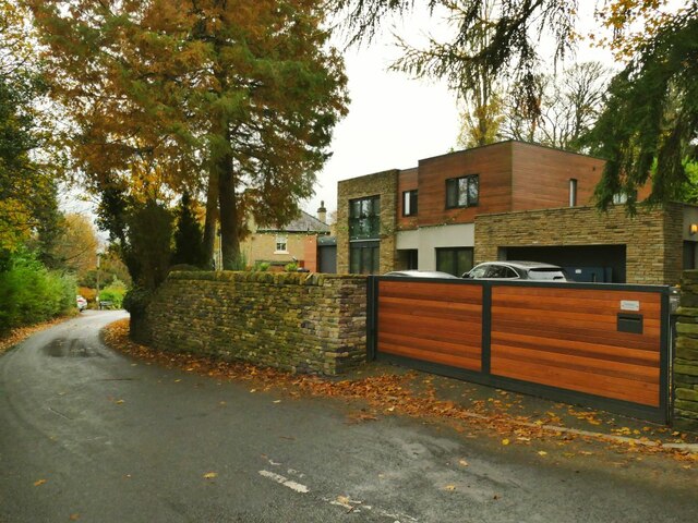
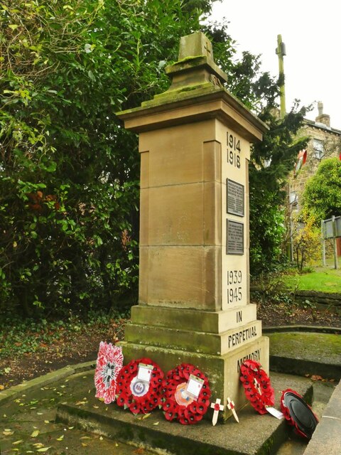
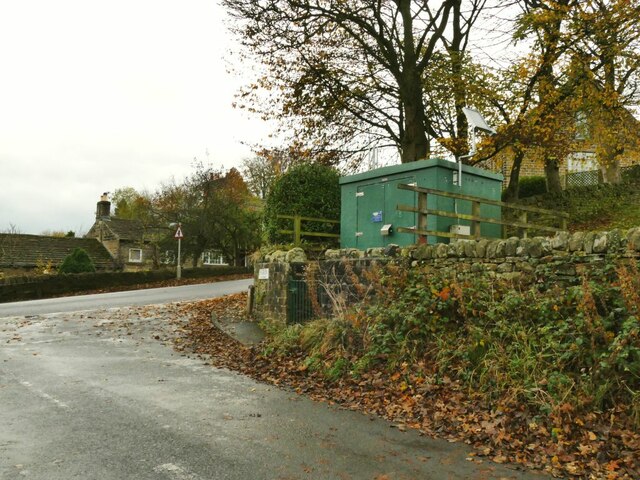
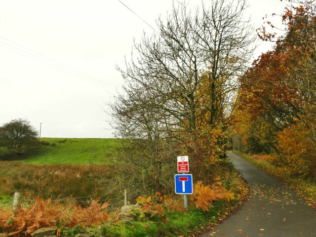
Acrehowe Hill Images

Images are sourced within 2km of 53.861406/-1.7825357 or Grid Reference SE1440. Thanks to Geograph Open Source API. All images are credited.

Potter Brow Road, Baildon Moor
Hawksworth Road, Baildon Moor
The top of Shipley Glen A view from Lode Pit Lane at the point whence a bridleway descends into the glen.
The top of Shipley Glen
A view from Lode Pit Lane at the point whence a bridleway descends into the glen.
Willow Cottage, Saltaire Road, Eldwick Actually a large detached house rather than a cottage.  It appeared on a property website with an estimated value of £369,000. The name of the road is also misleading, because although you can get to Saltaire this way, it's only on foot. It is part of the Welcome Way.
Willow Cottage, Saltaire Road, Eldwick
Actually a large detached house rather than a cottage. It appeared on a property website with an estimated value of £369,000. The name of the road is also misleading, because although you can get to Saltaire this way, it's only on foot. It is part of the Welcome Way.
Culvert on the Loadpit Beck The culvert carries an access road leading to a former quarry that now contains a modern industrial building.
Culvert on the Loadpit Beck
The culvert carries an access road leading to a former quarry that now contains a modern industrial building.
Houses at Eldwick Beck In between the photographer location on Saltaire Road and the terrace of houses in the background was Eldwick Beck Mill (now demolished). I assume the houses were built for millworkers.
Houses at Eldwick Beck
In between the photographer location on Saltaire Road and the terrace of houses in the background was Eldwick Beck Mill (now demolished). I assume the houses were built for millworkers.
The north end of Saltaire Road The name of the road is misleading, because although you can get to Saltaire this way, it's only on foot. It is part of the Welcome Way. The modernist house on the right is called Xantara.
The north end of Saltaire Road
The name of the road is misleading, because although you can get to Saltaire this way, it's only on foot. It is part of the Welcome Way. The modernist house on the right is called Xantara.
Eldwick War Memorial Listed grade II (list entry 1447944) where we learn that the First World War memorial was unveiled on 2 December 1922, and was crafted by David Wildman from  local sandstone at a cost of approximately £150.
Eldwick War Memorial
Listed grade II (list entry 1447944) where we learn that the First World War memorial was unveiled on 2 December 1922, and was crafted by David Wildman from local sandstone at a cost of approximately £150.
Eldwick War Memorial names The plaques name thirteen casualties of the First World War and eight from the Second. See <a href="https://www.geograph.org.uk/photo/7026425">SE1240 : Eldwick War Memorial</a> for context.
Eldwick War Memorial names
The plaques name thirteen casualties of the First World War and eight from the Second. See SE1240 : Eldwick War Memorial for context.
Former Eldwick Beck Wesleyan Methodist chapel The chapel on Otley Road was built in 1888, closed c.2010 <a href="https://www.geograph.org.uk/photo/2716706">SE1240 : The old Wesleyan Methodist Chapel, Eldwick</a> and is now presumably in private ownership.
Former Eldwick Beck Wesleyan Methodist chapel
The chapel on Otley Road was built in 1888, closed c.2010 SE1240 : The old Wesleyan Methodist Chapel, Eldwick and is now presumably in private ownership.
The Green, Eldwick Beck The Green is a short side road with these houses on the corner, and a pub and a few more houses further along. Note the post box in the wall <a href="https://www.geograph.org.uk/photo/581516">SE1240 : Victorian Post Box - The Green, Eldwick</a>.
The Green, Eldwick Beck
The Green is a short side road with these houses on the corner, and a pub and a few more houses further along. Note the post box in the wall SE1240 : Victorian Post Box - The Green, Eldwick.
The Acorn at Eldwick Beck A Casque Mark pub. It was only 11am when I passed, too early for a pint.
The Acorn at Eldwick Beck
A Casque Mark pub. It was only 11am when I passed, too early for a pint.
Gas installation at Eldwick Beck
Footpath beyond The Green The public road becomes a public footpath at this point though it is still well surfaced as the access to a few properties.  It forms part of the Welcome way.
Footpath beyond The Green
The public road becomes a public footpath at this point though it is still well surfaced as the access to a few properties. It forms part of the Welcome way.
Bingley Road, Baildon Moor Approaching the bends near Baildon Golf Club.
Bingley Road, Baildon Moor
Approaching the bends near Baildon Golf Club.
Bingley Road approaching Glovershaw Farm
A view towards Eldwick from Glen Road, Baildon
A view from Glen Road, Baildon
Show me another place!

Acrehowe Hill is located at Grid Ref: SE1440 (Lat: 53.861406, Lng: -1.7825357)

Division: West Riding

Unitary Authority: Bradford

Police Authority: West Yorkshire

What 3 Words

///limp.solar.reduce. Near Baildon, West Yorkshire

Related Wikis

Baildon Urban District

Baildon was an urban district in the West Riding of Yorkshire, England between 1894 and 1974. It was enlarged on 1 April 1937 by gaining part of Wharfedale...

Colne Valley Urban District

Colne Valley was an urban district in the West Riding of Yorkshire, England between 1937 and 1974. It takes its name from the River Colne which rises above...

Shipley (UK Parliament constituency)

Shipley is a constituency represented in the House of Commons of the UK Parliament since 2005 by Philip Davies, a Conservative. == Boundaries == 1885...

Baildon

Baildon is a town and civil parish in the Bradford Metropolitan Borough in West Yorkshire, England and within the historic boundaries of the West Riding...

Eldwick

Eldwick is a small village near Bingley in the City of Bradford district in West Yorkshire. It is split up into two main parts, Eldwick, the main populated...

Bracken Hall Countryside Centre and Museum

Bracken Hall Countryside Centre and Museum is a children's museum, natural history education centre and nature centre established in 1989 at Bracken Hall...

Shipley Glen Tramway

The Shipley Glen Tramway is a historic funicular tramway located in the wooded Shipley Glen near the village of Saltaire in the English county of West...

Baildon railway station

Baildon railway station serves the town of Baildon near Shipley in West Yorkshire, England. The station reopened under British Rail on 5 January 1973,...

Nearby Amenities

Located within 500m of 53.861406,-1.7825357
Pennythorn Hill
Natural: peak
Source: OS OpenData StreetView
Lat/Long: 53.8636541/-1.7873018
Archaeological Site: mineral_extraction
Historic: mine_shaft
Source: OS 1:25k
Lat/Long: 53.8640295/-1.7769113
Archaeological Site: mineral_extraction
Historic: mine_shaft
Source: OS 1:25k
Lat/Long: 53.8630551/-1.7771473
Archaeological Site: mineral_extraction
Historic: mine_shaft
Source: OS 1:25k
Lat/Long: 53.8623845/-1.7762032
Historic: mine_shaft
Source: OS 1:25k
Lat/Long: 53.8623971/-1.7774906
Archaeological Site: mineral_extraction
Historic: mine_shaft
Source: OS 1:25k
Lat/Long: 53.8621693/-1.7781558
Acrehowe Hill
Natural: peak
Source: OS 1:25k
Lat/Long: 53.8614752/-1.7824302
Historic: mine_shaft
Source: OS 1:25k
Lat/Long: 53.8624098/-1.7784562
Archaeological Site: mineral_extraction
Historic: mine_shaft
Source: OS 1:25k
Lat/Long: 53.8644217/-1.7773833
Historic: mine_shaft
Note: tentative
Source: Bing
Lat/Long: 53.8626129/-1.7783478
Archaeological Site: mineral_extraction
Historic: mine_shaft
Note: tentative
Source: Bing
Lat/Long: 53.8658617/-1.783326
Historic: mine_shaft
Note: tentative
Source: Bing
Lat/Long: 53.8588277/-1.7774941
Historic: mine_shaft
Note: tentative
Source: Bing
Lat/Long: 53.8591314/-1.7822577
Historic: mine_shaft
Note: tentative
Source: Bing
Lat/Long: 53.862632/-1.7787287
Historic: mine_shaft
Note: tentative
Source: Bing
Lat/Long: 53.8599698/-1.7803211
Archaeological Site: mineral_extraction
Historic: mine_shaft
Note: tentative
Source: Bing
Lat/Long: 53.8653239/-1.7825106
Historic: mine_shaft
Note: tentative
Source: Bing
Lat/Long: 53.8625687/-1.7785678
Archaeological Site: mineral_extraction
Historic: mine_shaft
Note: tentative
Source: Bing
Lat/Long: 53.8657067/-1.7817972
Historic: mine_shaft
Note: tentative
Source: Bing
Lat/Long: 53.8657035/-1.7828915
Historic: mine_shaft
Note: tentative
Source: Bing
Lat/Long: 53.859916/-1.7799081
Historic: mine_shaft
Note: tentative
Source: Bing
Lat/Long: 53.8578849/-1.7820807
Historic: mine_shaft
Note: tentative
Source: Bing
Lat/Long: 53.85835/-1.7826493
Historic: mine_shaft
Note: tentative
Source: Bing
Lat/Long: 53.8586412/-1.7772151
Archaeological Site: mineral_extraction
Historic: mine_shaft
Note: tentative
Source: Bing
Lat/Long: 53.8654473/-1.7831544
Historic: mine_shaft
Note: tentative
Source: Bing
Lat/Long: 53.8608919/-1.7761753
Historic: mine_shaft
Note: tentative
Source: Bing
Lat/Long: 53.8575305/-1.781732
Archaeological Site: mineral_extraction
Historic: mine_shaft
Note: tentative
Source: Bing
Lat/Long: 53.8654032/-1.7828432
Historic: mine_shaft
Note: tentative
Source: Bing
Lat/Long: 53.8595174/-1.7776336
Historic: mine_shaft
Note: tentative
Source: Bing
Lat/Long: 53.8603273/-1.7778106
Archaeological Site: mineral_extraction
Historic: mine_shaft
Note: tentative
Source: Bing
Lat/Long: 53.8657541/-1.7823282
Historic: mine_shaft
Note: tentative
Source: Bing
Lat/Long: 53.8627204/-1.778954
Historic: mine_shaft
Note: tentative
Source: Bing
Lat/Long: 53.8610627/-1.7773662
Archaeological Site: mineral_extraction
Historic: mine_shaft
Note: tentative
Source: Bing
Lat/Long: 53.8655643/-1.783487
Historic: mine_shaft
Note: tentative
Source: Bing
Lat/Long: 53.8604507/-1.7790927
Historic: mine_shaft
Note: tentative
Source: Bing
Lat/Long: 53.8596091/-1.7828585
Historic: mine_shaft
Note: tentative
Source: Bing
Lat/Long: 53.8570717/-1.781453
Historic: mine_shaft
Note: tentative
Source: Bing
Lat/Long: 53.8610975/-1.7751131
Historic: mine_shaft
Note: tentative
Source: Bing
Lat/Long: 53.8572489/-1.7821558
Historic: mine_shaft
Note: tentative
Source: Bing
Lat/Long: 53.8601092/-1.7826708
Historic: mine_shaft
Note: tentative
Source: Bing
Lat/Long: 53.8581127/-1.7792
Historic: mine_shaft
Note: tentative
Source: Bing
Lat/Long: 53.8610898/-1.7796399
Historic: mine_shaft
Note: tentative
Source: Bing
Lat/Long: 53.8605521/-1.7792751
Historic: mine_shaft
Note: tentative
Source: Bing
Lat/Long: 53.8587296/-1.7825098
Historic: mine_shaft
Note: tentative
Source: Bing
Lat/Long: 53.8599888/-1.7817749
Historic: mine_shaft
Note: tentative
Source: Bing
Lat/Long: 53.8587329/-1.7773278
Historic: mine_shaft
Note: tentative
Source: Bing
Lat/Long: 53.857945/-1.7826439
Historic: mine_shaft
Note: tentative
Source: Bing
Lat/Long: 53.8587613/-1.7770757
Historic: mine_shaft
Note: tentative
Source: Bing
Lat/Long: 53.8621067/-1.7775485
Historic: mine_shaft
Note: tentative
Source: Bing
Lat/Long: 53.8592738/-1.783057
Historic: mine_shaft
Note: tentative
Source: Bing
Lat/Long: 53.8591029/-1.7787386
Historic: mine_shaft
Note: tentative
Source: Bing
Lat/Long: 53.859429/-1.7790391
Historic: mine_shaft
Note: tentative
Source: Bing
Lat/Long: 53.8618411/-1.7776344
Historic: mine_shaft
Note: tentative
Source: Bing
Lat/Long: 53.8612859/-1.7793448
Historic: mine_shaft
Note: tentative
Source: Bing
Lat/Long: 53.865748/-1.7815987
Historic: mine_shaft
Note: tentative
Source: Bing
Lat/Long: 53.8628976/-1.7799035
Historic: mine_shaft
Note: tentative
Source: Bing
Lat/Long: 53.8606753/-1.7791249
Historic: mine_shaft
Note: tentative
Source: Bing
Lat/Long: 53.8592516/-1.7824455
Historic: mine_shaft
Note: tentative
Source: Bing
Lat/Long: 53.8628913/-1.7795924
Historic: mine_shaft
Note: tentative
Source: Bing
Lat/Long: 53.8628155/-1.7790345
Historic: mine_shaft
Note: tentative
Source: Bing
Lat/Long: 53.8603939/-1.7782237
Historic: mine_shaft
Note: tentative
Source: Bing
Lat/Long: 53.8627679/-1.7800913
Historic: mine_shaft
Note: tentative
Source: Bing
Lat/Long: 53.8607196/-1.7795487
Historic: mine_shaft
Note: tentative
Source: Bing
Lat/Long: 53.8603496/-1.7784436
Historic: mine_shaft
Note: tentative
Source: Bing
Lat/Long: 53.8601471/-1.7817964
Archaeological Site: mineral_extraction
Historic: mine_shaft
Note: tentative
Source: Bing
Lat/Long: 53.8656339/-1.7814431
Historic: mine_shaft
Note: tentative
Source: Bing
Lat/Long: 53.8625624/-1.77838
Historic: mine_shaft
Note: tentative
Source: Bing
Lat/Long: 53.86161/-1.7773125
Archaeological Site: mineral_extraction
Historic: mine_shaft
Note: tentative
Source: Bing
Lat/Long: 53.8653998/-1.7816899
Historic: mine_shaft
Note: tentative
Source: Bing
Lat/Long: 53.8571224/-1.7812492
Archaeological Site: mineral_extraction
Historic: mine_shaft
Note: tentative
Source: Bing
Lat/Long: 53.8656277/-1.7819152
Historic: mine_shaft
Note: tentative
Source: Bing
Lat/Long: 53.8585241/-1.7768504
Historic: mine_shaft
Note: tentative
Source: Bing
Lat/Long: 53.8608715/-1.7792
Historic: mine_shaft
Note: tentative
Source: Bing
Lat/Long: 53.8586442/-1.7787816
Historic: mine_shaft
Note: tentative
Source: Bing
Lat/Long: 53.8619928/-1.7779187
Historic: mine_shaft
Note: tentative
Source: Bing
Lat/Long: 53.8603811/-1.7780466
Historic: mine_shaft
Note: tentative
Source: Bing
Lat/Long: 53.8628882/-1.7786375
Archaeological Site: mineral_extraction
Historic: mine_shaft
Note: tentative
Source: Bing
Lat/Long: 53.8655453/-1.7817489
Historic: mine_shaft
Note: tentative
Source: Bing
Lat/Long: 53.8604349/-1.7782666
Historic: mine_shaft
Note: tentative
Source: Bing
Lat/Long: 53.8616891/-1.7774037
Historic: mine_shaft
Note: tentative
Source: Bing
Lat/Long: 53.8627679/-1.7792437
Historic: mine_shaft
Note: tentative
Source: Bing
Lat/Long: 53.8629136/-1.77838
Historic: mine_shaft
Note: tentative
Source: Bing
Lat/Long: 53.8603558/-1.7779608
Historic: mine_shaft
Note: tentative
Source: Bing
Lat/Long: 53.8625149/-1.778439
Ford: yes
Source: bing
Lat/Long: 53.8584175/-1.7852398
Ford: yes
Source: bing
Lat/Long: 53.8582931/-1.7855519
Ford: yes
Lat/Long: 53.8580275/-1.786317
The data included in this document is from www.openstreetmap.org. The data is made available under ODbL.

Have you been to Acrehowe Hill?

Leave your review of Acrehowe Hill below (or comments, questions and feedback).